Sold(3 Pc) Framed Vintage MapsDESCRIPTION: A lot of three vintage maps depicts Asia, Africa and the Mediterranean. Provenance: Purchased from Neville Sargent Gallery CIRCA: Early - Mid 20th Cent. DIMENSIONS: H: 15" W: 18" CONDITIOSee Sold Price
SoldGrp: 10 Maps of Africa 17th-19th c.Ten maps of Africa by cartographers including Pierre Duval (1618–1683), F. Von. Stulpnagel, Emanuel Bowen (1693-1767), and Abraham Ortelius (1527-1598). Includes three maps of Morocco and thSee Sold Price
SoldThree Maps by the Hydrographic Office U. S. Navy,Three Maps by the Hydrographic Office U. S. Navy, consisting of "Central American, West Coast of Nicaragua, Corinto Harbor and Approaches," 1929, H. - 30 in., W. - 42 in.; with "South Africa, BritishSee Sold Price
SoldRare 1st ed. map of world diseases, c1848World map showing the spread of diseases across the globe in mid-19th century. Three inset maps show diseases in North America, the spread of cholera throughout the world and South Africa. Charts andSee Sold Price
SoldThree hand colored engraved maps by Van Den KeereThree hand colored engraved maps by Van Den Keere including Europa, New and Accurate Map of the World, and Africa, pocket size. 3 3/4" x 5 1/4" Provenance: Property from the Credit Suisse AmericanSee Sold Price
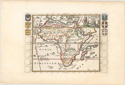
Sold1746 English Voyages ATLAS MAPS Africa Borneo Java Cape1746 English Voyages ATLAS MAPS Africa Borneo Java Cape Verde Prevost Geography The ‘General History of Voyages’ by abbe Prevost is one of the largest and most impressive collections of stories ofSee Sold Price
SoldTallis, John (Pub) 1852 Map. AfricaSteel Engraved Map with Original Outline Hand Color Published 1852-56 by John Tallis, London for "The Universal Pronouncing Dictionary" by Thomas Wright. Drawn & Engraved by John Rapkin. Centre fold aSee Sold Price
SoldLochhead (Pub) 1811 Rare Map. AfricaCopper Engraved Map Published 1811 by William Lochhead, Berwick for "Modern Geography: And a Compendious General Gazetteer" Rare. Folds as issued. Paper Size: 12 x 10 inch (30 x 26cm) Very minor toninSee Sold Price
SoldBarclay, James C1835 Hand Col Map. Africa ContinentHand Colored Copper Engraved Map Published C1835, London for "A Complete and Universal English Dictionary" by the Rev. James Barclay et al. Folds as issued. Paper Size: 11 x 8.5 inch (28 x 22cm) GoodSee Sold Price
SoldBarclay, James 1809 Hand Col Map. Africa ContinentHand Coloured Copper Engraved Map Published 1809, Leeds for "Barclay's Complete and Universal Dictionary of the English Language..." by the Rev. James Barclay. Folds as issued. Paper Size: 11 x 10 incSee Sold Price
Sold9 Maps: Africa, 1700's - 1800's.[Africa]. 9 Maps. Various sizes, 18th – 19th century. Condition varies, mostly very good, some light toning, foxing, and dampstain. Few with outline color. ++ H. Liebaux. Carte De L’Afrique PropreSee Sold Price
SoldGuthrie, William 1798 Map. Africa ContinentCopper Engraved Map Published 1798, London for "A New Geographical, Historical and Commercial Grammar..." by William Guthrie. The maps are by John Senex, Thomas Kitchin and others. Folds as issued. PaSee Sold Price
L'afrique Francoise Ou Du Senegal, French W. Africa MapL'afrique Francoise Ou Du Senegal'. French West Africa. 1727 Map by Guillaume de l'Isle. Approx 52.0 x 65.0cm, 20.5 x 25.5 inches (Large); Please note that this is a folding map. Large antique 18th ceSee Sold Price
Sold1844 MAP AFRICA1844 MAP AFRICA, color, marked 7ink 1844pencil ; approx measure. 16in x 13.5 color atlas folded showing AFRICA lower mediterranean Europe southwest part of asia minor, folded, printed at bottom; PubliSee Sold Price
SoldGross, Alexander 1920 Pair of Large Maps. AfricaAfrica Political and Physical. Large Lithograph Maps Published 1920, London for "The Daily Telegraph Victory Atlas of the World" by Alexander Gross. Centre fold as published. Paper Size: 25 x 19.5 incSee Sold Price
SoldGross, Alexander 1920 Lot of 5 Large Maps. AfricaLarge Lithograph Maps Published 1920, London for "The Daily Telegraph Victory Atlas of the World" by Alexander Gross. Centre fold as published. Paper Size: 25 x 19.5 inch (64 x 49cm) Good ConditionSee Sold Price
1882 West Africa MapAuthor: Blackie Title: 1882 West Africa Map Medium: Ink on Paper Dimensions: 21"X15" Map of Western Africa dated 1882. Part of the Comprehensive Atlas & Geography of the World. Engraved by Edwin WelleSee Sold Price
Sold1796 Map Africa PropriaANTIQUE MAP “AFRICA PROPRIA” CARTGAHE LIBYA, TRIPOLI, MALTA, BY CELLARIUS 1796. From: Geographia Antiqua London. Very Good, measures 15 x 10”, central fold. No Reserve Free shipping for this iteSee Sold Price
SoldAfrica C1800 Map. Africa including the MediterraneanCopper Engraved Map Published C1800, London. Unknown Cartographer/Engraver. Very similar to a Map by Robert Wilkinson. Paper Size: 11.5 x 10 inch (29 x 26cm) Closed split on centre fold. Small chip toSee Sold Price
SoldZatta: Antique Map of Africa, 1770Title/Content of Map: Africa by Zatta Date Printed: 1770 Cartographer: Antonio Zatta Material/Medium: Paper Size: 17" x 13" Published in Venice. Hand colored. Copperplate engraved. Antonio Zatta (1722See Sold Price
SoldTallis: Antique Map of Africa, 1853Map: Africa Date Printed: 1853 Cartographer: Tallis Material/Medium: lithograph Size: 10 3/4" x 14" Original lithograph by John Tallis & Company of London, c. 1853. Map vignettes feature North AfricaSee Sold Price
SoldAfrica according to Ancient sourcesTitle/Content of Map: Africa according to Ancient sources Date Printed: 1783 Cartographer: Thomas Stackhouse Material/Medium: Paper Size: 15 1/2" x 20" Orginal hand color, copperplate engraved. PublisSee Sold Price
SoldLotter: Antique Map of Africa, 1772Title/Content of Map: Africa by Lotter Date Printed: 1772 Cartographer: G.C. Lotter Material/Medium: Paper Size: 23" x 18" Hand colored copperplate engraved. Published in Augsburg Germany. Please noteSee Sold Price
AFRICA. French West Africa. Rio de Oro Rio Muni Nigeria. BARTHOLOMEW 1952 mapJasper524.5(9.9k)See Sold PriceFeb 28, 2024
AFRICA. Map pre-dating much exploration. Mountains of Kong. SDUK 1851 oldJasper524.5(9.9k)See Sold PriceFeb 28, 2024
AFRICA. Antiqua; Rome Carthage, start Punic War 1908 old antique map chartJasper524.5(9.9k)See Sold PriceFeb 28, 2024
Pre-colonial Africa. Mountains of Kong/Moon. Caravan routes. THOMSON 1817 mapJasper524.5(9.9k)See Sold PriceFeb 28, 2024
Colonial Africa. British German French Spanish Portuguese Italian TIMES 1900 mapJasper524.5(9.9k)See Sold PriceFeb 28, 2024
AFRICA. Africa. Britannica 9th edition 1898 old antique vintage map plan chartJasper524.5(9.9k)See Sold PriceFeb 28, 2024
Gulf of Guinea. Ghana Togo Benin Nigeria. ADMIRALTY sea chart 1928 (1954) mapJasper524.5(9.9k)See Sold PriceFeb 28, 2024
Pre-SECOND WORLD WAR AFRICA. European colonies & German mandates 1942 old mapJasper524.5(9.9k)See Sold PriceFeb 28, 2024
NORTH EAST AFRICA. Libya Egypt Sudan Ethiopia Ubangi-Shari Chad 1952 old mapJasper524.5(9.9k)See Sold PriceFeb 28, 2024
Central Africa. Map showing great forest traversed by Mr Stanley, 1890Jasper524.5(9.9k)See Sold PriceFeb 28, 2024
ANCIENT NORTH AFRICA Septentrionalis. Mauretania Tripolitana ARROWSMITH 1828 mapJasper524.5(9.9k)See Sold PriceFeb 28, 2024