SoldTHREE ANTIQUE FRAMED MAPSincluding a double page, hand-colored map of Norlingen Germany dated 1549, a double page uncolored engraving of Albany NY dated 1794, and an early hand colored etching of Franconia, Germany, likely c.See Sold Price
SoldLOT OF THREE ANTIQUE c.1819 FRAMED MAPSLOT OF THREE ANTIQUE c.1819 FRAMED MAPS - EAST INDIES, DENMARK, SWEDEN, & NORWAY Height: 16 1/2 & 8 in. by Width: 18 1/2 & 10 in.See Sold Price
SoldFramed Antique U.S. Maps; VariousFor your consideration are these three framed antique U.S. maps. One is from an 1858 textbook depicting the five section division of the U.S. at the time: Eastern States, Middle States, Southern StateSee Sold Price
SoldHawaii Antique Maps - Framed Set of 3 (125100)A set of three framed maps of Hawaii, also called the Sandwich Islands, pre-statehood. Professionally mounted, exquisitely matted (see photos), and framed -- two with glass, one without. Largest is frSee Sold Price
SoldHandcolored engravings Antique MapsThree framed handcolored engravings, Antique Maps (Golphe de Grimaul; Bovin, Forte de St Anne)See Sold Price
SoldLOT OF THREE FRAMED & MATTED ANTIQUE ENGRAVINGSLOT OF THREE FRAMED AND MATTED ANTIQUE ENGRAVINGS. 1. COLORED ENGRAVED MAP OF LEICESTERSHIRE AND RUTLANDSHIRE. (12 BY 18 IN.) 2. ENGRAVINGS PLATE 2 THE LONDINOPOLIS VIEW OF LONDON (8 BY 12 IN.) & PLATSee Sold Price
Sold3 ANTIQUE HAND COLORED COPPER ENGRAVED MAPSA collection of three antique hand colored copper engraved maps. Ht: 20.75" Wd: 25.75" (largest, framed)See Sold Price
SoldThree Antique New Orleans MapsThree Antique New Orleans Maps, 18th c., incl. 2 from Bellin's Petit Atlas Maritime and one published by London Magazine, sights 7 1/2 in. x 9 in. to 8 1/2 in. x 11 3/4 in., framed alikeSee Sold Price
SoldTHREE ANTIQUE MAPS, comprising West Riding of YorkshireTHREE ANTIQUE MAPS, comprising West Riding of Yorkshire by Blome, North Riding of Yorkshire by Morden; and Northallerton by Robert Cooper, each framed. (3) Blome 28.5cm by 36cmSee Sold Price
SoldTHREE FRAMED PCS OF ARTWORK - MAPSFramed Liberty of London silk scarf with antique map of Bermuda - 26 1/4" x 26 1/2", framed atlas map of Estonia 12 3/4" x 9" & Florentine plaque with map of Bermuda - 9" x 7 3/4"See Sold Price
SoldSET OF 3 18th CENTURY FRAMED HAND COLORED MAPSSET OF THREE 18th CENTURY FRAMED HAND COLORED MAPS OF BARBADOS, ANTILLES, JAMAICA, CIRCA 1766.See Sold Price
SoldLot of Antique Hand-Colored MapsLot consisting of three 19th century hand-colored maps, including Salisbury, Connecticut (18 1/2" x 21" framed); Redding, Connecticut (19" x 22" framed); and Pound Ridge, New York (20" x 23 1/2" frameSee Sold Price
Sold19th c. prints of American sites + map (4 pcs)Three framed 19th century English prints depicting American sites and one North American map. 1ST ITEM: Lincoln Cathedral engraved by J. Rogers and published in Leeds by John Saunders. Sight: 5" W x 7See Sold Price
SoldThree Antique Framed Pieces US Currency1863 US $2 Bill, 1899 US $1 Bill and Series 1923 US Silver CertificateSee Sold Price
SoldAntique Framed Map. Virginia Marylandia et Carolina. JoAntique Framed Map. Virginia Marylandia et Carolina. Johannes Baptisa Homann-- Dimensions: Image Size: H: 21 inches: W: 24.5 inches -- FRAME SIZE: Frame Height 25 inches - Frame Width 28.5 inches ---See Sold Price
SoldThree Antique Framed SilhouettesThree Antique Framed Silhouettes. 12 1/4" X 10 1/4"See Sold Price
SoldGROUP OF THREE ANTIQUE FRAMED FANS, ONE MOPGroup of three antique framed fans, two with figural scenes and gilt decorative details and one with feathers. All three in ornate shadowbox frames. Apparently unmarked.See Sold Price
SoldThree antique framed prints including Maxfield ParrishShipping not available. You (or your representative) must pickup during the pickup windows of Wednesday Dec. 16 from 11 am to 4 pm or Saturday Dec. 19 from 10 am to 4 pm. If you do not pick up you wilSee Sold Price
SoldAntique framed map of Indian Ocean, Asia, AustraliaTitle/Content of Map: Antique framed map of Indian Ocean, Asia, Australia Date Printed: 1713 Cartographer: Aa, Pieter van der Size (in): 11 x 8 Very attractive framed copper-engraved antique map by PiSee Sold Price
SoldTwo Antique Framed MapsA pairing of two antique framed maps: a colored map of France dated 1627, and a map of Asia dated 1744. Both in gilt frames under glass. Map of Asia: 19-3/4 x 20 in.See Sold Price
SoldSDUK: Three Antique Maps of Turkey in Europe, 1830Map: Turkey I, II and III Cartographer: Baldwin & Cradock, Society for the Diffusion of Useful Knowledge Place & Date: London / 1830/1852 Size: 15" x 12 1/2" (the largest of the three maps) Condition:See Sold Price
SoldAntique Framed Map of Germany by A Christophoro HurteroAntique Framed Map of Germany by A Christophoro Hurtero. Full title: Alemannia Sive Svevia Superior. Date of printing is somewhere in 1640's, and possibly engraved. Golden painted inner frame. DimSee Sold Price
SoldThree Antique Mapswith The Countries and Islands Of The South Sea Company, 25 3/4" x 19 3/4" (sight) America Meridio Nalis, 15" x 20" (sight) Hispaniae, Novae Sivae, 14 1/2" x 20" (sight)See Sold Price
Sold(2) ANTIQUE FRAMED MAPSAntique world map approximately 16" x 9.75" w/ frame and Asia minor 11.75" x 9.25" w/ frame.See Sold Price
Framed Hand Colored Antique Map of the Department of Nord, FranceDonny Malone Auctions4.5(1.7k)See Sold PriceMar 04, 2024
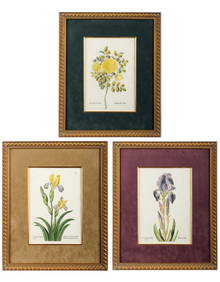
Georg Wolfgang Knorr (German, 1705-1761), Three Antique Hand Colored Botanical Engravings ofHoch LTD.4.5(73)See Sold PriceFeb 25, 2024
Two (2) Antique 18th C. Copper Engraved Framed Maps - America & EuropeMagnusson Art Group4.5(46)See Sold PriceMar 14, 2024
First Copy of Gautier's Le Roman de la Momie - 13 Original Watercolors by George Barbier (2 VolumesTrillium Antique Prints & Rare Books4.5(30)See Sold PriceFeb 24, 2024
Pascal's Collection de fleurs... - Volume with 48 Originally Hand-colored LithographsTrillium Antique Prints & Rare Books4.5(30)See Sold PriceFeb 24, 2024
Gulf of Guinea. Ghana Togo Benin Nigeria. ADMIRALTY sea chart 1928 (1954) mapJasper524.5(9.8k)See Sold PriceFeb 28, 2024