Thomson: Antique Map of Venetian States, 1817TITLE/CONTENT OF MAP: 'Venetian States' This large map shows the main contiguous part of the Republic of Venice, although as an entity it had ceased to exist in 1797 DATE PRINTED: 1817 IMAGE SIZE: AppSee Sold Price
Thomson: Antique Map of Venetian States, Italy, 1817TITLE/CONTENT OF MAP: 'Venetian States' This large map shows the main contiguous part of the Republic of Venice, although as an entity it had ceased to exist in 1797 DATE PRINTED: 1817 IMAGE SIZE: AppSee Sold Price
SoldThomson: Antique Map of The Venetian States, 1814Title/Content of Map: The Venetian States Cartographer: Thomson Place & Date: Edinburgh / 1814/1817 Size: 19 1/4" x 23 1/4" Condition: light overprinting; minor spotting; some browning along the centeSee Sold Price
SoldThomson: Antique Map Northeastern United States, 1817Northern Provinces of the United States The beautifully detailed and colored northern United States map from Thomson's New General Atlas, with a lovely inset view of "the Great Falls of Niagara.'" CarSee Sold Price
Thomson: Antique Map of Southern United States, 1817Southern provinces of the United States' The map shows the United States including the first 17 states to acceed, including Tennessee, which had joined in 1796. Ohio, Louisiana and Indiana, which hadSee Sold Price
SoldThomson: Antique Map of Southeastern United States 1817Southern Provinces of the United States A beautiful exemplar of the southern United States map from Thomson's New General Atlas, with a lovely inset view of "Characteristic Scenery of the Hudson RiverSee Sold Price
Thomson: Antique Map of the United States, 1817United States of America' The map shows the United States including the first 17 states to acceed, including Tennessee, which had joined in 1796. Ohio, Louisiana and Indiana, which had all joined theSee Sold Price
Thomson: Antique Map of Southwest United States, 1817TITLE/CONTENT OF MAP: 'Southern provinces of the United States' The map shows the United States including the first 17 states to acceed, including Tennessee, which had joined in 1796. Ohio, LouisianaSee Sold Price
Thomson: Antique Map of Northern United States, 1817Title/Content of Map: 'Northern provinces of the United States' The map shows the "District of Maine", prior to its accession to the Union as the state of Maine in 1820. Some Native American Indian viSee Sold Price
Thomson: Antique Map of Northern United States, 1817TITLE/CONTENT OF MAP: 'Northern provinces of the United States' The map shows the "District of Maine", prior to its accession to the Union as the state of Maine in 1820. Some Native American Indian viSee Sold Price
SoldAntique Map United States Thomson's 1817Antique Map United States Thomson's 1817, authentic antique map, inscribed, "drawn & engraved for Thomson's new general atlas 1817", along with "Northern Provinces of the United States", hand coloredSee Sold Price
SoldThomson: Antique Map of U.S. / St. Lawrence River, 1817Map: The Course of the River St. Laurence/United States of America Cartographer: Thomson Place & Date: Edinburgh / 1817 Size: 24 1/4" x 16 1/8" Condition: overprinting and light age-toning throughout;See Sold Price
Thomson: Antique Map of Italy, Island of Elba, 1817Italy. Island of Elba' Kingdom of Naples, Papal States &c. The map shows the Italian states largely as they had been prior to the French Revolution. Inset in the top right hand corner is a map of ElbaSee Sold Price
Thomson: Antique Map of US Northern Provinces, 1817Title/Content of Map: 'Northern provinces of the United States' The map shows the "District of Maine", prior to its accession to the Union as the state of Maine in 1820. Some Native American Indian viSee Sold Price
Thomson: Antique Map of Southern British India 1817TITLE/CONTENT OF MAP: 'British India, southern part' A large detailed map of southern India showing British territories and Native States. The Malabar, Coromandel and Pirate coasts are marked. Part ofSee Sold Price
Thomson: Antique Map of British India, 1817TITLE/CONTENT OF MAP: 'British India, southern part' A large detailed map of southern India showing British territories and Native States. The Malabar, Coromandel and Pirate coasts are marked. Part ofSee Sold Price
Thomson: Antique Map of Southern British India, 1817British India, southern part' A large detailed map of southern India showing British territories and Native States. The Malabar, Coromandel and Pirate coasts are marked. Part of ceylon is shown. DateSee Sold Price
SoldMap of the Southern Province of U.S. 1817An Antique Hand-Colored Map of the Southern Provinces of the United States, 1817, from Thomson's New General Atlas, copper-engraved map, sheet 21 1/2 in. x 28 3/4 inSee Sold Price
Sold2 United States Maps, including 1817.2 United States Maps, including 1817. 1st item: Northern Provinces of the United States map by John Thomson from "Thomson's New General Atlas", engraved by Nathaniel Rodgers Hewitt, 1817. Colored mapSee Sold Price
Venetian StatesReserve Reduced! Title: Venetian States Publication Date: 1817 Cartographer: THOMSON, JOHN & CO. Publisher: JOHN THOMSON, JUNR. & CO. Size: 19.75X23.3 No.26 from Thomson's New General Atlas 1817. N. RSee Sold Price
SoldThomson/Hewitt Map, 1817 Southern Provinces of US"Map of the Southern Provinces of the United States", drawn and engraved by N. R. Hewitt, published by John Thomson, Edinburgh, John Cumming, Dublin, and Baldwin, Cradock, and Joy, London, 1817. FromSee Sold Price
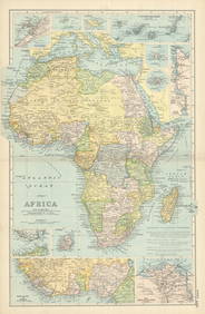
Thomson: Antique Map of Ireland, 1817TITLE/CONTENT OF MAP: 'Ireland' Coach roads 1817 old antique vintage map plan chart DATE PRINTED: 1817 IMAGE SIZE: Approx 64.0 x 53.0cm, 25.25 x 20.75 inches (Large); Please note that this is a foldinSee Sold Price
Thomson: Antique Map of Ireland, 1817Title/Content of Map: 'Ireland' Coach roads 1817 old antique vintage map plan chart Date Printed: 1817 Image Size: Approx 64.0 x 53.0cm, 25.25 x 20.75 inches (Large); Please note that this is a foldinSee Sold Price
Thomson: Antique Map of "Swisserland", 1817Swisserland. Mont Blanc, nearly three miles above the level of the sea.' This large, fascinating map depicts "Swisserland", the Republic of the Swiss, or the Old Swiss Confederacy, a precursor to theSee Sold Price
Arrowsmith & Lewis - Map of the United StatesTrillium Antique Prints & Rare Books4.5(30)See Sold PriceFeb 24, 2024
Putnam - First Map of the State of Ohio by Rufus PutnamTrillium Antique Prints & Rare Books4.5(30)See Sold PriceFeb 24, 2024
Mitchell - Map of the City of Washington (Washington, DC)Trillium Antique Prints & Rare Books4.5(30)See Sold PriceFeb 24, 2024
Carey, pub. 1796 - A Chart of the West IndiesTrillium Antique Prints & Rare Books4.5(30)See Sold PriceFeb 24, 2024
Carey, pub. 1796 - Map of the State of MarylandTrillium Antique Prints & Rare Books4.5(30)See Sold PriceFeb 24, 2024
Carey, pub. 1796 - Map of GeorgiaTrillium Antique Prints & Rare Books4.5(30)See Sold PriceFeb 24, 2024
Carey, pub. 1796 - Map of The State of South CarolinaTrillium Antique Prints & Rare Books4.5(30)See Sold PriceFeb 24, 2024
Carey, pub. 1796 - Map of KentuckyTrillium Antique Prints & Rare Books4.5(30)See Sold PriceFeb 24, 2024
Carey, pub. 1796 - Map of the Tennassee State formerly part of North Carolina (Tennessee)Trillium Antique Prints & Rare Books4.5(30)See Sold PriceFeb 24, 2024
Pre-colonial Africa. Mountains of Kong/Moon. Caravan routes. THOMSON 1817 mapJasper524.5(9.8k)See Sold PriceFeb 28, 2024
Central Africa. Congo Free State Rhodesia German East Africa. STANFORD 1896 mapJasper524.5(9.8k)See Sold PriceFeb 28, 2024
Carte d'Afrique. Africa Soudan Zanzibar. LAPIE 1831 old antique map plan chartJasper524.5(9.8k)See Sold PriceFeb 28, 2024
AFRICA French Congo State Soudan Nile Delta Suez canal by GW BACON 1898 mapJasper524.5(9.8k)See Sold PriceFeb 28, 2024
Clarke & Neele 1815 Map. Europe - Recent Political ChangesAlbion Auctions4.6(336)See Sold PriceMar 01, 2024
Cooke, George 1801 Antique Map. United States of AmericaAlbion Auctions4.6(336)See Sold PriceMar 01, 2024
Blackie (Pub) 1882 Folio Map. West USA - Pacific StatesAlbion Auctions4.6(336)See Sold PriceMar 01, 2024
Blackie (Pub) 1882 Folio Map. United States of North AmericaAlbion Auctions4.6(336)See Sold PriceMar 01, 2024
Antique Map - Views on the coast of Asia. J. Webber del. Engraved after J. Webber and W. Bligh.Proverde Auctions4.3(3)See Sold PriceFeb 28, 2024