SoldStanford (E) Map of Metropolitain RailwaysStanford (Edward) Publisher.- A New Map of Metropolitain Railways & Miscellaneous Improvements Deposited at the Private Bill Office, Nov. 30, 1863, for session 1864,a standard metropolitan mapSee Sold Price
SoldStanford (E.) Map of The County of LondonStanford (Edward) Map of The County of London, Shewing The Boundary of the Jurisdication of The London County Council,engraved colour map, 650 x 1000mm., surface dirt, ink stamp to upper leftSee Sold Price
SoldStanford (E) Map of The County of LondonStanford (Edward) Map of The County of London, Shewing The Boundary of the Jurisdication of The London County Council,engraved colour map, 650 x 1000mm., surface dirt, ink stamp to upper leftSee Sold Price
SoldStanford (E) Library Map of LondonStanford (Edward) Library Map of London and its Suburbs, 4 folding engraved linen-backed maps, each dissected into 20 sections with part original hand-colouring, each opening to 980 x 850mm.,See Sold Price
Very Rare 1853 Pocket Railroad Map of the MidwestLewis, I. T. & Gest, E. James' Map of Railways Centering at Cincinnati with Their Tributary Lines in Adjoining States and Canada West. Lithographed map. C. Mendenhall, c. 1853 (2nd edition). 21 ¼"See Sold Price
SoldSTANFORD, EDWARD. Stanford's Railway Map of EuSTANFORD, EDWARD. Stanford's Railway Map of European Russia. Color printed case map in 42 sections, 1225x990 mm overall; linen-backed; with the original cloth case. London, 1919 All items are offeredSee Sold Price
Sold(TRANS-SIBERIAN RAILWAY.) Stanford, Edward. Stanford's(TRANS-SIBERIAN RAILWAY.) Stanford, Edward. Stanford's Map of the Siberian Railway, the Great Land Route to China and Korea. Large lithographed case map of Russia, Kazakhstan, Mongolia, northern ChinaSee Sold Price
SoldStanford's Railway Map of European RussiaStanford (Edward) Railway Map of European Russia,lithographed map with extensive colouring, railway route overprinted, 1195 x 920mm., dissected and linen-backed, yellow advertisements to outerSee Sold Price
SoldStanford (Edward) Map of the Siberian RailwayStanford (Edward) Map of the Siberian Railway, The Great Land Route to China and Korea,lithographed map with full colouring, railway route and stops overprinted, 710 x 1130mm., dissected and lSee Sold Price
Sold(CANADA.) Edmonds, A.M., for the Canadian Government(CANADA.) Edmonds, A.M., for the Canadian Government Railways; and Stanford, Edward (sold by). Map Shewing the Railways of Canada. Enormous chromolithographed case map of Canada and the northern UniteSee Sold Price
SoldLarge map of U.S. at start of Civil WarHeading: Author: Stanford, Edward Title: Stanford's Railway and County Map of the United States and Territories Place Published: London Publisher: Date Published: 1861 Description:See Sold Price
SoldSTANFORD, EDWARD. Stanford's Portable Map of ESTANFORD, EDWARD. Stanford's Portable Map of Europe. Engraved case map in 28 sections, 765x845 mm overall; hand-colored in outline; linen-backed; with the original gilt-lettered cloth case. London, 18See Sold Price
SoldStanford (E) part of county DurhamStanford (Edward) Ordnance Geological Survey of England and Wales,sheet XVIII, part of county Durham, engraved map, with hand-colouring, 655 x 980mm., dissected and linen-backed, original clotSee Sold Price
SoldStanford (E) Stanford's London Atlas of UniversalStanford (Edward) Stanford's London Atlas of Universal Geography,68, mostly double-page, engraved maps only, of 100, with original hand-colouring, contents loose or partially disbound, most wiSee Sold Price
Sold2 London pocket maps: Collins' + Railways.[Pocket Maps] 2 Maps. ++ Collins’ Standard Map Of London. Lon: Edward Stanford, (nd), [c. 1860s]. Shows the minute details of the city’s street grid, with parks, constructed railways, proposed raiSee Sold Price
SoldTownship and Railway Map of the State of OhioTitle: Township and Railway Map of the State of Ohio Publication Date: 1866 Publisher: E. MENDENHALL Size: 18.75 x 20 "shewing the county & township boundaries, the locations of towns, villages, railwSee Sold Price
Township and Railway Map of the State of OhioReserve Reduced! Title/Content of Map: Township and Railway Map of the State of Ohio Date: 1866 Cartographer: MENDENHALL, E. Publisher: E. MENDENHALL Size: 18.75 x 20 inches shewing the county & townsSee Sold Price
SoldE H Spencer (dates unknown) York See Britain By TraE H Spencer (dates unknown) York See Britain By Train, original lithograph poster printed for BR(NER) by Waterlow 1960 - 102 x 127 cm; and Southern Railway Map of the System, Main Line and Suburban PaSee Sold Price
E H Spencer (dates unknown) York See Britain By TraE H Spencer (dates unknown) York See Britain By Train, original lithograph poster printed for BR(NER) by Waterlow 1960 - 102 x 127 cm; and Southern Railway Map of the System, Main Line and Suburban PaSee Sold Price
SoldE H Spencer (dates unknown) York See Britain By TrE H Spencer (dates unknown) York See Britain By Train, original lithograph poster printed for BR(NER) by Waterlow 1960 - 102 x 127 cm; and Southern Railway Map of the System, Main Line and Suburban PaSee Sold Price
Railway Map of KentuckyTitle: Railway Map of Kentucky Publication Date: 1876 Cartographer: MENDENHALL, E. Publisher: E. MENDENHALL Dimensions: 13 X 22.5 Additional Information: "exhibiting the locations of the counties, citSee Sold Price
E H Spencer (dates unknown) York See Britain By TrE H Spencer (dates unknown) York See Britain By Train, original lithograph poster printed for BR(NER) by Waterlow 1960 - 102 x 127 cm; and Southern Railway Map of the System, Main Line and Suburban PaSee Sold Price
Lloyd's Topographical and Railway Map of North-AmericaPublication Date: 1875 Title: Lloyd's Topographical and Railway Map of North-America Cartographer: LLOYD, J. T. Publisher: E. LLOYD Height: 60.5 Width: 56.5 Large wall map of North America emphasizingSee Sold Price
SoldSOUTHWEST VIRGINIA RESOURCE AND RAILWAY MAPSOUTHWEST VIRGINIA RESOURCE AND RAILWAY MAP, lithograph on paper, titled "South West Virginia Mineral Resources & Railway Facilities", by C. R. Boyd C. E., 1883. Covering Botetourt to Scott Co. and shSee Sold Price
Crams Colored Railway Map and Shippers Guide of South Dakota 1908-1909JM Hobby Supply and Railroad Artifact Auctions4.4(127)See Sold PriceFeb 24, 2024
OGILVY & BOWEN c1736 Original Map of Oxfordshire Berkshire Etc.Luis Porretta Fine Arts4.3(10)See Sold PriceMar 02, 2024
Early 1900's Railway Service Map, Illinois, Ohio, Indiana, Kentucky, TennesseeConnoisseur Auctions3.9(336)See Sold PriceFeb 24, 2024
1887 Appletons' General Guide to the United State and Canada Part IIRail & Road Auctions4.6(165)See Sold PriceMar 08, 2024
Rand McNally & Co's New Ideal State and County Survey and Atlas 1911North American Artifact Auctions4.7(198)See Sold PriceApr 20, 2024
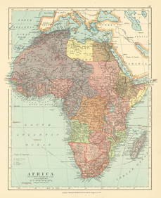
Africa. Congo Free Trade Area. British South Africa Company. STANFORD 1896 mapJasper524.5(9.9k)See Sold PriceFeb 28, 2024
Northwest Africa. Morocco Sahara Rio do Oro Ain Sefra Gardaia. STANFORD 1904 mapJasper524.5(9.9k)See Sold PriceFeb 28, 2024
Central Africa. Congo Free State Rhodesia German East Africa. STANFORD 1896 mapJasper524.5(9.9k)See Sold PriceFeb 28, 2024
Africa. French West/Equatorial. Tanganyika Belgian Congo. STANFORD c1925 mapJasper524.5(9.9k)See Sold PriceFeb 28, 2024
Africa. Congo Free Trade Area. British South Africa Company. STANFORD 1894 mapJasper524.5(9.9k)See Sold PriceFeb 28, 2024
Northwest Africa. Morocco Sahara Rio do Oro Ain Sefra Gardaia. STANFORD 1904 mapJasper524.5(9.9k)See Sold PriceFeb 28, 2024
Stanford, Edward 1901 Large Map. Geological Map of the British IslesAlbion Auctions4.6(341)See Sold PriceMar 01, 2024
Stanford, Edward 1901 Large Map. Hydrographical Map of the British IslesAlbion Auctions4.6(341)See Sold PriceMar 01, 2024
Stanford, Edward 1901 Large Map. Stereographical Map of The British IslesAlbion Auctions4.6(341)See Sold PriceMar 01, 2024