MAP - PIETER SCHENK / VALK / JANSSEN Hand Colored superb Map Central Italy c1702Luis Porretta Fine Arts4.3(10)See Sold PriceMar 02, 2024
CHARLES ROLLIN c1828 Ceasar Hand Colored Africa Military MapLuis Porretta Fine Arts4.3(10)See Sold PriceMar 02, 2024
MAP - Dufour, A. H. ( Malte / Brun ) :MAP - ESPAGNE PARTIE SUD DIVISEE EN PROVINCES ANCIENNES ( MAPLuis Porretta Fine Arts4.3(10)See Sold PriceMar 02, 2024
RIGOBERT BONNE c1787 Original Colored Map Germany & Region 15" x 12"Luis Porretta Fine Arts4.3(10)See Sold PriceMar 02, 2024
AMBROISE TARDIEU c1822 Napoleonic War Map GermanyLuis Porretta Fine Arts4.3(10)See Sold PriceMar 02, 2024
MAP - AMBROISE TARDIEU c1822 Napoleonic Miltary Map GermanyLuis Porretta Fine Arts4.3(10)See Sold PriceMar 02, 2024
1822 Rare Map by Ambroise Tardieu Napoleon Caldiero Battle of Vento 17" x 11Luis Porretta Fine Arts4.3(10)See Sold PriceMar 02, 2024
PIETER SCHENK / VALK / JANSSEN Hand Colored Map of Rhodes Greece ca1702 vgcLuis Porretta Fine Arts4.3(10)See Sold PriceMar 02, 2024
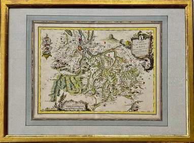
Map: Carte du Canton de Bale, Jacques Clermont, Paris, 1788Kensington Estate Auction4.6(216)See Sold PriceFeb 26, 2024
SoldSpain: Catalonia. Nicolas SansonMaker: Sanson, Nicolas. Origin: Paris, 1676. Medium: Original copper engraving on laid paper with later hand-coloring. Sheet size: 12 x 15 in No Reserve: This lot starts at $1 and has no reserve as aSee Sold Price
SoldSpain.- Sanson (Nicolas) & Pierre Mariette. Les EstatsSpain.- Sanson (Nicolas) & Pierre Mariette. Les Estats de la Couronne de Castille, dans les Parties Plus Meridionales de l'Espagne..., detailed map of southern Spain showing the Strait of Gibraltar anSee Sold Price
SoldSanson (Nicolas) La CatalogneSanson (Nicolas) La Catalogne, engraved map of Catalonia with original outline hand-colouring, decorative cartouche (uncoloured), 540 x 870mm., occasional light browning and offsetting, 2 isolSee Sold Price
SoldSanson (Nicolas) L'EspagneSanson (Nicolas) L'Espagnelarge engraved map of Spain and Portugal with full original hand-colouring, large decorative cartouches (uncoloured), 550 x 875mm., some browning, soiling and repairSee Sold Price
SoldSanson (Nicolas) L'EspagneSanson (Nicolas) L'Espagne subsiuisée en tous ses Royaumes, Principtes, seignries, &c.,Spain, the Balearics, and the northern coast of Africa, with large ornamental title cartouche (uncolouredSee Sold Price
SoldSanson (Nicolas) L'EspagneSanson (Nicolas) L'Espagne divisée en touts ses Royaumes et Principautés, large engraved map of Spain and Portugal with full original hand-colouring, large decorative cartouches (uncoloured),See Sold Price
SoldWith 18 maps by Nicolas SansonHeading: Author: Chemereau, N. Title: Geographie pratique, contenant outre les instructions suffisantes à rendre une personne assez habile pour dresser lui même des cartes, le moyen de trouver la lSee Sold Price
SoldNicolas Sanson d'Abbeville (1600-1667), "Mexique ouNicolas Sanson d'Abbeville (1600-1667), "Mexique ou Nouvelle Espagne, Nouvelle Gallice Iucatan, Panama," 1656, hand colored, H.- 15 1/2 in., W.- 22 1/2 in.See Sold Price
Sold1845 Spain-Catalonia Isabel II AE 3 Quartos Coin ANACSOne 1845 Spain-Catalonia Isabel II AE 3 Quartos Coin ANACS AU55. ANACS Certified.See Sold Price
SoldNicolas Sanson (1600-1667), "Amerique MeridionaleNicolas Sanson (1600-1667), "Amerique Meridionale divisee en ses Principales Parties au sont, Les Estats, Francois Castillans Portugais, Hollandois," 1691, hand colored, H.- 25 in., W.- 37 in.See Sold Price
SoldNicolas SANSON - Estats de la couronne de Pologne,Nicolas SANSON - Estats de la couronne de Pologne, subdivisés suivant l'estendue des palatinats Paris, H. Jaillot, 1692. Carte en couleur. 55 x 87 cm. 2 cartouches. Placée sous cadre d'acajou vitréSee Sold Price
Sold18th Century Nicolas Sanson French (1600-1667)18th Century Nicolas Sanson French (1600-1667) Copperplate Engraving and Hand Painted Watercolor Map "Le Paraguay" Good Condition. Frame Measures 18-1/2 Inches by 22-1/2 Inches. Heavy Glass Cover. ShiSee Sold Price
SoldNicolas Sanson Atlantis Insula Map Hand Colored ENicolas Sanson (1600-1677), "Atlantis Insula," Amsterdam: Mortier, ca. 1700. This wonderful hand colored engraving map of America purportedly shows the Western Hemisphere about 200,000 years ago beforSee Sold Price
SoldThree Maps by Nicolas Sanson (1600-1667, Paris), Two-Three Maps by Nicolas Sanson (1600-1667, Paris), Two- "Carte Generalle d'Espagne .. Royaumes," 1641; together with "Gouvernement General d'Orteans Maine, le Perche, la Beauce..Gastinois," 1650, hand cSee Sold Price
SoldNicolas Sanson (1600-1667), "Les Isles BritanniquesNicolas Sanson (1600-1667), "Les Isles Britanniques Divisees en peuples soivant Ptolomee," 1641, hand colored, H.- 17 1/4 in., W.- 23 1/4 in.See Sold Price
SoldNicolas Sanson (1600-1667), "lrlande Royaume diviseeNicolas Sanson (1600-1667), "lrlande Royaume divisee en ses quatre Provinces et ces Provinces en leurs Comtes," 1665, hand colored, H.- 18 in., W.- 24 in.See Sold Price
SoldTwo Maps by Nicolas Sanson (1600-1667, Paris), " LaTwo Maps by Nicolas Sanson (1600-1667, Paris), " La France L'Ancienne Gaule Primatiats… ar Evesches et Evesches," 1679; together with "Le Royaume de France et es Acqusitions Pays Bas L'AllemagneSee Sold Price
SoldAntique Map of France by Nicolas SansonAntique map of France engraved by Nicolas Sanson 1600-1667, published by Covens and Mortier in Amsterdam, 18th century. Measures 20 inches x 25 inches, in good condition.See Sold Price
Sold1845 Spain-Catalonia Isabel II AE 3 Quartos Coin ANACSOne 1845 Spain-Catalonia Isabel II AE 3 Quartos Coin ANACS AU55. ANACS Certified.See Sold Price
SoldNicolas Sanson (French 1600-1667) EngravingThe frontispice from the "Atlas Nouveau", decorated with Classical imagery, with laid down table of contents, some of which is handwritten. Dimensions: Sight 20 1/2" x 16 1/2", the frame 29" x 25".See Sold Price
SoldNicolas Sanson Map of Morea Greece 1692Nicolas Sanson (1600-1677), "La Moree et les Isles de Zante, Cafalonie, Ste Maure, Cerigo, &c." Paris: Hubert Jaillot, 1692. This hand-colored map depicts Morea, the southern part of Greece, with theSee Sold Price
SoldAN 1659 FRENCH MAP OF DENMARK BY NICOLAS SANSONA hand-colored map of Northern Denmark by Nicolas Sanson (1600-1667), signed Sanson and dated with a cartouche on the lower left. Sheet measures 16.25 x 21 inches. Frame measures 20.5 x 26.5 inches. WSee Sold Price
SoldNICOLAS SANSON L'Hydrographie Description De L'Eau17th century double hemispherical map of the world, dated 1652. 45 cm x 60 cm (17 3/4" x 23 1/2")See Sold Price
SoldGroup of Three Maps by Nicolas Sanson (1600-1667,Group of Three Maps by Nicolas Sanson (1600-1667, Paris), "La Gaule en dixsept provinces Romain," 1641; together with "Gouvernment General du Lyonnois, Forez, Beavoilais," 1679; and "Gouvernment De FrSee Sold Price
LATE 17TH C. FRENCH MAP OF THE NEW WORLD BY ALEXIS-HUBERT JAILLOT (1632-1712)Thomaston Place Auction Galleries4.4(386)See Sold PriceFeb 24, 2024
Antique Albarello earthenware medicine pot Spain CataloniaAuction Wallstreet4.5(47)See Sold PriceMar 02, 2024
Duval - Pair: Map of Georgia & Map of Moscow, RussiaTrillium Antique Prints & Rare Books4.5(30)See Sold PriceFeb 24, 2024
Duval - Pair: Map of India & Map of MaldivesTrillium Antique Prints & Rare Books4.5(30)See Sold PriceFeb 24, 2024
Salvador Dali, 'Space Elephant', FacsimileWhite Knight Auction, Inc4.7(248)See Sold PriceFeb 29, 2024
Salvador Dali, 'The Temptation Of St. Anthony', FacsimileWhite Knight Auction, Inc4.7(248)See Sold PriceFeb 29, 2024
Salvador Dali, 'Three Sphinxes of Bikini', FacsimileWhite Knight Auction, Inc4.7(248)See Sold PriceFeb 29, 2024
Salvador Dali, 'Woman with a butterfly', FacsimileWhite Knight Auction, Inc4.7(248)See Sold PriceFeb 29, 2024