Gothic Revival Stained Glass Window of The ResurrectionSchmidt's Antiques Inc. Since 19114.8(431)See Sold PriceMar 02, 2024
THE FITZGERALD FAMILY TEA and DINNER SERVICEJohn McInnis Auctioneers,LLC4.5(505)See Sold PriceFeb 25, 2024
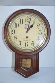
Union Pacific RR Cheyenne, WY Locomotive Shop ClockJM Hobby Supply and Railroad Artifact Auctions4.4(127)See Sold PriceFeb 24, 2024
A CHINESE PORCELAIN GREEN ENAMELED DRAGON MOON FLASK BIANHUBerkeley Auction Gallery4.4(16)See Sold PriceMar 03, 2024
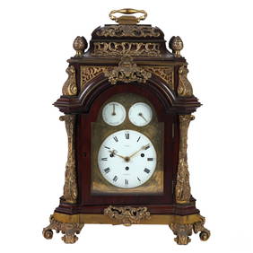
Antique George III Musical Bracket Clock by Hare LondonHill Auction Gallery 4.7(1k)See Sold PriceFeb 28, 2024
No Reserve Early 20th century French / Flemish Design Tapestry 6 ft 2 in x 4 ft 9 in (1.87 m x 1.44Nazmiyal Auctions4.4(34)See Sold PriceFeb 25, 2024
Central Anatolia Konya Antique Rug 4 ft 8 in x 3 ft 8 in (1.42 m x 1.11 m)Nazmiyal Auctions4.4(34)See Sold PriceFeb 25, 2024
PAIR MAGNIFICENT AND LARGE CLOISONNE ENAMEL CRANES INCENSE BURNERSBerkeley Auction Gallery4.4(16)See Sold PriceMar 03, 2024
From Davide Halevim Collection Antique Persian Mohtashem Kashan Rug 10'11" x 7'10" (3.32 m x 2.38 m)Nazmiyal Auctions4.4(34)See Sold PriceFeb 25, 2024
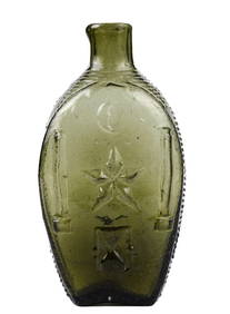
RARE COVENTRY GLASS WORKS MASONIC FLASKJohn McInnis Auctioneers,LLC4.5(505)See Sold PriceFeb 25, 2024
Empire by Buccellati Italy Sterling Silver Flatware Set 99 pieces DinnerBidhaus4.3(762)See Sold PriceFeb 25, 2024
Sketch Map Showing the Distribution of the Strata andPublication Date: 1881 Title: Sketch Map Showing the Distribution of the Strata and Eruptive Rocks in The Western Part of The Plateau Province Cartographer: DUTTON, CLARENCE C. Publisher: U.S. GEOLOGISee Sold Price
SoldAmerica.- Railroads.- Sketch Map Showing the Utica,America.- Railroads.- Sketch Map Showing the Utica, Ithaca & Elmira Railroad, & Connections, showing from New York in the lower right, to Niagra Falls and Lake Ontario in the upper left, lithograph prSee Sold Price
U.S. Coast and Geodetic Survey Sketch Map Showing theTitle: U.S. Coast and Geodetic Survey Sketch Map Showing the General Location of Los Angeles Base Line and Its Direct Connection With the Main Triangulation Publication Date: 1889 Cartographer: WESTDASee Sold Price
With maps showing distribution of diseasesHeading: Author: Fuchs, Caspar Friedrich Title: Medizinische Geographie Place Published: Berlin Publisher:Verlag von Alexander Duncker Date Published: 1853 Description: xii, 158See Sold Price
With maps showing distribution of diseasesHeading: Author: Fuchs, Caspar Friedrich Title: Medizinische Geographie Place Published: Berlin Publisher:Verlag von Alexander Duncker Date Published: 1853 Description: xiiSee Sold Price
SoldINDIA British/protected/ind states.Completed & plannedTITLE/CONTENT OF MAP: 'India; Inset Map of Sketch Map showing the extent of each Presidency and the protected States attached to it' This fascinating map shows British India divided between British teSee Sold Price
SoldAntique Map of Chicago, 1902Title/Content of Map: 1902 Map of Chicago -- Sketch Map Showing City Limits of Chicago Date Printed: 1902 Cartographer: Pub. Dudd, Mead & Co. Size: 8.5 X 5.5 in. A nice smaller map of greater ChicagoSee Sold Price
SoldINDIA British/protected/ind states.Completed & plannedTITLE/CONTENT OF MAP: 'India; Inset Map of Sketch Map showing the extent of each Presidency and the protected States attached to it' This fascinating map shows British India divided between British teSee Sold Price
SoldNatural Man (a record from Borneo)Artist: Hose, Charles Date: 1926 Media: 284 pp with illustrations and a map showing distribution of tribes Signature: No signedSee Sold Price
Sweden & Norway. Baltic Sea &C.Title/Content of Map: Sweden & Norway. Baltic Sea &C. Date: 1879 Cartographer: BARTHOLOMEW, J. Size: 19.75Height - 14.75Width Publisher: A. & C. Black Small sketch map showing the relative position anSee Sold Price
Sweden & Norway. Baltic Sea &C.Title: Sweden & Norway. Baltic Sea &C. Cartographer: BARTHOLOMEW, J. Publisher: A. & C. Black Height: 19.75 Width: 14.75 Small sketch map showing the relative position and climate of Norway. Some topoSee Sold Price
Santiago De Cuba. Position of Cuban and Spanish Forces1899 Title: Santiago De Cuba. Position of Cuban and Spanish Forces Prior to July 3. Cartographer: SIGNAL CORPS. U.S. ARMY Publisher: WAR DEPARTMENT Height: 13.3 Width: 24.75 "Sketch map showing CubanSee Sold Price
SoldBritish Isles.- Collection of over 45 maps of countiesBritish Isles.- Collection of over 45 maps of counties and regions of England & Wales, including maps by Robert Morden of Cambridge, Oxford, and Hertfordshire, two maps showing distribution of the VolSee Sold Price
SoldMap Showing the Distribution of the Indian Tribes, 1876Title/Content of Map: ... Map Showing the Distribution of the Indian Tribes of Washington Territory Date Printed: 1876 Cartographer: DALL, W. H. Size: 19.75X15.5 Elegant topographical and ethnologic mSee Sold Price
SoldMap Showing The Distribution Of The Genus JuglansMap Showing The Distribution Of The Genus Juglans [the Walnuts] In North America Exclusive Of Mexico. Dept. Of The Interior. 10th Census, Gannett, Henry/harry King, 1883, Folio – 17.40 H X 27.40 W ISee Sold Price
SoldWith map showing the distribution of slaves in theHeading: Author: [Lord, Daniel] Title: The Effect of Secession upon the Commercial Relations between the North and South, and upon each Section Place Published: New York Publisher:Office of the New YSee Sold Price
Map Showing the Distribution of Wealth.Title/Content of Map: Map Showing the Distribution of Wealth. Cartographer: WALKER, FRANCIS A. Date: 1874 Publisher: BUREAU OF THE CENSUS Size: 19.75Height - 14.75Width Compiled from the tables of truSee Sold Price
Map Showing the Distribution of Wealth.Title: Map Showing the Distribution of Wealth. Cartographer: WALKER, FRANCIS A. Publisher: BUREAU OF THE CENSUS Size: 19.75 X 14.75 Compiled from the tables of true valuation, Ninth Census 1870. By FrSee Sold Price
[Maps Showing the Distribution Within the Territory ofTitle: [Maps Showing the Distribution Within the Territory of The United States East of The 100th Meridian Of Certain Foreign Elements Of The Population, I. According to Their Number to The Square MilSee Sold Price
Distribution Map of Washington Indian Tribes 1876Map: Map Showing the Distribution of the Indian Tribes of Washington Territory Maker: U.S. Geographical and Geological Survey of the Rocky Mountain Region Size: 19.75 inches high x 15.5 inches wide DaSee Sold Price
Sold1850 Petermann Map of the Distribution of Birds andTitle/Content of Map: 1850 Petermann Map of the Distribution of Birds and Reptiles Globally -- Zoological Map Showing the Distribution of Birds and Reptiles (Aves et Reptilia) over the Globe Date: 185See Sold Price
Sold1850 Petermann Map of the Distribution of MammalsTitle/Content of Map: 1850 Petermann Map of the Distribution of Mammals Globally -- Zoological Map Showing the Distribution of the Principal Mammiferous Animals (Class Mammalia) over the Globe Date: 1See Sold Price
Map of Liriodendron Tulipifera & Pinus LambertianaMap Showing The Distribution Of Liriodendron Tulipifera And Pinus Lambertiana In North America Exclusive Of Mexico. Dept. Of The Interior. 10th Census, Gannett, Henry/harry King, 1883, Folio – 17.40See Sold Price
1850 Petermann Map of the Distribution of MammalsTitle/Content of Map: 1850 Petermann Map of the Distribution of Mammals Globally -- Zoological Map Showing the Distribution of the Principal Mammiferous Animals (Class Mammalia) over the Globe Date: 1See Sold Price
Rand McNally Railroad Map of Arizona-1909JM Hobby Supply and Railroad Artifact Auctions4.4(127)See Sold PriceFeb 24, 2024
CHARLES ROLLIN c1828 Ceasar Hand Colored Africa Military MapLuis Porretta Fine Arts4.3(10)See Sold PriceMar 02, 2024
Early 1900's Railway Service Map, Illinois, Ohio, Indiana, Kentucky, TennesseeConnoisseur Auctions3.9(336)See Sold PriceFeb 24, 2024
Vintage County Map Of NY State Plate EngravingThe Benefit Shop Foundation Inc.4.3(2.9k)See Sold PriceFeb 28, 2024
Pair of The Gateway to a Continent Books - Grand Central Zone and 1939 World's FairRail & Road Auctions4.6(165)See Sold PriceMar 07, 2024
Pair of Early Railroad Maps - 1862 Pittsburgh, Ft. Wayne & Chicago Railway and 1873 PennsylvaniaRail & Road Auctions4.6(165)See Sold PriceMar 07, 2024
Central Africa. Map showing great forest traversed by Mr Stanley, 1890Jasper524.5(9.9k)See Sold PriceFeb 28, 2024
Goode, George Brown 1884 Lot of 4 Natural History & Meteorology MapsAlbion Auctions4.6(341)See Sold PriceMar 01, 2024