SoldSamuel Lewis' 1819 US & Canada Map, "The travelleSamuel Lewis' 1819 US & Canada Map, "The travellers guide. A new and correct map of the United States, including great portions of Missouri Territory, Upper & Lower Canada, Nova Scotia, New Brunswick,See Sold Price
Sold1819 UNITED STATES WALL MAP BY SAMUEL LEWIS1819 UNITED STATES WALL MAP BY SAMUEL LEWIS, 36" X 47 1/2"; "NEW CORRECT MAP OF THE UNITED STATES INCLUDING GREAT PORTIONS OF MISSOURI TERRITORY, UPPER & LOWER CANADA, NOVA SCOTIA, NEW BRUNSWICK, THESee Sold Price
SoldFirst U.S. Atlas Map of North Carolina 1795Lewis, Samuel (1782-1865). State of North Carolina from Best Authorities. Engraved map. Matthew Carey, 1795. 11" x 18 ½" sheet.See Sold Price
SoldMississippi Territory MapInscribed in pencil u.l Samuel Lewis Atlas Philadelphia 1814. Alabama became a state 1819. 16 1/4"h x 21"wSee Sold Price
SoldU.S. shortly after Lewis & Clark discoveriesHeading: Author: Tardieu, P. Title: Carte des Etats-Unis de l'Amerique Septentrionale Place Published: Paris Publisher: Date Published: 1819 Description: Copper-engraved maSee Sold Price
SoldSamuel Lewis Map of South CarolinaEarly 19th C. hand-colored map by Samuel Lewis, engraved by Henry Schenck Tanner. With minor foxing and discoloration, not examined out of frame / in as-found condition.Visible image: approx. 11" x 8See Sold Price
SoldSamuel Lewis Map of South Carolina1795 map, William Barker. Nicely detailed and hand watercolored at the districts. Nicely framed and matted. Good overall condition. Sight size: H15 1/4" W17 1/4" (without frame)See Sold Price
SoldSAMUEL LEWIS MAP OF VIRGINIA 1794MAP STATE OF VIRGINIA FROM THE BEST AUTHORITIES, BY SAMUEL LEWIS, 1794. CAREY, MATHEW. PHILA. 1794. Engraved for the first American commercial atlas with reading, "Engraved for Carey's American EditioSee Sold Price
Samuel Lewis Map of New Hampshire, 1813.17 x 21 inches. Together with an 1867 S. Augustus Mitchell Jr. Map of New Hampshire and Vermont, 15 1/4 x 12 inches.See Sold Price
Extremely scarce map of South Carolina (1814)Scarce third state of Samuel Lewis’s map of South Carolina, appearing in the extremely scarce 1816 edition of Carey’s General Atlas (same map as in the 1814 Carey atlas). One of the earlieSee Sold Price
Samuel Lewis Antique Map of MarylandLate 18th/early 19th century. The piece is handsomely hand watercolored at border and bodies of water. Housed in a fine reverse painted glass frame which accents the piece nicely. H11 1/2" W16 1/2"See Sold Price
SoldSamuel Lewis' Topographical Map of County CorkSamuel Lewis' Topographical Map of County Cork, Framed engraving, Circa 1837 37 x 43 cm.See Sold Price
SoldMAP -- CAREY, Matthew . A Map of the United StatesMAP -- CAREY, Matthew (publisher); Samuel LEWIS. A Map of the United States: compiled chiefly from the State Maps, and other Authentic Information.Philadelphia: Matthew Carey, 1795 [but 1796].See Sold Price
SoldSamuel Lewis's 1795 Map of South CarolinaSamuel Lewis's 1795 Map of South Carolina from Carey's American Edition of Guthries Geography Improved. The map shows remarkable early detail, including towns, the 8 precincts, roads, rivers, lakes, cSee Sold Price
SoldTennessee Map, Samuel Lewis & Alexander Lawson, 1804"Tennessee" Map, drawn by Samuel Lewis, engraved by Alexander Lawson, published by John Conrad & Co., Philadelphia, 1804. From "A New And Elegant General Atlas: Comprising All the New Discoveries, toSee Sold Price
SoldTennessee Map, Samuel Lewis & Alexander Lawson, 1804"Tennessee" Map, drawn by Samuel Lewis, engraved by Alexander Lawson, published by John Conrad and Company, Philadelphia, 1804. From "A New And Elegant General Atlas: Comprising All the New DiscoverieSee Sold Price
SoldTennessee Map, Samuel Lewis & Alexander Lawson"Tennessee" Map, drawn by Samuel Lewis, engraved by Alexander Lawson, published by Thomas & Andrews, Boston, 1812. From "A New And Elegant General Atlas: Comprising All the New Discoveries, to the PreSee Sold Price
SoldTennessee Map, Samuel Lewis & Alexander Lawson, 1804"Tennessee" Map, drawn by Samuel Lewis, engraved by Alexander Lawson, published by John Conrad and Company, Philadelphia, 1804. From "A New And Elegant General Atlas: Comprising All the New DiscoverieSee Sold Price
MAPS - US & Canada. Trans-Canada Air LinesUnited States & Canada. Trans-Canada Air Lines, [Lot of 3] TCA Air Route Maps [and] Trans-Canada Air Lines Air Canada [and] Route Map Vancouver to Amsterdam, 1950-60 (circa). Printed Color. This lot iSee Sold Price
SoldTennessee Map, Samuel Lewis & Alexander Lawson, 1804"Tennessee" Map, drawn by Samuel Lewis, engraved by Alexander Lawson, published by John Conrad and Company, Philadelphia, 1804. From "A New And Elegant General Atlas: Comprising All the New DiscoverieSee Sold Price
SoldC.W.Era Map U.S. & Canada R. de Tournon/Jules RenouardU.S., East Coast, New York, Canada; R. de Tournon / Jules Renouard - Etats-Unies de L'Amérique du Nord - 1851-1860 Object Map(More lots) Country (current geographical location): U.S. | Geographical sSee Sold Price
SoldLewis (Samuel) Map of England and WalesLewis (Samuel) Map of England and Wales, 3 folding engraved linen-backed maps of the South East, South West and North West of England, with original hand-colouring, the later with a large engrSee Sold Price
SoldMAP, US & Canada, Arctic, Robert de VaugondyColonial United States & Canada, Arctic. Didier Robert de Vaugondy, Partie de la Carte du Capitaine Cluny Auteur d'un Ouvrage Anglois Intitule American Traveller Publie a Londres en 1769, 1773 (circa)See Sold Price
Samuel Oppenheim (NY,1901-1992) oil paintingBroward Auction Gallery4.8(277)See Sold PriceMar 10, 2024
1875 Rand Avery and Co. Map of Express Companies and Railroads of the USA and CanadaJM Hobby Supply and Railroad Artifact Auctions4.4(126)See Sold PriceFeb 24, 2024
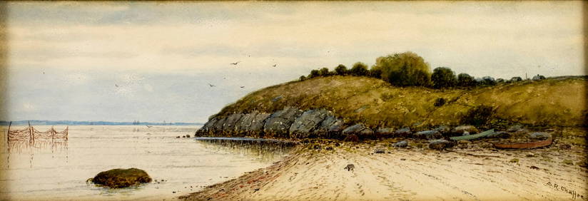
Samuel Chaffee (MA,RI,1850-1913) watercolor painting antiqueBroward Auction Gallery4.8(277)See Sold PriceMar 17, 2024
FLYING A TOURING SERVICE U.S. ROAD MAPS TIN WALL DISPLAY.Dan Morphy Auctions4.2(1.3k)See Sold PriceFeb 25, 2024
1885 CIVIL WAR 1ed Famous Memoirs US Grant Sheridan Sherman 6v RARE LOT MapsSchilb Antiquarian Rare Books4.8(421)See Sold PriceMar 10, 2024
MATTHEWS c1856 Map Of Upper Canada Ontario Indian Land Agency Divisions Scarce!Luis Porretta Fine Arts4.3(10)See Sold PriceMar 02, 2024
(4) PROFESSIONAL PERIOD PHOTOS of J.F.K.John McInnis Auctioneers,LLC4.6(502)See Sold PriceFeb 25, 2024
[MAP]. [ALBRIZZI, Giambatista, 1698-1777]. Carta Geografica...Potter & Potter Auctions4.6(539)See Sold PriceMar 07, 2024
[VIETNAM]. A group of approx. 120 photographs assembled by African American soldier Vernon CliftonFreeman's | Hindman4.4(1.6k)See Sold PriceFeb 27, 2024
Arrowsmith & Lewis - Map of PolynesiaTrillium Antique Prints & Rare Books4.5(30)See Sold PriceFeb 24, 2024
Arrowsmith & Lewis - Map of North AmericaTrillium Antique Prints & Rare Books4.5(30)See Sold PriceFeb 24, 2024
Arrowsmith & Lewis - Map of the World on Mercator's ProjectionTrillium Antique Prints & Rare Books4.5(30)See Sold PriceFeb 24, 2024
Arrowsmith & Lewis - Map of LouisianaTrillium Antique Prints & Rare Books4.5(30)See Sold PriceFeb 24, 2024
Arrowsmith & Lewis - Map of the United StatesTrillium Antique Prints & Rare Books4.5(30)See Sold PriceFeb 24, 2024
US Post Lewis And Clark First Day Stamp Sheet BundleRapid Estate Liquidators and Auction Gallery4.5(1.1k)See Sold PriceFeb 29, 2024
Mostly U.S., Some Canada Maps etc (40 Pcs)Grant Zahajko Auctions, LLC4.8(1k)See Sold PriceMar 06, 2024


![[MAP]. [ALBRIZZI, Giambatista, 1698-1777]. Carta Geografica... (1 of 1)](https://p1.liveauctioneers.com/928/318880/171361280_1_x.jpg?height=282&quality=70&version=1707501302)
![[VIETNAM]. A group of approx. 120 photographs assembled by African American soldier Vernon Clifton (1 of 6)](https://p1.liveauctioneers.com/197/319238/171468143_1_x.jpg?height=282&quality=70&version=1707520367)


