17TH C. ENGLISH LINEAR MAP BY OGILBY, FRAMEDThomaston Place Auction Galleries4.4(386)See Sold PriceFeb 24, 2024
MAP - PIETER SCHENK / VALK / JANSSEN Hand Colored superb Map Central Italy c1702Luis Porretta Fine Arts4.3(10)See Sold PriceMar 02, 2024
OGILVY & BOWEN c1736 Original Map of Oxfordshire Berkshire Etc.Luis Porretta Fine Arts4.3(10)See Sold PriceMar 02, 2024
CHARLES ROLLIN c1828 Ceasar Hand Colored Africa Military MapLuis Porretta Fine Arts4.3(10)See Sold PriceMar 02, 2024
MAP - Dufour, A. H. ( Malte / Brun ) :MAP - ESPAGNE PARTIE SUD DIVISEE EN PROVINCES ANCIENNES ( MAPLuis Porretta Fine Arts4.3(10)See Sold PriceMar 02, 2024
RIGOBERT BONNE c1787 Original Colored Map Germany & Region 15" x 12"Luis Porretta Fine Arts4.3(10)See Sold PriceMar 02, 2024
AMBROISE TARDIEU c1822 Napoleonic War Map GermanyLuis Porretta Fine Arts4.3(10)See Sold PriceMar 02, 2024
MAP - AMBROISE TARDIEU c1822 Napoleonic Miltary Map GermanyLuis Porretta Fine Arts4.3(10)See Sold PriceMar 02, 2024
1822 Rare Map by Ambroise Tardieu Napoleon Caldiero Battle of Vento 17" x 11Luis Porretta Fine Arts4.3(10)See Sold PriceMar 02, 2024
THOMAS MOULE 1837 Colored Map of Warwickshire Framed vgcLuis Porretta Fine Arts4.3(10)See Sold PriceMar 02, 2024
PIETER SCHENK / VALK / JANSSEN Hand Colored Map of Rhodes Greece ca1702 vgcLuis Porretta Fine Arts4.3(10)See Sold PriceMar 02, 2024
STICH & DRUCK c1888 Map Austrian Alps 20" x 16"Luis Porretta Fine Arts4.3(10)See Sold PriceMar 02, 2024
SoldRobinson / Dilly: Antique Map of Poland, 1785Map: Poland Date Printed: 1785 Cartographer: G. Robinson & C. Dilly Material/Medium: Paper Size: 9 3/4" x 8 1/3" Condition: Excellent Published in London. Showing the changes of Russia, Prussia, & AusSee Sold Price
SoldWILLIAM DARTON (1755-1819) British An Accurate Map ofWILLIAM DARTON (1755-1819) British An Accurate Map of Hindostan or India From the Best Authorities Engraving on laid paper, published May 23rd 1785 by C Dilly & G Robinson, London, framed and glazed.See Sold Price
SoldRussell: Antique Map of Europe, 1799Map: Europe, Drawn from the Best Authorities... Publication Date: 1799-04-07 Authors: C. DILLY/G.G. & J. ROBINSON, RUSSELL, J./RUSSELL JR. Publisher: C. DILLY/G.G. & J. ROBINSON Size: Folio – 15.25See Sold Price
SoldANTIQUE MAPS FOUR PIECESANTIQUE MAPS, FOUR PIECES, H 9 - 11":Including a framed map of the West Indies, H.11 3/4 x 21 1/4", inscribed at the lower middle: "Published as the Act directs January 1st, 1785 by C. Dilly and G. RoSee Sold Price
SoldWilliam Guthrie, 1785 Copper EngravingWilliam Guthrie. "The British Colonies in North America" for Guthrie's New System of Geography. Printed by C. Dilly, G. Robinson, London. c. 1785. Sight: 13 1/2" x 13". Frame: 22 1/2" x 22". Map of "TSee Sold Price
18th C. Guthrie Hand Colored Map of the WorldPublished by Dilly and Robinson, London, 1785. Some minor foxing / discoloration / creases, framed. Not examined out of frame. Visible image: approx. 21 3/4" x 12". Frame: approx. 28" x 18 1/4".See Sold Price
5 Maps: Netherlands, late 1759-60 to [1850.][Netherlands] 5 Maps. ++ Guthrie. THE SEVEN UNITED PROVINCES…FROM THE BEST AUTHORITIES. London: C. Dilly & G. Robinson, 1785. 11 ¾ x 13 7/8 in., hand-colored in outline. Two old tape repairs, foldSee Sold Price
Sold7 maps, mostly Netherlands. 1785-(1867).[Netherlands] 7 Maps, mostly the Netherlands. ++ Guthrie. THE SEVEN UNITED PROVINCES …FROM THE BEST AUTHORITIES. London: C. Dilly & G. Robinson, 1785. 11 ¾ x 13 7/8 in., hand-colored in outline. TwSee Sold Price
SoldGuthrie (William) - The West Indies According to thefor Guthrie's System of Geography, engraved map with original hand-colouring in outline, 300 x 550mm., slight browning on the left one of two vertical folds, C. Dilly & G. Robinson, 1785; with 3 otherSee Sold Price
SoldGuthrie/Dilly & Robinson: Map of West Indies, 1785Map: The West Indies According to the best Authorities. Cartographer: William Guthrie / Dilly & Robinson Place & Date: London / 1785 Size: 20 1/2" x 11" The West Indies map from Guthrie's New System oSee Sold Price
SoldWILLIAM GUTHRIE (1708-1770) WORLD MAPWILLIAM GUTHRIE (1708-1770) WORLD MAP, hand-colored engraving on paper, titled "A Map of the World from the best Authorities", published June 15th, 1785 by C. Dilly and G. Robinson, London. Detailed mSee Sold Price
SoldAntique map Poland MordenUnframed antique map, ''A New Mapp [sic] of the Estates of the Crown of Poland'', published by Robert Morden (British, 1668-1703), engraved by F. Lamb, sheet: 20''h x 24''wSee Sold Price
Soldde la Tour: Antique Map of Poland Lithuania, 1771TITLE/CONTENT OF MAP: 'Etats de Pologne et de Lithuanie, divisés par Palatinats et Provinces Ecclesiastiques. Avec le Roiaume de Prusse et le Duché de Curlande. D'après d'exactes connaissances acquSee Sold Price
SoldStackhouse: Antique Map of Poland, 1783Title/Content of Map: Poland by Stackhouse Date Printed: 1783 Cartographer: Thomas Stackhouse Material/Medium: Paper Size: 16" x 20" Original hand color, copperplate engraved. Published in London in 'See Sold Price
Santini / Homann: Antique Map of Poland, Prussia, 1784Title/Content of Map: 'Carte de la Prusse Occidentale où sont tracées les Provinces cédées par la Pologne au Roi de Prusse. Suivant I'exemplaire Homanien de l'an 1775. À Venise par P. Santini 177See Sold Price
SoldDelaporte: Antique Map of Poland Reserve, 1787Title/Content of Map: Poland Reserve Date Printed: 1787 Cartographer: Joseph Delaporte Material/Medium: Paper Size: 9 1/2" x 7 1/4" From the Atlas Ou Collection De Cartes. Geographiques Pour L'intelliSee Sold Price
SoldBarlow 1807 Antique Map of PolandCopper Engraved Map Published 1807 by Brightly & Kinnersley, Bungay, England for "A General View of the World, Geographical, Historical and Philosophical" by The Rev. E. Blomfield. Maps Engraved by BaSee Sold Price
SoldBecker, F. C1850 Antique Map of PolandSteel Engraved Map Published C1850 "A Complete and Universal English Dictionary" by the Rev. James Barclay et al. Maps by F. Becker & W. Hughes. Outline hand colour. Paper Size: 10.5 x 8 inch (27 x 21See Sold Price
SoldThomas Kitchen, antique map of Poland showing theThomas Kitchen, antique map of Poland showing the claims of Austria, Russia and Prussia, 8ins x 11ins, another hand coloured map of Afghanistan and another uncoloured map of Poland, Lithuania and PrusSee Sold Price
SoldBarlow 1807 Antique Map of PolandCopper Engraved Map Published 1807 by Brightly & Kinnersley, Bungay, England for "A General View of the World, Geographical, Historical and Philosophical" by The Rev. E. Blomfield. Maps Engraved by BaSee Sold Price
SoldAn antique map of Poland by Izaak Tirion, circa 1740An antique map of Poland by Izaak Tirion, circa 1740 Title: [Old Antique map of Poland / Lithuania] Nieuwe Kaart van het Koninkryk Poolen. Author: Tirion, Izaak , Amsterdam, c. 1740. DescriSee Sold Price
Sayer: Antique Map of Poland, 1787Title/Content of Map: 1787 Sayer Map of Poland -- A New Map of the Kingdom of Poland, with its Dismembered Provinces Date Printed: 1787, London Cartographer: R Sayer Size: 18.9 x 25.6 in. This is a hiSee Sold Price
SoldVandermaelen: Antique Map of Poland Czechia SlovakiaTitle/Content of Map: 'Europe - Partie de l'Allemagne - No 14 ' Poland south of Olsztyn, Czechia, Slovakia, and parts of Austria & Western Ukraine Date Printed: 1827 Image Size: Approx 71.0 x 52.0cm,See Sold Price
Mallet: Antique Map of Poland / Czech, 1683Title/Content of Map: 'Silesie et Maravie' POLAND/CZECH. Silesia Moravia. Schlesien. Date Printed: 1683 Image Size: Approx Overall page size 13 x 21cm approximately (5 x 8 inches); image size 10.5 x 1See Sold Price
D'Oyly (Calcutta, India) - Government House from St. Andrew's LibraryTrillium Antique Prints & Rare Books4.5(30)See Sold PriceFeb 24, 2024
D'Oyly (Calcutta, India) - Procession of the CurruckpoojaTrillium Antique Prints & Rare Books4.5(30)See Sold PriceFeb 24, 2024
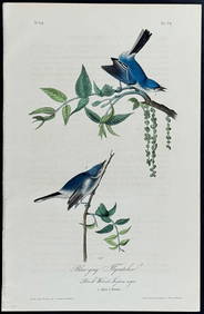
Audubon - Blue-grey Flycatcher. 70Trillium Antique Prints & Rare Books4.5(30)See Sold PriceFeb 24, 2024
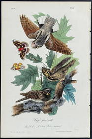
Audubon - Chuck-will's Widow. 41Trillium Antique Prints & Rare Books4.5(30)See Sold PriceFeb 24, 2024
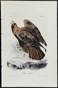
Audubon - Common Osprey Fish Hawk. 15Trillium Antique Prints & Rare Books4.5(30)See Sold PriceFeb 24, 2024
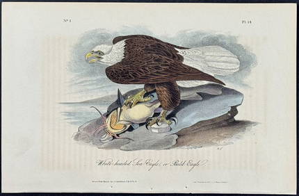
Audubon - White-headed Sea Eagle or Bald Eagle. 14Trillium Antique Prints & Rare Books4.5(30)See Sold PriceFeb 24, 2024
Audubon - Little Screech Owl. 40Trillium Antique Prints & Rare Books4.5(30)See Sold PriceFeb 24, 2024
1736 LARGE MAP OF SILESIA POLAND OPPAVIENSIS antique 25 by 34 3/4"Jasper524.5(9.8k)See Sold PriceFeb 27, 2024
1736 LARGE MAP OF SILESIA POLAND KARNOVIENSIS antique 25 x 4 3/4" Duchy of KrnovJasper524.5(9.8k)See Sold PriceFeb 27, 2024
La Nubia ed Abissinia. Red Sea Ethiopia Sudan Eritrea Arabia. ZATTA 1785 mapJasper524.5(9.8k)See Sold PriceFeb 28, 2024
Buffon, Vaugody & Bell 1785 America - Map of the New ContinentAlbion Auctions4.6(336)See Sold PriceMar 01, 2024
Buffon, Vaugody & Bell 1785 Map of the Old Continent. Africa, AsiaAlbion Auctions4.6(336)See Sold PriceMar 01, 2024
Antique Map - Views on the coast of Asia. J. Webber del. Engraved after J. Webber and W. Bligh.Proverde Auctions4.3(3)See Sold PriceFeb 28, 2024
Antique Map of Poland, 1700 by Guillaume De Lisle, ParisAntiques Online Auctions4.6(407)See Sold PriceMar 14, 2024


![5 Maps: Netherlands, late 1759-60 to [1850.] (1 of 3)](https://p1.liveauctioneers.com/179/85723/44107981_1_x.jpg?height=282&quality=70&version=1456876561)