1952 MAY, J.F.K. HANDWRITTEN LETTER & ENVELOPEJohn McInnis Auctioneers,LLC4.6(502)See Sold PriceFeb 25, 2024
WARNER BECKMAN'S TIGER MAPLE CELLO / SEABROOK NHJohn McInnis Auctioneers,LLC4.6(502)See Sold PriceFeb 25, 2024
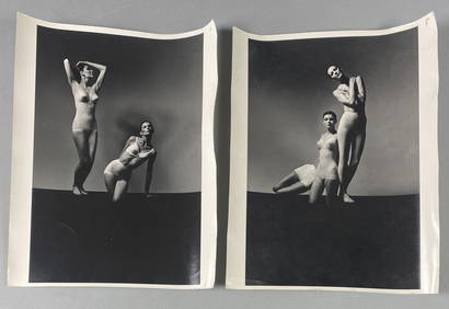
Victor Skrebneski Lingerie Fashion PhotographsEpic Auctions and Estate Sales4.6(204)See Sold PriceMar 02, 2024
[DOUGLASS, Frederick (1818-1895)]. ROBERTS, J.B., photographer. CDV of Frederick Douglass.Freeman's | Hindman4.4(1.6k)See Sold PriceFeb 27, 2024
1952 J.F.K. for SENATE TEAS & RECEPTION MATERIALJohn McInnis Auctioneers,LLC4.6(502)See Sold PriceFeb 25, 2024
HUGH D. AUCHINCLOSS' 70th BIRTHDAY with FAMILYJohn McInnis Auctioneers,LLC4.6(502)See Sold PriceFeb 25, 2024
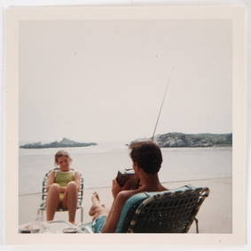
CAROLINE KENNEDY at BAILEYS BEACH, NEWPORT, RIJohn McInnis Auctioneers,LLC4.6(502)See Sold PriceFeb 25, 2024
WILLIAM LINSMAN PHOTO SIGNED by JACKIE KENNEDYJohn McInnis Auctioneers,LLC4.6(502)See Sold PriceFeb 25, 2024
[BASEBALL]. Original Photographic Team Portrait of the Cuba...Potter & Potter Auctions4.6(539)See Sold PriceMar 07, 2024
Rare map of Point LobosHeading: (Map - Monterey County - Point Lobos) Author: Cozzens, Howard F. & William Davies Title: Map of Point Lobos Proposed California State Park, a part of Rancho San José y Sur Chiquito in MonterSee Sold Price
Rare map of Point LobosHeading: (California - Monterey County - Point Lobos) Author: Cozzens, Howard F. & William Davies Title: Map of Point Lobos Proposed California State Park, a part of Rancho San José y Sur Chiquito inSee Sold Price
SoldRare map of Point LobosHeading: (California - Monterey County - Point Lobos) Author: Cozzens, Howard F. & William Davies Title: Map of Point Lobos Proposed California State Park, a part of Rancho San José y Sur Chiquito inSee Sold Price
SoldEDWARD WESTON - Rocks, Point Lobos, 1930This rare vintage print of a scarcely known image by Edward Weston is one of the last in private hands. At this time, circa 1930, Weston initialed and editioned his mounts beneath the image with a fulSee Sold Price
SoldWYNN BULLOCK - Wave, Point Lobos, 1958This rare enlargement was printed by Harry Abrams under the supervision of Wynn Bullock in 1972. This particular example is a test print from an edition of 10, which is inscribed and signed sheet versSee Sold Price
EDWARD WESTON - Point Lobo's Surf, China CoveArtist: EDWARD WESTON Print Title: Point Lobo's Surf, China Cove An incredible printing from a now rare portfolio printed in the 1970s Medium: Sheet-fed Gravure Printing Date: 1971 Printed in the USASee Sold Price
BRETT WESTON - Rocks, Point Lobos, 1950ARTIST: BRETT WESTON TITLE: 'Rocks, Point Lobos, 1950' MEDIUM: Vintage Silver Gelatin IMAGE SIZE: 7 5/8 x 9 1/2 in DESCRIPTION: This extremely rare, possibly unique, vintage silver gelatin print on seSee Sold Price
SoldEDWARD WESTON - Point Lobo's Surf, China CoveArtist: EDWARD WESTON Print Title: Point Lobo's Surf, China Cove An incredible printing from a now rare portfolio printed in the 1970s Medium: Sheet-fed Gravure Printing Date: 1971 Printed in the USASee Sold Price
SoldRare map of Southern CaliforniaHeading: (California) Author: Title: Maps of Southern California: Roads for leaving and entering twenty-three of the principal towns and cities; distances from Los Angeles and San Diego to points ofSee Sold Price
Currier & Ives. Seal Rocks-Point Lobos111. [SAN FRANCISCO]. CURRIER & IVES. California Scenery. Seal Rocks-Point Lobos. [below image] Published by Currier & Ives | 125 Nassau St. New York. New York, [1870s]. Lithograph with originSee Sold Price
SoldExceptionally Rare Confederate Map of the Seat of WarExceptionally Rare Confederate Map of the Seat of War Map of the Seat of War with the Lines of R. Roads Leading Thereto also the Strategical Points as Laid Down. Published by E. Ezekiel, Exchange BookSee Sold Price
SoldRare 19thc Map of The Pacific Ocean1899 Cram's Map of the Pacific Ocean, with erroneous date line around the Philippines. Full title "Map of the Pacific Ocean showing Distances between principal points and the International date line.See Sold Price
Rare 19thc Map of The Pacific Ocean1899 Cram's Map of the Pacific Ocean, with erroneous date line around the Philippines. Full title "Map of the Pacific Ocean showing Distances between principal points and the International date line.See Sold Price
Rare 19thc Map of The Pacific Ocean1899 Cram's Map of the Pacific Ocean, with erroneous date line around the Philippines. Full title "Map of the Pacific Ocean showing Distances between principal points and the International date line.See Sold Price
SoldRare pictorial tourist map of Imperial Valley, Cal.Heading: (California - Imperial Valley) Author: Pique, Ethel Title: Points of Interest in Imperial Valley, Land of Sunshine & Romance Place Published: El Centro, Calif. Publisher:El Centro Chamber ofSee Sold Price
SoldCahuilla Basket - Delores Lobo*2" x 14-1/2', Large shadow polychrome tray with rare eagle(?) figures, arrow points, snakes, etc. Very good condition, with some expected fading. *Attributed. 1" x 14-1/4" diam.See Sold Price
SoldRare Yosemite brochure with 3 mapsHeading: (California - Yosemite) Author: Harkenius, J. C. Title: Yosemite: Wawona route. Via Mariposa Big Trees, Inspiration Point and Glacier Point Place Published: San Francisco Publisher:Yosemite SSee Sold Price
SoldSecurity Savings Bank map of Los Angeles 1910 rareHeading: (California - Los Angeles) Author: Title: "Security" Map and Street Railway Guide of the City of Los Angeles and Vicinity with Map of Beaches and Nearby Points of Interest Place Published: LSee Sold Price
SoldDisneyland Resort Parking Map Used Prop Sign(Disneyland Resort, c. 2000's). A very rare and exceptional Disneyland Resort park used prop map sign. The sign helps point guests to the "Walkways to DIsney Parks & Downtown Disney", as well as parkiSee Sold Price
Rare brochure on Glacier Point Hotel YosemiteTitle: Glacier Point Hotel Author: ** Description: [12] pp. incl. self-wrappers. Illustrated from photographs; double-page map. 13.5x10 cm. (5¼x4"), stapled wrappers.Rare promotional booklet for theSee Sold Price
SoldExceptionally Rare "Historical Notes of the EarlyBy Robert J. Grace & Grace J. Slyter. Original 1963 edition. 163 pages with one map. First note is form 1849. "A company from Indiana arrived at this point and decided to remain..." Twelve photographsSee Sold Price
ANTIQUE SUNOCO SUN OIL CO. ROAD MAP OF NEW YORKRare Ephemera. Antique Sunoco / Sun Oil Company Folding Road Map of New York Showing Historical and Other Points of Interest. Color Illustrated. Shrinkwrapped on Acid Free Board.See Sold Price
ANTIQUE SUNOCO SUN OIL CO. ROAD MAP OF NEW YORKRare Ephemera. Antique Sunoco / Sun Oil Company Folding Road Map of New York Showing Historical and Other Points of Interest. Color Illustrated. Shrinkwrapped on Acid Free Board.See Sold Price
ANTIQUE SUNOCO SUN OIL CO. ROAD MAP OF NEW YORKRare Ephemera. Antique Sunoco / Sun Oil Company Folding Road Map of New York Showing Historical and Other Points of Interest. Color Illustrated. Shrinkwrapped on Acid Free Board.See Sold Price
Illinois Central RR July 24, 1906 Western Lines Public TimetableJM Hobby Supply and Railroad Artifact Auctions4.4(126)See Sold PriceFeb 24, 2024
1885 CIVIL WAR 1ed Famous Memoirs US Grant Sheridan Sherman 6v RARE LOT MapsSchilb Antiquarian Rare Books4.8(421)See Sold PriceMar 10, 2024
Map UNITED COUNTIES LEEDS & GRENVILLE by Walling 1861 Rare Canada Map 5ft x 5ftLuis Porretta Fine Arts4.3(10)See Sold PriceMar 02, 2024
AMBROISE TARDIEU c1822 Napoleonic War Map GermanyLuis Porretta Fine Arts4.3(10)See Sold PriceMar 02, 2024
1822 Rare Map by Ambroise Tardieu Napoleon Caldiero Battle of Vento 17" x 11Luis Porretta Fine Arts4.3(10)See Sold PriceMar 02, 2024
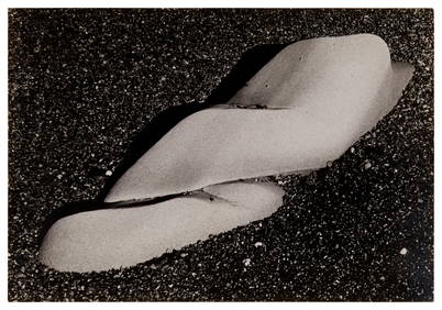
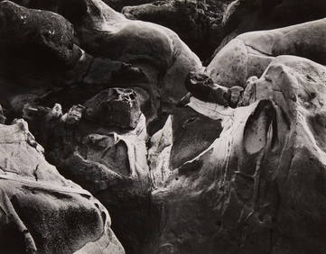
Edward Weston (1886-1958), "Sandstone Erosion, Point Lobos," 1942, Gelatin silver print on paperJohn Moran Auctioneers, Inc.4.7(453)See Sold PriceFeb 27, 2024
Edward Weston (1886-1958), "Eroded Rock, Point Lobos," 1930, Gelatin silver print on paper,John Moran Auctioneers, Inc.4.7(453)See Sold PriceFeb 27, 2024
Edward Weston (1886-1958), "Rock Erosion, Point Lobos," 1938, Gelatin silver print on paper mountedJohn Moran Auctioneers, Inc.4.7(453)See Sold PriceFeb 27, 2024
[MAP]. NICHOLLS, Sutton (1668-1729). An Epitome of Sr. Will...Potter & Potter Auctions4.6(539)See Sold PriceMar 07, 2024
Carey, pub. 1796 - A Chart of the West IndiesTrillium Antique Prints & Rare Books4.5(30)See Sold PriceFeb 24, 2024
Carey, pub. 1796 - Map of the State of MarylandTrillium Antique Prints & Rare Books4.5(30)See Sold PriceFeb 24, 2024
Carey, pub. 1796 - Map of GeorgiaTrillium Antique Prints & Rare Books4.5(30)See Sold PriceFeb 24, 2024
Carey, pub. 1796 - Map of The State of South CarolinaTrillium Antique Prints & Rare Books4.5(30)See Sold PriceFeb 24, 2024
Carey, pub. 1796 - Map of KentuckyTrillium Antique Prints & Rare Books4.5(30)See Sold PriceFeb 24, 2024
Carey, pub. 1796 - Map of the Tennassee State formerly part of North Carolina (Tennessee)Trillium Antique Prints & Rare Books4.5(30)See Sold PriceFeb 24, 2024


![[DOUGLASS, Frederick (1818-1895)]. ROBERTS, J.B., photographer. CDV of Frederick Douglass. (1 of 2)](https://p1.liveauctioneers.com/197/319238/171467829_1_x.jpg?height=282&quality=70&version=1707520367)


![[BASEBALL]. Original Photographic Team Portrait of the Cuba... (1 of 2)](https://p1.liveauctioneers.com/928/318880/171361386_1_x.jpg?height=282&quality=70&version=1707501302)


![[MAP]. NICHOLLS, Sutton (1668-1729). An Epitome of Sr. Will... (1 of 1)](https://p1.liveauctioneers.com/928/318880/171361281_1_x.jpg?height=282&quality=70&version=1707501302)


