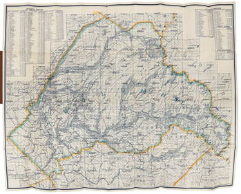
Rare folding map of Humboldt Co. 1886
AN ANTIQUE FOLDING MAP OF THE BRITISH ISLES DATED 1873Feb 28, 20241790 AFRICA TRAVELS Voyages dans le pays des Hottentots ILLUSTRATED antique RAREFeb 27, 2024A23 United States in the Caribbean Denoyer-Geppert Social Science MapsFeb 27, 2024Frémont's 1842 expedition in wrappersMar 07, 2024Journey to the Rocky Mountains in 1839, 1/500Mar 07, 2024Folding map of the East Bay, 1913Mar 07, 2024Folding map of Glenn County Cal., 1914Mar 07, 2024Pocket map of Humboldt County Cal. 1914Mar 07, 2024Rare street guide to Los Angeles 1919Mar 07, 2024Large folding map of Mariposa County 1914Mar 07, 2024Folding map of Placer County Cal., 1914Mar 07, 2024Folding map of San Benito County Cal., 1914Mar 07, 2024Folding map of Tehama County Cal., 1914Mar 07, 2024Weber's folding map of Tulare County Cal.1914Mar 07, 2024Large folding map of Tuolumne County 1914Mar 07, 2024NILE VALLEY. Upper & Lower. Egypt Sinai Nubia Sudan Abyssinia. BLACKIE 1886 mapFeb 28, 2024MAGHREB. North Africa. Marocco Algeria and Tunis. BLACKIE 1886 old antique mapFeb 28, 2024Showers of Red Dust. Africa. Sahara 1886 old antique vintage map plan chartFeb 28, 2024EARLY COLONIAL WEST AFRICA. Empires of Sokoto Gando Mas.Tribes.Fellatah 1886 mapFeb 28, 2024ANTIQUE ROMAN ARMORIAL VELLUM BINDING, 1744, ILLUSTRATED WITH AN ANTIQUE MAP BY FLORUSMar 03, 2024OLD ILLUSTRATED 1902 CROSS-COVERED LANDS JOURNEY TO CALCUTTA, INDIA, 2 VOLUMESMar 03, 2024ANTIQUE GEOMORPHOLOGY: 1782 POMPONII MELA DE SITU ORBIS ARMORIAL VELLUM BINDINGMar 03, 2024THE WHOLE CHRONICLE OF POLYBIUS ANCIENT IN ENGLISH, 1756Mar 03, 20241675: ANTIQUE ILLUSTRATED JULIUS CAESAR MAPS OF ROMAN HISTORYMar 03, 2024 


