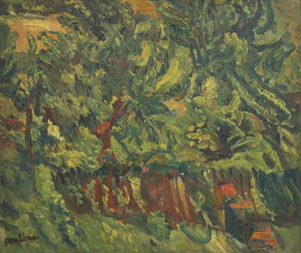
Chaim Soutine (Belarusian/French, 1893-1943) - La Petite Fille dans la VerdureFreeman's | Hindman4.5(158)See Sold PriceFeb 27, 2024
Elisabeth Frink (British, 1930-1993) - Harbinger Bird IFreeman's | Hindman4.5(158)See Sold PriceFeb 27, 2024
AMERICAN SEASCAPE PAINTING BY ROSS EMBROSE MOFFETTAntique Arena Inc.4.5(852)See Sold PriceMar 02, 2024
CHARLES HENRY GIFFORD (Massachusetts, 1839-1904), Luminist view of three sailboats in a quietEldred's4.7(409)See Sold PriceFeb 28, 2024
RARE MANHATTAN PROJECT GLASS LEADED FROM THE MANHATTAN PROJECT WORLD WAR II WW2 724 GRAMSCol. Christie Hatman Auctioneers4.5(312)See Sold PriceFeb 26, 2024
Estate Fresh Civil War Cavalry C. Roby 1863 With ScabbardRalph Fontaine Heritage Auctions Inc.4.7(235)See Sold PriceFeb 25, 2024
ABSTRACT ARAB LEBANESE OIL PAINTING BY ETEL ADNANAntique Arena Inc.4.5(852)See Sold PriceMar 02, 2024
SoldRare 19thc Map of The Pacific Ocean1899 Cram's Map of the Pacific Ocean, with erroneous date line around the Philippines. Full title "Map of the Pacific Ocean showing Distances between principal points and the International date line.See Sold Price
Rare 19thc Map of The Pacific Ocean1899 Cram's Map of the Pacific Ocean, with erroneous date line around the Philippines. Full title "Map of the Pacific Ocean showing Distances between principal points and the International date line.See Sold Price
Rare 19thc Map of The Pacific Ocean1899 Cram's Map of the Pacific Ocean, with erroneous date line around the Philippines. Full title "Map of the Pacific Ocean showing Distances between principal points and the International date line.See Sold Price
SoldRare map of Fredonia - U.S. 1832Heading: Author: Laurie, Richard S. Title: Fredonia, or the United States of North America; including also Cabotia, or the Canadian Provinces; the Western Territory to the Pacific Ocean; and the NortSee Sold Price
SoldRare map of Fredonia - U.S. 1836Heading: Author: Laurie, Richard S. Title: Fredonia, or the United States of North America; including also Cabotia, or the Canadian Provinces; the Western Territory to the Pacific Ocean; and the NortSee Sold Price
SoldA Chart of the Pacific OceanA Chart of the Pacific Ocean, Robert Seale, 1748. This adventure lover's delight traces Commodore George Anson's route from California to the Phillipines in pursuit of a Spanish treasure galleon. TheSee Sold Price
SoldRare "Fredonia" folding map of U.S. 1848Title: Fredonia. Or the United States of North America; including also Cabotia, or the Canadian Provinces; The Western Territory To the Pacific Ocean' And the Northern Part of the Mexican States AuthoSee Sold Price
SoldRare North America map 1846Heading: Author: Cross, Joseph Title: New Map of North America Place Published: London Publisher: Date Published: 1846 Description: Engraved map, hand-colored. Large insetSee Sold Price
SoldRare Hand-Colored Engraved Map of America,Rare Hand-Colored Engraved Map of America, ca. 1665-1670, by Matthaux Merian the Younger (1621-1687), showing the entire Western Hemisphere, the Atlantic and Pacific oceans, fully titled lower left anSee Sold Price
SoldPacific Ocean.Reserve Reduced! Item: Pacific Ocean. Date: 1841 Cartographer: BOYNTON, GEORGE W., engr. Publisher: S.G. GOODRICH, Size (inches): 13X16.6 no regional divisions. Detailed map from a rare Peter Parley aSee Sold Price
[MAP]. ORTELIUS, Abraham. Maris Pacifici. 1589“First Printed Map to be Devoted to the Pacific Ocean” (Burden) A Peninsular California—1589 347. &nbSee Sold Price
SoldKeeler. National Map of the Territory of the U.S.Pocket Map Issue of Keeler's Monumental Map of the West 61. [MAP]. KEELER, William J. National Map of the Territory of the United States from the Mississippi to the Pacific Ocean. Made by the AuthoritSee Sold Price
Sold[MAP]. Colton’s Map of the United States.... 1856.265. [MAP]. COLTON, J.H. Colton’s Map of the United States of America, the British Provinces, Mexico, and the West Indies, Showing the Country from the Atlantic to the Pacific Ocean...New York 1See Sold Price
SoldNational Map of the Territory of the U.S., 1868The Elusive Pocket Map Issue of Keeler’s Monumental Map of the West 49. KEELER, William J. National Map of the Territory of the United States from the Mississippi to the Pacific Ocean.Made by thSee Sold Price
[MAP]. CALIFORNIA GOLD DISTRICT. MITCHELL, A.T. Ms. Map252. [MAP]. CALIFORNIA GOLD DISTRICT. MITCHELL, A.T. Well executed manuscript map on laid paper, in ink and with light blue wash in Pacific Ocean, entitled “Gold Distrct [sic] in California,&rdqSee Sold Price
SoldRare report on Northern Pacific R.R. 1870 2 mapsTitle: Northern Pacific Railroad. Partial Report to the Board of Directors, of a Portion of a Reconnoissance Made in the Summer of 1869, between Lake Superior and the Pacific Ocean... Accompanied withSee Sold Price
South Pacific Directory. 1871 - MapsA Directory for the Navigation of the South Pacific Ocean; with descriptions of its coasts, islands, etc., from the Strait of Magalhaens to Panama, and those of New Zealand and Australia, etc., its wiSee Sold Price
SoldMackenzie's Voyages rare 2-volume issue 1802Heading: Author: MacKenzie, Sir Alexander Title: Voyages from Montreal on the River St. Laurence through the Continent of North America to the Frozen and Pacific Oceans in the Years 1789 and 1793. WiSee Sold Price
Sold1788 First edition of Keate's Pelew IslandsGeorge Keate: An Account of the Pelew Islands, Situated in the Western Part of the Pacific Ocean... London: G. Nicol, 1788. First edition, quarto, contemporary half leather and boards, complete with eSee Sold Price
Sold1799 Missionary Voyage DuffA Missionary Voyage to the Southern Pacific Ocean, performed in the years 1796, 1797, 1798 in the Ship Duff, commanded by Captain James Duff.... London, Chapman, 1799. Has 8 maps and plates - some folSee Sold Price
Sold1869 1ed Wild West INDIANS Mormon Gold Mine California1869 1ed Wild West INDIANS Mormon Gold Mine California Railroads MAP Bowles ‘Our New West’ is a record of travel on the Pacific Railroad from the Missouri River to the Pacific Ocean. Bowles givesSee Sold Price
SoldMap of the Country from Superior to the PacificThe Realization of Thomas Jefferson’s Vision of the Best Natural Highway for Commerce from Ocean to Ocean 317. See Sold Price
SoldENGRAVED MAP, PACIFIC OCEAN, BY CORONELLI.Map entitled “Mare Del Sud detto altrimenti Mare Pacifico”, drawn by Il P.M. CORONELLI and dated 1654 (near New Zealand), but likely later. Image sight size 18.5”H x 24.75, Overall iSee Sold Price
Times Atlas 1895 Antique Map. Pacific OceanLithograph Map Published 1895, London for "The Times Atlas" Paper Size: 16 x 10 inch (41 x 26cm) Good ConditionSee Sold Price
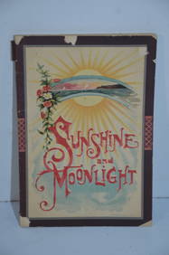
Chicago Rock Island and Pacific RR Book Sunshine and Moonlight-1889JM Hobby Supply and Railroad Artifact Auctions4.4(126)See Sold PriceFeb 24, 2024
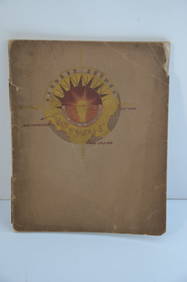
Southern Pacific RR Book West By South-Half South-1890JM Hobby Supply and Railroad Artifact Auctions4.4(126)See Sold PriceFeb 24, 2024
Southern Pacific RR Four Gateways to the Pacific Coast Brochure-1917JM Hobby Supply and Railroad Artifact Auctions4.4(126)See Sold PriceFeb 24, 2024
Southern Pacific RR Oregon Outdoors Brochure-May 1916JM Hobby Supply and Railroad Artifact Auctions4.4(126)See Sold PriceFeb 24, 2024
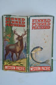
Western Pacific RR Finned Furred Feathered Brochure-1912JM Hobby Supply and Railroad Artifact Auctions4.4(126)See Sold PriceFeb 24, 2024
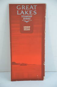
Canadian Pacific RY Great Lakes Steamship 1919 Brochure and TimetableJM Hobby Supply and Railroad Artifact Auctions4.4(126)See Sold PriceFeb 24, 2024
Chicago Rock Island and Pacific RY August 1, 1882 Public TimetableJM Hobby Supply and Railroad Artifact Auctions4.4(126)See Sold PriceFeb 24, 2024
EARLY 18TH C. DUTCH CHART OF PACIFIC OCEAN BY FREDERIK DE WIT (1629-1706) WITH CALIFORNIA AS ANThomaston Place Auction Galleries4.4(386)See Sold PriceFeb 24, 2024
Vaillant - Hawaii: Stranding in the Sandwich Islands (Echouage aux Iles Sandwich). 43Trillium Antique Prints & Rare Books4.5(30)See Sold PriceFeb 24, 2024
Vaillant - Kealakekua Bay, Hawaii (Village de Kearakekoua, Iles Sandwich). 44Trillium Antique Prints & Rare Books4.5(30)See Sold PriceFeb 24, 2024
Vaillant - Honolulu, Hawaii (Vue de Honolulu, Iles Sandwich). 45Trillium Antique Prints & Rare Books4.5(30)See Sold PriceFeb 24, 2024
Vaillant - Hawaiian Dance (Scene de Danse aux Iles Sandwich). 42Trillium Antique Prints & Rare Books4.5(30)See Sold PriceFeb 24, 2024
Rare 19thc Colton Map, Argentine Republic, Chile, Uruguay, PataguayConnoisseur Auctions4(333)See Sold PriceMar 16, 2024


![[Tintype] Massive Bowie knife (1 of 1)](https://p1.liveauctioneers.com/7226/317626/170485482_1_x.jpg?height=282&quality=70&version=1706368022)
![[Ambrotype] Magnificent Portrait (1 of 1)](https://p1.liveauctioneers.com/7226/317626/170485477_1_x.jpg?height=282&quality=70&version=1706368022)


![[Tintype] Native American Man w/ Knife (1 of 2)](https://p1.liveauctioneers.com/7226/317626/170485453_1_x.jpg?height=282&quality=70&version=1706368022)
![[REES, Charles] Enlistedman w/ Bowie Knife (1 of 1)](https://p1.liveauctioneers.com/7226/317626/170485489_1_x.jpg?height=282&quality=70&version=1706368022)
![[Ambrotype] Wounded at Gettysburg (1 of 1)](https://p1.liveauctioneers.com/7226/317626/170485471_1_x.jpg?height=282&quality=70&version=1706368022)


![[Ambrotype] Young Soldier w/ Bowie Knife (1 of 1)](https://p1.liveauctioneers.com/7226/317626/170485459_1_x.jpg?height=282&quality=70&version=1706368022)

![[Daguerreotype] Soldier w/ Bowie Knife (1 of 2)](https://p1.liveauctioneers.com/7226/317626/170485458_1_x.jpg?height=282&quality=70&version=1706368022)
![[Tintype] Soldier w/ Flowers (1 of 1)](https://p1.liveauctioneers.com/7226/317626/170485495_1_x.jpg?height=282&quality=70&version=1706368022)
![[Tintype] Identified North Carolina Infantryman (1 of 2)](https://p1.liveauctioneers.com/7226/317626/170485474_1_x.jpg?height=282&quality=70&version=1706368022)


![[MAP]. ORTELIUS, Abraham. Maris Pacifici. 1589 (1 of 3)](https://p1.liveauctioneers.com/514/20078/6859797_1_x.jpg?height=282&quality=70)

![[MAP]. Colton’s Map of the United States.... 1856. (1 of 1)](https://p1.liveauctioneers.com/514/38480/16487134_1_x.jpg?height=282&quality=70&version=1363614971)

![[MAP]. CALIFORNIA GOLD DISTRICT. MITCHELL, A.T. Ms. Map (1 of 3)](https://p1.liveauctioneers.com/514/38480/16487108_1_x.jpg?height=282&quality=70&version=1363614971)