Pacific.- a mixed group of maps and chartsa mixed group of maps and charts,the Pacific ocean, Australasia, smaller regions and individual islands, by or after Bellin, Bonne, Dalrymple, Lieutenant Trowbridge, Hall, Weller and others,See Sold Price
SoldA mixed group of maps and charts of Asia and theA mixed group of maps and charts of Asia and the PacificIncluding Ceylon, China, Japan and Pacific islands, several from Cook's voyages, engravings, v. s., one with hand-colouring, occasionalSee Sold Price
Soldgroup of maps of Pacific Islandsoceania.- A small, mixed group of maps of the Pacific Islands, comprising maps of Java, the Pacific, Eastern New Guinea, Perak, Fiji, and others, by or for, A. Petermann, Comr Wilkes and CaptnSee Sold Price
West Africa. A mixed group of 19th century mapsWest Africa. A mixed group of 19th century maps,including Lieut. William Allen's chart of the Quorra and Tchadda, or Niger and Chad, rivers, with inset recognition views, for the Admiralty, 18See Sold Price
SoldA small, mixed group of maps of OceaniaOceania.- A small, mixed group of maps of Oceania, including New South Wales with an inset plan of Sydney, several of Polynesia and the Pacific Islands, by or for De La Rochette, Edward WellerSee Sold Price
SoldMaps British A small, mixed group of mapsBritish Isles.- A small, mixed group of maps,including Scotland, Essex, Glocester & Monmouth, Nottinghamshire, and others, six engraved maps, and one chart, from 450 x 380 to 380 x 570mm., eacSee Sold Price
Sold(5) Antique Framed Maps of Fiji, Pacific IslandsGroup of (5) framed antique maps of Fiji and surrounding Pacific Islands, including a map "Chart of the Feejee Islands by the U.S. E.x. E.x. 1840" engraved by Edward Yeager in Philadelphia, one "PubliSee Sold Price
South Pacific – Fiji Islands, Easren Group BritishTitle/Content of Map: South Pacific – Fiji Islands, Easren Group British Admiralty Chart 440, published 1883 Date: 1883 Cartographer: British Admiralty Material/Medium: thick paper Size: standard VeSee Sold Price
South Pacific – Fiji Islands, Easren Group BritishVery nice engraved and detailed sea chart of the Fiji Islands with land view of the Nasavusavu Bay. The first surveys are from 1878 to 1881 by Captain W.U. Moore. Tidal information is mentioned. AutheSee Sold Price
South Pacific – Iles de la Société British AdmiraltyHardly used sea chart of the Iles de la Société, the group of islands in the South Pacific. Authentic, very detailed sea chart, no modern copy. On thick paper, folded as issued, suitable for framingSee Sold Price
Fiji Islands – Pacific Ocean British Admiralty ChartVery detailed, unused and authentic chart of Ngau Island and Mambulitha Reef in the Fiji or Viti Island Group. With beautiful view on the island. Authentic sea chart, no modern copy. On thick paper, fSee Sold Price
SoldGreek Islands.- a mixed group of maps and plansGreek Islands.- a mixed group of maps and plans,including Tobias Conrad Lotter's Graeciae Antiquae Designatio Nova ..., and with maps by or after Kauffer, Tardieu, d'Anville, and others, engraSee Sold Price
Soldmixed group of maps (A)mixed group of maps (A)including a Seutter map, Ducatus Sabaudiae Principat Pedemonti, and antique and modern maps of Italy, by or after Seale, Neele, and others, v.s., largest 500 x 590mm.,See Sold Price
SoldMediterranean.- A mixed group of maps and plansMediterranean.- A mixed group of maps and plans,including 43 maps by Joseph Roux, from 'Plans et Rades de la Méditerraneé', and others by or after Tardieu, Bernard, Gouffier, and others, engraSee Sold Price
SoldEurope.- a small mixed group of mapsEurope.- a small mixed group of maps,including 5 maps of Spain and Portugal, and maps of Greece, Sicily, and Corsica, by or after Vandermaelen, Tardieu, Alt, and others, engravings, some hand-See Sold Price
SoldWest Indies.- - A small mixed group of maps,comprising A New and Accurate Map of the Island of Antigua or Antego, by Emanuel Bowen; Map of the Island of Tobago, by Bryan Edwards; The Island of St Christophers alias St. Kits, by Herman Moll; PiaSee Sold Price
SoldItaly.- a mixed group of mapsItaly.- a mixed group of maps,general and regional maps, by or after Tardieu and Pachoux, engravings, v.s., largest 480 x 670mm, central vertical folds, some tears affecting the folds, minor sSee Sold Price
SoldA mixed group of maps of Japan, China & Korea-. A mixed group of maps of Japan, China and Korea, Formosa, Central China, Cochinchina, Loochoo & Formosa, the Canton river from Macau to Hong Kong, by, for or after Francis Garnier, P. BinetSee Sold Price
SoldMiscellany.- A mixed, group of maps and views-. A mixed group of maps, views and decorative items,including maps of the City of Dublin (Sewers) , North Wales, Worcestershire, Northamptonshire, Westmorland, Warwickshire, Staffordshire, viSee Sold Price
SoldSDUK. A large mixed group of mapsSDUK. A large mixed group of mapsregional and country maps including Russia, several of Italy and elsewhere, engraved maps, hand-coloured outlines, 390 x 310mm., [1845]; with 8 other maps of ISee Sold Price
SoldA mixed group of maps of India, East Asia, and RuA mixed group of maps of India, East Asia, and Russia,by Wyld, Cadell & Davies, de L'Isle, F.A. Garnier, Bonne, and many others, including a Chanlaire & Mentelle map of Russia in Europe, engrSee Sold Price
Solda mixed group of maps and plansa mixed group of maps and plans,including maps by or after Blome, Bowen, Arrowsmith, and others, mainly of the Middle East, particularly of the Levant, with a small section of plates relatingSee Sold Price
SoldA mixed group of maps of mainland ChinaA mixed group of maps of mainland China,including the province of Fujian, Shandong, Manchuria, and 2 of Hong Kong and the New Territories, coloured engravings, largest c.770 x 1020mm., all diSee Sold Price
SoldA mixed group of maps of South AmericaA small, mixed group of maps of South America, including British Guiana, Ucayali & Amazon, several of the Falkland Islands, including one plan of Port Louis, lithographs, v.s., from 480 x 600See Sold Price
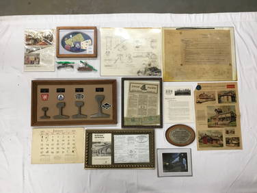
Assortment of Railroad Paper - Rule Books, Stationary, Ink Blotter, Map, Timetables, and MoreRail & Road Auctions4.6(165)See Sold PriceMar 07, 2024
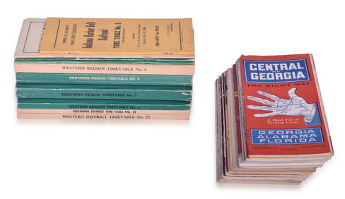
23 Employee and Public Railroad Timetables - NC&StL, NYC, Pennsylvania, C&EI, Southern Pacific, ACL,Rail & Road Auctions4.6(165)See Sold PriceMar 07, 2024
Mixed Group of Railroad Paper, Cross Sections, and Ephemera - Pennsylvania, Reading, Union Pacific,Rail & Road Auctions4.6(165)See Sold PriceMar 07, 2024
Group of Ten Railroad Photographs, Maps, and Prints - New Jersey, Long Island, and New YorkRail & Road Auctions4.6(165)See Sold PriceMar 07, 2024
Group of Railroad Lapel Pins and Button - West Point Route, Texas & Pacific, Atlantic Coast Line,Rail & Road Auctions4.6(165)See Sold PriceMar 07, 2024
Six Pieces of Railroad China Cups and Saucers - Texas & Pacific, Northern Pacific, CanadianRail & Road Auctions4.6(165)See Sold PriceMar 07, 2024
Twelve Pieces of Central and Western Railroad Flatware - Pullman, Burlington Route, Grand Pacific,Rail & Road Auctions4.6(165)See Sold PriceMar 08, 2024
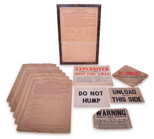
32 Railroad Loading Charts and Explosive Placards - Monon, Illinois Central, Northern Pacific, etc.Rail & Road Auctions4.6(165)See Sold PriceMar 08, 2024
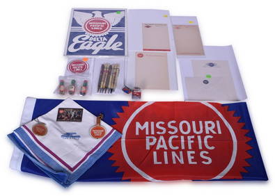
Twenty-Three Missouri Pacific and Texas & Pacific Railroad Advertising Items - Lighter, Pencils,Rail & Road Auctions4.6(165)See Sold PriceMar 08, 2024
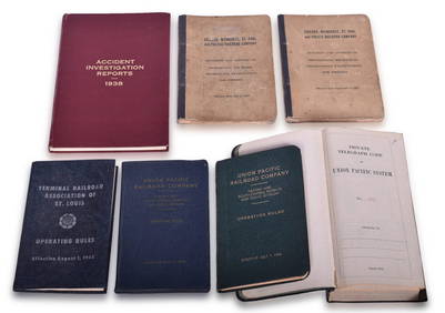
Seven Assorted Railroad Books - Union Pacific Operating Rules and Telegraph Code Book, MilwaukeeRail & Road Auctions4.6(165)See Sold PriceMar 08, 2024