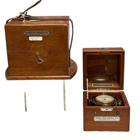
Hamilton Chronometer Model 22 Ship Clock 8630Premier Auction Galleries4.3(329)See Sold PriceMar 09, 2024
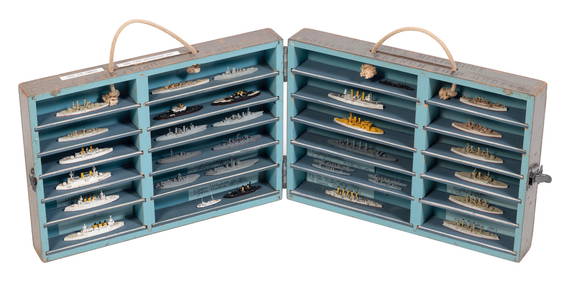
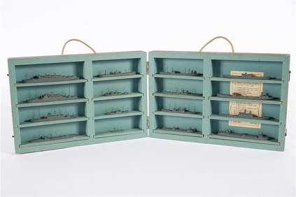
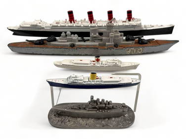
CASED SET OF SHIP RECOGNITION/TEACHING MODELS First Half of the 20th Century Model lengths fromEldred's4.7(409)See Sold PriceFeb 27, 2024
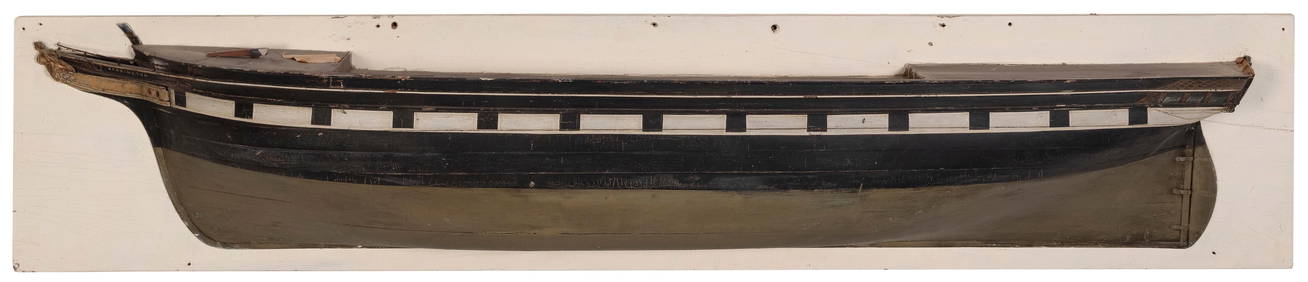
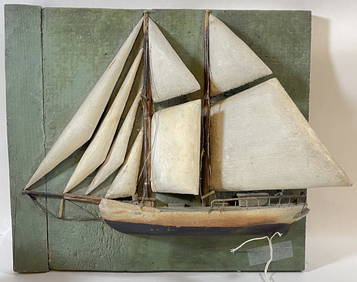
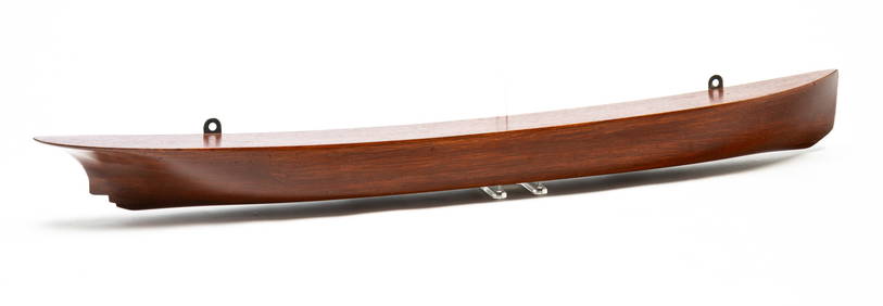
FINE AND LARGE MOUNTED HALF HULL MODEL OF THE SHIP "KENNINGTON" Backboard 14.5" x 71".Eldred's4.7(409)See Sold PriceFeb 27, 2024
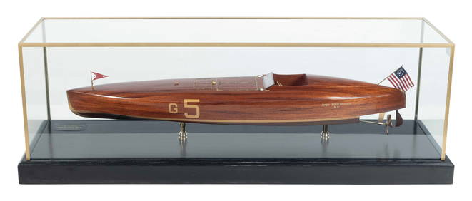
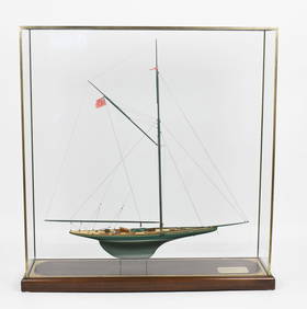
CASED MODEL OF THE SPEEDBOAT "BABY BOOTLEGGER" Contemporary Case height 16". Length 46". Width 14".Eldred's4.7(409)See Sold PriceFeb 27, 2024
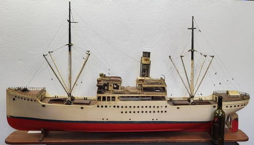
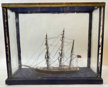
19th Century American Folk Art Ship Model in Glass CaseHeritage Gallery Auctions4.4(56)See Sold PriceMar 10, 2024
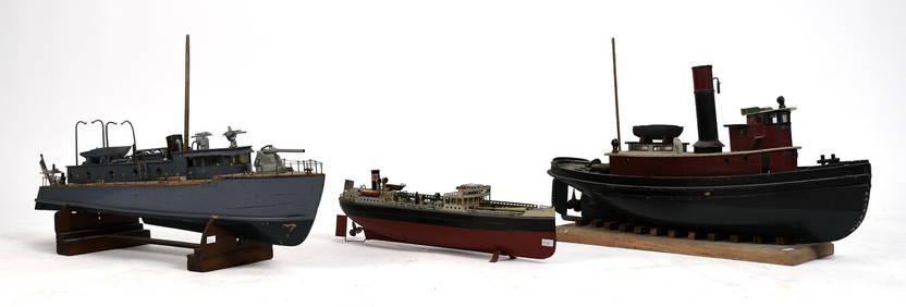
South Salem Studios, US Navy Ship Model CaseStefek's Auctioneers & Appraisers4.5(105)See Sold PriceFeb 28, 2024
[PHOTOGRAPHY]. A Group of 32 Cabinet Cards and 34 Real Phot...Potter & Potter Auctions4.6(539)See Sold PriceMar 07, 2024
Original Imray & Son Brazil Coast ChartImray & Son 1872 Chart of the Coast of Brazil, between Cape Frio and the River Plate, complied by M. le Baron Roussim and M. Mouchez of the French Navy. Stamped "1873" below title. Details shown incluSee Sold Price
Original Imray & Son Brazil Coast ChartImray & Son 1872 Chart of the Coast of Brazil, between Cape Frio and the River Plate, complied by M. le Baron Roussim and M. Mouchez of the French Navy. Stamped "1873" below title. Details shown incluSee Sold Price
Original Imray Chart of the Coast of BrazilImray & Son 1872 Chart of the Coast of Brazil, from Maranhao to Cape Frio. Stamped "1873" below title. Details include Cape Frio, Rio de Janerio, Bahia, Pernambuco and others. There are some rips in tSee Sold Price
Original Imray Chart of the Coast of BrazilImray & Son 1872 Chart of the Coast of Brazil, from Maranhao to Cape Frio. Stamped "1873" below title. Details include Cape Frio, Rio de Janerio, Bahia, Pernambuco and others. There are some rips in tSee Sold Price
Original Imray & Son Chart of North Atlantic, 1876Nautical chart of the North Atlantic showing the Eastern United States coast, Caribbean Islands, South America (Venezuela and Brazil), British Possessions (Canada - Gulf of Lawrence, Newfoundland, NovSee Sold Price
Original Imray & Son Chart of North Atlantic, 1876Nautical chart of the North Atlantic showing the Eastern United States coast, Caribbean Islands, South America (Venezuela and Brazil), British Possessions (Canada - Gulf of Lawrence, Newfoundland, NovSee Sold Price
SoldOriginal Imray & Son S. America Coast Chart, 1877Nautical Chart of South American coast, between Rio de la Plata and Valparaiso. Details include Cape Horn Islands, South Shetlands, Falklands, Southern tip of South American coast including Chile andSee Sold Price
SoldOriginal Imray & Sons Chart of the Coast of WesternOriginal Imray & Sons chart of the coast of Western India, from Cape Comorin to Bombay, stamped sold in 1876. Chart is based off a survey from the "Honorable East India Company." Chart shows coast ofSee Sold Price
Original 1875 Imray & Son Chart of European CoastOriginal Imray & Son chart of the Western Coast of Europe, including Ireland, England, France, Spain and Portugal, circa 1875. This chart has lots of details, including counties and cities for each coSee Sold Price
Original 1875 Imray & Son Chart of European CoastOriginal Imray & Son chart of the Western Coast of Europe, including Ireland, England, France, Spain and Portugal, circa 1875. This chart has lots of details, including counties and cities for each coSee Sold Price
SoldOriginal Imray & Son Nautical Chart of North Pacific,Imray & Son map of North Pacific showing the coast of Asia, including China, Manchooria, Nipon, Tungusi, Koriaki and more. The map also features Alaska and islands, British America, and the west coastSee Sold Price
Original Imray & Son Spain & Portugal Chart, 1883Original Imray & Son chart of Spain and Portugal, from Cape Penas to Gibralter, circa 1883. Showing Atlantic coast of Spain and Portugal, including geographic details of cities and mountain ranges. DeSee Sold Price
Original Imray & Son Spain & Portugal Chart, 1883Original Imray & Son chart of Spain and Portugal, from Cape Penas to Gibralter, circa 1883. Showing Atlantic coast of Spain and Portugal, including geographic details of cities and mountain ranges. DeSee Sold Price
Original Imray & Sons Chart of the English ChannelOriginal Imray & Sons Chart of the English Channel, circa 1873. Showing the English Channel and coast of England including Cornwall, Devon, Dorset, Hampton, Sussex, Kent, and the Strait of Dover, as wSee Sold Price
Original Imray & Sons Chart of the English Channel,Original Imray & Sons Chart of the English Channel, circa 1873. Showing the English Channel and coast of England including Cornwall, Devon, Dorset, Hampton, Sussex, Kent, and the Strait of Dover, as wSee Sold Price
Original Imray & Son Chart of South Pacific, 1876Nautical chart of the South Pacific from James Imray & Son, 1875, but stamped 1876. Details include New Zealand, Tonga Isles, Cook Islands, Tuobouai Archipelago, Tuamoti Archipelago, Fiji and more. UnSee Sold Price
Original Imray & Son Chart of South Pacific, 1876Nautical chart of the South Pacific from James Imray & Son, 1875, but stamped 1876. Details include New Zealand, Tonga Isles, Cook Islands, Tuobouai Archipelago, Tuamoti Archipelago, Fiji and more. UnSee Sold Price
Original Imray Chart of the South Pacific, 1867Original Imray & Son map of the South Pacific Ocean, 1867. Showing South America (including Peru, Bolivia, Chile, Patagonia, and the Falklands), New Zealand, Australia (including Victoria, Queensland,See Sold Price
Four 19th century Nautical Charts including WesternFour 19th century Nautical Charts including Western Coast of Island included between Lough Foyle and Waterford published by James Imray & Son 1889, and Chart of the Coast of France by J S Hobbs 1860,See Sold Price
SoldOriginal Imray East India Archipelago Chart No. 4Imray & Son 1880 marine chart of East India Archipelago, showing the western route to China, marine chart No. 4. Stamped with 1881. Shows Borneo, and detailed marine charts of Bruni and Labouan, PalawSee Sold Price
Original Imray 1878 East India Archipelago ChartImray & Son 1878 marine chart of East India Archipelago, showing the eastern passage to China and Japan, marine chart No. 3. Showing Papau New Guinea, Arrow Isles, Australia, Cape York Peninsula, TorrSee Sold Price
London.- Suffolk Coast.- Imray & Son (James) RiverLondon.- Suffolk Coast.- Imray & Son (James) River Thames [London to Sea Reach], large sea chart showing the Suffolk coastline from Thorpe to Maldon, with an inset map of the River Thames, and anotherSee Sold Price
Original Imray 1878 East India Archipelago Chart No. 3Imray & Son 1878 marine chart of East India Archipelago, showing the eastern passage to China and Japan, marine chart No. 3. Showing Papau New Guinea, Arrow Isles, Australia, Cape York Peninsula, TorrSee Sold Price
1876 CHART OF BRAZIL COASTJames Imray chart from 1876 showing the Coast of Brazil between Cape Frio and the River Plate.this is a very interesting chart showing Urugway, Rio grande, St Catharina, Rio de Janeiro, etc.. framed.See Sold Price
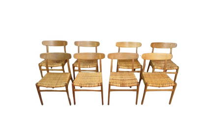
Set of 8 Original Hans Wegner Oak CH23 Chairs by Carl Hansen & SonA1 Consignment and Auction Gallery Inc4.4(16)See Sold PriceMar 07, 2024
LATE 18TH C. VERY LARGE CHART OF NORTHEAST CANADA BY DES BARRES (1721-1824), 1780, FRAMEDThomaston Place Auction Galleries4.4(386)See Sold PriceFeb 24, 2024
CHART "SOUTHERN COAST OF LONG ISLAND FROM MONTAUK POINT TO EAST HAMPTON" Circa 1877 11.25" x 22.75"Eldred's4.7(409)See Sold PriceFeb 27, 2024
Norman Saunders (NY,MN,NE,1907-1989) gouache paintingBroward Auction Gallery4.8(277)See Sold PriceApr 14, 2024
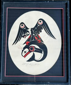
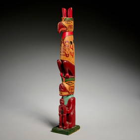
Doug LaFortune (1953) Signed Original Haida Tribal Art Print Northwest CoastCowboy Joe's Antiques4.7(189)See Sold PriceFeb 27, 2024
Peter Todd Mitchell (1924 - 1988) Antique Italian Street Scene Modernist Original Rare Oil PaintingCurated Gallery Auctions4.6(120)See Sold PriceFeb 25, 2024
William A. Hill (1886 -1969) Antique American Impressionist Maine Coast Original Oil PaintingCurated Gallery Auctions4.6(120)See Sold PriceFeb 25, 2024
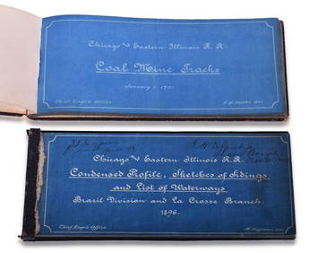
Chicago & Eastern Illinois Railroad 1901 Coal Mine Track and 1896 Brazil Division Track Chart BooksRail & Road Auctions4.6(165)See Sold PriceMar 08, 2024
Richard Blow 20C Italian Pietra Dura Mosaic PlaqueHill Auction Gallery 4.7(1k)See Sold PriceFeb 28, 2024
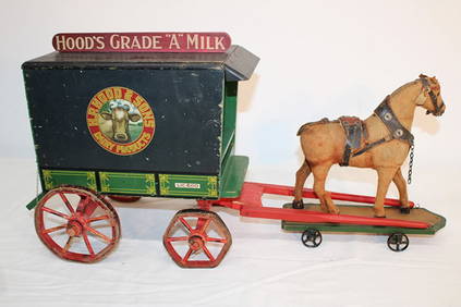
Early 1930'S H. P. Hood & Sons Milk Wagon With Original Painted Wood (Schoenhut Toy Co.)Ralph Fontaine Heritage Auctions Inc.4.7(235)See Sold PriceFeb 25, 2024
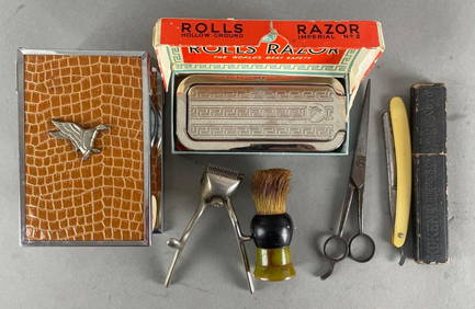
Group of 6 Vintage Mens Grooming SuppliesMatthew Bullock Auctioneers4.7(1.8k)See Sold PriceFeb 24, 2024
SIX DAYS IN 1866: THE COMPLETE STORY OF THE GREATEST LOSS OF AN ANTIQUE BRITISH SHIPWRECKNY Elizabeth 4.3(84)See Sold PriceMar 03, 2024
CANADA GOOSE, WILDFOWLER, OLD SAYBROOKFrank and Frank Sporting Collectibles LLC4.7(166)See Sold PriceMar 10, 2024


![[PHOTOGRAPHY]. A Group of 32 Cabinet Cards and 34 Real Phot... (1 of 1)](https://p1.liveauctioneers.com/928/318880/171361555_1_x.jpg?height=282&quality=70&version=1707501302)