Marc Chagall-Limited Edition -Paris Opera Ceiling after ChagallArt Legacy Auctions4.5(223)See Sold PriceFeb 24, 2024
Salvador Dali Pantagruel Limited Edition Lithograph Hand signed and numberedArt Legacy Auctions4.5(223)See Sold PriceFeb 24, 2024
Pablo Picasso Bouquet of Peace Collection Domaine Picasso Limited Edition on paper.Art Legacy Auctions4.5(223)See Sold PriceFeb 24, 2024
A RARE MAXFIELD PARRISH JACK AND THE BEANSTALK PRINTSoulis Auctions4.8(953)See Sold PriceFeb 24, 2024
LARGE MECHANICAL PRINT 'STARS' AFTER MAXFIELD PARRISHSoulis Auctions4.8(953)See Sold PriceFeb 24, 2024
Heinrich Aldegrever, etc. 15 old master prints. 16th-17th centuries. Aldegrever works include "ManTremont Auctions4.5(297)See Sold PriceFeb 25, 2024
SoldOrdnance Survey.- A group of 14 folding mapsOrdnance Survey.- A group of 14 folding maps,all with original offset-lithograph vignette covers, with maps of The Chilterns, The Lake District, Dartmoor, The Cotswolds, and others, lithographSee Sold Price
SoldOrdnance Survey.- A group of 70 folding mapsOrdnance Survey.- A group of 70 folding maps,with various counties and areas of the British Isles, lithographed maps, many printed in colour, v.s., all folding into contemporary paper covers,See Sold Price
SoldOrdnance Survey Folding MapsOrdnance Survey Folding Maps,various editions and scales, other publisher's maps, including cycling and railways, 19th./20th. C., v.s. (qty.)See Sold Price
SoldA SET OF 19TH CENTURY CANVAS BACKED ORDNANCE SURVEYA SET OF 19TH CENTURY CANVAS BACKED ORDNANCE SURVEY FOLDING MAPS OF GREAT BRITAIN, in two book-form boxes with gilt titled spines, many with 1860's publication date.See Sold Price
SoldSt Kilda - Mathieson, John and A.M. Cockburn, surveyorsSt Kilda - Mathieson, John and A.M. Cockburn, surveyors Map of St Kilda or Hirta and Adjacent Islands & Stacs. Ordnance Survey, 1928, folding map, 83 x 58cm, printed in red and blackSee Sold Price
Sold[Ordnance Survey]. a group of maps of South East A[Ordnance Survey]. a group of maps of South East Asia,variously covering areas of Siam (Thailand), Burma, China, Sumatra, Java, Borneo, and French Indo China, including a revised boundary on tSee Sold Price
SoldQuantity of Ordnance Survey and other folding maps,Quantity of Ordnance Survey and other folding maps, various road atlases, etcSee Sold Price
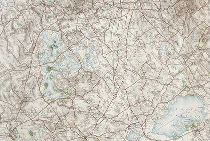
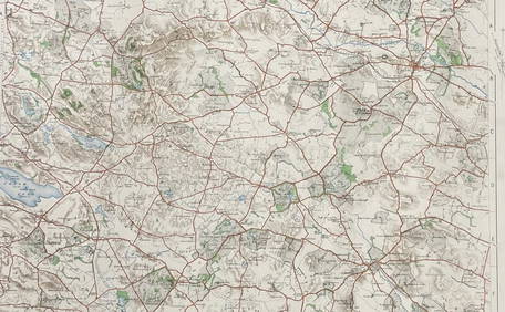
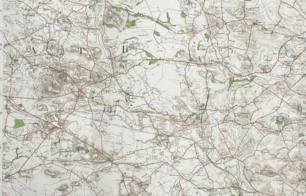
[Ordnance Survey]. 8 1950s maps S.E. Asia[Ordnance Survey]. a group of maps of South East Asia,variously covering areas of Siam (Thailand), Burma, China, Sumatra, Java, Borneo, and French Indo China, including a revised boundary on tSee Sold Price
SoldA quantity of folding ordnance survey maps, includingA quantity of folding ordnance survey maps, including examples by Bacon, Ward, Lock & Co., Gall & Inglis and Bartholomew. To include, Motoring and Touring Map of England, Map and Guide to London, HertSee Sold Price
SoldA folding Ordnance Survey map, circa 1840, South EastA folding Ordnance Survey map, circa 1840, South East England section, hand coloured, (part of a larger map), one leather board attached, canvas backed, 105 x 89cmSee Sold Price
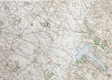
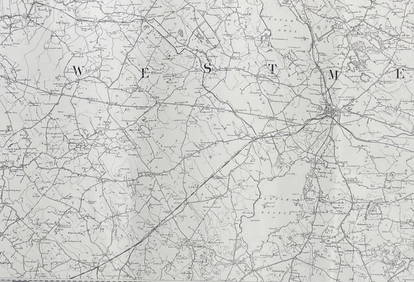
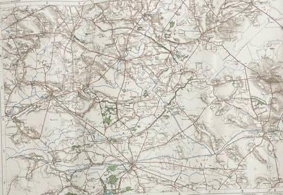
Ordnance Survey of Scotland. Sheet 24. [Peeblesshire]Title: Ordnance Survey of Scotland. Sheet 24. [Peeblesshire] Cartographer: Ordnance Survey of Scotland Publisher: Ordnance Survey Brief Description: Unmounted folding map, repaired at folds. Third ediSee Sold Price
SoldFive Government Reports on OregonTitle: Five Government Reports on Oregon Author: ** Description: Includes: Letter from The Secretary of War Transmitting Reports of Maj. G.L. Gillespie... 14 pp. Folding map. 1880. * Survey of Coos RiSee Sold Price
SoldLondon - Stanford, Edward C1860 Large Folding Map"Map of the Environs of London Reduced from the Ordnance Survey" Steel Engraved Map Published C1860, London by Edward Stanford. Reduced from the Ordnance Survey. Fine original hand colour. Contained iSee Sold Price
SoldThe Times Survery Atlas of the WorldThe Times Survery Atlas of the World, 1922, portfolio form with loose folding map-sheets, red cloth, c/w the companion Gazeteer; also The Ordnance Survey Atlases of England and Wales and Scotland in tSee Sold Price
SoldFrench War maps (D-Day planning),French War maps (D-Day planning), 11 folding Ordnance Survey sheets circa 1943-44, scale 1:50,000 (11)See Sold Price
SoldHasted (Edward)Hasted (Edward) The History and Topographical Survey of the County of Kent, first edition, 3 vol. only of 4, lacks vol. 4, 40 engraved plates (some folding) and 14 folding maps only, vol. 1 &See Sold Price
SoldEngland.- A group of 16 Ordnance Survey maps, mainlyEngland.- A group of 16 Ordnance Survey maps, including a Col. Mudge map of Kent showing Whitstable, Ramsgate and Dover, 4 Col. Colby maps sold by Letts, Son & Co. of Essex, Kent, Berkshire, and HampsSee Sold Price
SoldHampshire.- Ordnance Survey.- A group of 40 detailedNO RESERVE Hampshire.- Ordnance Survey.- A group of 40 detailed plans in South West England, Hampshire, including one of Southampton, Dorset, Somerset, Gloucestershire, Devon and Cornwall, on a scaleSee Sold Price
Ordnance Survey. - A group of 40 detailed plans inHampshire, including one of Southampton, Dorset, Somerset, Gloucestershire, Devon and Cornwall, on a scale of 1:2500, zincographed maps, some with contemporary hand-colouring, each sheet c.730 x 1050mSee Sold Price
SoldBENG A large mixed group of maps of the U.K.BENG A large mixed group of maps of the U.K.including editions of Bartholomew's Half-Inch to Mile Map of England & Wales, with editions of Ordnance Survey New Popular Edition One-Inch MapsSee Sold Price
SoldReport of the Secretary of War Communicating Copi118 pp. 3 large folding maps. (8vo) 9x5½, disbound. 33rd Congress, 1st Session. Ex. Doc. No. 29, Senate Issue. First Edition. Rare preliminary report on the Pacific Railroad Surveys. Includes 14 repoSee Sold Price
Plan of the Church of the Holy Sepulchre from thePlan of the Church of the Holy Sepulchre from the Ordnance Survey of Jerusalem conducted by Captain Charles William Wilson (1836-1905), 1865. Cloth-backed map. Folding. 68x102. See Sold Price
SoldMaps from the Ordnance Survey of Palestine by Wilson,A portfolio of maps, being the second part of the "Ordnance Survey of Palestine" conducted by Captain Charles William Wilson (1836-1905), in 1864. Contains five folding, cloth-backed maps, including tSee Sold Price
SoldOrdnance Survey. Kent, Sussex, SurreyOrdnance Survey. Kent, Sussex, Surrey,4 sheets by Col. Mudge, V, VI, VIII and IX, East and West Sussex each with a folding extension, engraved maps, each c.645 x 960mm., dissected, linen-backeSee Sold Price
[ADVERTISING FOLDING FANS]. Group of 14 Folding Fans Advert...Potter & Potter Auctions4.6(545)See Sold PriceMar 07, 2024
Nottingham.- Ordnance Survey Office (publisher) Collection 8 geological maps on the environs ofForum Auctions4.3(53)See Sold PriceFeb 29, 2024
EARLY COLONIAL WEST AFRICA. Empires of Sokoto Gando Mas.Tribes.Fellatah 1882 mapJasper524.5(9.9k)See Sold PriceFeb 28, 2024
AFRICA. French North Africa and Morocco 1907 old antique map plan chartJasper524.5(9.9k)See Sold PriceFeb 28, 2024
MAGHREB. North Africa. Marocco Algeria and Tunis. BLACKIE 1882 old antique mapJasper524.5(9.9k)See Sold PriceFeb 28, 2024
ORDNANCE SURVEY OF IRELAND/ Sheet No. 79/ CAVAN, LEITRIM, LONGFORD, MEATH & WESTMEATH Revised 1899Churchill Galleries3.7(217)See Sold PriceFeb 26, 2024
ORDNANCE SURVEY OF IRELAND/ Sheet No. 89/ LONGFORD, MEATH & WESTMEATH/ Published in 1903Churchill Galleries3.7(217)See Sold PriceFeb 26, 2024
ORDNANCE SURVEY OF IRELAND/ Sheet No. 89/ LONGFORD, MEATH & WESTMEATH/ Published in 1903Churchill Galleries3.7(217)See Sold PriceFeb 26, 2024
ORDNANCE SURVEY OF IRELAND/ Sheet No. 89/ LONGFORD, MEATH & WESTMEATH/ Published in 1903Churchill Galleries3.7(217)See Sold PriceFeb 26, 2024
ORDNANCE SURVEY OF IRELAND/ Sheet No. 89/ LONGFORD, MEATH & WESTMEATH/ Published in 1903Churchill Galleries3.7(217)See Sold PriceFeb 26, 2024
ORDNANCE SURVEY OF IRELAND/ Sheet No.90/ MEATH & WESTMEATH/ Published in 1903Churchill Galleries3.7(217)See Sold PriceFeb 26, 2024
ORDNANCE SURVEY OF IRELAND/ Sheet No.90/ MEATH & WESTMEATH/ Published in 1903Churchill Galleries3.7(217)See Sold PriceFeb 26, 2024
ORDNANCE SURVEY OF IRELAND/ Sheet No.90/ MEATH & WESTMEATH/ Published in 1903Churchill Galleries3.7(217)See Sold PriceFeb 26, 2024
ORDNANCE SURVEY OF IRELAND/ Sheet No.90/ MEATH & WESTMEATH/ Published in 1903Churchill Galleries3.7(217)See Sold PriceFeb 26, 2024
ORDNANCE SURVEY OF IRELAND/ Sheet No.90/ MEATH & WESTMEATH/ Published in 1903Churchill Galleries3.7(217)See Sold PriceFeb 26, 2024
ORDNANCE SURVEY OF IRELAND/ Sheet No.99/ KILDARE, MEATH, KINGS & WESTMEATH/ Published in 1902Churchill Galleries3.7(217)See Sold PriceFeb 26, 2024
ORDNANCE SURVEY OF IRELAND/ Sheet No.100/ KILDARE, MEATH & WESTMEATH/ Published in 1903Churchill Galleries3.7(217)See Sold PriceFeb 26, 2024
ORDNANCE SURVEY OF IRELAND/ Sheet No.100/ KILDARE, MEATH & WESTMEATH/ Published in 1903Churchill Galleries3.7(217)See Sold PriceFeb 26, 2024
ORDNANCE SURVEY OF IRELAND/ Sheet No.100/ KILDARE, MEATH & WESTMEATH/ Published in 1903Churchill Galleries3.7(217)See Sold PriceFeb 26, 2024
ORDNANCE SURVEY OF IRELAND/ Sheet No.100/ KILDARE, MEATH & WESTMEATH/ Published in 1903Churchill Galleries3.7(217)See Sold PriceFeb 26, 2024
ORDNANCE SURVEY OF IRELAND/ Sheet No.100/ KILDARE, MEATH & WESTMEATH/ Published in 1903Churchill Galleries3.7(217)See Sold PriceFeb 26, 2024
ORDNANCE SURVEY OF IRELAND/ SHEET NO.109/ KING CO. & CO. WESTMEATH. / PUBLISHED IN 1900Churchill Galleries3.7(217)See Sold PriceFeb 26, 2024


![[Ordnance Survey]. 8 1950s maps S.E. Asia (1 of 1)](https://p1.liveauctioneers.com/410/19007/6434163_1_x.jpg?height=282&quality=70)


![Ordnance Survey of Scotland. Sheet 24. [Peeblesshire] (1 of 1)](https://p1.liveauctioneers.com/5584/168246/84824619_1_x.jpg?height=282&quality=70&version=1589321827)


![[ADVERTISING FOLDING FANS]. Group of 14 Folding Fans Advert... (1 of 1)](https://p1.liveauctioneers.com/928/318880/171360906_1_x.jpg?height=282&quality=70&version=1707501302)