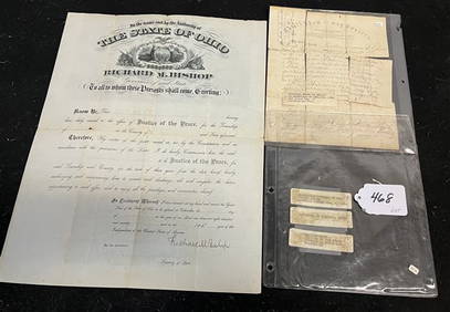
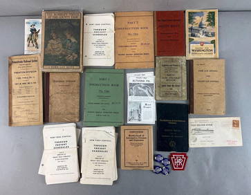
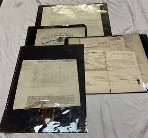
Timetable, Paper and Ephemera Lot-Eastern USA RailroadsJM Hobby Supply and Railroad Artifact Auctions4.4(127)See Sold PriceFeb 24, 2024
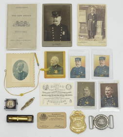
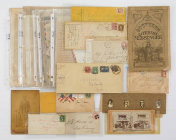
[BASEBALL]. Group of Varied Ephemera, including: Sporting L...Potter & Potter Auctions4.6(545)See Sold PriceMar 07, 2024
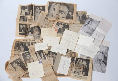
EPHEMERA from the MARRIAGE of MS. EUNICE KENNEDYJohn McInnis Auctioneers,LLC4.5(505)See Sold PriceFeb 25, 2024
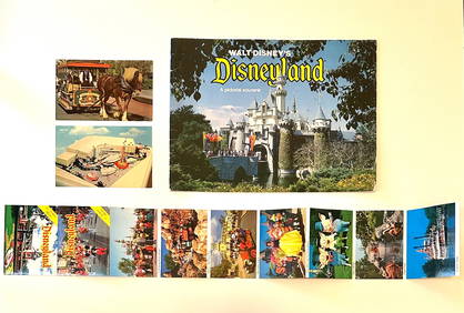
Rare Lot of 1965 and 1977 Walt Disneyland Collectible EphemeraSouth Florida Auction & Estate Sale Services Inc4.5(522)See Sold PriceMar 08, 2024
[CIGARETTE CARDS AND TOBACCO EPHEMERA]. A Group of Six Coll...Potter & Potter Auctions4.6(545)See Sold PriceMar 07, 2024
Group of MLB Ticket and Passes, Other Ephemera: American League Annual PassDana J. Tharp Auctions4.7(271)See Sold PriceFeb 24, 2024
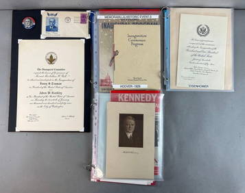
Group of US Presidents inauguration souvenirs, and EphemeraMatthew Bullock Auctioneers4.7(1.8k)See Sold PriceFeb 24, 2024
Old 18th Century World Map Displaying TracksOLD 18th CENTURY WORLD MAP DISPLAYING TRACKS of CAPTAIN COOK Engraved by T BROWN OLD 18th CENTURY WORLD MAP DISPLAYING TRACKS of CAPTAIN COOK Engraved by T BROWN Description Circa 1768-1787 Antique WoSee Sold Price
Sold18TH CENTURY FRENCH MAP OF THE WORLDDimensions: Frame: H 14.5" x W 19.35" Sight: H 9.25" x W 13.75" Condition: Discolored old watercolor, some toning to mat.See Sold Price
SoldAfter Samuel Dunn, New Chart of the World MapAfter Samuel Dunn (British, 18th century), "A New Chart of the World of Mercator's Projection: with The Tracks & Discoveries of the Latest Circumnavigators", published by Laurie & Whittle, London, EngSee Sold Price
MAP - World. SeutterWorld. Matthias Seutter, Diversi Globi Terr-Aquei Statione Variante et Visu Intercedente, per Coluros Tropicorum..., 1742 (circa). Hand Color. This is one of the most graphic 18th century world maps.See Sold Price
MAP, Malta, WitOne of the Most Decorative 18th Century Maps of Malta. Malta. Frederick de Wit, Insula Malta Accuratissime Delineata, Urbibus, et Fortalitiis, 1680 (circa). Hand Color. This superb map shows the stratSee Sold Price
Three 18th Century World Mapsincluding Partie du Cours de Fleuve de Saint Laurent and Carte du Cours du Fleuve de Saint Laurent by Jacques Nicholas Bellin, 1761, two-part hand-colored map of the Saint LaurSee Sold Price
SoldVintage Metallic Paper Peter Shenk Map of WorldVintage Metallic Gold Foil Embellished Paper Shenk Map of the World, with a reverse painted black mat on the frame's glass. Copy of an 18th century world map by Peter Schenk the elder (1645-1715). FraSee Sold Price
Vintage Metallic Paper Peter Shenk Map of WorldVintage Metallic Gold Foil Embellished Paper Shenk Map of the World, with a reverse painted black mat on the frame's glass. Copy of an 18th century world map by Peter Schenk the elder (1645-1715). FraSee Sold Price
Vintage Metallic Paper Peter Shenk Map of WorldVintage Metallic Gold Foil Embellished Paper Shenk Map of the World, with a reverse painted black mat on the frame's glass. Copy of an 18th century world map by Peter Schenk the elder (1645-1715). FraSee Sold Price
SoldTwo 18th Century French World MapsA nautical world map, signed at the lower right corner "Moithey Ing.Geo. del et sculp Herault Scrip" and a world map published by Delmarche. Both hand colored. Dimensions: Each frame is 13" x 18 1/2".See Sold Price
Rare Early 18th Century Buddhist World Map, c.1710Nansenbushu Bankoku Shoka no Zu - [Map of all the countries in Jambudvipa], by HOTAN ( ZUDA ROKASHI). Woodcut map drawn with Indian ink and beautiful blue colouring of the sea, Pulished: Bundaiken UheSee Sold Price
French 18th Century Engraved World MapOne leaf from Henri Chatelain's "Atlas Historique". Hand-colored map on laid paper. Plate impression [17 3/8" x 13 1/8"] on larger sheet. Matted and framed (no glass); [Frame: 26 1/2" x 22 1/2"]. ToniSee Sold Price
SoldAn antique map of the world17th/18th Century The world map with Cicero quote in Latin on red banner to bottom 14.5" H x 20.325" WSee Sold Price
Sold18th century Herman Moll World Map18th century Herman Moll World Map "A New and Correct Map of the Whole World," London, 1719, hand colored outlines and title cartouche, the latter depicting an Ottoman Turk, two American Indians and aSee Sold Price
Mid Century Old World Map Wrapped Glass Bottle Made inMade in Italy Mid Century Old World Map Wrapped Glass Bottle Decanter. Approx. 7-inches Diameter 10 1/2-inches Tall w/Stopper. As-Is, As-Shown from an estate. In vintage, as-found estate condition witSee Sold Price
Sold18TH CENTURY DE l'ISLE FRENCH WORLD MAP18TH CENTURY DE l'ISLE FRENCH WORLD MAP: Circa mid 18th century, double hemisphere map of the world with alternate views in all 4 corners. Top cartouche with banner and motto, partial title ''Mappe-MoSee Sold Price
Rare 18th Century Old World English Decorative ClockRare 18th Century Old World English Decorative ClockSee Sold Price
Rare 18th Century Old World English Decorative ClockRare 18th Century Old World English Decorative Clock Made of Brass & WoodSee Sold Price
Two old / antique Dutch 17th - 18th century maps, city maps. Once Delft by HendrTwo old / antique Dutch 17th - 18th century maps, city maps. Once Delft by Hendrik van Leth. One time Muyden. Crack. Engravings on paper. Size: 22 - 25 cm. In reasonable / good condition.See Sold Price
Sold6 PC VINTAGE MID CENTURY BARWARE, OLD WORLD MAP DESIGN,6 PC VINTAGE MID CENTURY BARWARE, OLD WORLD MAP DESIGN, INCLUDES PITCHER APPROX 8"H, 4 GLASSES APPROX 3.25"H, & WOODEN TRAY APPROX 12" X 8.5"See Sold Price
Sold6 PC VINTAGE MID CENTURY BARWARE, OLD WORLD MAP DESIGN,6 PC VINTAGE MID CENTURY BARWARE, OLD WORLD MAP DESIGN, INCLUDES PITCHER APPROX 8"H, 4 GLASSES APPROX 3.25"H, & WOODEN TRAY APPROX 12" X 8.5"See Sold Price
6 PC VINTAGE MID CENTURY BARWARE, OLD WORLD MAP DESIGN,6 PC VINTAGE MID CENTURY BARWARE, OLD WORLD MAP DESIGN, INCLUDES PITCHER APPROX 8"H, 4 GLASSES APPROX 3.25"H, & WOODEN TRAY APPROX 12" X 8.5"See Sold Price
18th Century Map of the World18th Century map of the world, titled " Map of the World-Comprehending Latest Discoveries". Engraved on plate CCXIV. Sight Size: 8 in x 14 in Condition: Foxing to paperSee Sold Price
1738 BIBLE in DUTCH ILLUSTRATED w/ MAPS antique MASSIVE FOLIO BIBLIAJasper524.5(9.9k)See Sold PriceFeb 27, 2024
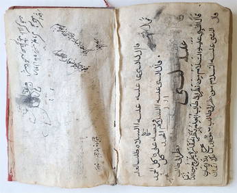
18th C. ARABIC MANUSCRIPT antique ISLAMIC MYSTICAL TREATISE on SPIRITUAL WORLDJasper524.5(9.9k)See Sold PriceFeb 27, 2024
World map.- Macrobius (Ambrosius Aurelius Theodosius) In somnium Scipionis, Libri II. Saturnaliorum,Forum Auctions4.3(53)See Sold PriceFeb 29, 2024
1730 BIBLE in DUTCH ILLUSTRATED w/ MAPS antique MASSIVE FOLIO BIBLIAJasper524.5(9.9k)See Sold PriceFeb 27, 2024
The Dead Bird, Large Oil Painting on Canvas by Louvre Copyist c. 2000Jasper524.5(9.9k)See Sold PriceFeb 28, 2024
Royaumes, Etats et Pays de la Haute Guinée. Gulf of Guinea. BONNE 1788 old mapJasper524.5(9.9k)See Sold PriceFeb 28, 2024
1792 OLD INDIA HISTORY ANTIQUE ILLUSTRATED WITH MAPS OF THE EIGHTEENTH CENTURY IN FRENCHNY Elizabeth 4.2(86)See Sold PriceMar 03, 2024
ANCIENT ISLAMIC MYSTICAL TREATISE ON THE SPIRITUAL WORLD, WRITTEN IN ARABIC IN THE 18TH CENTURYNY Elizabeth 4.2(86)See Sold PriceMar 03, 2024
Antique 18th Century German Painting Oil on WoodWorld Auction Gallery LLC4.7(264)See Sold PriceMar 10, 2024


![[BASEBALL]. Group of Varied Ephemera, including: Sporting L... (1 of 2)](https://p1.liveauctioneers.com/928/318880/171361366_1_x.jpg?height=282&quality=70&version=1707501302)
![[CIGARETTE CARDS AND TOBACCO EPHEMERA]. A Group of Six Coll... (1 of 1)](https://p1.liveauctioneers.com/928/318880/171361529_1_x.jpg?height=282&quality=70&version=1707501302)