North and South America by Homann c.1720
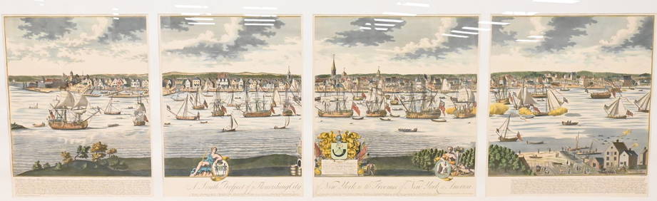
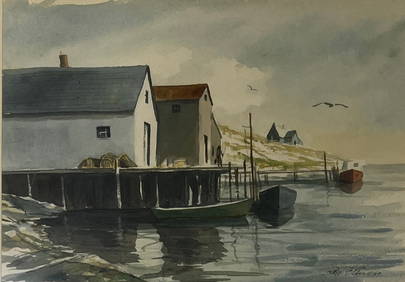
Al Barnes (1937-2015), A Meeting at the PointFeb 24, 2024LARGE EARLY 18TH C. DUTCH CHART OF UPPER NORTH AMERICA, PIERRE MORTIER (1661-1711), FRAMEDFeb 24, 2024A South Prospect of Ye Flourishing City of New York in the Province of New York, North AmericaFeb 24, 2024The Rolling Stones Bridges To Babylon Tour Original Promotional PosterFeb 25, 2024Carey, pub. 1796 - Map of the Tennassee State formerly part of North Carolina (Tennessee)Feb 24, 2024Map: An 18thC engraved and hand coloured map of North America and South America, titled DeFeb 26, 20241822 MAP of NORTH & SOUTH AMERICA GEOGRAPHICAL STATISTICAL HISTORICAL antiqueFeb 27, 20245" Olmec God Effigy Pre-Colombian Pendant, South AmericaMar 10, 2024Mexico, Central America and the West IndiesFeb 27, 2024Mexico, Central America and West Indies Physical PoliticalFeb 27, 2024De l'Isle's influential map of Americas 1722Mar 07, 2024The Americas in 1596Mar 07, 2024Morden's America with California an islandMar 07, 2024Americas with Californa an island 1705Mar 07, 2024Weigel map of Americas Calif. an islandMar 07, 2024Large map of the Americas 1794Mar 07, 2024Ray George Ellis (1921 - 2013) AmericanFeb 29, 2024MAP, World, DoppelmayrMar 12, 2024MAP, World, BaschlinMar 12, 2024MAP, Eastern US, StockdaleMar 12, 2024MAP, Lesser Antilles, GoosMar 12, 2024MAP, France, HomannMar 12, 2024MAP, Germany, HomannMar 12, 2024Large Fossilized Tortoise Shell - Stylemys NebraskensisMar 01, 2024