SoldMoxon (Joseph) A Map of the EarthMoxon (Joseph) A Map of the Earth and how after the Flood it was Divided among the Sons of Noah,the World in oval form, surrounded with biblical scenes from the Creation to the Crucifixion, orSee Sold Price
SoldWorld.- Genesis flood.- Moxon (Joseph) A Map of all theWorld.- Genesis flood.- Moxon (Joseph) A Map of all the Earth and how after the flood it was divided among the sons of Noah, map of the World, with Eden located in modern-day Iran, surrounded with decSee Sold Price
SoldMoxon World Map after the Flood insular Calif.Title: A Map of All the Earth and How after the Flood it was Divided among the Sons of Noah... Author: Moxon, Joseph Description: Copper-engraved map, later hand-coloring. 32x44.4 cm. (12½x17½"), maSee Sold Price
SoldOval Map of the World, Joseph Moxon, ca. 1710"A Map of All the Earth and How After the Flood it Was Divided Among the Sons of Noah" by Joseph Moxon, ca. 1710. Hand-colored copperplate engraving. Plate dimensions: 31.5X44.5 cm. Shirley 457, LaorSee Sold Price
SoldHARPER. Map of Mining Claims Butte & Vicinity"THE RICHEST HILL ON EARTH" 92. [MAP]. HARPER, Joseph H. & Malcolm L. MacDonald. Map of Mining Claims Butte & Vicinity Montana Compiled and Published by Harper & MacDonald Butte, Silver Bow County MonSee Sold Price
Map. The Holy Land and the Near East. NocolasParadaise or the Garden of Eden. A map of the Holy Land and the Middle East. Attractive copper engraving. Black and white. By Nicolas Visscher. Translated by Joseph Moxon. Amsterdam 1671. The map indiSee Sold Price
Sold(HOLY LAND.) Lea, Philip; after Joseph Moxon. 4(HOLY LAND.) Lea, Philip; after Joseph Moxon. 4 double-page engraved maps with decorative Biblical vignettes. Each approximately 15¾x22 inches sheet size, wide margins; hand-color in yellow outliSee Sold Price
SoldMoxon Map of Jerusalem 1688 VersionArtist: Moxon, Joseph, 1627-1699, corrected and sold by P. Lea Atlas and Hercules in Cheap Side London Title: A Map of Jerusalem Date: 1688 Medium: engraving Dimensions: 12 x 17.5 inches Edition:See Sold Price
SoldMoxon (Joseph) Totius Orbis Terrarum TabulaMoxon (Joseph) Totius Orbis Terrarum Tabula,World, with title cartouche and key beneath, engraved map, 210 x 330mm., central vertical fold, some light spotting and discolouration, neat repairSee Sold Price
SoldHoly Land.- Moxon (Joseph) Israels Peregrination, orHoly Land.- Moxon (Joseph) Israels Peregrination, or the Forty Years Travels of the Children of Israel out of Egypt through the Red Sea, and the Wilderness into Canaan, Or The Land of Promise, map ofSee Sold Price
SoldMaps of the Holy Lands (5)ORTELIUS, Abraham (1527-1598). Terra Sancta, A Petra Laicftain perlus trata, et ab eius ore et fchedis a Chriftiano Schrot in tabulam redacta. 17 3/4 x 21 7/8 inches.; MOXON, Joseph (1627-1691). CanaaSee Sold Price
SoldMoxon, Joseph (1627-1691) Mathematicks Made Easie: or,Moxon, Joseph (1627-1691) Mathematicks Made Easie: or, a Mathematical Dictionary. London: Printed for J. Moxon, at the Sign of Atlas, in Warwick Lane, 1692.Octavo, engraved frontispiece portrait opposSee Sold Price
Paradise.- Holy Land.- Moxon (Joseph) Paradise or theParadise.- Holy Land.- Moxon (Joseph) Paradise or the Garden of Eden with the Countries Circumjacent Inhabited by the Patriarchs, engraving with hand-colouring, on laid paper with watermark of fleur dSee Sold Price
SoldHoly Land.- Jerusalem.- Moxon (Joseph) Jerusalem,Holy Land.- Jerusalem.- Moxon (Joseph) Jerusalem, plan of ancient Jerusalem based on Stern's plan from 1630, showng the City with the Second Temple, Herod's Castle, and streets and markets surroundedSee Sold Price
SoldFRAMED MAP OF THE HOLY LANDACCORDING TO PROVENANCE ON BACK "MAP OF THE HOLY LAND BY JOSEPH MOXON ENGRAVED FOR WELL'S NEW SET OF MAPS 1671" Dimensions: 18 1/2" X 12 3/4" AND 26" X 21" OVERALLSee Sold Price
SoldMoxon (J) Paradise or the Garden of Eden[Moxon (Joseph)] Paradise or the Garden of Eden with the Countries circumjacent Inhabited by the Patriarchs, engraved map of the Holy Land from Cyprus and the Mediterranean to the Persian GulfSee Sold Price
English . The Holy Bible , with Book of Common PrayerEnglish . The Holy Bible , with Book of Common Prayer and Book of Psalms, 22 engraved plates of multiple images, 6 folding engraved maps, including plan of Jerusalem, by Joseph Moxon, woodcut decoratiSee Sold Price
SoldJames Moxon, "The Great Ocean", a 1685 map of all TheJames Moxon, "The Great Ocean", a 1685 map of all The Earth and how after the flood it was divided among the sons of Noah, by J Moxon Hydrographer to the King's most Excellent Majesty. 12 1/2" x 17 1/See Sold Price
SoldJ. Moxon Totius Orbis TerrarumJoseph Moxon, English, 1627-1691. Hand colored engraved map of the world, in the time of Noah, after the Great Flood; note California along the right margin is depicted as an island. Title cartouche aSee Sold Price
SoldScarce 1850 world hemispheres mapInteresting and scarce map by Joseph Meyer highlighting how much of the Earth is land and how much is water. Various tables of information also adorn the map. Original outline hand color. From Meyer��See Sold Price
Historical map of Europe, Franz Johann Joseph vonHistorical map of Europe, Franz Johann Joseph von Reilly (1766-1820), ''The Eastern andNorthern Europe Third introductory and overview map ... to Büschings large earth description'', border colored cSee Sold Price
SoldMap: 'Earth Crust' - John Morris 1852 ; GeologicalMap: 'Earth Crust' - John Morris 1852 ; Geological diagram of the Earths Crust, Pub. London: I. Reynolds 174, Strand dated August 9. 1852. In hardback portfolio. £15 - 25See Sold Price
SoldPepys (Samuel).- Moxon (Joseph) [A Tutor to Astronomy and Geography], third edition, Printed by Tho.Pepys (Samuel).- Moxon (Joseph) [A Tutor to Astronomy and Geography], third edition, engraved and woodcut illustrations, lacks additional engraved title, first 2 leaves with head worn away from damp cSee Sold Price
Joseph Martin Kronheim Pair Early Color Glamor Prints c1850Luis Porretta Fine Arts4.3(10)See Sold PriceMar 02, 2024
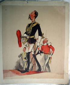
JOSEPH MARTIN KRONHEIM - "Captain Of The Blues" Early Colore Printing MilitaryLuis Porretta Fine Arts4.3(10)See Sold PriceMar 02, 2024
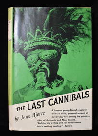
THE LAST CANNIBALS by JENS BJERRE 1957 Fine or Near FineNorth American Artifact Auctions4.7(198)See Sold PriceApr 20, 2024
1977 JRR Tolkien 1st ed Silmarillion Lord of the Rings Middle Earth + MAPSchilb Antiquarian Rare Books4.8(428)See Sold PriceMar 31, 2024
Group of 15 Printed or Lithographed Items, including: litho...Potter & Potter Auctions4.6(545)See Sold PriceMar 07, 2024
[MAP]. NICHOLLS, Sutton (1668-1729). An Epitome of Sr. Will...Potter & Potter Auctions4.6(545)See Sold PriceMar 07, 2024
1772 GREEK BIBLE NEW TESTAMENT antique BIBLIA LATIN text MAP NOVUM TESTAMENTUMJasper524.5(9.9k)See Sold PriceFeb 27, 2024
Joseph Williamson Ludlow (1840 - 1916) - Set of 2 Bird Prints - Aylesbury Ducks - Toulouse GeeseProverde Auctions4.3(3)See Sold PriceFeb 28, 2024
Joseph Williamson Ludlow (1840 - 1916) - Set of 2 Bird Prints - White-faced black Spanish - WhiteProverde Auctions4.3(3)See Sold PriceFeb 28, 2024
Joseph Meyer - Set of 12 Prints - Prag - Czech Republic - Germany - Buchberg - Nachod - JohannisbergProverde Auctions4.3(3)See Sold PriceFeb 28, 2024
Joseph Meyer - Set of 50 Prints - Views of Austria - Germany - Italy - Sweden - France - CzechProverde Auctions4.3(3)See Sold PriceFeb 28, 2024
Joseph Meyer - Set of 50 Prints - Views of Austria - Germany - Italy - Sweden - France - UnitedProverde Auctions4.3(3)See Sold PriceFeb 28, 2024
Joseph Meyer - Set of 20 Prints - Views of Austria - Germany - Italy - Torino - PisaProverde Auctions4.3(3)See Sold PriceFeb 28, 2024
Joseph Meyer - Set of 20 Prints - Views of Austria - Germany - Italy - Switzerland - France - SpainProverde Auctions4.3(3)See Sold PriceFeb 28, 2024
Franz Johann Joseph von Reilly - The southern part of the Bishopric of Liège or the country ofProverde Auctions4.3(3)See Sold PriceFeb 28, 2024


![Pepys (Samuel).- Moxon (Joseph) [A Tutor to Astronomy and Geography], third edition, Printed by Tho. (1 of 1)](https://p1.liveauctioneers.com/5458/290764/154020785_1_x.jpg?height=282&quality=70&version=1685111024)


![[MAP]. NICHOLLS, Sutton (1668-1729). An Epitome of Sr. Will... (1 of 1)](https://p1.liveauctioneers.com/928/318880/171361281_1_x.jpg?height=282&quality=70&version=1707501302)