SoldMortier, Pierre [Chart of the Indian Ocean on two sheets], Amsterdam, c.1700Mortier, Pierre [Chart of the Indian Ocean on two sheets], Amsterdam, c.1700 Each sheet separately titled, 'Partie occidentale d'une partie d'Asie, ou sont les isles de Zocotora, de l'Amirante' and 'CSee Sold Price
The Indian Ocean in two sheets, British Admiralty ChartTitle/Content of Map: The Indian Ocean in two sheets, British Admiralty Chart 748A and B, published 1870 Date Printed: Published: 1870 Edition: 1923 Cartographer: British Admiralty Size: large, 71x136See Sold Price
SoldMap, Mortier, Pierre, Amsterdam c. 1705MAP. Mortier, Pierre, Carte Particuliere de l'Isle Dauphine ou Madagascar et St. Laurens..., Amsterdam c.1705, Copper-engraved map, hand-colored in outline. 57x85 cm. (22½x33½"), on two sheets joineSee Sold Price
SoldAsia.- Southeast Asia.- Mortier (Pierre) Le Royaume deAsia.- Southeast Asia.- Mortier (Pierre) Le Royaume de Siam Avec les Royaumes qui luy sont Tributaires et les Isles de Sumatra, Andemaon, etc. et les Isles Voisine, two-sheet map covering part of ThaiSee Sold Price
Southeast Asia.- Mortier (Pierre) Le Royaume de SiamSoutheast Asia.- Mortier (Pierre) Le Royaume de Siam Avec les Royaumes qui luy sont Tributaires et les Isles de Sumatra, Andemaon, etc. et les Isles Voisine, two-sheet map covering part of Thailand, CSee Sold Price
Map of Madagascar by Pierre Mortier c.1705Title: Carte Particuliere de l'Isle Dauphine ou Madagascar et St. Laurens... Author: Mortier, Pierre Description: Copper-engraved map, hand-colored in outline. 57x85 cm. (22½x33½"), on two sheets joSee Sold Price
Maldive Islands - Indian Ocean, 3 sheets, BritishTitle/Content of Map: Maldive Islands - Indian Ocean, 3 sheets, British Admiralty Charts 66a, 66 b and 66c, published in 1839 Date Printed: Sheet 1 Engraved: 1839 Edition: 1918 Sheet 2 Engraved: 1839See Sold Price
Maldive Islands - Indian Ocean, 3 sheets, BritishTitle/Content of Map: Maldive Islands - Indian Ocean, 3 sheets, British Admiralty Charts 66a, 66 b and 66c, published in 1839 Date: Sheet 1 Engraved: 1839 Edition: 1918 Sheet 2 Engraved: 1839 Edition:See Sold Price
Maldive Islands - Indian Ocean, 3 sheets, BritishTitle/Content of Map: Maldive Islands - Indian Ocean, 3 sheets, British Admiralty Charts 66a, 66 b and 66c, published in 1839 Date: Sheet 1 Engraved: 1839 Edition: 1918 Sheet 2 Engraved: 1839 Edition:See Sold Price
SoldRare chart of the Indian Ocean, 1681Heading: Author: Jacobsz, Theunis Title: Pascaerte van't westelyckste deel van Oost-Indien, en de Eylanden daer onder begrepen, van C. de Bona Esperança tot C. Comorin Place Published: Amsterdam PubSee Sold Price
Sold(Maps and Charts, Africa and Indian Ocean), Teixei(Maps and Charts, Africa and Indian Ocean), Teixeira, Joao & Thevenot, Melchisedec, Untitled map of the East Coast of Africa, the Arabian Peninsula and Persia, [Paris, 1649 or later], large two-page fSee Sold Price
SoldMortier (Pierre) Costes de l'AfriqueMortier (Pierre) Costes de l'Afriquecoastal chart of West Africa, with large compass rose and rhum lines, engraved map with full original hand-colouring, 575 x 435mm., slight browning, AmsterdSee Sold Price
SoldThree Frederick de Wit (1630-1706)Sea Charts including Terra Nova ac Maris Tractus, Amsterdam, 1675, sea chart of the western Atlantic Ocean, with two compass roses, thumb lines, two large decorative cartouches, 20 x 22-7/8 in., centeSee Sold Price
SoldMORTIER, PIERRE. Carte Particuliere de Virginie,MORTIER, PIERRE. Carte Particuliere de Virginie, Maryland, Pennsilvanie, la Nouvelle Jarsey Orient et Occidentale. Large double-page engraved chart of the Chesapeake Bay. 25x37 inches sheet size, wideSee Sold Price
SoldIndian ocean.- Sayer (Robert) Carte du Sisteme desIndian ocean.- Sayer (Robert) Carte du Sisteme des Courants des Mers de l'Inde ... N.E au N.; Carte du Sisteme des Courants des Mers de l'Inde ... S.O au N., two charts detailing monsoons in the IndiaSee Sold Price
Pacific Charts by La PérouseTitle: Three charts on two sheets, from the Atlas to La Pérouse's Voyage Author: La Pérouse, Jean François Galaup de Description: Includes: Carte d'une Partie du Grande Océan à l'E. et SE. de laSee Sold Price
SoldMORTIER, PIETER. Carte Particuliere de l'AmeriMORTIER, PIETER. Carte Particuliere de l'Amerique Septentrionale. Two-sheet engraved map, 590x835 mm, wide margins; hand-colored in outline; a few minor pin-size wormholes. Amsterdam, circa 1700 A nicSee Sold Price
SoldCOVENS and MORTIER. Partie Meridionale du RoyaCOVENS and MORTIER. Partie Meridionale du Royaume de Naples. Engraved two-sheet folding map, 455x735 mm, wide margins; hand-colored in outline; several short repairs at edges. Amsterdam, circa 1720 ASee Sold Price
SoldCARTE PARTICULIERE DE VIRGINIE, MARYLAND, PENNSYLVANIA;CARTE PARTICULIERE DE VIRGINIE, MARYLAND, PENNSYLVANIA; ALEXIS-HUBERT JAILLOT (1632-1712), ENGRAVED HAND COLORED MAP, AMSTERDAM AND PAIRIS, PIERRE MORTIER, C.1693-1710 (AN IMPORTANT CHART OF THE MID-ASee Sold Price
SoldMortier Map of Southeast AsiaMORTIER, Pierre (1661-1711). Le Royaume de Siam Avec les Royaumes qui luy sont Tributaires... Engraved Map with original hand color. Amsterdam, c. 1700. 32 1/4" x 23 1/2" sheet. This finely detailed aSee Sold Price
SoldAsia.- Laurie (Robert) and James Whittle. - Asia andwith the rare untitled southern strip of the Indian Ocean from Africa to Australia, to form the expanded 6-sheet wall map of Asia, Australia with 2 inset charts of King George III's Sound and the discSee Sold Price
SoldHooghe (Romain de) - Carte Maritime des Environs decoastal chart with inset views of Dieppe and Rouen, upper and lower right corners, rhum lines, compass rose and ships, engraved map with hand-colouring, 600 x 4580mm., Amsterdam, Pierre Mortier, 1693;See Sold Price
SoldCarte Nouvelle de L'Amerique Angloise...Pierre Mortier (1661-1711). Amsterdam, c. 1700. Engraved Map with Original Hand-color in Outline, 1 sheet of 2. 24 1/2 x 20 3/4 inches paper size.See Sold Price
Blaeu Map of Viterbo, ItalyBLAEU, Willem Janszoon (1571-1638). Viterbo, Ville de l'etat de l'Englise. Engraved map with original hand color. Amsterdam: Pierre Mortier, c. 1704. 21 1/4" x 25 1/4" sheet. From Blaeu's Nouveau TheaSee Sold Price
ATTR TO Harry Leith Ross (PA,1886-1973) oil paintingBroward Auction Gallery4.7(292)See Sold PriceMar 17, 2024
LATE 18TH C. VERY LARGE CHART OF NORTHEAST CANADA BY DES BARRES (1721-1824), 1780, FRAMEDThomaston Place Auction Galleries4.4(393)See Sold PriceFeb 24, 2024
LARGE LATE 17TH C. DUTCH CHART OF CANADA, GREAT LAKES, NEW FRANCE, LABRADOR, HUDSON BAY, BY PIERREThomaston Place Auction Galleries4.4(393)See Sold PriceFeb 24, 2024
EARLY 18TH C. DUTCH CHART OF PACIFIC OCEAN BY FREDERIK DE WIT (1629-1706) WITH CALIFORNIA AS ANThomaston Place Auction Galleries4.4(393)See Sold PriceFeb 24, 2024
RARE 1638 HONDIUS MAP OF BERMUDA, FRAMEDThomaston Place Auction Galleries4.4(393)See Sold PriceFeb 24, 2024
LARGE EARLY 18TH C. DUTCH CHART OF UPPER NORTH AMERICA, PIERRE MORTIER (1661-1711), FRAMEDThomaston Place Auction Galleries4.4(393)See Sold PriceFeb 24, 2024
17TH C. ENGLISH CHART OF THE THAMES BY CAPT. GREENVILLE COLLINS, 1693-4, FRAMEDThomaston Place Auction Galleries4.4(393)See Sold PriceFeb 24, 2024
1585 OXONIUM VINDESORIUM (OXFORD AND WINDSOR CASTLE) BY BRAUN AND HOGENBERG, FRAMEDThomaston Place Auction Galleries4.4(393)See Sold PriceFeb 24, 2024
COVENS & MORTIER 1745 MAP OF THE GLOBEThomaston Place Auction Galleries4.4(393)See Sold PriceFeb 24, 2024
ABRAHAM ORTELIUS (1527-1598) MAP OF ROMAN GAUL (FRANCE)Thomaston Place Auction Galleries4.4(393)See Sold PriceFeb 24, 2024
NICOLAES VISSCHER (NETHERLANDS, 1618-1709) MAP OF THE NEW WORLDThomaston Place Auction Galleries4.4(393)See Sold PriceFeb 24, 2024
WILLEM JANSZOON BLAEU (NETHERLANDS, 1571-1638)Thomaston Place Auction Galleries4.4(393)See Sold PriceFeb 24, 2024
MAP OF SALZBURG BY GEORGE BRAUN & FRANS HOGENBURG. 1588Thomaston Place Auction Galleries4.4(393)See Sold PriceFeb 24, 2024
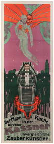
KASSNER, Alois (1887 – 1970). Der Mann in Der Kanne. Direkt...Potter & Potter Auctions4.6(545)See Sold PriceFeb 24, 2024
Hand Colored Map of the city of Amsterdam 1720Global Auctions Company4.3(36)See Sold PriceMar 03, 2024
[LITHOGRAPHY]. [PLAYING CARDS]. Group of Three Proof Sheets...Potter & Potter Auctions4.6(545)See Sold PriceMar 07, 2024
4 Cozy Earth Split King Sheet Sets- Harbor Mist.Direct Auction Galleries 4.7(337)See Sold PriceFeb 24, 2024
WHO FRAMED ROGER RABBIT (1988) - Fourth Draft Script with Pair of Call SheetsPropstore4.2(6)See Sold PriceMar 13, 2024
A Group of Two Oleographs Holker Dynasty & Maharana of MewarIndigo Art AuctionsSee Sold PriceMar 08, 2024
![Mortier, Pierre [Chart of the Indian Ocean on two sheets], Amsterdam, c.1700 First Image](https://p1.liveauctioneers.com/94/251108/130828917_1_x.jpg?height=282&quality=95&version=1655281539&width=282)
![Mortier, Pierre [Chart of the Indian Ocean on two sheets], Amsterdam, c.1700 (1 of 1)](https://p1.liveauctioneers.com/94/251108/130828917_1_x.jpg?height=282&quality=70&version=1655281539)
![Mortier, Pierre [Chart of the Indian Ocean on two sheets], Amsterdam, c.1700 First Image](https://p1.liveauctioneers.com/94/251108/130828917_1_x.jpg?height=282&quality=1&version=1655281539&width=282)


![[LITHOGRAPHY]. [PLAYING CARDS]. Group of Three Proof Sheets... (1 of 3)](https://p1.liveauctioneers.com/928/318880/171361080_1_x.jpg?height=282&quality=70&version=1707501302)