RARE 1638 HONDIUS MAP OF BERMUDA, FRAMEDThomaston Place Auction Galleries4.4(389)See Sold PriceFeb 24, 2024
SoldMorden (Robert) DarbyshireMorden (Robert) Darbyshire,engraved map with hand-colouring, 360 x 420mm., central vertical fold, slight area of staining to upper margin, just inside image, faint offsetting, Abel Swale and JSee Sold Price
SoldMorden (Robert) DarbyshireMorden (Robert) Darbyshire,engraved map with hand-colouring, 360 x 420mm., central vertical fold, faint staining to upper portion, Abel Swale and John Churchill, [1695]; with three maps of DerSee Sold Price
SoldMorden (Robert) DarbyshireMorden (Robert) Darbyshire [Derbyshire], engraved map, contemporary handcolouring in outline, decorative title cartouche, c.358 x417mm, central vertical fold, edges trimmed along the platemark, pastedSee Sold Price
SoldMORDEN, ROBERT. Darby Shire.MORDEN, ROBERT. Darby Shire. Double-page engraved map, 365x420 mm, wide margins; hand-colored in outline; moderately foxed; matted and framed. London, 1695 All items are offered for sale subject to SwSee Sold Price
Morden (Robert) Nottinghamshire; Darbyshire; StaffMorden (Robert) Nottinghamshire; Darbyshire; Staffordshirehand-coloured engraved maps, each c.360 x 425mm, or the reverse, central horizontal and vertical folds, minor surface dirt, Abel SwaleSee Sold Price
SoldNottinghamshire.- Morden (Robert) Nottinghamshire;Nottinghamshire.- Morden (Robert) Nottinghamshire; Darbyshire; Staffordshirehand-coloured engraved maps, each c.360 x 425mm, or the reverse, central horizontal and vertical folds, minor surfacSee Sold Price
SoldRobert Morden (17th - 18th Century) British.Robert Morden (17th - 18th Century) British. "Darbyshire", Map, 14" x 16.5".See Sold Price
SoldRobert Morden (c. 1650 - 1703), by and after, two-pageRobert Morden (c. 1650 - 1703), by and after, two-page map, Darbyshire (sic, Derbyshire), [Published and] Sold by Abel Swale, Awnfham (sic) and John Churchill, London, later dated 1722 in MS pencil wiSee Sold Price
SoldMorden, Robert 1701 Hand Col Map of Staffordshire, UKHand Colored Copper Engraved Map Published 1701-08, London for "The New Description and State of England, containing the Mapps of the Counties of England and Wales" by Robert Morden. Light folds as isSee Sold Price
SoldWorld.- Morden (Robert) [ Geography Rectified: or, AWorld.- Morden (Robert) [Geography Rectified: or, A Description of the World], maps only, no title or text, comprising double-page engraved 'Catalogue of Mapps in This Booke' and 79 double-page engravSee Sold Price
Sold* MORDEN, Robert (ca 1650-1703). Geography Rectified:* MORDEN, Robert (ca 1650-1703). Geography Rectified: or, A Description of the World. London: for Robert Morden and Thomas Cockeril, 1680. Small 4to (200 x 157 mm). Title printed in red and black, hanSee Sold Price
SoldMorden, Robert. A New Map of CarolinaMorden, Robert. A New Map of Carolinacopperplate leaf with hand color from Geography Rectified (London, circa 1688-1700), the sheet with descriptive text on both sides. Presented under mat. 7.25 x 6.2See Sold Price
Sold(MAP) MORDEN, ROBERT. Oxfordshire. [London, 1695 o(MAP) MORDEN, ROBERT Oxfordshire. [London, 1695 or later]. Engraved map with hand-coloring. Framed and matted. Crease down the center. 17 x 14 1/4 inches.See Sold Price
SoldMorden, Robert. Westmorland MapMorden, Robert. Westmorland Mapfrom an 18th century edition of Camden's Britannia, copperplate engraving with hand-coloring. Presented in silver toned wooden frame. SS 14.5 x 17 in.; DOA 21.25 x 23.5See Sold Price
SoldMorden, Robert. Of The Islands About Asia Minor.copperplate engraving with hand color from Atlas Terestris (London, 1687), below is an inset map showing Aegean islands. Presented in a plain wooden frame. DOA 15.75 x 14 in.; SS 5.25 x 7.25 in. A SinSee Sold Price
SoldMorden (Robert) Essex; Suffolk; Norfolk; CambridgeMorden (Robert) Essex; Suffolk; Norfolk; Cambridgeshire,engraved maps with outline hand-colouring, 350 x 415mm, 360 x 420mm, 370 x 580mm, and 430 x 360mm, respectively, central horizontal andSee Sold Price
SoldAtlases.- Morden (Robert) [Geography Rectified: or, AAtlases.- Morden (Robert) [Geography Rectified: or, A Description of the World], maps only, no title or text, comprising double-page engraved 'Catalogue of Mapps in This Booke' and 77 double-page engrSee Sold Price
Sold(Geography), Morden, Robert (c.1650-1703) Geograph(Geography), Morden, Robert (c.1650-1703) Geography Rectified: or, A Description of the World, London: Printed for Robert Morden and Thomas Cockerill, at the Atlas in Cornhill, 1693, third edition, coSee Sold Price
SoldMORDEN, ROBERT. A New Map of New England and New York.MORDEN, ROBERT. A New Map of New England and New York. Small-scale engraved map of New England on a folio leaf of English text. 8x6½ inches sheet size; preceding text leaf tipped to verso. - LondSee Sold Price
SoldMorden (Robert) - A small group of maps of the Americasincluding the insular California map, 'New Mexico vel New Granata et Marata et California', also 'A Map of Florida and ye Great Lakes of Canada', 'A Map of the Western Islands', Chili and Paragay', anSee Sold Price
Sold9 Maps, 7 Morden, Robert, London 1695-[??]MAP. Morden, Robert, Collection of 7 maps of England and her parts by Robert Morden, London 1695-[??], Includes: England. (Verso repair along centerfold, a few other repairs.) * England. (Split halfwaSee Sold Price
SoldMorden (Robert) Middlesex playing card mapMorden (Robert) Middlesex,rare playing card map, originally 'The King' from Morden's Fifty two counties of England and Wales Geographically described in a Pack of Cards, with crown and portraSee Sold Price
Sold-. Morden (Robert) Hampshire-. Morden (Robert) Hampshire,engraved map with hand colouring, 365 x 420mm, [c.1695] § Ogilby (John) The Road From London to Lands End, being London to Winchester, engraved road map with handSee Sold Price
SoldMorden (Robert) A group of 12 county mapsMorden (Robert) A group of 12 county mapsincluding Middlesex, Hertfordshire, The Isle of White and The Smaller Islands in The British Ocean, engraved maps, original hand-colouring, 360 x 420 mSee Sold Price
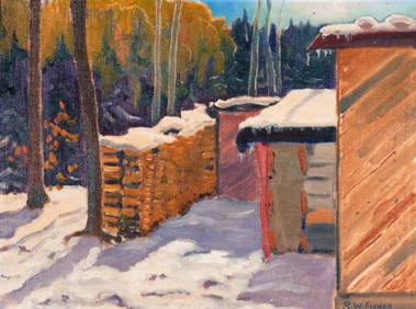
LARGE Robert Waltsak (NJ,b 1944) oil paintingBroward Auction Gallery4.8(285)See Sold PriceMar 10, 2024
LARGE Robert Waltsak (NJ,b 1944) oil paintingBroward Auction Gallery4.8(285)See Sold PriceMar 10, 2024
LARGE Robert Waltsak (NJ,b 1944) oil paintingBroward Auction Gallery4.8(285)See Sold PriceMar 10, 2024
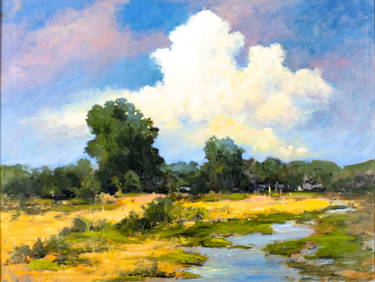
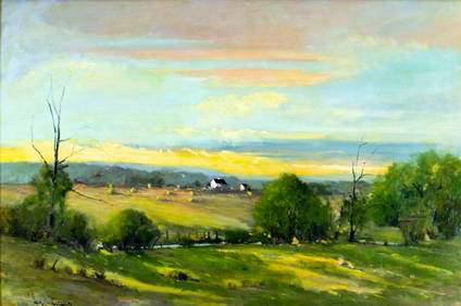
Robert William Wood (1889 - 1979) Texas BluebonnetsPremier Auction Galleries4.3(329)See Sold PriceMar 09, 2024
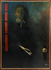
American Patrick Henry Davenport 1803-1890 Portrait Of John Robert Allen Oil On CanvasRbfinearts4.4(575)See Sold PriceFeb 24, 2024
Portfolio of 15 County Maps by Robert Morden (English 1650-1703)Nadeau's Auction Gallery4.7(405)See Sold PriceFeb 24, 2024
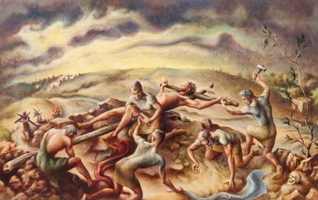
Henri Robert Bresil 1952-1999 Haitian Oil PaintingHill Auction Gallery 4.7(1k)See Sold PriceFeb 28, 2024
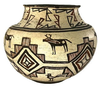
9" D. x 7" H. Pueblo Polychrome Olla Pot. Ex Robert Hand and Nick GatsesTony Putty Artifacts4.7(404)See Sold PriceMar 09, 2024
[BLACK PANTHER PARTY]. An Attack Against One Is An Attack Against All. San Francisco, CA: RobertFreeman's | Hindman4.4(1.6k)See Sold PriceFeb 27, 2024
Map: An 18thC engraved and hand coloured map of Buckinghamshire after Robert Morden. Approx. 8 1/4"Claydon Auctioneers Ltd4.3(125)See Sold PriceFeb 26, 2024
Map: A 17thC engraved and hand coloured map of Bedfordshire after Robert Morden. Approx. 12 1/2" xClaydon Auctioneers Ltd4.3(125)See Sold PriceFeb 26, 2024
Dr. Robert W. FISHER, O.S.A. (1923 - 2000)Pridham's Auctions & Appraisals4.7(223)See Sold PriceMar 02, 2024


![9 Maps, 7 Morden, Robert, London 1695-[??] (1 of 4)](https://p1.liveauctioneers.com/130/16182/5354503_1_x.jpg?height=282&quality=70&version=1213128912)


![[BLACK PANTHER PARTY]. An Attack Against One Is An Attack Against All. San Francisco, CA: Robert (1 of 1)](https://p1.liveauctioneers.com/197/319238/171467895_1_x.jpg?height=282&quality=70&version=1707520367)