SoldMorden (Robert) BuckinghamshireMorden (Robert) Buckinghamshire, engraving with original hand-colouring, 410 x 350mm., central horizontal fold, some browning, Abel Swale, Awnsham & John Churchill, [1695]; with a facsimile maSee Sold Price
Buckinghamshire.- Morden (Robert) Buckinghamshire,Buckinghamshire.- Morden (Robert) Buckinghamshire, county map from Camden's Britannia, engraving with outline hand-colouring, on laid paper with watermark of a horse within a circle, sheet 435 x 370 mSee Sold Price
SoldMorden (Robert) - Buckingham Shireengraved county map with hand-colouring, 420 x 345mm., central horizontal fold, some browning, Abel Swale, Awnsham and John Churchill , [1695 or later]; with a facsimile of Morden's map of Hertford ShSee Sold Price
Morden (Robert) Hertfordshire; Buckinghamshire; NoMorden (Robert) Hertfordshire; Buckinghamshire; Northamptonshire,engraved maps with outline hand-colouring, 370 x 440mm, 420 x 345mm, and 365 x 420mm, respectively, central vertical and horizoSee Sold Price
SoldHertfordshire.- Morden (Robert) Hertfordshire; BucHertfordshire.- Morden (Robert) Hertfordshire; Buckinghamshire; Northamptonshire,engraved maps with outline hand-colouring, 370 x 440mm, 420 x 345mm, and 365 x 420mm, respectively, central verSee Sold Price
SoldFOUR VARIIOUS MAPSRobert Morden Buckinghamshire, engraved map coloured in outline, 42 x 34cm; William Kip, Essex Comitatus, hand coloured engraved map, 29 x 37cm; James Wyld. The Country Round Washington from 'StrategiSee Sold Price
SoldRobert Morden Map of Buckingham Shire 16.5 x 13.5Robert Morden coloured engraving Map of Buckingham Shire 16.5 x 13.5in.See Sold Price
SoldThree 18th and 19th c. maps, Ireland and UK(Lot of 3) Framed 18th and 19th century maps, ''Buckingham Shire'' by Robert Morden, ''Seven United Provinces'' by Eman Bowen, and ''Ireland'' by Herman Moll 1732, largest overall: 19.5''h x 22''wSee Sold Price
SoldHand Colored Engraved Map, Buckingham ShireFramed hand colored engraving, Map of Buckingham Shire after Robert Morden, engraved by S. Nicholls, 19th century, overall: 22''h x 19''wSee Sold Price
SoldMap: A map of Buckinghamshire by Sutton Nicholls afterMap: A map of Buckinghamshire by Sutton Nicholls after Robert Morden. Showing the borders Northamptonshire, Oxfordshire, Barkshire, Hertfordshire, Bedfordshire etc. Retailed by Swale, Awnsham & ChurchSee Sold Price
SoldMap : Robert Morden a hand coloured map of BuckinghamshMap : Robert Morden a hand coloured map of Buckinghamshire taken from Camden's Britannia published in 1695. Framed and glazed. 16 3/4" x 14"See Sold Price
SoldANTIQUE MAP BUCKINGHAMSHIREBy Robert Morden. 16.25"H X 13.5"W, sight. 22"H X 19"W, framed.See Sold Price
SoldRobert Morden (c1650-1703). Handtinted County map ofRobert Morden (c1650-1703). Handtinted County map of Buckinghamshire. These maps were produced by Morden and others between 1695 and 1772 for the various editions of Camden's atlas 'Britannia'. The maSee Sold Price
SoldMorden, Robert 1701 Hand Col Map of Staffordshire, UKHand Colored Copper Engraved Map Published 1701-08, London for "The New Description and State of England, containing the Mapps of the Counties of England and Wales" by Robert Morden. Light folds as isSee Sold Price
SoldWorld.- Morden (Robert) [ Geography Rectified: or, AWorld.- Morden (Robert) [Geography Rectified: or, A Description of the World], maps only, no title or text, comprising double-page engraved 'Catalogue of Mapps in This Booke' and 79 double-page engravSee Sold Price
Sold* MORDEN, Robert (ca 1650-1703). Geography Rectified:* MORDEN, Robert (ca 1650-1703). Geography Rectified: or, A Description of the World. London: for Robert Morden and Thomas Cockeril, 1680. Small 4to (200 x 157 mm). Title printed in red and black, hanSee Sold Price
SoldMorden, Robert. A New Map of CarolinaMorden, Robert. A New Map of Carolinacopperplate leaf with hand color from Geography Rectified (London, circa 1688-1700), the sheet with descriptive text on both sides. Presented under mat. 7.25 x 6.2See Sold Price
Sold(MAP) MORDEN, ROBERT. Oxfordshire. [London, 1695 o(MAP) MORDEN, ROBERT Oxfordshire. [London, 1695 or later]. Engraved map with hand-coloring. Framed and matted. Crease down the center. 17 x 14 1/4 inches.See Sold Price
SoldMorden, Robert. Westmorland MapMorden, Robert. Westmorland Mapfrom an 18th century edition of Camden's Britannia, copperplate engraving with hand-coloring. Presented in silver toned wooden frame. SS 14.5 x 17 in.; DOA 21.25 x 23.5See Sold Price
SoldMorden, Robert. Of The Islands About Asia Minor.copperplate engraving with hand color from Atlas Terestris (London, 1687), below is an inset map showing Aegean islands. Presented in a plain wooden frame. DOA 15.75 x 14 in.; SS 5.25 x 7.25 in. A SinSee Sold Price
SoldMorden (Robert) Essex; Suffolk; Norfolk; CambridgeMorden (Robert) Essex; Suffolk; Norfolk; Cambridgeshire,engraved maps with outline hand-colouring, 350 x 415mm, 360 x 420mm, 370 x 580mm, and 430 x 360mm, respectively, central horizontal andSee Sold Price
SoldAtlases.- Morden (Robert) [Geography Rectified: or, AAtlases.- Morden (Robert) [Geography Rectified: or, A Description of the World], maps only, no title or text, comprising double-page engraved 'Catalogue of Mapps in This Booke' and 77 double-page engrSee Sold Price
Sold(Geography), Morden, Robert (c.1650-1703) Geograph(Geography), Morden, Robert (c.1650-1703) Geography Rectified: or, A Description of the World, London: Printed for Robert Morden and Thomas Cockerill, at the Atlas in Cornhill, 1693, third edition, coSee Sold Price
SoldMORDEN, ROBERT. A New Map of New England and New York.MORDEN, ROBERT. A New Map of New England and New York. Small-scale engraved map of New England on a folio leaf of English text. 8x6½ inches sheet size; preceding text leaf tipped to verso. - LondSee Sold Price
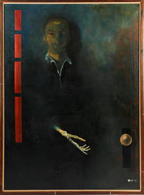
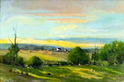
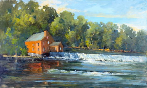
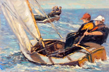
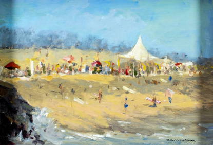
LARGE Robert Waltsak (NJ,b 1944) oil paintingBroward Auction Gallery4.8(277)See Sold PriceMar 10, 2024
LARGE Robert Waltsak (NJ,b 1944) oil paintingBroward Auction Gallery4.8(277)See Sold PriceMar 10, 2024
LARGE Robert Waltsak (NJ,b 1944) oil paintingBroward Auction Gallery4.8(277)See Sold PriceMar 10, 2024
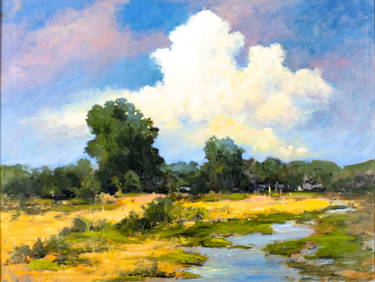
Robert William Wood (1889 - 1979) Texas BluebonnetsPremier Auction Galleries4.3(329)See Sold PriceMar 09, 2024
American Patrick Henry Davenport 1803-1890 Portrait Of John Robert Allen Oil On CanvasRbfinearts4.4(571)See Sold PriceFeb 24, 2024
Portfolio of 15 County Maps by Robert Morden (English 1650-1703)Nadeau's Auction Gallery4.7(401)See Sold PriceFeb 24, 2024
Henri Robert Bresil 1952-1999 Haitian Oil PaintingHill Auction Gallery 4.7(1k)See Sold PriceFeb 28, 2024
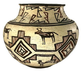
9" D. x 7" H. Pueblo Polychrome Olla Pot. Ex Robert Hand and Nick GatsesTony Putty Artifacts4.7(404)See Sold PriceMar 09, 2024
[BLACK PANTHER PARTY]. An Attack Against One Is An Attack Against All. San Francisco, CA: RobertFreeman's | Hindman4.4(1.6k)See Sold PriceFeb 27, 2024
Map: An 18thC engraved and hand coloured map of Buckinghamshire after Robert Morden. Approx. 8 1/4"Claydon Auctioneers Ltd4.3(125)See Sold PriceFeb 26, 2024
Map: A 17thC engraved and hand coloured map of Bedfordshire after Robert Morden. Approx. 12 1/2" xClaydon Auctioneers Ltd4.3(125)See Sold PriceFeb 26, 2024
Dr. Robert W. FISHER, O.S.A. (1923 - 2000)Pridham's Auctions & Appraisals4.7(223)See Sold PriceMar 02, 2024


![[BLACK PANTHER PARTY]. An Attack Against One Is An Attack Against All. San Francisco, CA: Robert (1 of 1)](https://p1.liveauctioneers.com/197/319238/171467895_1_x.jpg?height=282&quality=70&version=1707520367)