Vintage MAZ Turquoise Shell 14k Gold Clip-On EarringsMiami Auctions & Appraisals LLC 4.4(32)See Sold PriceFeb 26, 2024
Vintage Sterling Silver Black Stone RingThe Benefit Shop Foundation Inc.4.3(2.9k)See Sold PriceMar 13, 2024
SoldMoll Map of Peru and AmazonMOLL, Herman (1654-1732). A Map of Peru and the West Part of the Country of the Amazones. Engraved map from Atlas Geographus. London, c. 1711-1717. 13 1/4" x 8 1/2" sheet.See Sold Price
Moll Map of PeruMOLL, Herman (1654-1732). A Chart of the Coasts of Peru, Quito, Popayan and the Isthmus of Darien. Engraved map from Atlas Geographus. London, c. 1711-1717. 8 1/2" x 12 1/2" sheet.See Sold Price
Bowen map of Peru & Amazon 1747Heading: Author: Bowen, Emanuel Title: A New and Accurate Map of Peru, and the Country of the Amazones. Drawn from the most authentick French Maps &c. Place Published: London Publisher: Date PubSee Sold Price
Bowen map of Peru & Amazon 1747Heading: Author: Bowen, Emanuel Title: A New and Accurate Map of Peru, and the Country of the Amazones. Drawn from the most authentick French Maps &c. Place Published: London Publisher: Date PubSee Sold Price
Bowen map of Peru & Amazon 1747Heading: Author: Bowen, Emanuel Title: A New and Accurate Map of Peru, and the Country of the Amazones. Drawn from the most authentick French Maps &c. Place Published: London Publisher: Date PubSee Sold Price
Sold(3) ANTIQUE MAPS, BRAZIL, PERU, AMAZON, 18TH C.(lot of 3) Antique maps, including: (1) "Carte de la Terre Ferme du Perou, du Bresil, et du Pays des Amazones," (Peru, Brazil, Amazon), c.1725, Coven & Mortiers Publishers, based on the cartography ofSee Sold Price
SoldCovens & Mortier Map of Peru Brazil & Amazon 1730Covens and Mortier Map of Brazil & the Amazon Region, 1730. Map titled "Tabula Geographica Peruae, Braziliae & Amazonum Regionis" Map measures 24.5" x 20.25" sheet size. Unframed, loose and not gluedSee Sold Price
SoldHAND COLORED MAP OF PERU & COUNTRY OF THE AMAZONS,"A New And Accurate Map Of Peru And The Country Of The Amazones. Drawn From The Most Authentick French Maps &C. And Regulated By Astronomical Observations", London]: William Innys [et al.], 1747. A deSee Sold Price
SoldMap of the Upper Amazon. Peru. 1867.Map of unexplored tributary of the Upper Amazon. Peru. 1867.Print of woodcut engraving titled „Carte des affluents inexplores du Haut-Amazone“.Author M. Paul Marcoy.Engraved by unknown.From "Le ToSee Sold Price
Sold1883 1ed South AMERICA Peru Brazil Amazon Illustrated1883 1ed South AMERICA Peru Brazil Amazon Illustrated MAP Animals Far-Off Lands ‘Pictures of Travel in Far-off Lands’ is a late 19th-century geography handbook designed to provide basic informatioSee Sold Price
1883 1ed South AMERICA Peru Brazil Amazon Illustrated1883 1ed South AMERICA Peru Brazil Amazon Illustrated MAP Animals Far-Off Lands ‘Pictures of Travel in Far-off Lands’ is a late 19th-century geography handbook designed to provide basic informatioSee Sold Price
SoldMoll, 5 maps South America, c.1710-1735[South America]. Herman Moll. 5 engraved maps, hand-colored, c.1710-1735. Very good condition. ++ A Map Of Terra Firma Peru, Amazone-Land, Brasil &c. the North P. of La Plata. 8 1/4 x 11 1/8 8 in. LowSee Sold Price
SoldHerman Moll, "A Map of Brasil," "A Map of ChiliHerman Moll, "A Map of Brasil," "A Map of Chili Patagonia," and "A Map of Peru," c. 1730, group of three hand colored engravings, presented in identical gilt frames, H.- 10 1/2 in., W.- 7 1/2 in.See Sold Price
SoldFRAMED PERUVIAN TEXTILE, MID 20TH C, SHIPIBOPEOPLE, AMAZON BASIN, PUCALLA, PERU. COTTON, WOVEN AND PAINTED "MAP OF THE WORLD", 52 1/2" X 36", 2" AREA UPPER RIGHT BLEACHED OUT. CONSERVATION WITH PLEXIGLASS BOX.See Sold Price
SoldJ. B. Homann Map of Brazil & Amazon 1746J. B. Homann Map of Brazil & the Amazon Region, 1746. Map titled "Tabula Americae Specialis Geographica Regni Peru Brasiliae, Terrae Firmae". Map measures 23.5" x 19-7/8" sheet size. Unframed, loose aSee Sold Price
SoldMoll, Hermann Sammlung von 36 Kupferstichen aus: AtlasMoll, Hermann Collection with 36 copper engravings. The collection represents beautiful geographic maps with rare maps of Persia, North Pole, Japan and China, Peru, Mexico, Barbados, Great Tartary, JaSee Sold Price
Amazon River by Herman Moll, 1716Original copper engraving of Amazon River published in Atlas Geographicus by Herman Moll, London, 1716. Dimensions: 11 1/2” x 19 1/2” Shipping Domestic: Shipping rates are determind by destinationSee Sold Price
Sold(11) PERU AMAZON TRIBAL BOWS & ARROWS(lot of 11) Peruvian Amazon tribal bow and arrows: (10) arrows up to 74"l, extremely sharp wood arrowheads; (2) wood bows Start Price: $80.00See Sold Price
Sold(11) PERU AMAZON TRIBAL BOW, ARROWS & SPEAR(lot of 11) Peruvian Amazon tribal bows and arrows: (9) arrows up to 73"l, extremely sharp wood arrowheads; (1) wood bow; (1) spear Start Price: $80.00See Sold Price
Sold(16) PERU AMAZON TRIBAL BOWS & ARROWS(lot of 16) Peruvian Amazon tribal bows and arrows: (14) arrows up to 73"l, extremely sharp wood arrowheads; (2) wood bows Start Price: $80.00See Sold Price
SoldShipibo Peru Amazon RainForest Indian Pottery BowlVintage Shipibo Peruvian Amazon rain forest Indian pottery bowl. Shipibo are an ancient tribe from the Amazonian rain forest in Peru credited with holding the traditions of the potent entheogenic brewSee Sold Price
SoldHerman Moll Map Virginia and Maryland 1741Herman Moll (ca. 1654-1732), "A New Map of Virginia and Maryland," London, 1741. Hand colored engraved map of the Chesapeake Bay region, showing what is now Virginia, Maryland, Delaware, and parts ofSee Sold Price
SoldMoll: Map of Poland, 1701Map of Poland. An original copperplate engraving published by Herman Moll in 1701. With text describing the Kingdom Of Poland. 7 x 7.5 " (map only) Please note that this lot has a reserve. When you leSee Sold Price
Sold(9) PERU AMAZON TRIBAL BOW & ARROWS(lot of 9) Peruvian Amazon tribal bow and arrows: (8) arrows up to 73"l, extremely sharp wood arrowheads; (1) wood bow Start Price: $80.00See Sold Price
Central Railroad of New Jersey Map of Sandy Hook Route-ca. 1903JM Hobby Supply and Railroad Artifact Auctions4.4(126)See Sold PriceFeb 24, 2024
LATE 17TH C. FRENCH MAP OF THE NEW WORLD BY ALEXIS-HUBERT JAILLOT (1632-1712)Thomaston Place Auction Galleries4.4(386)See Sold PriceFeb 24, 2024
18TH C. ANTIQUE MAP: FRENCH & INDIAN WAR, FRAMEDThomaston Place Auction Galleries4.4(386)See Sold PriceFeb 24, 2024
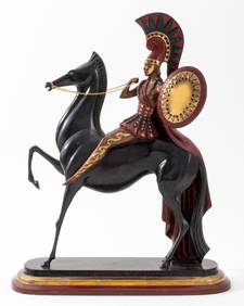
Erte "Amazon" Patinated Bronze Sculpture, 1985Auctions at Showplace4.5(726)See Sold PriceMar 03, 2024
Natural History - Fossil Amazon Rainforest Fossil Tree Trunk SectionTimeLine Auctions Ltd.4.5(183)See Sold PriceMar 08, 2024
Keith Haring - Ink on New York Map, Best Buddies, Inscribed, Signed, and DatedSapphire Auction Gallery4(67)See Sold PriceMar 02, 2024
Rand McNally Railroad Map Cabinet w/ 21 Railroad MapsRail & Road Auctions4.6(165)See Sold PriceMar 08, 2024
Linnea Pergola "Moonlight over Manhattan" Signed Seri. LEMichael's Gallery4.6(89)See Sold PriceFeb 24, 2024
Putnam - First Map of the State of Ohio by Rufus PutnamTrillium Antique Prints & Rare Books4.5(30)See Sold PriceFeb 24, 2024
Herman Moll A New Map of Ye North Parts of AmericaWillow Auction House4.5(283)See Sold PriceMar 14, 2024
Linnea Pergola "Moonlight over Manhattan" Signed Seri. LEMichael's Gallery4.6(89)See Sold PriceMar 02, 2024