SoldMitchell's Universal AtlasMitchell, Samuel Augustus, [New Universal Atlas Containing Maps of the Various Empires, Kingdoms, States and Republics of the World With a special map of each of the United States, Plans of Cities &c.See Sold Price
SoldMitchell, Samuel Augustus. A New Universal AtlasMitchell, Samuel Augustus. A New Universal Atlas of the World. Philadelphia: Thomas Cowperthwait & Co., 1852. Folio, disbound, with seventy of seventy-four hand-colored maps, lacking New Hampshire andSee Sold Price
Sold1 vol. (Mitchell, Samuel Augustus.) A New Universa1 vol. (Mitchell, Samuel Augustus.) A New Universal Atlas. Philadelphia: Charles Desilver, 1857. Folio, orig. 1/2 black morocco & gilt decorated & lettered olive cloth; spine defective, front cover deSee Sold Price
Sold* MITCHELL, Samuel Augustus (1792-1868). A New* MITCHELL, Samuel Augustus (1792-1868). A New Universal Atlas. Philadelphia: Thomas Cowperthwait, 1851. 4to (432 x 351 mm). Chromolithographic title-page, chromolithographic contents leaf, 74 lithogrSee Sold Price
SoldMITCHELL, Samuel Augustus (1790-1868).* MITCHELL, Samuel Augustus (1790-1868). A New Universal Atlas Containing Maps of the Various Empires, Kingdoms, States, and Republics of the World, with a Special Map of Each of the United States, PlSee Sold Price
Sold(Maps and Charts), Mitchell, Samuel Augustus (1792(Maps and Charts), Mitchell, Samuel Augustus (1792-1868), A New Universal Atlas...of the World, Philadelphia: Thomas, Cowperthwait & Co., 1853, three quarter calf, folio, (boards off, spring, extremitSee Sold Price
Sold* MITCHELL, Samuel Augustus (1792-1868). A New* MITCHELL, Samuel Augustus (1792-1868). A New Universal Atlas. Philadelphia: Charles Desilver, 1857. 4to (438 x 356 mm). Lithographic title-page, 76 lithographic maps with hand-coloring (3 double-pagSee Sold Price
Sold[MITCHELL, Samuel Augustus (1790–1868)]. A New[MITCHELL, Samuel Augustus (1790–1868)]. A New Universal Atlas Containing Maps of the various Empires, Kingdoms, States and Republics of the World with a special Map of each of the United StatesSee Sold Price
SoldSamuel Augustus Mitchell A NEW UNIVERSAL ATLAS 1846Title: A New Universal Atlas Containing Maps of the Various Empires, Kingdoms, States and Republics of the World with a Special Map of Each of the United States, Plans of Cities, etc. Comprehended inSee Sold Price
Sold3 Maps Total , 1 of Tennessee, 2 of Kentucky andThree (3) Maps, 1 of Tennessee, 2 of Kentucky and Tennessee. 1st item: "A New Map of Tennessee" by Samuel Augustus Mitchell from his "A New Universal Atlas" 1846. Colored map featuring Tennessee dividSee Sold Price
SoldMitchell's A New Universal Atlas 1853Title: A New Universal Atlas Containing Maps of the various Empires, Kingdoms, States and Republics of the World... Author: Mitchell, Samuel Augustus Description: Chromolithograph title page and tableSee Sold Price
SoldMitchell's New Universal 1854 Atlas, 72 mapsTitle: A New Universal Atlas Containing Maps of the various Empires, Kingdoms, States and Republics of the World... Author: [Mitchell, Samuel Augustus] Description: With 72 hand-colored maps (1 doubleSee Sold Price
Venezuela, New Grenada & Equador by Mitchell, 1850Original engraving by Samuel Augustus Mitchell from Mitchell’s Universal Atlas, 1850. Vignette features railroad across the Isthmus of Darien from Victor Bay to Panama. Dimensions: 14 x 16 inchesSee Sold Price
Venezuela, New Grenada & Equador by Mitchell, 1850Original engraving by Samuel Augustus Mitchell from Mitchell’s Universal Atlas, 1850. Vignette features railroad across the Isthmus of Darien from Victor Bay to Panama. Dimensions: 14 x 16 inchesSee Sold Price
SoldHawaiian & Pacific Polynesian Islands, Australia, 1850Original engraving by Samuel Augustus Mitchell from Mitchell’s Universal Atlas, 1850. Map highlights the Pacific ocean & surrounding islands; Hawaii, Polynesian, Australia & New Zealand. Dimensions:See Sold Price
1849 Mitchell Map of Russia in AsiaTitle/Content of Map: 1849 Mitchell Map of Russia in Asia Date Printed: 1849 Cartographer: Samuel Augustus Mitchell Material/Medium: Engraving Size: 12.5" x 16" Original engraving from the New UniversSee Sold Price
SoldMitchel, Samuel Augustus "A New Universal Atlas"Mitchel, Samuel Augustus "A New Universal Atlas", (Baltimore, Cushings & Bailey 1859); folio; quarter-gilt pebbled sheep over gilt embossed cloth (front panel detached); Final edition of Michell's renSee Sold Price
SoldMitchell, Samuel Augustus New General Atlas, containingAtlanten Mitchell Samuel Augustus New General Atlas containing maps of the various countries of the world plans of cities etc ... also a list of the post-offices of the United States and territories aSee Sold Price
SoldMITCHELL, S. AUGUSTUS. A New Universal Atlas.MITCHELL, S. AUGUSTUS. A New Universal Atlas. Color lithographed title, 75 hand-colored mapsheets [complete]. Folio, publisher's 1/2 morocco, with the morocco cover label; front hinge cracked, frontisSee Sold Price
SoldMITCHELL, S. AUGUSTUS. A New Universal Atlas.MITCHELL, S. AUGUSTUS. A New Universal Atlas. Color lithographed title, 74 hand-colored mapsheeets [complete]. Folio, library buckram; preliminaries slightly chipped along fore-edges, fore-edge of froSee Sold Price
SoldMitchells New Universal Atlas, 1857Mitchells New Universal Atlas, 1857MITCHELL, S. AUGUSTUS. A New Universal Atlas--Containing Maps of the Various Empires, Kingdoms, States, and Republics of the World. Philadelphia: Charles Desilver, 1See Sold Price
Sold1 vol. (Mitchell, S. Augustus.) A New Universal A1 vol. (Mitchell, S. Augustus.) A New Universal Atlas Containing Maps of the Various Empires, Kingdoms,... of the World, with a Special Map of Each of the United States... Philadelphia: Thomas CoppertSee Sold Price
Sold1 vol. [Mitchell, S. Augustus.] A New Universal A1 vol. [Mitchell, S. Augustus.] A New Universal Atlas... of The World. Philadelphia: Thomas Cowperthwait, 1855. Folio, orig. 1/2 diced red calf, gilt & marbled bds., orig. richly gilt red morocco coveSee Sold Price
SoldMITCHELL, SAMUEL AUGUSTUS. Mitchell's New GeneMITCHELL, SAMUEL AUGUSTUS. Mitchell's New General Atlas. Profusion of hand-colored lithographed maps. Folio, publisher's 1/2 morocco, extremities worn, backstrip ragged, front cover about loose; interSee Sold Price
1849 Mitchell School ATLAS 24 MAPS America Holy Land France Africa Egypt AsiaSchilb Antiquarian Rare Books4.8(428)See Sold PriceMar 31, 2024
Its New PLAX Universal Finish Advertising Cardboard Easel Back w Poison BottleHoller and Hammer4.6(64)See Sold PriceFeb 25, 2024
Hoyt Wilhelm Signed Mitchell & Ness New York Giants Jersey JSA COAMynt Auctions4.6(697)See Sold PriceFeb 25, 2024
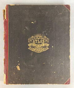
1872 New Combination Atlas of Lee County Illinois BookMatthew Bullock Auctioneers4.7(1.8k)See Sold PriceFeb 24, 2024
Arrowsmith & Lewis - Map of PolynesiaTrillium Antique Prints & Rare Books4.5(32)See Sold PriceFeb 24, 2024
Arrowsmith & Lewis - Map of North AmericaTrillium Antique Prints & Rare Books4.5(32)See Sold PriceFeb 24, 2024
Arrowsmith & Lewis - Map of the World on Mercator's ProjectionTrillium Antique Prints & Rare Books4.5(32)See Sold PriceFeb 24, 2024
Arrowsmith & Lewis - Map of LouisianaTrillium Antique Prints & Rare Books4.5(32)See Sold PriceFeb 24, 2024
Arrowsmith & Lewis - Map of the United StatesTrillium Antique Prints & Rare Books4.5(32)See Sold PriceFeb 24, 2024
Mitchell - Map of the City of Washington (Washington, DC)Trillium Antique Prints & Rare Books4.5(32)See Sold PriceFeb 24, 2024
West Indies Islands. Guadaloupe. | Mariegalante &C. | Antigua.Jasper524.5(9.9k)See Sold PriceFeb 27, 2024
Two Hand-Colored 19th Century Maps of New Orleans and Louisiana, Larger- H.- 12 1/2 in., W.- 15 1/2Crescent City Auction Gallery4.3(231)See Sold PriceMar 08, 2024
Robert H Labberton - Map of The Territory of the Present United States - The territory of theProverde Auctions4.3(3)See Sold PriceFeb 28, 2024


![[MITCHELL, Samuel Augustus (1790–1868)]. A New (1 of 9)](https://p1.liveauctioneers.com/928/212515/108628865_1_x.jpg?height=282&quality=70&version=1627420959)


![1 vol. [Mitchell, S. Augustus.] A New Universal A (1 of 1)](https://p1.liveauctioneers.com/65/13677/4265567_1_x.jpg?height=282&quality=70&version=1190989121)