SoldMitchell's New General Atlas 1885 color mapsTitle: Mitchell's New General Atlas, Containing Maps of the Various Countries of the World, Plans of Cities, Etc. Embraced in Ninety-Three Quarto Maps...Together with Valuable Statistical Tables. AlsoSee Sold Price
SoldMitchell's New General Atlas 1882, color mapsTitle: [Mitchell's New General Atlas, Containing Maps of the Various Countries of the World, Plans of Cities...] Author: Mitchell, [Samuel Augustus] Description: [No title page]. With 80 hand-coloredSee Sold Price
SoldMitchell's NEW GENERAL ATLAS 1881 Color World MapTitle: Mitchell's New General Atlas Publisher: Bradley & Company Printing Year: 1881 Condition/Details: Bound in gilt embossed cloth boards, this volume contains 147 color maps and plans from all oveSee Sold Price
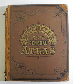
SoldMitchell's NEW GENERAL ATLAS 1866 World Color MapTitle: Mitchell's New General Atlas Publisher: S. Augustus Mitchell Printing Year: 1866 Condition/Details: Bound in gilt embossed cloth boards with three-quarter leather, this rare antique volume conSee Sold Price
SoldAugustus Mitchell Hand Tinted Colored Map of KY & TNA beautiful antique hand-tinted color map from Augustus Mitchell's New General Atlas | Augustus Mitchell was the premier map-maker of the time | This map of the "County Map Of Georgia And Alabama";isSee Sold Price
1886 California from Mitchell atlasFine antique lithograph map with original hand color. “County Map of the State of California” by William Bradley and found in the 1887 Mitchell New General Atlas. Detailed, scarce and interestingSee Sold Price
Sold1886 California from Mitchell atlasFine antique lithograph map with original hand color. “County Map of the State of California” by William Bradley and found in the 1887 Mitchell New General Atlas. Detailed, scarce and interestingSee Sold Price
1886 map of California from Mitchell atlasFine antique lithograph map with original hand color. “County Map of the State of California” by William Bradley and found in the 1887 Mitchell New General Atlas. Detailed, scarce and interestingSee Sold Price
Sold1864 Mitchell New General Atlas, rebacked bright1864 Mitchell New General Atlas, rebacked bright color-- Dimensions: ---See Sold Price
Sold1886 Bradley map of FloridaAntique hand colored map of Florida, with counties delineated by color, and inset map of the southern portion of Florida. Published by M. Bradley in Mitchell’s 1887 New General Atlas. Shows forts, rSee Sold Price
1886 Bradley map of FloridaAntique hand colored map of Florida, with counties delineated by color, and inset map of the southern portion of Florida. Published by M. Bradley in Mitchell’s 1887 New General Atlas. Shows forts, rSee Sold Price
(MAP) MITCHELL, S. AUGUSTUS Size of largest 15 1/4(MAP) MITCHELL, S. AUGUSTUS A group of two maps from Mitchell's New General Atlas. Philadelphia: Bradley, 1882. In color. Creased to center; otherwise fine. Size of largest 15 1/4 x 23 inches.See Sold Price
Sold1862 County Map of Georgia and AlabamaThis is an authentic, antique lithograph map of Georgia and Alabama by Samuel Augustus Mitchell Jr. The map was published in Philadelphia as part of Mitchell's New General Atlas of 1862. It is color cSee Sold Price
1862 County Map of Virginia and West VirginiaThis is an authentic, antique lithograph map of Georgia and Alabama by Samuel Augustus Mitchell Jr. The map was published in Philadelphia as part of Mitchell's New General Atlas of 1862. It is color cSee Sold Price
Sold1 vol. Mitchell, S. Augustus. Mitchell'1 vol. Mitchell, S. Augustus. Mitchell's New General Atlas. Philadelphia, 1869. Folio, orig. cloth; worn & blistered, spine gone, covers detached. 100 maps & plans on 63 color lithographic sheets. OccSee Sold Price
New York and Brooklyn, 1886 hand colorReserve Reduced! Beautiful example of William Bradley’s 1886 map of New York and Brooklyn as found in the 1887 Mitchell New General Atlas. Shows wards, parks, wharves, railroads, major public buildiSee Sold Price
Sold1860 Map of Louisiana, Mississippi and Arkansas, in1860 Map of Louisiana, Mississippi and Arkansas, in Full Color. Page #32. Published In: Mitchell's New General Atlas, Containing Maps Of The Various Countries Of The World, Plans Of Cities, Etc. EmbraSee Sold Price
SoldMitchell's New General Atlas, Containing Maps Of TheMitchell's New General Atlas, Containing Maps Of The Various Countries Of The World, Plans Of Cities, Etc., Embraced In Fifty-Three Quarto Maps, Forming A Series of Eighty-Four Maps And Plans, TogetheSee Sold Price
SoldMitchell's New General Atlas, Containing Maps ofAuthor: Mitchell, [Samuel Augustus] With approximately 80 hand-colored maps and plans plus several insets (28 are double-page) and 1 double-page railroad map of the United States; all on approximatelySee Sold Price
SoldMitchell's New General Atlas, Containing Maps ofAuthor: Mitchell, S[amuel] Augustus With 76 total hand-colored maps and plans including insets (4 are double-page); all on 43 map-sheets. 15½x13, original half sheep and brown cloth, front cover lettSee Sold Price
Mitchell's New General Atlas containing maps of the various countries of the world, plans of cities,Publication Date: 1877 Title: Mitchell's New General Atlas containing maps of the various countries of the world, plans of cities, etc., embraced in seventy-nine quarto maps. Primary Authors: SAMUEL ASee Sold Price
Mitchell's New General Atlas containing maps of theTitle:Mitchell's New General Atlas containing maps of the various countries of the world, plans of cities, etc., embraced in seventy-nine quarto maps. Author: SAMUEL AUGUSTUS MITCHELL, JR Publisher/MaSee Sold Price
Mitchell's New General Atlas, Containing Maps of theTitle: Mitchell's New General Atlas, Containing Maps of the Various Countries of the World Publication Date: 1879 Primary Authors: MITCHELL, SAMUEL AUGUSTUS (JR.) Publisher: S. AUGUSTUS MITCHELL (JR.)See Sold Price
Mitchell's New General Atlas, Containing Maps of thePublication Date: 1879 Title: Mitchell's New General Atlas, Containing Maps of the Various Countries of the World Primary Authors: MITCHELL, SAMUEL AUGUSTUS (JR.) Publisher: S. AUGUSTUS MITCHELL (JR.)See Sold Price
1849 Mitchell School ATLAS 24 MAPS America Holy Land France Africa Egypt AsiaSchilb Antiquarian Rare Books4.8(428)See Sold PriceMar 31, 2024
Arrowsmith & Lewis - Map of PolynesiaTrillium Antique Prints & Rare Books4.5(32)See Sold PriceFeb 24, 2024
Arrowsmith & Lewis - Map of North AmericaTrillium Antique Prints & Rare Books4.5(32)See Sold PriceFeb 24, 2024
Arrowsmith & Lewis - Map of the World on Mercator's ProjectionTrillium Antique Prints & Rare Books4.5(32)See Sold PriceFeb 24, 2024
Arrowsmith & Lewis - Map of LouisianaTrillium Antique Prints & Rare Books4.5(32)See Sold PriceFeb 24, 2024
Arrowsmith & Lewis - Map of the United StatesTrillium Antique Prints & Rare Books4.5(32)See Sold PriceFeb 24, 2024
Mitchell - Map of the City of Washington (Washington, DC)Trillium Antique Prints & Rare Books4.5(32)See Sold PriceFeb 24, 2024
West Indies Islands. Guadaloupe. | Mariegalante &C. | Antigua.Jasper524.5(9.9k)See Sold PriceFeb 27, 2024
Africa. Mauritius, Bourbon (Reunion) & Natal by Edward Weller 1860 old mapJasper524.5(9.9k)See Sold PriceFeb 28, 2024
Robert H Labberton - Map of The Territory of the Present United States - The territory of theProverde Auctions4.3(3)See Sold PriceFeb 28, 2024