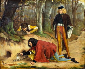
Sold[MISCELLANY]. About 45 loose maps, mostly fro[MISCELLANY]. About 45 loose maps, mostly from Mitchell (1863) and Johnson (1880) atlases. Condition varies, sold to viewing bidders only. This is a live auction at our physical auction gallery, thatSee Sold Price
SoldCompleat Geographer (The)Compleat Geographer (The), 2 parts in 1, The Fourth Edition, title in red and black, engraved frontispiece and 45 maps, mostly by Herman Moll, all but 1 folding map in the letterpress, 5 illuSee Sold Price
Sold1940s-60s PHOTOS OF ANNE FRANCIS W/ BULLApproximately 45 loose mostly B&W 8"X10" photographs of film and television actress Anne Francis. Most photos studio issued fare, with many portraits, stills and candids. Also two originals found hereSee Sold Price
SoldMaps of Cleveland, OH 187445+ Miscellaneous loose maps of Cleveland- of 11th-18th wards, appear to be from ''Atlas of Cuyahoga County, Ohio'', Titus, Simmons and Titus, Philadelphia, 1874, title page present, missing cover, seSee Sold Price
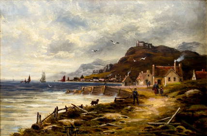
Sold[MISCELLANY]. About 92 loose maps published b[MISCELLANY]. About 92 loose maps published by Charles Knight, London, for The Society for the Diffusion of Useful Knowledge, ca.1860. Outline color, various areas of the Americas, Europe, and Asia. MSee Sold Price
Sold[MISCELLANY]. About 34 loose maps, from vario[MISCELLANY]. About 34 loose maps, from various atlases including Mitchell, Johnson & Ward, mid-19th century. Sold to viewing bidders only, as is. This is a live auction at our physical auction gallerSee Sold Price
SoldCarribean/Arctic: 11 maps. Late 16th - late 19th[Miscellany]. 11 engraved maps, mostly in less than good condition, c.1600 to late 1800s. Includes: ++ Ortelius. Asiae Nova Descriptio. Uncolored, some loss. ++ Partie De La Mer Glaciale...Nova ZemblaSee Sold Price
Sold[Miscellany]. About 45 Picture Books. 1990s. Most[Miscellany]. About 45 Picture Books. 1990s. Mostly hardcover in dj, many near fine condition. Sold on floor only.See Sold Price
SoldRatelband "Geographisch Toneel Kaarten," AtlasErve Ratelband, "Geographisch Toneel Kaarten," rare global atlas with approximately 45 four fold hand colored maps and guide, mostly complete. Provenance: From a Melrose, MA estate.See Sold Price
SoldBooks: A collection of 18 books, to include mostlyBooks: A collection of 18 books, to include mostly travel books and 3 loose maps. To include 'The Roadmender' by Michael Fairless. Published by Duckworth & Co , London. 'The buildings of England; CornSee Sold Price
Sold[Map Miscellany]. About 35 Maps. Various countrie[Map Miscellany]. About 35 Maps. Various countries; cities, regions. Mostly 19th century; excised from various editions. Some in tatters. Sold on floor only. This is a live auction at our physical aucSee Sold Price
SoldShackleton (Ernest H.) South,1st,1919Shackleton (Ernest H.) South: The Story of Shackleton's Last Expedition 1914-1917,first edition, half-title, colour frontispiece, plates, folding map loose, plates with light foxing (mostly maSee Sold Price
SoldLot of 45 maps depicting Texas105. [MAP]. TEXAS. Lot of 45 maps, all depicting Texas, at least in part, mostly nineteenth and early twentieth century with approximately 10 twentieth-century facsimiles. Various plSee Sold Price
Sold45 maps: Scandanavia Russia Iceland [1784 - c1911[Scandanavia/Russia]. About 45 Maps. 17 of Scandanavia, 8 Denmark, 18 Russia, and 2 Iceland. All but 3 maps in color or with color outline. Various sources, 1784 - c.1911. Mostly about 12 x 7 in., somSee Sold Price
Sold19 maps, mostly 19th century[Miscellany]. 19 Maps. Includes 11 maps of portions of Europe, 5 of portions of Canada, 1 North America, 2 of Middle East. 10 hand-colored maps from various editions of Johnson's Illustrated Family AtSee Sold Price
SoldLot of 10 map-sheets, mostly hand-colored 1855-56Title: Lot of 10 map-sheets, mostly hand-colored, 5 double-page Author: Cornell, S.S. Description: 21 loose maps (20 are hand-colored), 5 are double-page, plus full-page with 17 Principal U.S. CitiesSee Sold Price
SoldMiscellany, 6 maps[Miscellany]. 6 mostly folding mamps. First 2 listed below backed with linen, last 4 in publisher's original wraps or envelope. ++ De Belleyme. Carte Itineraire De La France Divisee en 86 DepartamensSee Sold Price
Sold[Map Miscellany]. 19 Maps. Sizes vary 7.5 x 8.5 t[Map Miscellany]. 19 Maps. Sizes vary 7.5 x 8.5 to 22 x 17. Mostly 19th Century Colton & Johnson maps; many in color, including Africa, Germany, Northern [Polar] Regions, South America, Sweden. This iSee Sold Price
SoldJapanese Metal Thread TextileJapanese Metal Hanging Textile, depicting a natural scene. Areas of loose thread, mostly to the center of the image. Fabric border fragile with some small tears. 45"x 63 1/2" with 6" border.Estimate:See Sold Price
SoldAustralia.- [Notes on Australia]Australia.- [Notes on Australia],written on Government House, Brisbane notepaper & Coker Court Yeovil, manuscript, 68pp., pen and ink maps, loose, 11th August 1920; and a quantity of others, mSee Sold Price
SoldWorld.- Shoberl (Frederic) - The World in Miniature:6 vol., 73 hand-coloured stipple-engraved plates, some spotting and browning, mostly to text, modern boards, uncut, [1821-22]; Africa, 4 vol., 2 folding hand-coloured engraved maps and 45 stipple-engrSee Sold Price
SoldSuez Canal.- - A group of 32 loose photographs,mostly relating to Egypt, including Pompey's Pillar, the Obelisk & Temple of Luxor, including photographs by the Zangaki Brothers and Bonfils, and a map of the Canal, mostly c.270 x 210 mm., togetherSee Sold Price
SoldWorld.- Betts (John, publisher) The London ModernWorld.- Betts (John, publisher) The London Modern Atlas, 26 engraved maps with hand-colouring, mostly double-page, some light spotting and surface dirt, several leaves loose from spine, nicks and tearSee Sold Price
SoldLondon Atlas of Universal Geography, 1889London Atlas of Universal Geography,46 colour maps, a few loose, a few corners creased, a few small stains or smudges, mostly marginal, original half morocco, spine ends and corners worn, scuSee Sold Price
Charles Kratke (France,1848-1921) oil painting antiqueBroward Auction Gallery4.7(300)See Sold PriceMar 10, 2024
Eastern RR Summer Book of Tours-1884JM Hobby Supply and Railroad Artifact Auctions4.4(127)See Sold PriceFeb 24, 2024
Rand McNally Railroad Map Cabinet w/ 21 Railroad MapsRail & Road Auctions4.6(165)See Sold PriceMar 08, 2024
Vaillant - Honolulu, Hawaii (Vue de Honolulu, Iles Sandwich). 45Trillium Antique Prints & Rare Books4.5(33)See Sold PriceFeb 24, 2024
Framed Space Age Rand McNally Map of Planets Poster, 1958PUBLIC SALE4.7(227)See Sold PriceMar 02, 2024
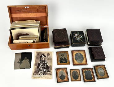
LARGE GROUP OF ANCESTRAL PHOTOGRAPHY Mostly 19th Century Cabinet cards 4" x 2.5" and 6.5" x 4.25".Eldred's4.7(423)See Sold PriceMar 07, 2024
Churchill & Nieuhof 1744 Folio Map. Batavia Indonesia East IndiesAlbion Auctions4.7(341)See Sold PriceMar 01, 2024
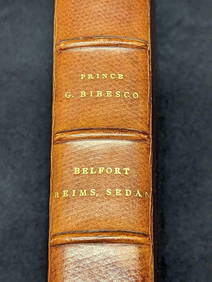
Antique Signed Prince Georges Bibesco Campagne De 1870 HardcoverRapid Estate Liquidators and Auction Gallery4.5(1.1k)See Sold PriceFeb 25, 2024
GROUP OF 14KT GOLD AND 18KT GOLD CHARMS AND CHARM BRACELETS Approx. 44.24 total dwt.Eldred's4.7(423)See Sold PriceMar 14, 2024
Hudson River Map & North American Postcards, 45Auctions at Showplace4.6(744)See Sold PriceFeb 13, 2025


![[MISCELLANY]. About 45 loose maps, mostly fro First Image](https://p1.liveauctioneers.com/179/10971/2682752_1_x.jpg?height=282&quality=95&version=1162265652&width=282)
![[MISCELLANY]. About 45 loose maps, mostly fro (1 of 1)](https://p1.liveauctioneers.com/179/10971/2682752_1_x.jpg?height=282&quality=70&version=1162265652)
![[MISCELLANY]. About 45 loose maps, mostly fro First Image](https://p1.liveauctioneers.com/179/10971/2682752_1_x.jpg?height=282&quality=1&version=1162265652&width=282)


![[MISCELLANY]. About 92 loose maps published b (1 of 1)](https://p1.liveauctioneers.com/179/10971/2682753_1_x.jpg?height=282&quality=70&version=1162265652)
![[MISCELLANY]. About 34 loose maps, from vario (1 of 1)](https://p1.liveauctioneers.com/179/10971/2682751_1_x.jpg?height=282&quality=70&version=1162265652)

![[Miscellany]. About 45 Picture Books. 1990s. Most (1 of 0)](https://p1.liveauctioneers.com/dist/images/placeholder.jpg?height=282&quality=70)