Gilt Filigree Jeweled Chatelaine Perfume Bottle Belt ClipPassion For Antiques3.9(23)See Sold PriceFeb 24, 2024
Antique Victorian Fleus de Lis German Silver Chatelaine PurseSuccetti Gallery4.6(80)See Sold PriceFeb 25, 2024
David Yurman Chatelaine Stud Earrings in Sterling Silver with Pave DiamondsArk Auctions Inc3.9(27)See Sold PriceFeb 24, 2024
A velvet ladies purse with silver mount hallmarked London 1903, maker Samuel Jacob with a chatelaineClaydon Auctioneers Ltd4.3(125)See Sold PriceFeb 25, 2024
Chatelaine scissors with silver handles and sheath with floral and foliate decoration, hallmarkedClaydon Auctioneers Ltd4.3(125)See Sold PriceFeb 25, 2024
David Yurman Chatelaine 18K Yellow Gold Full Pave Diamond Ring Size 7.5Ark Auctions Inc3.9(27)See Sold PriceFeb 24, 2024
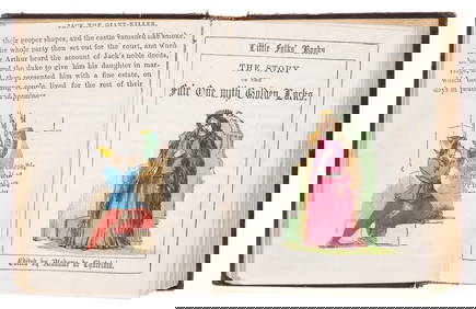
Children's.- Chatelain (Clara de) Little Folks' Books, 13 vol. in 1, hand-coloured illustrations,Forum Auctions4.3(52)See Sold PriceFeb 29, 2024
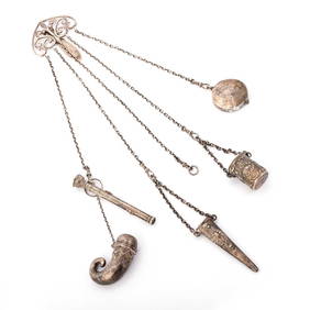
A vintage Chatelaine together with bangles, necklaces, pendants etc (Qty)Hannam's Auctioneers Ltd4.3(386)See Sold PriceMar 01, 2024
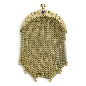
Victorian Antique Chatelaine Mesh Chain Mail Coin Purse 20K Yellow Gold 28.11 GrJasper524.5(9.8k)See Sold PriceFeb 27, 2024
Antique Franklin Lunt Chatelaine Seventy Six Piece Sterling Silver Flatware SetEric's Estate & Jewelry4.6(505)See Sold PriceFeb 25, 2024
Antique Franklin Lunt Chatelaine Seventy Six Piece Sterling Silver Flatware SetEric's Estate & Jewelry4.6(505)See Sold PriceFeb 24, 2024
Sold[maps] Chatelain, Mappe-mondeHenri Abraham Chatelain, Mappe-monde pour connoitre les progrés & le conquistes les plus Remarquables des provinces-Unies. 1708-1721. Incisione in rame. mm 335x460. Foglio: mm 445x550. Titolo inSee Sold Price
Basire: Antique Map Caucasus and Caspian Sea, 1748Title/Content of Map: 1748 Basire Map Southern Ukraine, Caucasus and Caspian Sea -- Bosporus, Maeotis, Iberia, Albania and Sarmatia Date Printed: 1748 London Cartographer: I Basire Size: 7.8 x 11.9 inSee Sold Price
SoldMAPS - [CHATELAIN, Henri Abraham]. Carte du GouveMAPS - [CHATELAIN, Henri Abraham]. Carte du Gouvernemente de l'Amerique.[Amsterdam or Paris: c. 1720]. Double-page engraved map from Atlas Historique (530 x 447 mm). Condition: browning and spSee Sold Price
Sold[maps] Chatelain, Carte de la nouvelle FranceHenri Abraham Chatelain, Carte de la nouvelle France. 1708-1721. Incisione in rame. mm 425x500. Foglio: mm 445x550. Titolo impresso nel margine superiore dell'incisione. La carta mostra i territoSee Sold Price
MAP, Caucasus & Russia, MaginiCaucasus, Russia & Ukraine. Ptolemy/Magini, Tabula Asiae II, 1598 (circa). Black & White. This Ptolemaic map, presented on a trapezoidal projection, presents a slice of the ancient world known as SarmSee Sold Price
Sold[maps] Chatelain, Nouveaux mappemondeHenri Abraham Chatelain, Nouveaux mappemonde ou globe terréstre avec des tables et des remarques pour conduire a la connoissance de la geographie et de l'histoire. 1708-1720. Incisione in rame.See Sold Price
Sold[maps] Chatelain, 2 mappe dall'Atlas historiqueHenri Abraham Chatelain, Lotto composto di 2 carte geografiche provenienti dall'Atlas historique ou nouvelle introduction a l'histoire , à la chronologie & à la géographie ancienne & moderne..See Sold Price
MAP, Caucasus, Ptolemy/FriesCaucasus & Southwestern Russia. Ptolemy/Fries, [Title on Verso] Asiae Tabula Secunda Continet Sarmatiam Asiaticam, from Claudii Ptolemaei Alexandrini Geographicae…, 1541 (published). Black & White.See Sold Price
[maps] Chatelain, 2 mappe dall'Atlas historiqueHenri Abraham Chatelain, Lotto composto di 2 carte geografiche provenienti dall'Atlas historique ou nouvelle introduction a l'histoire , à la chronologie & à la géographie ancienne & moderne..See Sold Price
[maps] Chatelain, Carte du CanadaHenri Abraham Chatelain, Carte du Canada ou de la Nouvelle France & des découvertes qui y ont été faites. 1708-1720. Incisione in rame. mm 410x530. Foglio: mm 445x555. Titolato nell'inciso inSee Sold Price
Sold[maps] Chatelain, 2 mappe dall'Atlas historiqueHenri Abraham Chatelain, Lotto composto di 2 carte geografiche provenienti dall'Atlas historique ou nouvelle introduction a l'histoire , à la chronologie & à la géographie ancienne & moderne..See Sold Price
MAP - Caucasus & Central Asia. MaginiCaucasus & Central Asia. Ptolemy/Magini, Tabula Asiae II, 1621 (published). Black & White. This Ptolemaic map, presented on a trapezoidal projection, presents a slice of the ancient world known as SarSee Sold Price
[maps] Chatelain, 5 mappe dall'Atlas historiqueHenri Abraham Chatelain, Lotto composto di 5 carte geografiche provenienti dall'Atlas historique ou nouvelle introduction a l'histoire , à la chronologie & à la géographie ancienne & moderne..See Sold Price
SoldMAP, Caucasus, ThevenotCaucasus. Melchisedech Thevenot, Carte de la Colchide Appelee Maintenant Megrelie et par Ceux du Pays, Odisci, from Relations de Divers Voyages Curieux, 1663 (circa). Black & White. A simple yet attraSee Sold Price
[maps] Chatelain, Plan de L'Histoire UniverselleHenri Abraham Chatelain, Plan de L'Histoire Universelle oulon voit les quatre Monarchies du Monde... 1708-1720. Incisione in rame. mm 340x450. Foglio: mm 445x556. Titolo inciso in alto al centro.See Sold Price
[maps] Chatelain, Carte du fleuve Saint LouisHenri Abraham Chatelain, Carte particuliere du fleuve Saint Louis dressee sur les lieux avec les noms des sauvages du pais. 1708-1721. Incisione in rame. mm 367x460. Foglio: mm 445x550. Titolo imSee Sold Price
[maps] Chatelain, Carte du Paraguai, du Chili…Henri Abraham Chatelain, Carte du Paraguai, du Chili, du Detroit de Magellan & C. 1708-1720. Incisione in rame. mm 410x525. Foglio: mm 445x540. Titolo inciso nel margine superiore della lastra. LSee Sold Price
MAP, Caucasus, Ptolemy/MercatorRare First Edition. Caucasus. Ptolemy/Mercator, Asiae II Tab:, from Theatrum Geographiae Veteris, 1618 (published). Hand Color. This lovely map covers the region north of the Black and Caspian Seas asSee Sold Price
[maps] Chatelain, Nouvelle carte de la sphereHenri Abraham Chatelain, Nouvelle carte de la sphere pour faire connoitre les divers mouvemens des planetes. 1708-1721. Incisione in rame. mm 515x600. Foglio: mm 550x645. Titolo impresso in altoSee Sold Price
[maps] Chatelain, 4 mappe dall'Atlas historiqueHenri Abraham Chatelain, Lotto composto di 4 carte geografiche provenienti dall'Atlas historique ou nouvelle introduction a l'histoire , à la chronologie & à la géographie ancienne & moderne..See Sold Price
[maps] Chatelain, 3 mappe dall'Atlas historiqueHenri Abraham Chatelain, Lotto composto di 3 carte geografiche provenienti dall'Atlas historique ou nouvelle introduction a l'histoire , à la chronologie & à la géographie ancienne & moderne..See Sold Price
[maps] Chatelain, 3 mappe dall'Atlas historiqueHenri Abraham Chatelain, Lotto composto di 3 carte geografiche provenienti dall'Atlas historique ou nouvelle introduction a l'histoire , à la chronologie & à la géographie ancienne & moderne..See Sold Price
[maps] Chatelain, 2 mappe dall'Atlas historiqueHenri Abraham Chatelain, Lotto composto di 2 carte geografiche provenienti dall'Atlas historique ou nouvelle introduction a l'histoire , à la chronologie & à la géographie ancienne & moderne..See Sold Price
[maps] Chatelain, L'empire du JaponHenri Abraham Chatelain, L'empire du Japon tiré des cartes des Japonnois. 1708-1720. Incisione in rame. mm 385x445. Foglio: mm 445x545. Titolo inciso in alto al centro. In alto a destra: "TSee Sold Price
1885 CIVIL WAR 1ed Famous Memoirs US Grant Sheridan Sherman 6v RARE LOT MapsSchilb Antiquarian Rare Books4.8(421)See Sold PriceMar 10, 2024
Large lot of assorted prints. 18th-20th century. To include: North American and other maps, CivilTremont Auctions4.6(293)See Sold PriceFeb 25, 2024
Rand McNally Railroad Map Cabinet w/ 21 Railroad MapsRail & Road Auctions4.6(165)See Sold PriceMar 08, 2024
Willem Blaeu, Etc. 17th C. Antiquarian Maps, 2Auctions at Showplace4.5(726)See Sold PriceMar 17, 2024
Chatelain - Map of the Americas and Details and Insets of Government CounselsTrillium Antique Prints & Rare Books4.5(30)See Sold PriceFeb 24, 2024
Chatelain - 3 Maps of the British Isles (England, Ireland, Scotland)Trillium Antique Prints & Rare Books4.5(30)See Sold PriceFeb 24, 2024
Putnam - First Map of the State of Ohio by Rufus PutnamTrillium Antique Prints & Rare Books4.5(30)See Sold PriceFeb 24, 2024
De Jode, Rare, pub. 1593 - Map of Africa (Africae Vera Forma, et Situs)Trillium Antique Prints & Rare Books4.5(30)See Sold PriceFeb 24, 2024


![[maps] Chatelain, Mappe-monde (1 of 1)](https://p1.liveauctioneers.com/1306/122788/62497211_1_x.jpg?height=282&quality=70&version=1527839290)

![MAPS - [CHATELAIN, Henri Abraham]. Carte du Gouve (1 of 1)](https://p1.liveauctioneers.com/839/16941/5652907_1_x.jpg?height=282&quality=70&version=1221072577)
![[maps] Chatelain, Carte de la nouvelle France (1 of 1)](https://p1.liveauctioneers.com/1306/122788/62497198_1_x.jpg?height=282&quality=70&version=1527839290)

![[maps] Chatelain, Nouveaux mappemonde (1 of 1)](https://p1.liveauctioneers.com/1306/122788/62497212_1_x.jpg?height=282&quality=70&version=1527839290)
![[maps] Chatelain, 2 mappe dall'Atlas historique (1 of 2)](https://p1.liveauctioneers.com/1306/122788/62497205_1_x.jpg?height=282&quality=70&version=1527839290)

![[maps] Chatelain, 2 mappe dall'Atlas historique (1 of 2)](https://p1.liveauctioneers.com/1306/122788/62497206_1_x.jpg?height=282&quality=70&version=1527839290)
![[maps] Chatelain, Carte du Canada (1 of 1)](https://p1.liveauctioneers.com/1306/122788/62497199_1_x.jpg?height=282&quality=70&version=1527839290)
![[maps] Chatelain, 2 mappe dall'Atlas historique (1 of 1)](https://p1.liveauctioneers.com/1306/122788/62497203_1_x.jpg?height=282&quality=70&version=1527839290)

![[maps] Chatelain, 5 mappe dall'Atlas historique (1 of 1)](https://p1.liveauctioneers.com/1306/122788/62497210_1_x.jpg?height=282&quality=70&version=1527839290)

![[maps] Chatelain, Plan de L'Histoire Universelle (1 of 1)](https://p1.liveauctioneers.com/1306/122788/62497214_1_x.jpg?height=282&quality=70&version=1527839290)
![[maps] Chatelain, Carte du fleuve Saint Louis (1 of 1)](https://p1.liveauctioneers.com/1306/122788/62497201_1_x.jpg?height=282&quality=70&version=1527839290)
![[maps] Chatelain, Carte du Paraguai, du Chili… (1 of 1)](https://p1.liveauctioneers.com/1306/122788/62497200_1_x.jpg?height=282&quality=70&version=1527839290)

![[maps] Chatelain, Nouvelle carte de la sphere (1 of 1)](https://p1.liveauctioneers.com/1306/122788/62497213_1_x.jpg?height=282&quality=70&version=1527839290)
![[maps] Chatelain, 4 mappe dall'Atlas historique (1 of 1)](https://p1.liveauctioneers.com/1306/122788/62497209_1_x.jpg?height=282&quality=70&version=1527839290)
![[maps] Chatelain, 3 mappe dall'Atlas historique (1 of 1)](https://p1.liveauctioneers.com/1306/122788/62497208_1_x.jpg?height=282&quality=70&version=1527839290)
![[maps] Chatelain, 3 mappe dall'Atlas historique (1 of 1)](https://p1.liveauctioneers.com/1306/122788/62497207_1_x.jpg?height=282&quality=70&version=1527839290)
![[maps] Chatelain, 2 mappe dall'Atlas historique (1 of 2)](https://p1.liveauctioneers.com/1306/122788/62497204_1_x.jpg?height=282&quality=70&version=1527839290)
![[maps] Chatelain, L'empire du Japon (1 of 1)](https://p1.liveauctioneers.com/1306/122788/62497202_1_x.jpg?height=282&quality=70&version=1527839290)