SoldMap of the Most Inhabited Part of New England 28x42 GicSeries: Antique World MapsArtist: Thomas JefferysPeriod: Source country: BritainSource Year: 177428 inch by 42 inch Giclee print on Canvas.All files are stored digitally and are ready for reproductionSee Sold Price
SoldA Map of the Most Inhabited part of New England...John Green "Braddock Mead" (1688-1757). London:Thomas Jeffreys,1755. Copperplate engraving with original hand outline color. On two sheets, each measuring 21 x 39 inches.See Sold Price
SoldA Map of the Most Inhabited Part of New EnglandTobias Conrad Lotter Publisher, Augsburg 1775. Containing the Provinces of Massachusetts Bay and New Hampshire, with the Colonies of Connecticut and Rhode Island, Divided into Counties and Townships.See Sold Price
SoldA Map of the Most Inhabited Part of New England...[America/ New England] Mead, Braddock, alias John Green (c.1688-1757). "A Map of the Most Inhabited Part of New England Containing the Provinces of Massachusetts Bay and New Hampshire. with the ColoniSee Sold Price
A Map of the Most Inhabited Part of New England...[New England] Mead, Braddock, alias John Green (c.1688-1757). "A Map of the Most Inhabited Part of New England Containing the Provinces of Massachusetts Bay and New Hampshire. with the Colonies of ConSee Sold Price
SoldMap of the Most Inhabited Part of New England 20x30 posSeries: Antique World MapsArtist: Thomas JefferysPeriod: Source country: BritainSource Year: 177420inch by 30 inch poster print on standard paper.All files are stored digitally and are ready for reproSee Sold Price
SoldMAP OF THE MOST INHABITED PARTS OF NEW ENGLANDBY THOMAS JEFFERYS, DATED 1774. INCLUDES MASS BAY, NH WITH THE COLONIES OF CT & RI. HAND COLORED, EXCELLENT CONDITION BUT SHOWS CREASES FROM FOLDING. SIGHT SIZE 41" X 39 1/2", OVERALL 43 3/4" X 42 1/4See Sold Price
SoldT.C. Lotter, Map of New England, 1776'A Map of the most Inhabited part of New England containing the Provinces of Massachusetts Bay and New Hampshire, with the Colonies of Connecticut and Rhode Island, Divided into Counties and TownshipsSee Sold Price
SoldBOWLES’S Map of New England Offset LithographBOWLES’S Map of New England Offset Lithograph, inscription reads ‘BOWLES’s New Pocket Map of the most inhabited part of New England comprehending the provinces of Massachusetts Bay and Nee HampsSee Sold Price
SoldTobias Lotter Map of New England 1776Tobias Conrad Lotter (1717-1777), "A Map of the Most Inhabited part of New England, containing the Provinces of Massachusets Bay and New Hampshire, with the Colonies of Conecticut and Rhode Island, DiSee Sold Price
SoldLotter's version of Jeffery's New England 1776Title: A Map of the Most Inhabited Part of New England, Containing the Provinces of Massachusetts Bay and New Hampshire, with the Colonies of Connecticut and Rhode Island, Divided into Counties and ToSee Sold Price
SoldThomas Jeffreys 1774 Map of New EnglandNew England. Braddock Mead (c. 1688-1757) and Thomas Jefferys (1695-1771) A Map of the Most Inhabited Part of New England. London: Jefferys, 29 November 1774. Copper-plate engraved map on four separatSee Sold Price
(4) THOMAS JEFFERYS 1755 NEW ENGLAND MAPSExtremely rare, full uncut, untrimmed sheets. Acid-free, widely matted to preserve the full size of the sheets. "A Map of the Most Inhabited Part of New England Containing the Provinces of MassachusetSee Sold Price
SoldMEAD, BRADDOCK, alias GREEN, JOHN. A Map of the MostMEAD, BRADDOCK, alias GREEN, JOHN. A Map of the Most Inhabited Part of New England Containing the Provinces of Massachusetts Bay and New Hampshire with the Colonies of Konektikut and Rhode Island, DivSee Sold Price
Sold1774 Thomas Jefferys Map of New EnglandCa. 1774 A map of the most Inhabited part of New England containing the provinces of Massachusets Bay and New Hampshire with the Colonies of Conecticut and Rhode Island. Divided into Counties and TownSee Sold Price
SoldBraddock Mead and Thomas Jefferys/PublisherBraddock Mead (British, 1688-1757) and Thomas Jefferys/Publisher, "A Map of the most Inhabited part of New England containing the Provinces of Massachusets Bay and New Hampshire, with the Colonies ofSee Sold Price
SoldRare Original 18th century large map of New England. "ARare Original 18th century large map of New England. "A Map of the Most Inhabited Part of New England Containing the Provinces of Massachusetts Bay and New Hampshire with the Colonies of Connecticut aSee Sold Price
SoldMEAD, BRADDOCK. A Map of the most Inhabited paMEAD, BRADDOCK. A Map of the most Inhabited part of New England. Engraved 4-sheet map with vertical sheets joined to make 2, 1040x990 mm overall, margins trimmed close but ample; hand-colored in outliSee Sold Price
SoldMead Map of New England 1755MEAD, Braddock, alias "GREEN, John" (1688-1757).A Map of the Most Inhabited Part of New England Containing the Provinces of Massachusetts Bay and New Hampshire with the Colonies of Konektikut and RhodSee Sold Price
SoldJEFFERYS, THOMAS. A Map of the most InhabitedJEFFERYS, THOMAS. A Map of the most Inhabited part of New England. Engraved 4-sheet map with horizontal sheets joined, 1080x1000 mm, wide margins; hand-colored in outline; scattered heavy browning, fiSee Sold Price
SoldJEFFERYS / BOWLES. Bowles's New Pocket Map ofJEFFERYS / BOWLES. Bowles's New Pocket Map of the Most Inhabited Part of New England. Double-page engraved map, 650x530 mm, side margins ample, others wide, hand-colored in outline; scattered foxing oSee Sold Price
SoldLOTTER, TOBIAS CONRAD; after MEAD, BRADDOCK, aliasLOTTER, TOBIAS CONRAD; after MEAD, BRADDOCK, alias GREEN, JOHN. A Map of the Most Inhabited Part of New England, Containing the Provinces of Massachusets Bay and New Hampshire, with the Colonies of CoSee Sold Price
1775 Lotter New England Map1775 A map of the most inhabited part of New England, containing the Provinces of Massachusetts Bay and New Hampshire, with the Colonies of Connecticut and Rhode Island, divided into counties and townSee Sold Price
SoldGreen Map of New EnglandGreen, John (1688-1757), a.k.a. Braddock Mead. A Map of the Most Inhabited Part of New England... Engraved Map with original hand color in full. London, 1774. (2 Parts) 21 1/2" x 40 1/2" sheet each, 2See Sold Price
1849 THE NEW-ENGLAND MERCANTILE UNIONNorth American Artifact Auctions4.7(201)See Sold PriceApr 20, 2024
[MAP]. [ALBRIZZI, Giambatista, 1698-1777]. Carta Geografica...Potter & Potter Auctions4.6(550)See Sold PriceMar 07, 2024
1803 NARRATIVE OF INDIAN WARS IN NEW-ENGLAND antique Stockbridge AMERICANAJasper524.5(9.9k)See Sold PriceFeb 27, 2024
"The Romance of Old New England Rooftrees" by Mary C. Crawford - Antique HardcoverRapid Estate Liquidators and Auction Gallery4.5(1.1k)See Sold PriceFeb 24, 2024
100th Anniversary American Numismatic Association MedalRapid Estate Liquidators and Auction Gallery4.5(1.1k)See Sold PriceFeb 24, 2024
Black and white map of part of New York City (mostly Manhattan)Proverde Auctions4.3(3)See Sold PriceFeb 28, 2024
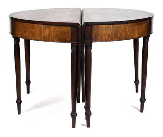
19TH C. NE TIGER MAPLE & CHERRY BANQUET TABLE.William Smith Auctions4.6(147)See Sold PriceMar 06, 2024
Herman Moll A New Map of Ye North Parts of AmericaWillow Auction House4.5(292)See Sold PriceMar 14, 2024
Vintage New England Clock Company Steeple ClockRapid Estate Liquidators and Auction Gallery4.5(1.1k)See Sold PriceMar 02, 2024
Vintage SPNEA Society For Preservation of New England Gold Tone ANGEL Brooch PinAnnzstiques Auction House4.5(630)See Sold PriceJan 05, 2025


![[MAP]. [ALBRIZZI, Giambatista, 1698-1777]. Carta Geografica... (1 of 1)](https://p1.liveauctioneers.com/928/318880/171361280_1_x.jpg?height=282&quality=70&version=1707501302)