SoldMap of newly minted United States 1783Heading: Author: Fielding, John Title: A Map of the United States of America, as Settled by the Peace of 1783 Place Published: London Publisher:European Magazine Date Published: Dec. 1, 1783See Sold Price
SoldNorthern part of new U.S. c.1783Title: Carte de la Partie Nord, des Etats Unis, de l'Amerique Septentrionale Author: Bonne, Rigobert Description: Copper-engraved map. 21x31.5 cm. (8½x12¼").The newly minted United States from the CSee Sold Price
SoldStackhouse: Earliest Independent United States Map 1783Item: Earliest Independent United States Map Maker: Thomas Stackhouse Date: 1783 Measures 16" x 20 1/4" Map fully within boarder. Margin uneven on left side. Strong printing, plate mark easily visibleSee Sold Price
SoldJohn Cary, Map United States, Treaty of Peace 1783John Cary (London, 1754-1835) "An Accurate Map of the United States of America, with Part of the Surrounding Provinces agreeable to the Treaty of Peace of 1783", 1783 (created/published) Hand coloredSee Sold Price
SoldMap of United States of America, Peace of 1783Fielding, John A Map of the United States of America, as Settled by the Peace of 1783 Place Published: London Publisher: European Magazine, Paternoster Row. Date Published: 1783 Edition: 1st Edition BSee Sold Price
Sold1793 Map of United States of America, Treaty of1793 Map of United States of America, Treaty of 1783, 14 3/4" x 18 3/4", framed 19" x 23 1/4"See Sold Price
SoldMap, United States, 1784, first map of the nationMap, United States, 1784,"Carte Des Etats-Unis De L'Amerique Suivant le Traite de Paix de 1783. Dediee et Presentee A.S. Excellence M. Benjamin Franklin Ministre Pleinipotentaire des Etats-Unis", theSee Sold Price
SoldUnited States named on 1783 mapHeading: (United States & Mexico) Author: De l'Isle, Guillaume & J.A. Dezauche Title: Carte du Mexique et des Etats Unis d'Amerique, Partie Meridionale… Place Published: Paris Publisher: Date PubSee Sold Price
SoldUnited States of America, 1783 MapUnited States of America by Robert Wilkinson, 1783, hand-colored map of the eastern part of the United States, featuring the State of Franklinia, 11-1/8 x 13-3/4 in., unframedSee Sold Price
SoldBrion de la Tour 1783 Map of the United States aBrion de la Tour 1783 Map of the United States and the Mississippi River. 30.5" x 21.5" hSee Sold Price
SoldNorth America with infant United States 1783Heading: Author: Delamarche, Charles François Title: Amérique Septentrionale divesée en ses principaux Etats Place Published: Paris Publisher: Date Published: 1783 Description:See Sold Price
SoldState of Franklin, TN 1827 Map, book, 2 itemsTwo (2) State of Franklin, Tennessee related items, including 1827 Benjamin Smith map and Samuel Cole Williams book. 1st item: Map titled "The United States of America Confirmed by Treaty 1783", engraSee Sold Price
Sold18 Maps of Original US States 1795Title:Eighteen bound maps of the early United States Publisher:John Reid Year:1783, 1795-96 Condition/Details:This is a fabulous collection of bound maps of the original U.S. states, printed at the enSee Sold Price
SoldMAP OF UNITED STATES, HC ENGRAVING, 1794Title: Map: An Accurate Map of the United States of America According to the Treaty of Peace of 1783, Printmaker: Russell, Pub: H.D. Symonds, Date: 1794, Medium: HC Engraving , Paper size: 14 1/2 x 18See Sold Price
SoldRare early map showing United StatesHeading: Author: Stackhouse, Thomas Title: North America in its present Divisions, agreeable to the Peace Place Published: London Publisher:Published by T. Stackhouse Date Published: June 1sSee Sold Price
SoldWilkinson map of United States 1812Title: The United States of America Confirmed by Treaty, 1783 Author: Wilkinson, Robert Description: Copper-engraved map, hand-colored. 22x28.5 cm. (8¾x11¼"). Attractive map of the young United StatSee Sold Price
SoldRare early map showing United StatesHeading: Author: Stackhouse, Thomas Title: North America in its present Divisions, agreeable to the Peace Place Published: London Publisher:Published by T. Stackhouse Date Published: April 1See Sold Price
R. Wilkinson United States MapRobert Wilkinson, London, 18th/19th Century. Hand colored engraved map of "The United States of America: Confirmed by the Treaty 1783". Not examined out of the frame. Minor foxing. Image is 12" x 10"See Sold Price
Sold[MAP REFERENCE].[MAP REFERENCE]. 2 Titles. ++ Peter J. Guthorn. United States Coastal Charts 1783-1861. Exton: Schiffer Publishing, (1984). 4to. 224pp. Blue cloth. Near fine in dj. Coastal charts with concise descripSee Sold Price
SoldMAP OF THE UNITED STATES "The United States ofMAP OF THE UNITED STATES "The United States of America", "with the British Possessions...and the Spanish Territories of Louisiana and Florida...as of 1783, London, Laurie & Whittle, May 1794", (note:See Sold Price
SoldAmerica.- Guthrie (William) A Map of the United StatesAmerica.- Guthrie (William) A Map of the United States of America Agreeable to the Peace of 1783, following the Treaty of Paris, showing New York and Pennsylvania both bordering Lake Ontario, with parSee Sold Price
SoldAmerica according to the peace treaty of 1783Heading: Author: Russell, John Title: An Accurate Map of the United States of America, According to the Treaty of Peace of 1783 Place Published: London Publisher:H.D. Symonds Date Published:See Sold Price
SoldTwo Early English Maps of the United States,Two Early English Maps of the United States, GUTHRIE, William. – DARTON, William. A Map of the United States of America, Agreeable to the Peace of 1783. and GIBSON, John. The British Governments inSee Sold Price
SoldKitchin. Map Of The United States In North America[United States] Thomas Kitchin. Map Of The United States In North America. With the British, French and Spanish Dominions adjoining, according to the Treaty of 1783. Lon: T. Cadell, 1783. One of the eSee Sold Price
American Express/New York Central Railroad Map of the United States-1934JM Hobby Supply and Railroad Artifact Auctions4.4(126)See Sold PriceFeb 24, 2024
Union Pacific RR Map of the United States-1926JM Hobby Supply and Railroad Artifact Auctions4.4(126)See Sold PriceFeb 24, 2024
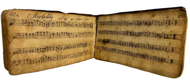
1798 Hand-Written Colonial American Hymnal Leather-Bound Book Signed Abraham Ford New England TownsHess Fine Auctions4.5(197)See Sold PriceMar 02, 2024
United States Map with American Flag 3-D Wall Mount PaintingWeatherham Estate Treasures3.9(157)See Sold PriceFeb 29, 2024
1905 20th Century Atlas of Boone County IllinoisMatthew Bullock Auctioneers4.7(1.8k)See Sold PriceFeb 24, 2024
Arrowsmith & Lewis - Map of the United StatesTrillium Antique Prints & Rare Books4.5(30)See Sold PriceFeb 24, 2024
Cooke, George 1801 Antique Map. United States of AmericaAlbion Auctions4.6(336)See Sold PriceMar 01, 2024
Blackie (Pub) 1882 Folio Map. United States of North AmericaAlbion Auctions4.6(336)See Sold PriceMar 01, 2024
Robert H Labberton - Map of The Territory of the Present United States - The territory of theProverde Auctions4.3(3)See Sold PriceFeb 28, 2024
Map of United States of North America, 1785Antiques Online Auctions4.6(407)See Sold PriceMar 14, 2024
Vintage 1920s Rand McNally Auto Trails MapThe Benefit Shop Foundation Inc.4.3(2.9k)See Sold PriceMar 20, 2024
1973 Republic of Panama Proof Set Minted by The United StatesAndrew's Coin & Jewelry4.5(209)See Sold PriceMar 07, 2024


![[MAP REFERENCE]. (1 of 0)](https://p1.liveauctioneers.com/dist/images/placeholder.jpg?height=282&quality=70)