17TH C. ENGLISH LINEAR MAP BY OGILBY, FRAMEDThomaston Place Auction Galleries4.4(386)See Sold PriceFeb 24, 2024
MAP - PIETER SCHENK / VALK / JANSSEN Hand Colored superb Map Central Italy c1702Luis Porretta Fine Arts4.3(10)See Sold PriceMar 02, 2024
OGILVY & BOWEN c1736 Original Map of Oxfordshire Berkshire Etc.Luis Porretta Fine Arts4.3(10)See Sold PriceMar 02, 2024
CHARLES ROLLIN c1828 Ceasar Hand Colored Africa Military MapLuis Porretta Fine Arts4.3(10)See Sold PriceMar 02, 2024
MAP - Dufour, A. H. ( Malte / Brun ) :MAP - ESPAGNE PARTIE SUD DIVISEE EN PROVINCES ANCIENNES ( MAPLuis Porretta Fine Arts4.3(10)See Sold PriceMar 02, 2024
RIGOBERT BONNE c1787 Original Colored Map Germany & Region 15" x 12"Luis Porretta Fine Arts4.3(10)See Sold PriceMar 02, 2024
AMBROISE TARDIEU c1822 Napoleonic War Map GermanyLuis Porretta Fine Arts4.3(10)See Sold PriceMar 02, 2024
MAP - AMBROISE TARDIEU c1822 Napoleonic Miltary Map GermanyLuis Porretta Fine Arts4.3(10)See Sold PriceMar 02, 2024
1822 Rare Map by Ambroise Tardieu Napoleon Caldiero Battle of Vento 17" x 11Luis Porretta Fine Arts4.3(10)See Sold PriceMar 02, 2024
THOMAS MOULE 1837 Colored Map of Warwickshire Framed vgcLuis Porretta Fine Arts4.3(10)See Sold PriceMar 02, 2024
PIETER SCHENK / VALK / JANSSEN Hand Colored Map of Rhodes Greece ca1702 vgcLuis Porretta Fine Arts4.3(10)See Sold PriceMar 02, 2024
STICH & DRUCK c1888 Map Austrian Alps 20" x 16"Luis Porretta Fine Arts4.3(10)See Sold PriceMar 02, 2024
Map of French Empire in 1813. Europe. 1854.Print of hand colored steel engraving titled „Carte de L’ Empire Francais en 1813”.Drawn by L. Dussieux. Engraved by Marlier.From „Atlas General De Geographie physique, politique et historiqueSee Sold Price
SoldMap of Empire of Charlemagne. Europe. 1854.Print of hand colored steel engraving titled „Carte du Partage de L’Empire de Charlemagne“.Drawn by L. Dussieux.Engraved by unknown.From „Atlas General De Geographie physique, politique et hisSee Sold Price
Empire of Charlemagne. Europe. 1854.Print of hand colored steel engraving titled „Empire de Charlemagne“.Drawn by L. Dussieux.Engraved by unknown.From „Atlas General De Geographie physique, politique et historique par L. Dussieux.See Sold Price
Map of French Empire. Europe. 1871.Map of French Empire divided into 130 departments. Europe. 1871.Print from steel engraving titled „Empire Francais divise en 130 departements“.Author/compiler - MM. Drioux et Ch. Leroy.Engraver unSee Sold Price
SoldMap of Roman Empire. Europe. 1854.Print of hand colored steel engraving titled „Carte de L’Empire Romain”.Drawn by L. Dussieux. Engraved by unknown.From „Atlas General De Geographie physique, politique et historique par L. DusSee Sold Price
Map of Empire Of Alexander. Europe. 1854.Print of hand colored steel engraving titled „Empire D’Alexandre”.Drawn by L. Dussieux. Engraved by unknown.From „Atlas General De Geographie physique, politique et historique par L. Dussieux.See Sold Price
Map of Empire of Germany. Europe. 1854.Print of hand colored steel engraving titled „De l’Empire D’Allemagne“.Drawn by L. Dussieux.Engraved by unknown.From „Atlas General De Geographie physique, politique et historique par L. DusSee Sold Price
Map of Empire of Germany. Europe. 1854.Print of hand colored steel engraving titled „Carte pour servir a l’Histoire de L’Empire D’Allemagne“.Drawn by L. Dussieux.Engraved by unknown.From „Atlas General De Geographie physique, pSee Sold Price
Map of the Empire of Germany. Europe. 1854.Print of hand colored steel engraving titled „Carte Geographique de L’ Empire D’ Allemagne”.Drawn by L. Dussieux.Engraved by unknown.From „Atlas General De Geographie physique, politique etSee Sold Price
NAPOLEONIC EMPIRE. The French Empire in 1810. Europe 1902 old antique mapTITLE/CONTENT OF MAP: 'The French Empire in 1810' DATE PRINTED: 1902 IMAGE SIZE: Approx 25.0 x 32.5cm, 9.75 x 12.75 inches (Large) TYPE: Antique colour map. This map was published in 1902 but it may dSee Sold Price
NAPOLEONIC EMPIRE. The French Empire in 1810. Europe 1902 old antique mapTITLE/CONTENT OF MAP: 'The French Empire in 1810' DATE PRINTED: 1902 IMAGE SIZE: Approx 25.0 x 32.5cm, 9.75 x 12.75 inches (Large) TYPE: Antique colour map. This map was published in 1902 but it may dSee Sold Price
SoldMID-LATE 20TH CENTURY PRINTED MAP OF EUROPE AMID-LATE 20TH CENTURY PRINTED MAP OF EUROPE AND THE FRENCH EMPIRE IN 1807. Printed in France 19" x 14" *Condition: Good *Est. Sale Time: 2:57 PM Eastern *Kamelot handles shipping arrangements for thosSee Sold Price
Europe exhibiting its principal states &c. First French Empire. FADEN 1791 mapTITLE/CONTENT OF MAP: 'Europe exhibiting its principal states &c' DATE PRINTED: 1791 IMAGE SIZE: Approx 54.5 x 69.5cm, 21.5 x 27.25 inches (Large); Please note that this is a folding map. TYPE: LargeSee Sold Price
Europe exhibiting its principal states &c. First French Empire. FADEN 1791 mapTITLE/CONTENT OF MAP: Turquie d’Europe [Turkey in Europe] DATE PRINTED: 1788 IMAGE SIZE: Approx 24.5 x 36.0cm, 9.5 x 14.25 inches (Large); Please note that this is a folding map. TYPE: Antique 1See Sold Price
SoldTwo French Maps and Augustus MitchellAugustus Mitchell 1867 Map of The Austrian Empire Italian States. Turkey in Europe and Greece, Also This hand colored celestial map of the Stars and Constellations is a steel plate engraving, dating tSee Sold Price
SoldA French Map of Paris.A French Map of Paris. 19th century restrike of a 1576 map of Paris published by Rossingol. Together with a later strike of the 19th century map 'Carte Politique de l'Europe et de l'Empire Francais' (See Sold Price
SoldFrench Lithographic Map of 1807 EuropeFrench lithographic map of 1807 Europe, coat of arms and title to the upper left corner reads in French ‘Carte politburo et itineraire de L’Europe et du L’Empire Francais en 1807’, legend to lSee Sold Price
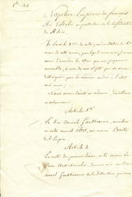
Sold[FOY - HERNANI]:[FOY - HERNANI]: An excellent military map of Hernani, issued by French Napoleon´s army, one page, oblong large 16 x 12 folio, Hernani, 26th June 1813, with annotations in French. The map is issuedSee Sold Price
Map of Europe. 1854.Print of hand colored steel engraving titled „Carte Geographique et Politique de L’Europe”.Drawn by L. Dussieux. Engraved by unknown.From „Atlas General De Geographie physique, politique et hiSee Sold Price
SoldFaden (William) - The French Empire and the Kingdom ofshowing most of Europe, large table of French departments to the left, inset table of Italian departments upper right, engraved map with original hand-colouring, 565 x 905mm., dissected and linen-backSee Sold Price
Map of Gaul. Europe. 1854.Print of hand colored steel engraving titled „Carte de la Gaule D’Apres D’Anville”.Drawn by L. Dussieux. Engraved by unknown.From „Atlas General De Geographie physique, politique et historiqSee Sold Price
Map of France. Europe. 1854.Print of hand colored steel engraving titled „Carte pour servir a L’Histoire de France”.Drawn by L. Dussieux. Engraved by unknown.From „Atlas General De Geographie physique, politique et histoSee Sold Price
Map of France before 1790. Europe. 1854.Print of hand colored steel engraving titled „Carte Geographique et Historique de la France avant 1790”.Drawn by L. Dussieux. Engraved by unknown.From „Atlas General De Geographie physique, poliSee Sold Price
SoldAlexis Hubert Jaillot "Estats de l'empire" engravingALEXIS HUBERT JAILLOT (French 1632-1712) "Estats de L'Empire des Turqs en Europe, subdivises suivant l'Estendue des Beglerbeglicz our Gouvernements...1700" Copperplate engraving with hand colored outlSee Sold Price
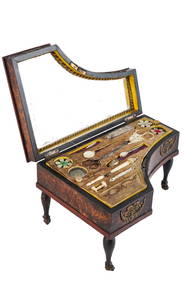
(19th c) FRENCH EMPIRE PIANO-FORM NECESSAIREJohn McInnis Auctioneers,LLC4.6(502)See Sold PriceFeb 25, 2024
Mitchell - Map of the City of Washington (Washington, DC)Trillium Antique Prints & Rare Books4.5(30)See Sold PriceFeb 24, 2024
1816 MAP SOUTHERN PART OF RUSSIA or MUSCOVY in EUROPE copper engraving ANTIQUEJasper524.5(9.8k)See Sold PriceFeb 27, 2024
1816 MAP NORTHERN PART OF RUSSIA or MUSCOVY in EUROPE copper engraving ANTIQUEJasper524.5(9.8k)See Sold PriceFeb 27, 2024
New and Correct Map of North America With the West India Islands,Jasper524.5(9.8k)See Sold PriceFeb 27, 2024
Clarke & Neele 1815 Map. Europe - Recent Political ChangesAlbion Auctions4.6(336)See Sold PriceMar 01, 2024
VERDI GIUSEPPE: (1813-1901)International Autograph Auctions Europe S.L.4.5(52)See Sold PriceMar 13, 2024
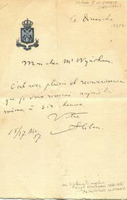
PONIATOWSKI JOZEF: (1763-1813)International Autograph Auctions Europe S.L.4.5(52)See Sold PriceMar 14, 2024
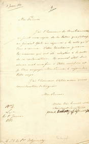
MARIE LOUISE DUCHESS OF PARMA: (1791-1847)International Autograph Auctions Europe S.L.4.5(52)See Sold PriceMar 14, 2024
KUTUZOV MIKHAIL: (1745-1813)International Autograph Auctions Europe S.L.4.5(52)See Sold PriceMar 14, 2024


![[FOY - HERNANI]: (1 of 1)](https://p1.liveauctioneers.com/1458/162756/82183431_1_x.jpg?height=282&quality=70&version=1582802677)