SoldMap of Boston Waterfront Wards 6&7Framed copy after a original showing Boston’s waterfront wharves. Long, Commercial, Central, Rowes, and T Wharves are all shown as are many tenants, owners, and addresses. Framed in burlwood. OSee Sold Price
SoldCity of Boston Ward Maps C. 1900 (12pc)Collection includes twelve color plates 5-12, 15, 16 and 31 with Index of Boston city proper identifying the various wards with buildings coded by construction type, number of stories, outbuildings, eSee Sold Price
Sold1874 Map of Boston, part of ward 6, Vol. 1 Plate: Nnicely framed & Matted approx. 25 x 34, shows Charles RiverSee Sold Price
Sold1874 Map of Boston, part of ward 5, Vol. 1 Plate: Knicely framed & matted approx. 25 x 34, shows Wasington Sq and Fort Point ChannelSee Sold Price
Sold1874 Map of Boston, part of ward 3, Vol. 1 Plate: Dnicely framed & Matted approx. 25 x 34, shows Mass GeneralSee Sold Price
SoldEARLY BOSTON MA MAP WARD ZONING PRECINCT GOVERNMENT DOCUMENT STAMP LOT8 stamps all of Boston Massachusetts with different wards. the stamps are made of brass copper and wood. believed to be from a zoning or assessor's office. some stamps are loose where they connectSee Sold Price
Sold1874 Map of Boston, part of the 7th ward, Vol. 1 Plate:nicely framed & matted, approx. 25 x 34, shows Boston & Albany Railroad, Fort Point ChannelSee Sold Price
Collection of assorted mapsCollection of assorted maps including city of New York the 5 boroughs, Harlem line, the town at Central Park, map of Boston showing new division of wards 1886. Tears, staining, taped.See Sold Price
Collection of assorted mapsCollection of assorted maps including city of New York the 5 boroughs, Harlem line, the town at Central Park, map of Boston showing new division of wards 1886. Tears, staining, taped.See Sold Price
SoldCollection of assorted mapsCollection of assorted maps including city of New York the 5 boroughs, Harlem line, the town at Central Park, map of Boston showing new division of wards 1886. Tears, staining, taped.See Sold Price
Scarce Plan of Boston & Adj. Cities, c1886Colton’s scarce, detailed map of Boston and vicinity. Colored by wards. Includes streets, wharfs, Railroad lines, public buildings and many other details. This authentic vintage map comes from tSee Sold Price
SoldOriginal Ward 4 & 5 Map of BostonCirca 1900 map of Wards 4 & 5 of the City of Boston showing the Mass State Prison, Rail Yards, Charles River, North Station, etc.. Matted and framed 31" tall x 41" wideSee Sold Price
Two 1890's Maps of BostonTwo maps showing the Back Bay neighborhood of Boston, wards 11 and 22. Plate 21 shows areas between Boyston Street and close to Massachusetts Avenue, which is the current site of the expansive PrudentSee Sold Price
Two 1890 Maps of BostonTwo maps showing the Back Bay neighborhood of Boston, wards 11 and 22. Plate 21 shows areas between Boyston Street and close to Massachusetts Avenue, which is the current site of the expansive PrudentSee Sold Price
Sold19th C. Map of the North Shore of Boston19th Century map of the North Shore of Boston, showing the waterfront of Marblehead, Salem, Beverly, Manchester and Gloucester. Published 1891 by George H. Walker and Co. of Boston, nicely matted andSee Sold Price
SoldLate 19th Century Part of Wards 10 11 & 12 City ofLate 19th Century Part of Wards 10 11 & 12 City of Boston Map, plate 23, with hand-coloring, unframed, 22 1/2 x 32 1/2 in.See Sold Price
SoldLate 19th Century Part of Wards 10 11 & 12 City ofLate 19th Century Part of Wards 10 11 & 12 City of Boston Map, plate 23, with hand-coloring, unframed, 22 1/2 x 32 1/2 in.See Sold Price
Sold1853 Boynton Map of Boston [verso] Map of New EnglandTitle: 1853 Boynton Map of Boston [verso] Map of New England -- New Map of Boston, Comprising the Whole City, with the New Boundaries of the Wards… [verso] Map of New England Exhibiting the Rail RoaSee Sold Price
SoldOriginal Map of Boston, 1851Original map of Boston, comprising the whole city with new boundaries of the wards, 1851. Showing landmarks, bays, harbor, and East Boston. Framed in distressed silver. Overall Dimensions: 17.5" H x 1See Sold Price
Sold1864 Map of Boston"New Map of the City of Boston Comprising the whole City with the new boundaries of the Wards". Engraved expressly for the Boston Almanac for 1864. Includes inset map of East Boston. W. C. (William CoSee Sold Price
1853 Boynton Map of Boston [verso] Map of New EnglandTitle/Content of Map: 1853 Boynton Map of Boston [verso] Map of New England -- New Map of Boston, Comprising the Whole City, with the New Boundaries of the Wards… [verso] Map of New England ExhibitiSee Sold Price
Original Map of Boston, 1851Original map of Boston, comprising the whole city with new boundaries of the wards, 1851. Showing landmarks, bays, harbor, and East Boston. Framed in distressed silver. Overall Dimensions: 17.5" H x 1See Sold Price
1853 Boynton Map of Boston [verso] Map of New EnglandTitle: 1853 Boynton Map of Boston [verso] Map of New England -- New Map of Boston, Comprising the Whole City, with the New Boundaries of the Wards… [verso] Map of New England Exhibiting the Rail RoaSee Sold Price
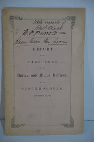
Boston and Maine RR Annual Report-September 12, 1849JM Hobby Supply and Railroad Artifact Auctions4.4(126)See Sold PriceFeb 24, 2024
Eastern RR Summer Book of Tours-1884JM Hobby Supply and Railroad Artifact Auctions4.4(126)See Sold PriceFeb 24, 2024
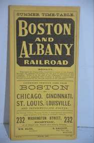
Boston and Albany RR March 17, 1881 Public TimetableJM Hobby Supply and Railroad Artifact Auctions4.4(126)See Sold PriceFeb 24, 2024
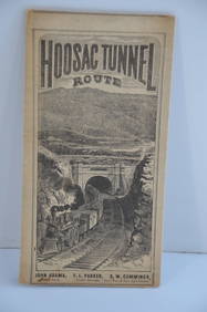
Fitchburg Railroad 1880 Hoosac Tunnel Route Public TimetableJM Hobby Supply and Railroad Artifact Auctions4.4(126)See Sold PriceFeb 24, 2024
1818 RARE Geography Made Easy MAPS Jedidiah Morse Boston Indians Atlas AsiaSchilb Antiquarian Rare Books4.8(421)See Sold PriceMar 31, 2024
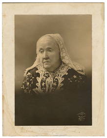
HOWE, Julia Ward (1819-1910). Signed Photo. Boston: J. E. P...Potter & Potter Auctions4.6(539)See Sold PriceMar 07, 2024
Arrowsmith & Lewis - Map of PolynesiaTrillium Antique Prints & Rare Books4.5(30)See Sold PriceFeb 24, 2024
Arrowsmith & Lewis - Map of North AmericaTrillium Antique Prints & Rare Books4.5(30)See Sold PriceFeb 24, 2024
Arrowsmith & Lewis - Map of the World on Mercator's ProjectionTrillium Antique Prints & Rare Books4.5(30)See Sold PriceFeb 24, 2024
Arrowsmith & Lewis - Map of LouisianaTrillium Antique Prints & Rare Books4.5(30)See Sold PriceFeb 24, 2024
Arrowsmith & Lewis - Map of the United StatesTrillium Antique Prints & Rare Books4.5(30)See Sold PriceFeb 24, 2024
San Xavier Del Bac Mission, Edward S. Curtis photogravurePBA Galleries4.7(381)See Sold PriceMar 07, 2024


![1853 Boynton Map of Boston [verso] Map of New England (1 of 2)](https://p1.liveauctioneers.com/5584/190355/95871630_1_x.jpg?height=282&quality=70&version=1609884614)


![1853 Boynton Map of Boston [verso] Map of New England (1 of 2)](https://p1.liveauctioneers.com/5584/178208/89700256_1_x.jpg?height=282&quality=70&version=1599603893)

![1853 Boynton Map of Boston [verso] Map of New England (1 of 2)](https://p1.liveauctioneers.com/5584/185466/93191477_1_x.jpg?height=282&quality=70&version=1605655429)