SoldMap, Europe, c. 1640 by William BleauMap, Europe - c. 1640 by William Bleau (1571-1638) Carte-a-figures with figures at sides and city view/plans at top. Earlier state with Frisland. Condition: Recently professionally conserved and rebacSee Sold Price
SoldBlaeu's map of Europe with side vignettes, c.1640Title: Europa Recens Descripta Author: Blaeu, Willem Description: Copper-engraved map, hand-colored. 41x55 cm. (16x21½"), including vignette panels at sides and top. Blaeu's striking map of Europe, wSee Sold Price
SoldWilliam Bleau, "Guiana Fiue Amazonam Regio," 17thWilliam Bleau, "Guiana Fiue Amazonam Regio," 17th c. map, framed, H.- 14 1/2 in., W.- 19 1/2 in.See Sold Price
Political map of Europe, adapted to Woodbridge'sTitle: Political map of Europe, adapted to Woodbridge's Geography. Publication Date: ©1843 Cartographer: Publisher: William C. Woodbridge Dimension: 8.3Height - 10.75Width Reserve: $45.00 Shipping: DSee Sold Price
Sold[Europe]. 3 Maps.[Europe]. 3 Maps. First two Blaeu. ++ Hungaria Regnum. 20 x 16. ++ Transylvania Sibenburgen. 19 5/8 x 14 3/4. Both [c1640] in contemporary outline color, Latin text verso, mild toning, soiling, and weSee Sold Price
1830€™s Map of Central Europe by W.C. Woodbridge1830€™s Map of Central Europe by W.C. Woodbridge, €œentered according to act of Congress, in the year 1832 by William C. Woodbridge in the Clerks office of the District Court of Connecticut��See Sold Price
Sold[Europe/Scythia]. 2 Maps.[Europe/Scythia]. 2 Maps. Each double-page engraving, Latin text on verso. ++ Blaeu [after]. Limovicum [with] Topographia Limaniae. [c1640]. 15 x 20 with wide margins. Toned with minor spotting, uncolSee Sold Price
Sold(MAP) WELLS, EDWARD. A New Map of Europe ... Dedicated(MAP) WELLS, EDWARD A New Map of Europe according to the Present General Divisions and Names ... Capital Cities, Chief Rivers, Mountains, &c. ... Dedicated to His Highness William Duke of Gloucester.See Sold Price
SoldBarber, John 1785 Antique Map of Turkey & Hungary"Turky in Europe &c. Hungary" Copper Engraved Map Published 1783-85, London for "A New Geographical, Historical and Commercial Grammar..." by William Guthrie. Drawn and Engraved by Thomas Kitchin (KitSee Sold Price
SoldWillem Blaeu, Cornubia sive Cornwallia, Amsterdam:Willem Blaeu, Cornubia sive Cornwallia, Amsterdam: c.1640, Handcolored engraved map of Cornwall, coats-of-arms, galleons, foxing, and water staining, center creaseSee Sold Price
SoldBlaeu Map of VirginiaNova Virginiae Tabula. William Blaeu (1571-1638). Engraved Map with original hand color. Amsterdam, c. 1640. 18 x 22 1/4 inches sheet.See Sold Price
SoldBleau map: Hollandia Comitatus, c.1631[Netherlands]. William Bleau. Hollandia Comitatus. Double-page map engraved by Joshua van den Ende. Amst: c.1631. 15 1/8 x 18 3/4 in. Shields of 32 cities featured on lower border, decorated cartoucheSee Sold Price
FADEN, WILLIAM. A Map of Europe, In Which AreFADEN, WILLIAM. A Map of Europe, In Which Are Delineated Its Grand Modern Divisions, As Well As Partitions Into Inferior States, Governments, &c. Large engraved wall map of Europe. 60½x62 inchesSee Sold Price
SoldFADEN, WILLIAM. A Map of Europe, In Which AreFADEN, WILLIAM. A Map of Europe, In Which Are Delineated Its Grand Modern Divisions, As Well As Partitions Into Inferior States, Governments, &c. Large engraved wall map of Europe. 60½x62 inchesSee Sold Price
SoldBowen, Thomas 1791 Map of EuropeCopper Plate Published 1789-91 by C. Cooke, London for "The New Royal Encyclopedia, Or, Complete Modern Universal Dictionary of Arts and Sciences..." by William Henry Hall. Drawn by Thomas Bowen. PapeSee Sold Price
Bowen, Thomas 1791 Map of EuropeCopper Plate Published 1789-91 by C. Cooke, London for "The New Royal Encyclopedia, Or, Complete Modern Universal Dictionary of Arts and Sciences..." by William Henry Hall. Drawn by Thomas Bowen. PapeSee Sold Price
Bowen, Thomas 1791 Map of EuropeCopper Plate Published 1789-91 by C. Cooke, London for "The New Royal Encyclopedia, Or, Complete Modern Universal Dictionary of Arts and Sciences..." by William Henry Hall. Drawn by Thomas Bowen. PapeSee Sold Price
Sold(Europe), Blaeu, Willem (1571-1638) and Blaeu, Jan(Europe), Blaeu, Willem (1571-1638) and Blaeu, Jan (1596-1673), six double-page folding maps, Amsterdam, c. 1630-1640, all uncolored, mostly regions of Germany and one of Macedonia, folio, (scatteredSee Sold Price
Edward Wells Europe Poland LithuaniaEdward Wells (1667-1727) A new map of Sarmatia Europaea, Pannonia and Dacia, shewing their principal divisions, people, cities, towns, rivers, mountains &c. Dedicated to His Highness William Duke of GSee Sold Price
Sold3 Items: 2 maps (Senex, Bleau) + 1 navy battle.[Europe] 3 Engravings. ++ PICARDIA REGIO BELGICA, Auctore Joanne Surhonio. “Amsterdami/ Bleau.” Probably from “Nieuwe Atlas,” [c. 1642-43.] Hand-colored outline, scale, shield, and cartouche.See Sold Price
SoldWALACHIA, SERVIA... [Bleau, ca. 1630's-1640's].[Europe/Balkans]. Blaeu. WALACHIA, SERVIA, BULGARIA, ROMANIE. [Ca. 1630's to 1640's]. Double-page engraved map, 15 x 19 7/8, Latin text on both sides of verso. outline color and to cartouche. Minor faSee Sold Price
Sold18th C. English Needlework Maps18th C. English needleworks on silk, globe maps, signed Mary Kekwick and Catherine Kekwick, depicting the Americas and Europe, with a neo-classical floral stitched border, ca 1800, image oval matted 1See Sold Price
SoldMap, c. 1640, Northeast SpainMapsc. 1640, ARAGONIA REGNVM, by Blaeu, [Amsterdam], Choice Very Fine. 16.25” x 20.5”, copper-engraved map with early hand coloring. Showing the northeast region of Spain, which was a kingSee Sold Price
SoldVALENTIA REGNVM - Map, c. 1640Mapsc. 1640, VALENTIA REGNVM, by Blaeu, Amsterdam, Choice Very Fine. 15” x 19.5”, copper-engraved map with early hand coloring. The lovely title cartouche is softly colored in rose, blue,See Sold Price
Two (2) Antique 18th C. Copper Engraved Framed Maps - America & EuropeMagnusson Art Group4.5(53)See Sold PriceMar 14, 2024
Catherwood - General View of Uxmal, Taken from the Archway of Las Monjas, Looking SouthTrillium Antique Prints & Rare Books4.5(32)See Sold PriceFeb 24, 2024
1816 MAP SOUTHERN PART OF RUSSIA or MUSCOVY in EUROPE copper engraving ANTIQUEJasper524.5(9.9k)See Sold PriceFeb 27, 2024
1816 MAP NORTHERN PART OF RUSSIA or MUSCOVY in EUROPE copper engraving ANTIQUEJasper524.5(9.9k)See Sold PriceFeb 27, 2024
1704 DESCRIPTION OF ALL THE SEATS OF THE PRESENT WARS OF EUROPE antique w/ MAPSJasper524.5(9.9k)See Sold PriceFeb 27, 2024
Railways & Transport.- [Prospectus] The Dorking, Brighton, and Arundel Atmospheric Railway, byForum Auctions4.3(53)See Sold PriceFeb 29, 2024
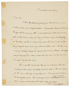
[HOMOSEXUALITY]: COURTENAY WILLIAM (c.1768-1835)International Autograph Auctions Europe S.L.4.5(52)See Sold PriceMar 13, 2024
CATHCART CHARLES: (1721-1776)International Autograph Auctions Europe S.L.4.5(52)See Sold PriceMar 14, 2024
DE GAULLE CHARLES: (1890-1970)International Autograph Auctions Europe S.L.4.5(52)See Sold PriceMar 14, 2024
C. R. Knight - Falls of the Rhine at Schaffhausen - SwitzerlandProverde Auctions4.3(3)See Sold PriceFeb 28, 2024


![[Europe]. 3 Maps. (1 of 3)](https://p1.liveauctioneers.com/179/1435/617490_1_x.jpg?height=282&quality=70)

![[Europe/Scythia]. 2 Maps. (1 of 2)](https://p1.liveauctioneers.com/179/1435/617489_1_x.jpg?height=282&quality=70)


![WALACHIA, SERVIA... [Bleau, ca. 1630's-1640's]. (1 of 5)](https://p1.liveauctioneers.com/179/49347/23134557_1_x.jpg?height=282&quality=70&version=1388425910)


![Railways & Transport.- [Prospectus] The Dorking, Brighton, and Arundel Atmospheric Railway, by (1 of 1)](https://p1.liveauctioneers.com/5458/319736/171654703_1_x.jpg?height=282&quality=70&version=1708010439)


![[HOMOSEXUALITY]: COURTENAY WILLIAM (c.1768-1835) (1 of 2)](https://p1.liveauctioneers.com/1458/320147/172024427_1_x.jpg?height=282&quality=70&version=1708358712)