Sold(MAP) BRAUN, GEORGE AND HOGENBERG. A group of two(MAP) BRAUN, GEORGE AND HOGENBERG A group of two hand-colored engraved views of Modon and Candia from Civitates orbis terrarum. Both pasted to mats. 11 x 23 1/4 inches each. ProSee Sold Price
SoldFrance.- Fourteen maps including Braun & Hogenberg'sFrance.- A group of maps including Braun & Hogenberg's plans of Macon and Chalons, engraving with hand-colouring, c. 1617; F.de Witt's Generalis Lotharingiae, map of Lorraine in outline hand-colour, cSee Sold Price
MAP, Germany, Braun & HogenbergKrempe & Rendsburg, Germany. Braun & Hogenberg, Crempa [on sheet with] Reinholdsburga, from Civitates Orbis Terrarum, Vol. IV, 1620 (circa). Hand Color. This sheet includes two lovely panoramic viewsSee Sold Price
MAP - Spain. Braun & HogenbergMarchena & Osuna, Spain. Braun & Hogenberg, Marchena [on sheet with] Orchuna, 1620 (circa). Hand Color. The top view shows the city of Marchena among rolling hills, with its two towers, San Miguel andSee Sold Price
Sold1590s PRAGUE MAP antique from Civitates Orbis TerrarumPraga, Bohemiae Metropolis Accuratissime Expressa [on sheet with] Egra, Urbs a Fluvio ... Georg Braun & Frans Hogenberg. Old map with two bird's-eye views by Braun and Hogenberg: Prague (Praha) and ChSee Sold Price
Braun & Hogenberg, Map of Jerusalem and the TempleYear 1572. Title: "Hierosolyma, Clarissima totius orientis Civitas Iudaee Metropolis". Copper engraving from Atlas of Cities of the World by Georg Braun and Franz Hogenberg which describes two periodsSee Sold Price
Map of Jerusalem. Braun & Hogenberg. Koln, 1572Hierosolyma, Clarissima totius orientis Civitas Iudaee Metropolis, copperplate engraving of the city. From two eras: The first century and the 16th century. Braun & Hogenberg. Koln, 1572. Early hand pSee Sold Price
Braun & Hogenberg, Map of Jerusalem and the TempleYear 1572. Title: "Hierosolyma, Clarissima totius orientis Civitas Iudaee Metropolis". Copper engraving from Atlas of Cities of the World by Georg Braun and Franz Hogenberg which describes two periodsSee Sold Price
SoldMap of Jerusalem. Braun & Hogenberg. Koln, 1582.Hierosolyma urbs sancta, Iudeae, Totius que Orientis Longe Clarissima .... Bird's eye view of modern Jerusalem. Colored, copperplate engraving. By George Braun & Franz Hogenberg. From: Civitatus OrbisSee Sold Price
SoldGrp: 6 Maps of Europe by Braun & HogenbergGroup of six maps by Georg Braun (1541–1622) and Frans Hogenberg (1540–1590) including maps of Ghent, Odense in Denmark originally for the book "Civitates Orbis Terrarum", a map of ParisSee Sold Price
SoldMap of Jerusalem. Braun & Hogenberg. Koln, 1575.Hierosolyma urbs sancta, Iudeae, Totius que Orientis Longe Clarissima .... Bird's eye view of modern Jerusalem. Black and white, copperplate engraving. By George Braun & Franz Hogenberg. From: CivitatSee Sold Price
SoldMap of Jerusalem. Braun & Hogenberg. Koln, 1575.Hierosolyma urbs sancta, Iudeae, Totius que Orientis Longe Clarissima …. Bird’s eye view of modern Jerusalem. Black and white, copperplate engraving. By George Braun & Franz Hogenberg. FrSee Sold Price
MAP - Urbino & Sulmona, Italy. Braun & HogenbergUrbino & Sulmona, Italy. Braun & Hogenberg, Urbino [on sheet with] Sulmo Ovidii Patria, 1620 (circa). Hand Color. This sheet includes two views of Urbino and a bird's-eye plan of Sulmona. The upper viSee Sold Price
SoldMexico City & Cusco Peru Hand Colored Engraved MapFramed antique hand colored etching print of Mexico City and Cuzco, Peru. From George Braun and Frans Hogenberg's work, "Civitates Orbis Terrarum," produced in Cologne 1572-1618. Fair condition with fSee Sold Price
SoldGeorge Braun and Frans Hogenberg etchingGeorge Braun (German 1541-1622) and Frans Hogenberg (Flemish 1535-1590)- Map City View - Rome- etching in color, paper loss in upper left and lower left corners, fold down center, minor creases. 15 xSee Sold Price
Antwerpen; George Braun and Franz Hogenberg - 1572Anverpia, nobile in Brabantia oppidum, parrim maritimum. From Civitates Orbis Terrarum by Braun and Hogenberg, published in Köln from 1572 to 1617. This ca. 450 year old map shows the Belgian port onSee Sold Price
Map of Jerusalem - Engraving - Cologne, 1572Hierosolyma, Clarissima totius Orientis civitas, Iudaeae Metropolis, map of Jerusalem. Copper engraving from the book by George Braun and Franz Hogenberg "Civitates Orbis Terrarum" [Atlas of World's TSee Sold Price
Antwerpen; George Braun and Franz Hogenberg - 1572Anverpia, nobile in Brabantia oppidum, parrim maritimum. From Civitates Orbis Terrarum by Braun and Hogenberg, published in Köln from 1572 to 1617. This ca. 450 year old map shows the Belgian port onSee Sold Price
Scarce view of Antwerp, c1580Scarce and stunning view of Antwerp from the first part of The Civitates Orbis Terrarum by Georg Braun and Frans Hogenberg. Printed from two copper plates. Full original hand coloring. The Civitates OSee Sold Price
SoldA Map of Jerusalem and the Temple. Braun & Hogenberg.Hierosolyma, Clarissima totius orientis Civitas Iudaee Metropolis, a copperplate engraving of a map of the ('Jewish') city from two eras: the 1st and 16th centuries. Braun & Hogenberg. Klon, 1572.See Sold Price
SoldMap, Braun & HogenbergGeorge Braun (German, 1541–1622) & Franz Hogenberg (Flemish, 1540–1590), "Buda Citerioris Hungarie...," 1617, hand-colored engraving, image (sight): 12.5"h x 18.75"w, overall (with mat/uSee Sold Price
SoldMap of Jerusalem and the Temple, Braun & Hogenberg.Hierosolyma, Clarissima totius orientis Civitas Iudaee Metropolis, copper engraving of a map of the (Jewish) city from two periods: the first century and the 16th century CE. Braun & HogenSee Sold Price
SoldMap of Jerusalem and the Temple, Braun & Hogenberg.Hierosolyma, Clarissima totius orientis Civitas Iudaee Metropolis, copper engraving of a map of the (Jewish) city from two periods: the first century and the 16th century CE. Braun & HogenSee Sold Price
SoldMap, Braun & HogenbergGeorge Braun (German, 1541–1622) & Franz Hogenberg (Flemish, 1540–1590), "Mexico, Regia et Celebris Hispaniae Novae Civitas...," circa 1572, hand-colored engraving, image (sight): 10.75"See Sold Price
1585 OXONIUM VINDESORIUM (OXFORD AND WINDSOR CASTLE) BY BRAUN AND HOGENBERG, FRAMEDThomaston Place Auction Galleries4.4(394)See Sold PriceFeb 24, 2024
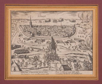
16TH C. BIRDSEYE VIEW OF SEIGE OF STEENWYCK, NETHERLANDS BY FRANS HOGENBERG (1535-1590)Thomaston Place Auction Galleries4.4(394)See Sold PriceFeb 24, 2024
MAP OF SALZBURG BY GEORGE BRAUN & FRANS HOGENBURG. 1588Thomaston Place Auction Galleries4.4(394)See Sold PriceFeb 24, 2024
Eight Gulf, Mobile & Ohio Railroad Playing Card Decks - Alton Route Map and LogoRail & Road Auctions4.6(165)See Sold PriceMar 08, 2024
Antique German Kampen Town Color Copper EtchingHill Auction Gallery 4.7(1k)See Sold PriceFeb 28, 2024
[THEATRE]. [CLOWNS]. FOX, George L. (1825-1...Potter & Potter Auctions4.6(550)See Sold PriceMar 07, 2024
[BASEBALL]. Group of Five Real Photo Postcards of Various T...Potter & Potter Auctions4.6(550)See Sold PriceMar 07, 2024
[BASEBALL]. Group of Three 1907 Championship Chicago White ...Potter & Potter Auctions4.6(550)See Sold PriceMar 07, 2024
[BASEBALL CARDS]. Group of 61 Bowman Gum Baseball Cards. [P...Potter & Potter Auctions4.6(550)See Sold PriceMar 07, 2024
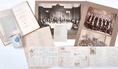
CARVER, George Washington (ca 1864-1943). Two TLsS ("G.W. Carver"), April and October 1936.[With:]Freeman's | Hindman4.4(1.6k)See Sold PriceFeb 27, 2024
Two (2) Antique 18th C. Copper Engraved Framed Maps - America & EuropeMagnusson Art Group4.5(53)See Sold PriceMar 14, 2024


![[THEATRE]. [CLOWNS]. FOX, George L. (1825-1... (1 of 1)](https://p1.liveauctioneers.com/928/318880/171361244_1_x.jpg?height=282&quality=70&version=1707501302)
![[BASEBALL]. Group of Five Real Photo Postcards of Various T... (1 of 1)](https://p1.liveauctioneers.com/928/318880/171361359_1_x.jpg?height=282&quality=70&version=1707501302)
![[BASEBALL]. Group of Three 1907 Championship Chicago White ... (1 of 2)](https://p1.liveauctioneers.com/928/318880/171361360_1_x.jpg?height=282&quality=70&version=1707501302)
![[BASEBALL CARDS]. Group of 61 Bowman Gum Baseball Cards. [P... (1 of 1)](https://p1.liveauctioneers.com/928/318880/171361410_1_x.jpg?height=282&quality=70&version=1707501302)
![CARVER, George Washington (ca 1864-1943). Two TLsS ("G.W. Carver"), April and October 1936.[With:] (1 of 2)](https://p1.liveauctioneers.com/197/319238/171467840_1_x.jpg?height=282&quality=70&version=1707520367)