SoldLOWE, THEODORE H. Map of the Mining DistrictsLOWE, THEODORE H. Map of the Mining Districts surrounding the Townsite of Idaho Springs. Situate in Clear Creek County, Colorado. Large hand-colored lithographed folding pocket map, 890x1370 mm overalSee Sold Price
SoldU.S.G.S. Mineral Resources of the U.S., Part 1 MetallicLot of 1. Contains production statistics for Gold, Silver, Copper, Lead,Zinc, Quicksilver, etc. by States and Counties and a 34" W x 50" H, fold out map of the mining districts of the Western States.See Sold Price
SoldVincent. Bear Gulch District, 1908Manuscript Map of Bear Gulch Mining District, Deadwood 151. [MAP]. VINCENT, H. S. "The Bear Gulch District of the Black Hill 1908" [lower right above neat line] "H. S. Vincent, DeadwoodSee Sold Price
SoldVincent. Nigger Hill Tin Mines, 1902Manuscript Map of the Largest Tin Mines in the U.S. 1902 152. [MAP]. VINCENT, H. S. "Map of the Consolidated Nigger Hill Tin Mines Rawlins and Hurricane Mining Districts Black Hills Lawrence &See Sold Price
SoldJackson's seminal map of Calif. Gold Region 1850Heading: Author: Jackson, William A. Title: Map of the Mining District of California by Wm. A. Jackson Place Published: New York Publisher:Theodore A. Mudge Date Published: 1850 DescriSee Sold Price
SoldMap Columbus Consolidated Gold Mining Co.Properties and Surroundings. Lead. Whitewood Mining District. Lawrence County. South Dakota. 21"H. x 17 1/2"WSee Sold Price
Map of the Territory of New MexicoPublication Date: 1896 Title: Map of the Territory of New Mexico Cartographer: SECRETARY OF THE INTERIOR Publisher: SECRETARY OF THE INTERIOR Height: 18.8 Width: 13 Map showing mining districts (w/numSee Sold Price
Map of the Territory of New MexicoTitle/Content of Map: Map of the Territory of New Mexico Cartographer: SECRETARY OF THE INTERIOR Date: 1890 Publisher: SECRETARY OF THE INTERIOR Size: 18.8Height - 13Width Map showing mining districtsSee Sold Price
SoldMap of Colorado mining district 1906Heading: (Colorado) Author: Clason Map Co. Title: Mining Districts of Gilpin and Clear Creek Counties, Colorado Place Published: Denver, CO Publisher:Denver Litho. Co. Date Published: 1906See Sold Price
Map of the Mining Districts of the Western StatesMap: Map of the Mining Districts of the Western States Date: 1907 Cartographer: LINDGREN, WALDEMAR Publisher: U.S. GEOLOGICAL SURVEY Size (inches): 48x32.5 "compiled by Waldemar Lindgren assisted by JSee Sold Price
SoldKootenay, Alaska Mining Districts Map Drawn in 1909This is a topo. map of East and West Kootenay drawn by the Lands and Works, Dept. in Victoria, B.C. scale is 1 in.= 8 miles. Mining districts are outlined in red. 28 in. X 33 in. In good condition twoSee Sold Price
Tintic & North Tintic Mining Districts Map (120034)Chief Consolidated Mining Co's. Map of Tintic & North Tintic Mining Districts, Utah, Compiled by Chas. P. Brooks. Approximately 42" x 42". Folded to approx. 4" x 9". Creased at folds, slight discoloraSee Sold Price
SoldJackson's map of Calif. Mining District 1851Title: Map of the Mining District of California Author: Jackson, W[illiam] A. Description: Lithographed map, hand-colored. 58.3x50.1 cm. (22¾x19¾"), laid down on modern linen backing. Second EditionSee Sold Price
SoldMaps of mines & mining districts in the westHeading: (Mining) Author: Title: Three binders with typescript descriptions of mining districts in the Western United States, along with numerous large folding maps Place Published: No place PublisheSee Sold Price
Jackson's map of Calif. Mining District 1851Title: Map of the Mining District of California Author: Jackson, W[illiam] A. Description: Lithographed map, hand-colored. 58.3x50.1 cm. (22¾x19¾"), laid down on modern linen backing. Second EditionSee Sold Price
SoldThe Leadville Mining District MapComplied from official records and other reliable sources by Chas F. Saunders. January 1901. Scale 1200ft to the inch. Copyrighted 1901 by Chas F. Saunders. 45.75x32"See Sold Price
Tonopah Mining District Map - Pristine (125060)This is a virtually pristine, original copy of a map of the Tonopah Mining District, compiled and published by William K. Moran, U.S. Mineral Surveyor, in 1912. Photo Litho by Britton & Rey, San FrancSee Sold Price
The Leadville Mining District Map In Frame.Marked "The Leadville Mining District Map. Compiled from official records and other reliable sources. By Chas. F. Saunders, January 1901". Scale is 1200 ft to the inch. There is a 2-1/2" x 3" tear aloSee Sold Price
SoldMap of the Mining District of California, with Ap[2], 12 pp. With folding facsimile map in back. Volume 6x3½, gilt-lettered red cloth. 1 of 150 copies printed by the Grabhorn Press. Facsimile of the map and its accompanying appendix; Wheat calls itSee Sold Price
Paddock mining district map and pamphlet gold fielPaddock mining district map and pamphlet gold fieldSee Sold Price
SoldLeadville Mining District Map, 1901January 1901. By Charles S. Saunders. Includes Iron Silver Mining Company, Big Evans Mining Company, Omega Group, Iron Silver Mining Company, Ibex Mining Company, etc. Tears on top left corner and a sSee Sold Price
SoldIowa Hill Mining District Map #89970Iowa Hill Mining District, Placer County, CA color map. 19x19", tape repair, multiple seam tears, sold as is State: California City: Placer County Date:See Sold Price
SoldRare map of Tonopah mining district, Nevada c.1905Heading: (Nevada) Author: Title: Map of Tonopah Mining District, Nevada Place Published: Tonopah, Nevada Publisher:Bradford & Bradford Date Published: [c.1905?] Description: ColSee Sold Price
SoldEly Copper Mining District Map, White Pine CountyPublished by Haff & Colwell Bros. 14 x 32" Blueprint of Mining Claims on Linen with rollers.Date: 1914Country if not USA: State: NevadaCity: ElyProvenance:See Sold Price
MAP - Dufour, A. H. ( Malte / Brun ) :MAP - ESPAGNE PARTIE SUD DIVISEE EN PROVINCES ANCIENNES ( MAPLuis Porretta Fine Arts4.3(10)See Sold PriceMar 02, 2024
Vintage County Map Of NY State Plate EngravingThe Benefit Shop Foundation Inc.4.3(3k)See Sold PriceFeb 28, 2024
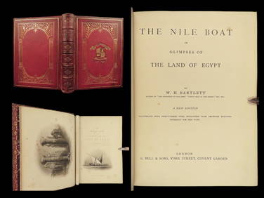
1880 Niles Boat Egypt Voyages Sphinx Pyramids Valley of Kings Illustrated MAPSSchilb Antiquarian Rare Books4.8(431)See Sold PriceMar 31, 2024
(2) THEODORE ALEXANDER FLORAL & FOLIATE DECORATED WALL PANELS, 53" X 29"Austin Auction Gallery4.7(1.2k)See Sold PriceFeb 25, 2024
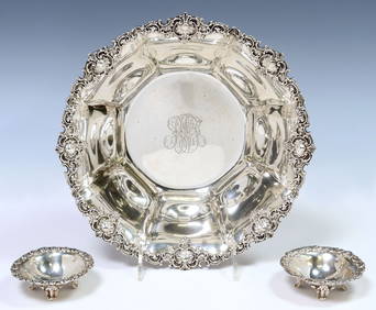
(3) AMERICAN STERLING BOWLS, GORHAM & THEODORE B. STARRAustin Auction Gallery4.7(1.2k)See Sold PriceFeb 25, 2024
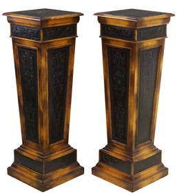
(2) THEODORE ALEXANDER (ATTRIB) NEOCLASSICAL STYLE PEDESTALS/ TORCHIEREsAustin Auction Gallery4.7(1.2k)See Sold PriceFeb 25, 2024
ANTIQUE FRENCH THEODORE DECK ENAMELED CERAMIC LAMPSAntique Arena Inc.4.5(883)See Sold PriceFeb 24, 2024
Willem Blaeu, Etc. 17th C. Antiquarian Maps, 2Auctions at Showplace4.6(744)See Sold PriceMar 17, 2024
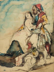
POSSIBLY THEODORE GERICAULT (1791-1824) "SKETCH WITH FIGURES".Amelia Jeffers, Auctioneers & Appraisers4.5(124)See Sold PriceMar 07, 2024
THEODORE ROUSSEAU (1812-1867) "BACK ALLEY".Amelia Jeffers, Auctioneers & Appraisers4.5(124)See Sold PriceMar 07, 2024
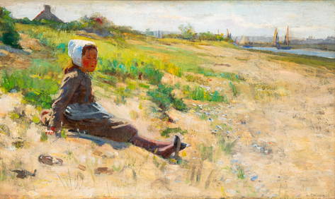
AFTER THEODORE ROBINSON (1852-1896) "GIRL ON A HILL".Amelia Jeffers, Auctioneers & Appraisers4.5(124)See Sold PriceMar 07, 2024
Attributed to Theodore Robinson. Houses by the River, oilAlex Cooper4.5(501)See Sold PriceMar 02, 2024
Framed Space Age Rand McNally Map of Planets Poster, 1958PUBLIC SALE4.7(227)See Sold PriceMar 02, 2024
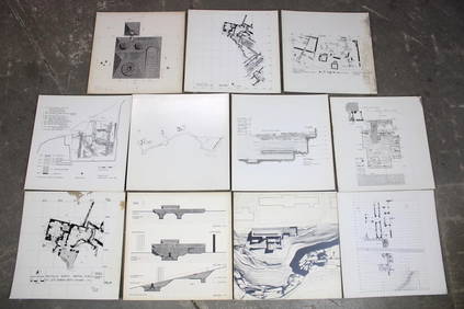
Set of 11 Mid Century Modern Architectural Plans & Site Map RenderingsPUBLIC SALE4.7(227)See Sold PriceMar 02, 2024
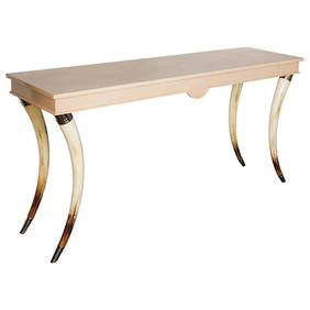
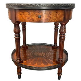
Theodore Alexander Inlaid Round Side TableWorld Auction Gallery LLC4.7(267)See Sold PriceMar 10, 2024