London.- Andrews (John) and Andrew Dury. - A Map of theand Andrew Dury. A Map of the Country Sixty Five Miles Round London from Actual Surveys, 19 of 20 double-page sheets, lacking sheet 12 due west of London, with large oval title on sheet 1, dedicationSee Sold Price
SoldAndrews (John)Andrews (John) and Andrew Dury. A Map of the Country Sixty Five Miles Round London from Actual Surveys, engraved map on 20 double-page sheets with large oval title on sheet 1, dedication ovalSee Sold Price
SoldSussex.- South Coast.- Andrews (John) and Andrew Dury.Sussex.- South Coast.- Andrews (John) and Andrew Dury. Two sheets from 'A Map of the Country Sixty Five Miles Round London', sheet 18 and 19, showing from Little Hampton to Rye, including Brighton, LeSee Sold Price
SoldAndrews & Dury. A Map of the County of KentAndrews (John) and Andrew Dury A Map of the County of Kent,index map, only, for the 25-sheet map of Kent, engraved map with original hand-colouring in outline, 515 x 725mm., central vertical fSee Sold Price
Andrews (John) and Andrew Dury. A New Travelling MAndrews (John) and Andrew Dury. A New Travelling Map of the Country Round LondonExtending from the North to South 190 Miles and East to West 150 Miles, engraved map with hand-colouring, 1010 xSee Sold Price
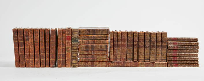
SoldKent.- Andrews (John Andrew Dury and W. Herbert) - A25-sheet map, with index map and plan of Canterbury in addition, 27 sheet double-page engraved map sheets, unjoined, many with original hand-colouring in outline, occasional slight browning, generallySee Sold Price
Andrews (John Andrew Dury and William Herbert - A25-sheet map, with index map and plan of Canterbury in addition, 27 sheet double-page engraved map sheets, unjoined, many with original hand-colouring in outline, occasional slight browning, generallySee Sold Price
SoldKent.- Andrews (John) and Andrew Dury. After - Afacsimile 25 double-sheet county map, with index sheet, maroon cloth mounted with publisher's paper label, folio (515 x 405mm.), Lympne Castle, Kent, Harry Margary, 1968.See Sold Price
SoldAndrew Dury and John Andrews, 'A Topographical Map ofAndrew Dury and John Andrews, 'A Topographical Map of Hartford-shire From An Actual Survey...', hand coloured engraving, published 1766, mounted over margins, 52 x 69cm; and: Robert Morden, 'ShropshirSee Sold Price
SoldHERTFORDSHIRE. DURY, ANDREW & JOHN ANDREWSHertfordshire. Dury, Andrew and John Andrews. A Topographical Map of Hartford-Shire, from an Actual Survey, folding dissected map backed on to linen, on 36 sheets, a few manuscript marks, offsetting,See Sold Price
SoldMontresor, Plan of City of New YorkMONTRESOR, John (1736-1799). A Plan of the City of New-York & its Environs Survey'd in the Winter, 1775. Engraved map by P. Andrews. London: A. Dury, 1775. 29 1/4" x 22" sheet, 40" x 33" framed. RARESee Sold Price
London.- Andrews (John) Andrews's Accurate Map of theLondon.- Andrews (John) Andrews's Accurate Map of the Country, Twenty-Five Miles Round London, showing north west of central London, from Windsor to Rochford in the east, and from Sevenoak up to Ware,See Sold Price
London.- Andrews (John) A New Travelling Map of theLondon.- Andrews (John) A New Travelling Map of the Country Round London Extending from the North to South 190 Miles and East to West 150 Miles, engraved map with hand-colouring, 1010 x 1230 mm (43 1/See Sold Price
John Andrews and Andrew Drury, map of Enford,John Andrews and Andrew Drury, map of Enford, Wiltshire, circa 1810, 48cm x 65cm, framedSee Sold Price
Sold1 piece. Hand-Colored Engraved Map. Easburn, Benja1 piece. Hand-Colored Engraved Map. Easburn, Benjamin. A Plan of The City of Philadelphia, The Capital of Pennsylvania,..." London: Andrew Dury, 1776. Engraved by P. Andre. 20 1/4 x 26 7/8 inches; 514See Sold Price
Sold(Maps and Charts, Revolutionary War, Boston), A Pl(Maps and Charts, Revolutionary War, Boston), A Plan of Boston and its Environs shewing the true Situation of His Majesty's Army and also those of the Rebels, London, Andrew Dury, March 12, 1776, contSee Sold Price
Sold(Maps and Charts, Delaware), Fisher, Joshua, A Cha(Maps and Charts, Delaware), Fisher, Joshua, A Chart of Delaware Bay and River...from the Capes to Philadephia, London: Andrew Dury, 30th November, 1776, double-page folio, engraved by William Haydon,See Sold Price
(Maps and Charts, Revolutionary War, Boston), A Pl(Maps and Charts, Revolutionary War, Boston), A Plan of Boston and its Environs shewing the true Situation of His Majesty's Army and also those of the Rebels, London, Andrew Dury, March 12, 1776, contSee Sold Price
Sold(2 re: Maps of the American Revolution) History o(2 re: Maps of the American Revolution) History of the War with America, France, Spain, and Holland; Commencing in 1775 and Ending 1783. Volume IV. By John Andrews. London, 1786. 1st ed. 4 maps and 9See Sold Price
Dury, Andrew A map of the provinces of Delhi, Agrah,Dury, Andrew A map of the provinces of Delhi, Agrah, Oude and Allahabad. Teilkolorierte Kupferstichkarte in 2 Teilen (nicht zusammengesetzt). London, Laurie & Whittle, 1794. 109 x 107 cm. Große, detaSee Sold Price
SoldENGRAVED & COLORED 1761 POCKET ATLAS.Dury, Andrew. A New, General, and Universal Atlas, Containing Forty five Maps by Andrew Dury, Engraved by Mr. Kitchin, & others. [London:] Printed for & sold by A. Dury at the Indian Queen … & Robt.See Sold Price
SoldLondon.- Mogg (Edward) New Map of the Country FortLondon.- Mogg (Edward) New Map of the Country Forty-Five Miles Round London,outline colouring, linen backed, original card case, worn, 970x1180mm, 1821 § Andrews (John) A New and Accurate MapSee Sold Price
Andrews (John) A New and Accurate Map of the CountAndrews (John) A New and Accurate Map of the Country Twenty-Five Miles Round London,from Welwyn to East Grinstead, and from Windsor Great Park to Sheerness, title panel above, engraved map witSee Sold Price
SoldAndrews (John) A New and Accurate Map of the CountAndrews (John) A New and Accurate Map of the Country Twenty-Five Miles Round London,from Welwyn to Tunbridge Wells, and from Rochford to Windsor, engraved map with original hand-colouring in oSee Sold Price
John Boydell / Carlo Dolci 1768 Scarce Engraving Death of St Andrew 17" x 12"Luis Porretta Fine Arts4.3(10)See Sold PriceMar 02, 2024
THOMAS KEMPIS Imitation Of Christ c1890 Superb BindingLuis Porretta Fine Arts4.3(10)See Sold PriceMar 02, 2024
WASHINGTON, JACKSON and other HISTORICAL AMERICANAJohn McInnis Auctioneers,LLC4.5(505)See Sold PriceFeb 24, 2024
General Books - Nicolson - The Counties of Britain - A Tudor Atlas by John SpeedTimeLine Auctions Ltd.4.6(183)See Sold PriceMar 08, 2024
Catherwood - General View of Uxmal, Taken from the Archway of Las Monjas, Looking SouthTrillium Antique Prints & Rare Books4.5(32)See Sold PriceFeb 24, 2024
Book: With the Aurora in the Antarctic 1911-1914, by John King Davis. Published by Andrew Melrose,Claydon Auctioneers Ltd4.3(125)See Sold PriceFeb 26, 2024
1704 DESCRIPTION OF ALL THE SEATS OF THE PRESENT WARS OF EUROPE antique w/ MAPSJasper524.5(9.9k)See Sold PriceFeb 27, 2024
A group of mostly leather bound books in EnglishAndrew Jones Auctions4.7(208)See Sold PriceFeb 29, 2024
San Xavier Del Bac Mission, Edward S. Curtis photogravurePBA Galleries4.7(385)See Sold PriceMar 07, 2024
Guthrie, William 1812 Antique Map. Spain and PortugalAlbion Auctions4.6(341)See Sold PriceMar 01, 2024
John Senex Map of Louisiana & Mississippi RiverWillow Auction House4.5(289)See Sold PriceMar 14, 2024
1964 Hard Cover Used John F. Kennedy Half Dollar Collection Starting 1964 Whitman Folder # 9699 BookAndrew's Coin & Jewelry4.5(209)See Sold PriceMar 07, 2024
Elton John - Rock Of The Westies-LP- MCA-2163 1st 1975 USAAndrew's Coin & Jewelry4.5(209)See Sold PriceMar 07, 2024


![Ice On Fire [Vinyl] Elton John (1 of 1)](https://p1.liveauctioneers.com/2742/320466/172198302_1_x.jpg?height=282&quality=70&version=1708642023)

