LEANDER RANSOM - NEW MAP OF THE STATE OF CALIFORNIA ANDLeander Ransom - New Map Of The State Of California And Nevada Territory, 1863 - 28 5/8 X 36 In. - This Giclée Print Is Gallery Stretched And Ready To Hang Or Lean Against A Wall, Or Display On An EaSee Sold Price
Leander Ransom - New Map Of The State Of California AndLeander Ransom - New Map Of The State Of California And Nevada Territory, 1863 Size: 28 5/8 X 36 In. - This Is A Gallery Stretched Giclee Print On Canvas. The Piece Was Printed On High Quality ArtistSee Sold Price
LEANDER RANSOM - NEW MAP OF THE STATE OF CALIFORNIA ANDLeander Ransom - New Map Of The State Of California And Nevada Territory, 1863 - 31 7/8 X 40 In. - This Giclée Print Is Gallery Stretched And Ready To Hang Or Lean Against A Wall, Or Display On An EaSee Sold Price
LEANDER RANSOM - NEW MAP OF THE STATE OF CALIFORNIA ANDLeander Ransom - New Map Of The State Of California And Nevada Territory, 1863 - 23 7/8 X 30 In. - This Giclée Print Is Gallery Stretched And Ready To Hang Or Lean Against A Wall, Or Display On An EaSee Sold Price
LEANDER RANSOM - NEW MAP OF THE STATE OF CALIFORNIA ANDLeander Ransom - New Map Of The State Of California And Nevada Territory, 1863 - 35 X 44 In. - Gallery Stretched The Piece Of Art Is Ready To Hang Or Lean Against A Wall, Or Display On An Easel. - A GSee Sold Price
LEANDER RANSOM - NEW MAP OF THE STATE OF CALIFORNIA ANDLeander Ransom - New Map Of The State Of California And Nevada Territory, 1863 - 28 5/8 X 36 In. - This Giclée Print Is Gallery Stretched And Ready To Hang Or Lean Against A Wall, Or Display On An EaSee Sold Price
LEANDER RANSOM - NEW MAP OF THE STATE OF CALIFORNIA ANDLeander Ransom - New Map Of The State Of California And Nevada Territory, 1863 - 35 X 44 In. - This Giclée Print Is Gallery Stretched And Ready To Hang Or Lean Against A Wall, Or Display On An Easel.See Sold Price
LEANDER RANSOM - NEW MAP OF THE STATE OF CALIFORNIA ANDLeander Ransom - New Map Of The State Of California And Nevada Territory, 1863 - 35 X 44 In. - This Giclée Print Is Gallery Stretched And Ready To Hang Or Lean Against A Wall, Or Display On An Easel.See Sold Price
LEANDER RANSOM - NEW MAP OF THE STATE OF CALIFORNLeander Ransom - New Map Of The State Of California And Nevada Territory, 1863 - Giclée On Canvas - 35 X 44 In. A Giclée Print Is The Highest Quality Print Available Today. Because There Is No VisibSee Sold Price
NEW MAP OF THE STATE OF CALIFORNIA AND NEVADALeander Ransom - New Map Of The State Of California And Nevada Territory, 1863 - 31 7/8 X 40 In. - This Giclée On Canvas Is Gallery Stretched And Ready To HangSee Sold Price
NEW MAP OF THE STATE OF CALIFORNIA AND NEVADALeander Ransom - New Map Of The State Of California And Nevada Territory, 1863 - 31 7/8 X 40 In. - This Giclée Print Is Gallery Stretched And Ready To Hang Or Lean Against A Wall, Or Display On An EaSee Sold Price
NEW MAP OF THE STATE OF CALIFORNIA AND NEVADALeander Ransom - New Map Of The State Of California And Nevada Territory, 1863 - 31 7/8 X 40 In. - This Giclée Print Is Gallery Stretched And Ready To Hang Or Lean Against A Wall, Or Display On An EaSee Sold Price
Sold1867 Map of California and NevadaLeander Ransom & Amos Doolittle: A New Map of the States of California and Nevada, Exhibiting the Rivers, Lakes, Bays and Islands, with the principal Towns, Roads, Railroads and Transit Routes to theSee Sold Price
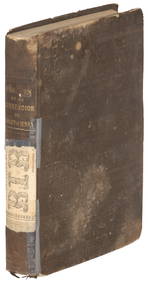
[MAP]. RANSOM. California and Nevada Territory. 1863356. [MAP]. RANSOM, Leander & A.J. Doolittle (cartographers & surveyors); Warren Holt (publisher); Louis Nagel (lithographer). New Map of the State of California and Nevada Territory.... San FSee Sold Price
Ransom's map of California 1863 with NevadaHeading: Author: Ransom, Leander Title: New Map of the State of California Exhibiting the Rivers, Lakes, Bays and Islands, with the principal Towns, Roads, Railroads and Transit Routes to the SilverSee Sold Price
SoldMap of California & Nevada 1871Heading: Author: Ransom, Leander Title: A New Map of the States of California and Nevada Exhibiting the Rivers, Lakes, Bays and Islands, with the principal Towns, Roads, Railroads and Transit RoutesSee Sold Price
SoldS.A. Mitchell: New Map of the State of California, 1854Map: A New Map of the State of California, the Territories of Oregon, Washington, Utah and New Mexico Cartographer: S. Augustus Mitchell Illustrator: J.H. Young Publisher: Thomas, Cowperthwait & Co. PSee Sold Price
new map of the State of California, the territoriesMap: new map of the State of California, the territories Oregon, Washington, Utah & New Mexico. Date: 1855 Cartographer: S. Augustus Mitchell Publisher: Thomas Cowperthwait & Co Size (inches): 15.5x12See Sold Price
1850 map of California and Territories by CowperthwaitVery desirable and distinctive map of the American west, with Utah Territory and New Mexico Territory accounting for nearly half of the West. “A New Map of the State of California, the Territories oSee Sold Price
SoldMitchell's map of the west 1853Heading: Author: Mitchell, Samuel Augustus Title: A New Map of the State of California, the Territories of Oregon, Washington, Utah & New Mexico... Place Published: Philadelphia Publisher:Thomas, CowSee Sold Price
Mitchell: State of California, the Territories ofMap: A New Map of the State of California, the Territories of Oregon, Washington, Utah & New Mexico Maker: Mitchell, S. Augustus Publisher: Thomas Cowperthwait & Co. Publishing Date: 1853 Size: 12.75See Sold Price
1850 Calif. and Territories by CowperthwaitVery desirable and distinctive map of the American west, with Utah Territory and New Mexico Territory accounting for nearly half of the West. “A New Map of the State of California, the Territories oSee Sold Price
Sold1850 Calif. and Territories by CowperthwaitVery desirable and distinctive map of the American west, with Utah Territory and New Mexico Territory accounting for nearly half of the West. “A New Map of the State of California, the Territories oSee Sold Price
Sold1850 Cowperthwait Map of California, Oregon, Utah andTitle/Content of Map: 1850 Cowperthwait Map of California, Oregon, Utah and New Mexico Terr. -- A New Map of the State of California, The Territories of Oregon & Utah and the Chief Part of New MexicoSee Sold Price
1892 Adams and Bowles New Road Map of the State of New YorkJM Hobby Supply and Railroad Artifact Auctions4.4(127)See Sold PriceFeb 24, 2024
Crams Railroad Map of New York-1881JM Hobby Supply and Railroad Artifact Auctions4.4(127)See Sold PriceFeb 24, 2024
EARLY 18TH C. DUTCH CHART OF PACIFIC OCEAN BY FREDERIK DE WIT (1629-1706) WITH CALIFORNIA AS ANThomaston Place Auction Galleries4.4(393)See Sold PriceFeb 24, 2024
Vintage County Map Of NY State Plate EngravingThe Benefit Shop Foundation Inc.4.3(2.9k)See Sold PriceFeb 28, 2024
Mitchell - Map of the City of Washington (Washington, DC)Trillium Antique Prints & Rare Books4.5(32)See Sold PriceFeb 24, 2024
Chinese Enameled Copper Snuff Box w/ Ivory FiguresArtemis Fine Arts4.8(1.4k)See Sold PriceFeb 26, 2024
2020 1oz Silver Treasures of the U.S.California GoAffinity Antique Auction4.6(251)See Sold PriceMar 03, 2024


![[MAP]. RANSOM. California and Nevada Territory. 1863 (1 of 8)](https://p1.liveauctioneers.com/514/38482/16500412_1_x.jpg?height=282&quality=70&version=1363615005)