MATTHEWS c1856 Map Of Upper Canada Ontario Indian Land Agency Divisions Scarce!Luis Porretta Fine Arts4.3(10)See Sold PriceMar 02, 2024
DEVINE c1856 Dr Salters Map Of Lake Huron Ontario Indian Lands etc. No. 7 ScarceLuis Porretta Fine Arts4.3(10)See Sold PriceMar 02, 2024
DUNLEVIE c1856 Map Counties Of Gaspe & Bonaventure Quebec Canada SCARCE! #1Luis Porretta Fine Arts4.3(10)See Sold PriceMar 02, 2024
DUNLEVIE c1856 Map Counties Of Gaspe & Bonaventure Quebec Canada SCARCE! #2Luis Porretta Fine Arts4.3(10)See Sold PriceMar 02, 2024
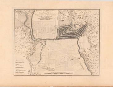
Map UNITED COUNTIES LEEDS & GRENVILLE by Walling 1861 Rare Canada Map 5ft x 5ftLuis Porretta Fine Arts4.3(10)See Sold PriceMar 02, 2024
Ambroise TARDIEU c1822 Map Venice Napoleon Italian Campaign 17" x 11"Luis Porretta Fine Arts4.3(10)See Sold PriceMar 02, 2024
Kitchen: Antique Map of Mexico/New Spain, 1777Map: Mexico or New Spain in which the Motions of Cortes may be traced Cartographer: Kitchin Place & Date: London / 1777 / 1821 Size: 15 3/8" x 11 1/4" Condition: trimmed close to neat line; margins reSee Sold Price
SoldKitchen: Antique Map of Mexico or New Spain, 1777Map: Mexico or New Spain in which the Motions of Cortes may be traced Cartographer: Kitchin Place & Date: London / 1777 / 1821 Size: 15 3/8" x 11 1/4" Condition: trimmed close to neat line; margins reSee Sold Price
SoldANTIQUE MAP, MEXICO/NEW SPAIN, GERMAN MAPMAKER, MAANTIQUE MAP, MEXICO/NEW SPAIN, GERMAN MAPMAKER, MATTHEW QUAD 1557-1613, APPX. 9.25" X 12.5". GOOD COND.See Sold Price
SoldJ.B. HOMANN ANTIQUE MAP OF MEXICO & NEW SPAINJ. B. Homann's map of Mexico, Florida, New England, the West Indies, and the Mississippi Valley. Dimensions: (Frame) H 20.5" x W 24.5", (Sight) H 18.5" x W 22..25" Condition: Colors faded. Some wear tSee Sold Price
Kitchen: Antique Map of South America, 1777Title/Content of Map: Map of South America. Date Printed: 1777-09-29 Cartographer: KITCHEN, THOS. (SR.) Size: 17.5X12.75 Folding book illustration map with title within handsome cartouche. Slight browSee Sold Price
SoldBarclay, James 1809 Antique Map. Spain and Portugal"The Kingdoms of Spain and Portugal &ca" Outline Hand Coloured Copper Engraved Map Published 1809, Leeds for "Barclay's Complete and Universal Dictionary of the English Language..." by the Rev. JamesSee Sold Price
SoldGuthrie, William 1790 Antique Map. Spain & PortugalCopper Engraved Map Published 1790, London for "A New Geographical, Historical and Commercial Grammar..." by William Guthrie. The maps are by John Senex, Thomas Kitchin and others. Folds as issued. EaSee Sold Price
SoldKitchen: Antique Map of Africa, 1782Map: Africa, Agreeable to the Most Approved Maps and Charts, by Mr. Kitchen. Engraved for Millar's New Complete & Universal System of Geography Publication Date: 1782 Cartographer: Thomas Kitchen/Geo.See Sold Price
SoldKitchen: Antique Map of Asia, 1800Map: Asia, Drawn from the Latest Astronomical Observations. Publication Date: 1800 ca. Authors: KITCHEN, T. ? Size: Quarto – 11.50 H x 8.75 W Inches Folding map from an unidentified octavo volume. FSee Sold Price
SoldThomas Kitchen, antique map of Poland showing theThomas Kitchen, antique map of Poland showing the claims of Austria, Russia and Prussia, 8ins x 11ins, another hand coloured map of Afghanistan and another uncoloured map of Poland, Lithuania and PrusSee Sold Price
SoldFindlay, Alex C1835 Antique Map. Spain & PortugalSteel Engraved Map Published C1835 by Thomas Kelly, London for "A New and Universal English Dictionary" by the Rev. James Barclay. Maps Drawn & Engraved by Alexander Findlay. Paper Size: 10.5 x 8 inchSee Sold Price
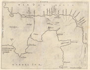
Kitchen: Antique Map of Countries On the South SeaTitle/Content of Map: Map of the Countries On the South Sea, from Panama to Guayquil. Date Printed: 1777 Cartographer: KITCHEN THOM. SR. Size: 14.5X9.5 Topographically detailed showing mountains, riveSee Sold Price
Large Beautiful Antique Map Spain & PortugalEnglish rendered. Cartograpphers unknown. Fine colors. Measures 30x24 matted for framing inches.See Sold Price
Antique Map : Spain & Portugal - 1802Antique Map : Spain & Portugal - 1802 Size : 10.5" x 8.25"See Sold Price
Antique Map : Spain & Portugal - 1841Antique Map : Spain & Portugal - 1841 by EP Williams, Eton and London. Hand-Tinted. Size : 13.75" x 10.25"See Sold Price
Antique Map : Spain & Portugal - 1802Antique Map : Spain & Portugal - 1802 Size : 10.5" x 8.25"See Sold Price
Antique Map : Spain & Portugal - 1841Antique Map : Spain & Portugal - 1841 by EP Williams, Eton and London. Hand-Tinted. Size : 13.75" x 10.25"See Sold Price
SoldAntique Map : Spain & Portugal - 1802Antique Map : Spain & Portugal - 1802 Size : 10.5" x 8.25"See Sold Price
Sold(3) ANTIQUE MAPS, SPAIN, PORTUGAL, SAXONY, 18TH C.(lot of 3) Antique maps, including: (1) "Saxonie Inferioris Circulus...," c.1730, Georg Matthaus Seutter (German, 1678-1757), hand colored, approx 20.5"h, 23.75"w; (1) "La Catalogna Li Regni Di AragonSee Sold Price
Sold(6) antique maps: Spain, Germany, Austria, etc.(6) antique maps: Spain, Germany, Austria, etc., 17th/18th century, largest: 21.5" x 26.5", unframedSee Sold Price
Seutter: Antique Map of Spain and Portugal, 1740Title/Content of Map: Spain and Portugal Date Printed: c1740 Cartographer: Matthaus Seutter Material/Medium: Paper Size: 23 1/2" x 19 3/4" Original hand colored copperplate engraved. Published in AugsSee Sold Price
SoldMillar: Antique Map of Spain & Portugal, 1768Title/Content of Map: 1768 Millar Map of Spain and Portugal -- A New and Complete Map of Spain and Portugal Date Printed: 1768 c. Cartographer: G Millar Size: 14.3 x 9.3 in. Condition: Good - fair. SeSee Sold Price
SoldHomann: Antique Map of Spain & Portugal, 1753Title/Content of Map: 1753 Homann Map of Spain and Portugal -- Regnorum Hispaniae et Portugalliae, Tabula generalis de l' Isliana, aucta et ad Usum Scholarum… Date Printed: 1753 Nurnberg CartographeSee Sold Price
SoldAN ANTIQUE MAP OF SPAIN AND PORTUGAL, "Accuratis sim aAN ANTIQUE MAP OF SPAIN AND PORTUGAL, "Accuratis sim a totius Regni Hispaniæ, Portugalliæ..." AMSTERDAM, 1668-1680, hand colored engraving on paper, a page fragment from an atlas printed by FrederikSee Sold Price
Raphael - Religious Fresco or Decorative Pilaster. 3Trillium Antique Prints & Rare Books4.5(30)See Sold PriceFeb 24, 2024
Raphael - Religious Fresco or Decorative Pilaster. 7Trillium Antique Prints & Rare Books4.5(30)See Sold PriceFeb 24, 2024
1790 AFRICA TRAVELS Voyages dans le pays des Hottentots ILLUSTRATED antique RAREJasper524.5(9.8k)See Sold PriceFeb 27, 2024
Guthrie, William 1812 Antique Map. Spain and PortugalAlbion Auctions4.6(336)See Sold PriceMar 01, 2024
Robert Benard (1734 - 1777) - Set of 9 Copperplate Engravings - Greek and Roman architecture - ViewProverde Auctions4.3(3)See Sold PriceFeb 28, 2024
Robert Benard (1734 - 1777) - Set of 9 Copperplate Engravings - Architecture, Masonry, Quarry withProverde Auctions4.3(3)See Sold PriceFeb 28, 2024
Robert Benard (1734 - 1777) - Set of 9 Chemical Engravings - Alchemical symbols - Utensils forProverde Auctions4.3(3)See Sold PriceFeb 28, 2024
Joseph Meyer - Set of 20 Prints - Views of Austria - Germany - Italy - Switzerland - France - SpainProverde Auctions4.3(3)See Sold PriceFeb 28, 2024
Antique Map of The Kingdom of Spain, 1701 PrintAntiques Online Auctions4.6(407)See Sold PriceMar 14, 2024