SoldKeith Johnston Edinburgh Map of JAPAN and CHINAKeith Johnston Edinburgh Map of JAPAN and CHINA. Engraved and printed by W & AK Johnston Edinburgh & London. Approx. 24" x 19.5" and in good, age appropriate condition as shown, see photos.See Sold Price
SoldJohnston: Antique Map of China and Japan, 1873Title/Content of Map: China and Japan Cartographer: JOHNSTON, KEITH Size: 12X16.25 by Keith Johnston, F.R.S.E. Sheet 49 from an American and French Joines and Hamilton atlas edition printed by Ferd. MSee Sold Price
China and JapanTitle: China and Japan Date: 1875 Cartographer: JOHNSTON, KEITH Publisher: H. H. HARDESTY & CO. Size: 12.1Height - 16.1Width Provenance: by Keith Johnston F.R.S.E. Double page map reprinted from The (See Sold Price
SoldJohnston (Alexander Keith) China and JapanJohnston (Alexander Keith) China and Japan, engraved map with outline hand-colouring, 440 x 570mm., central vertical fold, faint browning, [mid-18th century]; with 3 18th and 19th century engrSee Sold Price
SoldA MAP OF CHINA & JAPAN 1861.B018.A MAP OF CHINA & JAPAN 1861.B018. Description Author: Johnston, Keith Title: China and Japan Place Published: Edinburgh & London Publisher: W. & A.K. Johnston and William Blackwood & Sons Date PublishSee Sold Price
SoldMap of China & Japan 1861Heading: Author: Johnston, Keith Title: China and Japan Place Published: Edinburgh & London Publisher:W. & A.K. Johnston and William Blackwood & Sons Date Published: 1861 Description:See Sold Price
Three 19th C. Asian Maps, c.1820 & c.1860Three 19th C. Asian Maps, China c.1820 Engraved by Anthony Finley, American, 1784-1836; China and Japan F.R.S.E. (with) Islands of Japan. Engraved & printed by W. & A.K. Johnston, Edinburgh. William BSee Sold Price
SoldKeith Johnston Edinburgh Map of ASIA19th Century world map of ASIA by KEITH JOHNSTON F.R.S.E. Engraved and printed by W & AK Johnston Edinburgh & London. Approx. 24" x 19.5" and in good, age appropriate condition as shown, see photos.See Sold Price
SoldTwo Keith Johnston Edinburgh Map of INDIATwo 19th century Keith Johnston general Atlas maps of INDIA including the Northern section and Southern as shown, Engraved and printed by W & AK Johnston Edinburgh & London. Approx. 24" x 19.5" and inSee Sold Price
Johnston: Antique Map of China & Japan, 1879Title/Content of Map: 'China and Japan [inset: Islands of Japan]' Date Printed: 1879 Image Size: Approx 47.5 x 61.0cm, 18.75 x 24 inches (Large); Please note that this is a folding map. Type: Large, fSee Sold Price
SoldAsia/China/Russia: 6 color maps, [ca. 1813-1861].[Asia]. 6 engraved maps (first two double-page), in outline or full color. Very good condition. Largest 11 1/2 x 17 3/8 in. Smalles 9 1/4 x 7 1/8 in. ++ China And Japan. Map 34 from ''Keith Johnston'sSee Sold Price
ASIA POLITICAL. Persia Siam Hejaz China Japan Corea Turkestan. JOHNSTON 1900 mapTITLE/CONTENT OF MAP: 'Asia' DATE PRINTED: 1900 IMAGE SIZE: Approx 20.5 x 26.0cm, 8 x 10.25 inches (Medium) TYPE: Antique colour map CONDITION: Good; suitable for framing. However, please note: The imSee Sold Price
ASIA POLITICAL. Persia Siam Hejaz China Japan Corea Turkestan. JOHNSTON 1895 mapTITLE/CONTENT OF MAP: 'Asia' DATE PRINTED: 1895 IMAGE SIZE: Approx 20.5 x 26.0cm, 8 x 10.25 inches (Medium) TYPE: Antique colour map CONDITION: Good; suitable for framing. However, please note: The imSee Sold Price
ASIA POLITICAL Persia Siam Hejaz China Japan Corea Turkestan JOHNSTON 1892 mapTITLE/CONTENT OF MAP: 'Asia' DATE PRINTED: 1892 IMAGE SIZE: Approx 20.5 x 26.0cm, 8 x 10.25 inches (Medium) TYPE: Antique colour map CONDITION: Good; suitable for framing. However, please note: The imSee Sold Price
ASIA POLITICAL. Persia Siam Hejaz China Japan Korea Turkestan. JOHNSTON 1910 mapTITLE/CONTENT OF MAP: Asia [Political] DATE PRINTED: 1910 IMAGE SIZE: Approx 21.5 x 27.5cm, 8.25 x 10.75 inches (Medium) TYPE: Colour antique map CONDITION: Good; suitable for framing. However, pleaseSee Sold Price
ASIA POLITICAL. Persia Siam Hejaz China Japan Corea Turkestan. JOHNSTON 1906 mapTITLE/CONTENT OF MAP: 'Asia, political' DATE PRINTED: 1906 IMAGE SIZE: Approx 20.5 x 26.5cm, 8 x 10.5 inches (Medium) TYPE: Colour antique map CONDITION: Good; suitable for framing. However, please noSee Sold Price
SoldJohnston Maps [Turkey, Asia Minor, Persia]Three (3) Keith Johnston's General Atlas, published by William Blackwood and Sons, Edinburgh, maps, circa mid-19th century. Maps include Turkey in Asia (Minor); Turkey in Europe; and Persia and AfghanSee Sold Price
SoldCa.1860's Keith Johnston MapsFour Ca. 1860's Keith Johnston Maps. By Keith Johnston, F.R.S.E. Keith Johnston's General Atlas Engraved, Printed, and Published by W. & A.K. Johnston, Edinburgh & London. Maps include: 1) Top - 'N.W.See Sold Price
SoldScotland.- Edinburgh.- Johnston (Alexander Keith)Scotland.- Edinburgh.- Johnston (Alexander Keith) Johnston's plan of Edinburgh & Leith in 1850, large city plan showing from Granton Harbour and Leith Pier, including Edinburgh Castle and Arthur's SeaSee Sold Price
K. Johnston, W. Blackwood and Sons Map [Scotland]Keith Johnston's General Atlas, published by William Blackwood and Sons, Edinburgh, two-part map of Scotland, circa mid-19th century. Second page depicts area south of first page. Each measures 17.25-See Sold Price
SoldJohnston: Map of France, 1878France. The Cabinet Atlas of the World, by Alexander Keith Johnston. This plate: France. Edinburgh, W. & A.K. Johnston, 1878. Sheet size: 9 3/4 x 12 1/4 in. Please note that this lot has a confidentiaSee Sold Price
CHINA & JAPAN showing Opium Wars battlefields & dates. JOHNSTON 1913 old mapCAPTION PRINTED BELOW PICTURE: 'China and Japan // Islands of Japan' DATE PRINTED: 1913 IMAGE SIZE: Approx 34.5 x 43.5cm, 13.5 x 17.25 inches (Large); Please note that this is a folding map. TYPE: AntSee Sold Price
SoldAlison, Archibald 1852 Lot of 13 Battle Plans/MapsIncl France, Germany, and Belarus.Steel Engraved Maps Published 1852, Edinburgh & London for "Atlas to Alison's History of Europe" by Sir Archibald Alison and Alexander Keith Johnston. Outline Hand CoSee Sold Price
SoldAfrica 1881-83 Pair of Maps by Stieler & JohnstonLithograph Maps Published 1883, Edinburgh for "Handy Royal Atlas of Modern Geography" by Alexander Keith Johnston and 1881, Gotha for "Schul-Atlas Uber Alle Theile der Erde..." by Adolf Stieler. PaperSee Sold Price
A Fine RARE Antique Woven ikat Pictorial TextilePremier Auction Galleries4.3(329)See Sold PriceMar 09, 2024
Famous Dealer Spink 1997 Form & Function Furniture from China Japan and KoreaSunburst Auction4.4(21)See Sold PriceFeb 24, 2024
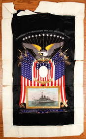
(Early 20th c) MEMENTO of the U.S.S. MONTANAJohn McInnis Auctioneers,LLC4.6(504)See Sold PriceFeb 25, 2024
Collection of Chinese and Japanese Seals.Turner Auctions + Appraisals4.3(313)See Sold PriceMar 09, 2024
Tsukioka Yoshitoshi Woodblock - Lord SadanobuFloating World Auctions4.7(233)See Sold PriceMar 01, 2024
Tsukioka Yoshitoshi Woodblock - Nikki Danjo NaonoriFloating World Auctions4.7(233)See Sold PriceMar 01, 2024
Large Early Imperial German Navy, Service to Navy TapestryEagles Corps International LLC4.5(107)See Sold PriceMar 10, 2024
Perry, Matthew C. 1856 Large Map. Shah Bay, Lew Chew I. JapanAlbion Auctions4.6(341)See Sold PriceMar 01, 2024
ANTIQUE ILLUSTRATED HANDBOOK OF GEOGRAPHY AND TRAVEL IN ASIA, VOLUME 2, 1896NY Elizabeth 4.3(85)See Sold PriceMar 03, 2024
Henri Plon - Set of 20 topographical prints depicting Asia - Japan - China - Religious building -Proverde Auctions4.3(3)See Sold PriceFeb 28, 2024


![Asia/China/Russia: 6 color maps, [ca. 1813-1861]. (1 of 6)](https://p1.liveauctioneers.com/179/15522/5074017_1_x.jpg?height=282&quality=70&version=1206672512)


![Johnston Maps [Turkey, Asia Minor, Persia] (1 of 7)](https://p1.liveauctioneers.com/5755/162895/82236703_1_x.jpg?height=282&quality=70&version=1582932540)


![K. Johnston, W. Blackwood and Sons Map [Scotland] (1 of 5)](https://p1.liveauctioneers.com/5755/162895/82236695_1_x.jpg?height=282&quality=70&version=1582932540)