SoldJOSEPH PURCELL (AMERICAN) MAP OF THE SOUTHEASTERNJOSEPH PURCELL (AMERICAN) MAP OF THE SOUTHEASTERN UNITED STATES, titled "A Map of the States of Virginia North Carolina South Carolina and Georgia, Comprehending the Spanish Provinces of East and WestSee Sold Price
1792 map of southeastern U.S.,1792 map of southeastern U.S., "A map of the States of Virginia, North Carolina, South Carolina and Georgia…from Surveys by Joseph Purcell," engraved by W. Harrison, Jr. and Sr., for "Morse's GeograSee Sold Price
Sold18th c. Purcell Map, "State of Franklin"Joseph Purcell: A MAP OF THE STATES OF VIRGINIA, NORTH CAROLINA, SOUTH CAROLINA, AND GEORGIA; Comprehending the SPANISH PROVINCES of EAST AND WEST FLORIDA. Scarce Edinburgh, Scotland imprint, circa 17See Sold Price
SoldJOSEPH T. SCOTT (AMERICAN, 18TH/19TH C.) MAP OFJOSEPH T. SCOTT (AMERICAN, 18TH/19TH C.) MAP OF VIRGINIA, on laid paper, titled "VIRGINIA" in upper left corner, above scale; printed for "The New and Universal Gazetteer". Late 18th century. 7 1/2" xSee Sold Price
SoldJOSEPH HUTCHINS COLTON, (American, 1800-1893), New MapJOSEPH HUTCHINS COLTON (American, 1800-1893) New Map of the State of Texas, 1859 Hand colored engraving Compiled from J. De Cordova's large map. Counties in color. Red outline of state. Inset maps: NoSee Sold Price
SoldMap of Southeastern North America and CanadaHand-Colored, Engraved and Framed Map of Southeastern North American and Canada, including Louisiane, Mexique, Floride, The Great Lakes, and the east coast Atlantique states, titled "Etats Unis De L'ASee Sold Price
SoldVarious Cartographer Maps [South America]Three (3) maps by various cartographers. 1) Joseph Hutchins Colton (American Cartographer 1800 - 1893) map of Patagonia, including the Islands of Outh Orkney, Falkland and South Georgia, measures 14.5See Sold Price
SoldColton/Johnston, Blackwood Maps [South America]One Joseph Hutchins Colton (American Cartographer 1800 - 1893) map of southern South American and nearby Islands (including the Falkland Islands); and a Keith Johnston's General Atlas, published by WiSee Sold Price
SoldJ. H. Colton Maps [South America]Four (4) Joseph Hutchins Colton (American Cartographer 1800 - 1893) maps of South America, and countries in South America, including Chili, Uruguay, Paraguay; New Granada, Ecuador; and Brazil, Guyana.See Sold Price
SoldJ. H. Colton Maps [South America]Three (3) Joseph Hutchins Colton (American Cartographer 1800 - 1893) maps countries in South America, including Chili, Uruguay, Paraguay; New Granada, Ecuador; and Peru, Bolivia. (Text on back unrelatSee Sold Price
SoldJOSEPH HUTCHINS COLTON (AMERICAN, 1800-1893) UNITEDJOSEPH HUTCHINS COLTON (AMERICAN, 1800-1893) UNITED STATES MAP, hand-colored engraving on paper, depicting Ohio, Indiana, Kentucky, and Tennessee, with an inset of Cincinnati, published New York City,See Sold Price
Americas.- Blaeu ( Willem Jansz.) Virginiae PartisAmericas.- Blaeu (Willem Jansz.) Virginiae Partis Australis, et Floridae Partis Orientalis, Interjacentiumq Regionum Nova Descriptio, map of the Southeastern American coast, showing from the southernSee Sold Price
SoldState of Franklin Map, PurcellA MAP OF THE STATES OF VIRGINIA, NORTH CAROLINA, SOUTH CAROLINA, AND GEORGIA by Joseph Purcell, engraved by W. Harrison, for Morse's Geography by Jedidiah Morse, published by John Stockdale, London, 1See Sold Price
Sold1869 Map of Great Railroad Routes to the Pacific...Gorlinlinski (Draughtsman) Joseph American Photo Lithograph co. ... Great Railroad Routes to the Pacific and their connections. NY: 1869100 miles to One (1) inch.Note: 40th Congress, 3rd Session, ReprSee Sold Price
Sold1795 Map of VA, NC, SC, & GA1795 Map of the states of Virginia, North Carolina, South Carolina & Georgia by Joseph Purcell & Book by Jedidiah Morse, 12 1/4" x 15". Good condition.See Sold Price
1869 Map of Great Railroad Routes to the PacificGorlinlinski (Draughtsman) Joseph American Photo Lithograph co. ... Great Railroad Routes to the Pacific and their connections. NY: 1869100 miles to One (1) inch.Note: 40th Congress, 3rd Session, ReprSee Sold Price
1869 Map of Great Railroad Routes to the Pacific andGorlinlinski (Draughtsman) Joseph American Photo Lithograph co. ... Great Railroad Routes to the Pacific and their connections. NY: 1869100 miles to One (1) inch.Note: 40th Congress, 3rd Session, ReprSee Sold Price
1869 Map of Great Railroad Routes to the Pacific andGorlinlinski (Draughtsman) Joseph American Photo Lithograph co. ... Great Railroad Routes to the Pacific and their connections. NY: 1869100 miles to One (1) inch.Note: 40th Congress, 3rd Session, ReprSee Sold Price
Rand McNally: Southeastern Portion of California, 1882Map: Southeastern Portion of California Maker: Rand McNally Date: 1882 Origin: Chicago Size: 19.8 x 12.8 inches Very nice map Southeast California, primarily San Bernandino and San Diego Counties. GreSee Sold Price
Map of Southeastern Portion of California, 1883Map: Southeastern Portion of California Maker: H.H. Hardesty, Rand, Mcnally & Co. Date: 1883 Size: Folio, 19.8 x 12.8 inches From Hardesty's Historical and Geographical Encyclopedia illustrated. FromSee Sold Price
Sold-. Vincent,-. Vincent, Jnr. (Frank) The Land of the White Elephant: Sights and Scenes in South-Eastern Asia, first American edition, maps, wood-engraved plates and illustrations, 4pp. publishers' catalogSee Sold Price
SoldBonne: Antique Map of Southeastern USA, 1780Title/Content of Map: 'Carte de la Louisiane et de la Floride' A map of the south eastern United States & the Mississippi valley north to St Louis, including Florida Date Printed: 1780 Image Size: AppSee Sold Price
SoldTardieu: Antique Map of Southeastern U.S., 1790Map: Carte de la Partie Meridionale des Etats-Unis Cartographer: Tardieu Place & Date: Paris / 1790 Size: 20" x 15" Condition: b&w; some browning along folds; a small hole on the Kentucky/Tennessee boSee Sold Price
Zatta: Antique Map of Southeastern Canada, 1778Map: Parte Orientale del Canada, Nuova Scozia Settentrionale, e parte di Labrador Cartographer: Zatta Place & Date: Venice / 1778 Size: 17" x 12 1/2" Condition: Original color; light overall age toninSee Sold Price
Joseph Cellini (US,Hungary,1924-1988) oil paintingBroward Auction Gallery4.7(292)See Sold PriceApr 14, 2024
Joseph Hirsch (American 1910-1981) Lithograph, Conference at the Bench 1946 LtdGlobal Auctions Company4.3(36)See Sold PriceMar 03, 2024
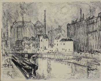
Joseph Pennell (American 1857-1926) Lithograph 'Charleroi Evening' SignedGlobal Auctions Company4.3(36)See Sold PriceMar 03, 2024
Joseph Hirsch (American 1910-1981) Lithograph, The Brief 1946 Ltd Edition 250Global Auctions Company4.3(36)See Sold PriceMar 03, 2024
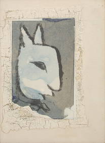
Joseph Cornell (American, 1903-1972) - The Commodore PoseFreeman's | Hindman4.5(158)See Sold PriceFeb 27, 2024
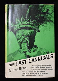
THE LAST CANNIBALS by JENS BJERRE 1957 Fine or Near FineNorth American Artifact Auctions4.7(198)See Sold PriceApr 20, 2024
Howard Joseph Brodie 1949 Litho Chinatown New York CityConcept Art Gallery4.7(510)See Sold PriceMar 06, 2024
Joseph Grippi Blue and Tan Landscape 1988 Signed ScreenprintConcept Art Gallery4.7(510)See Sold PriceMar 06, 2024
Joseph Grippi Purple Geometric 1973 Signed SerigraphConcept Art Gallery4.7(510)See Sold PriceMar 06, 2024
Joseph Grippi Red Circles Signed Screenprint 1970Concept Art Gallery4.7(510)See Sold PriceMar 06, 2024
AMERICAN OP ART SILKSCREEN BY RICHARD ANUSZKIEWICZAntique Arena Inc.4.5(878)See Sold PriceMar 02, 2024
Native American Archaic / Woodland Projectile PointsArtemis Fine Arts4.8(1.4k)See Sold PriceFeb 26, 2024
Jacques Soulas (French/New Orleans, b. 1957), "Still Life with 'Eight Oranges' in Tissue," 1994, H.-Crescent City Auction Gallery4.3(231)See Sold PriceMar 09, 2024
Joseph D. PURCELL, N.S.A. (1927 - 2015) CanadianPridham's Auctions & Appraisals4.7(223)See Sold PriceMar 02, 2024
Joseph Crilley (American 1920-2008) "Cans" Still Life Oil Painting on CanvasMarket Auctions4.5(136)See Sold PriceMar 06, 2024
Joseph Raffael (American, B. 1933) Lithograph in Colors on Wove Paper, 1979, "New Lily", H 24" W 30"DuMouchelles4.6(830)See Sold PriceMar 15, 2024


![Various Cartographer Maps [South America] (1 of 4)](https://p1.liveauctioneers.com/5755/162895/82236700_1_x.jpg?height=282&quality=70&version=1582932540)
![Colton/Johnston, Blackwood Maps [South America] (1 of 7)](https://p1.liveauctioneers.com/5755/162895/82236698_1_x.jpg?height=282&quality=70&version=1582932540)
![J. H. Colton Maps [South America] (1 of 6)](https://p1.liveauctioneers.com/5755/162895/82236697_1_x.jpg?height=282&quality=70&version=1582932540)
![J. H. Colton Maps [South America] (1 of 5)](https://p1.liveauctioneers.com/5755/162895/82236699_1_x.jpg?height=282&quality=70&version=1582932540)