1952 MAY, J.F.K. HANDWRITTEN LETTER & ENVELOPEJohn McInnis Auctioneers,LLC4.6(502)See Sold PriceFeb 25, 2024
WARNER BECKMAN'S TIGER MAPLE CELLO / SEABROOK NHJohn McInnis Auctioneers,LLC4.6(502)See Sold PriceFeb 25, 2024
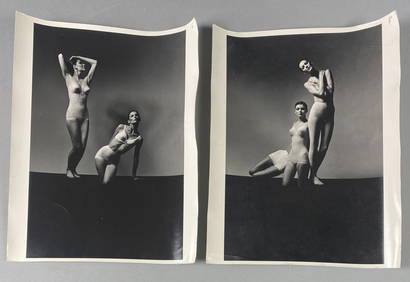
Victor Skrebneski Lingerie Fashion PhotographsEpic Auctions and Estate Sales4.6(204)See Sold PriceMar 02, 2024
[DOUGLASS, Frederick (1818-1895)]. ROBERTS, J.B., photographer. CDV of Frederick Douglass.Freeman's | Hindman4.4(1.6k)See Sold PriceFeb 27, 2024
1952 J.F.K. for SENATE TEAS & RECEPTION MATERIALJohn McInnis Auctioneers,LLC4.6(502)See Sold PriceFeb 25, 2024
HUGH D. AUCHINCLOSS' 70th BIRTHDAY with FAMILYJohn McInnis Auctioneers,LLC4.6(502)See Sold PriceFeb 25, 2024
CAROLINE KENNEDY at BAILEYS BEACH, NEWPORT, RIJohn McInnis Auctioneers,LLC4.6(502)See Sold PriceFeb 25, 2024
WILLIAM LINSMAN PHOTO SIGNED by JACKIE KENNEDYJohn McInnis Auctioneers,LLC4.6(502)See Sold PriceFeb 25, 2024
SoldJohnson's Map [China]Johnson's 'China' map, circa 1860's. Alvin Jewett Johnson Cartographer. Published by A. J. Johnson, New York. Detailed map. Minor stain in upper right margin. Chronological History of the Great RebellSee Sold Price
SoldJohnson: Antique Map of China, 1863Title/Content of Map: 1863 Johnson Map of China -- Johnson's China Date Printed: 1863, New York Cartographer: A Johnson Size: 12.5 x 15.5 in. A very nice and highly detailed map of China. The provinceSee Sold Price
SoldJohnson: Antique Map of China, 1863Map: 1863 Johnson Map of China -- Johnson's China Cartographer: A Johnson Year / Place: 1863, New York Map Dimensions: 12.5 x 15.5 in. Condition: Very Good. Slight age toning, Slight marginal foxing,See Sold Price
Johnson: Antique Map of China, 1863Title/Content of Map: 1863 Johnson Map of China -- Johnson's China Date Printed: 1863, New York Cartographer: A Johnson Size: 12.5 x 15.5 in. A very nice and highly detailed map of China. The provinceSee Sold Price
SoldJohnson & Ward: Map of China, 1860Map: China Maker: Johnson & Ward Date: 1860 Origin: New York Size: 12.75 x 15.25 inches This excellent map of China with insets of Amoy and Canton of the lower part of British India is very detailed wSee Sold Price
SoldJohnson Browning: Map of China, 1860Title: Map of China by Johnson Browning Date: 1860 Dimensions: 17.5 x 15 Medium: Hand Colored Lithograph Please note that this lot has a confidential reserve. When you leave a bid in advance of the auSee Sold Price
SoldJohnson: Antique Map of China, 1868Map: Johnson's China Date Printed: 1868 Cartographer: A.J. Johnson Material/Medium: Paper Size: 18" x 13 1/3" Condition: Excellent Hand colored, copperplate engraved. Published in New York. From JohnsSee Sold Price
SoldMitchell: Antique Map of Palestine, 18481861 Johnson’s China. Lovely map of China with original hand coloring. Features two insets: Harbor & Island of Amoy, and Map of Canton and Adjacent Islands. Very clean with good impression. From theSee Sold Price
Sold(18) 19th Century Johnson's & London News MapsTo include Johnson's hand colored maps of China, Palestine, France, Holland, Belgium, Roman Empire, South America, Turkey & Arabia, New Brunswick & Newfoundland, Australia, Brazil, Agentine, ParaguaySee Sold Price
SoldMap of China & Japan, 1868Original engraving from Johnson's Atlas of the World, 1868. Map includes vignette of Canton and details cities, towns and territories. Dimensions: 18" x 26". This item ships from Ocean View, DE.See Sold Price
Sold1858 Map of ChinaAuthor: Johnson Title: 1858 Map of China Medium: Ink on Paper Dimensions: 18.5"X14" Map of China dated 1858. Engraved by A.J. Johnson. Published by Johnson and Browning in New York. Key located upperSee Sold Price
Sold18th Century British Map Of China.Published by J. Johnson, London 1791. Size 17 -1/2" x 14 -1/2".See Sold Price
Sold1865 Map of ChinaAuthor: Johnson Title: 1865 Map of China Medium: Ink on Paper Dimensions: 17.5"X13.5" Map of China dated 1864. Engraved by A.J.Johnson. Published by Johnson and Ward in New York. Map key located upperSee Sold Price
1858 Map of ChinaAuthor: Johnson Title: 1858 Map of China Materials: Ink on Paper Dimensions: 18.5"X14" Description: Map of China dated 1858. Engraved by A.J. Johnson. Published by Johnson and Browning in New York. MaSee Sold Price
SoldSET OF FIVE MAP OF CHINAA.J.Johnson, New York 1862, #97. Colton's China, New York, 1855, #28. Colton's Asian, New York, 1856 #24. Cowperthwait's China, Pennsylvania, 1850, #70. S.G. Goodrish, Massassachusetts 1841, #50. thesSee Sold Price
1858 Map of ChinaAuthor: Johnson Title: 1858 Map of China Medium: Ink on Paper Dimensions: 18.5"X14" Map of China dated 1858. Engraved by A.J. Johnson. Published by Johnson and Browning in New York. Map key located upSee Sold Price
Sold1858 Map of ChinaAuthor: Johnson Title: 1858 Map of China Medium: Ink on Paper Dimensions: 18.5"X14" Map of China dated 1858. Engraved by A.J. Johnson. Published by Johnson and Browning in New York. Map key located upSee Sold Price
Sold4 Hand-Colored Copper Engraved Maps of China and Japan(Lot of 4) Hand-Colored Copper Engraved Maps including; "China," c. 1840, published by William Darton at the Repository of Genius, (London, UK), "Johnson's China," by Johnson and Ward, "China and JapaSee Sold Price
SoldGroup of twelve framed maps to include Africa,Group of twelve framed maps to include Africa, Johnson's Russia, Mississippi, Arkansas, Ohio, Missouri, Kentucky, Africa, Asia, Asia, Greece, and China. 11 1/4" x 13 1/2" to 14" x 16 3/4" Provenance:See Sold Price
Sold3 Asian mapsJohnson, Alvin- 3 hand-colored maps, 1862- ''Japan- Nippon, Kiusiu, Sikok, Yesso and the Japanese Kuriles''; ''Asia''; and ''China''- paper has some age toning, minor tears around edges. 14 x 18''See Sold Price
Sold1781 Jesuit Voyage Missions MAP China Peking Philippine1781 Jesuit Voyage Missions MAP China Peking Philippines ASIA Lettres Edifiantes The ‘Lettres Edifiantes et Curieuses’ is a collection of reports and letters from Jesuit missions from around the wSee Sold Price
Sold1859 INDIA 1ed History Indian Revolt Sepoy Mutiny Voyages MAP China Illustrated1859 INDIA 1ed History Indian Revolt Sepoy Mutiny Voyages MAP China Illustrated George Dodds “History of the Indian Revolt” is a rare account of the Indian Rebellion of 1857, or more commoSee Sold Price
Johnson's Map of New York and Adjacent CitiesJohnson & Ward, Johnson, A.J., 1863, Double Folio – 15.30 H x 24.70 W Inches, City plan naming streets, squares, parks, railroads etc. Decorative border. Inset: continuation of N.Y.C. north. PleaseSee Sold Price
SoldJohnson Map of Florida, 18631863 Johnson Map of Florida -- Johnson's Florida. A nice Johnson map of Florida, showing only 37 counties in the state. The majority of development is in the north with no mention of St. Petersburg orSee Sold Price
2 Retired Friendly Village Bread & Butter Plates JB ARapid Estate Liquidators and Auction Gallery4.5(1.1k)See Sold PriceFeb 25, 2024
2 Retired Friendly Village Cereal Bowls JB BRapid Estate Liquidators and Auction Gallery4.5(1.1k)See Sold PriceFeb 25, 2024
2 Retired Friendly Village Mugs JB ARapid Estate Liquidators and Auction Gallery4.5(1.1k)See Sold PriceFeb 25, 2024
Retired Friendly Village Sugar Bowl & CreamerRapid Estate Liquidators and Auction Gallery4.5(1.1k)See Sold PriceFeb 25, 2024
Covered Bridge Friendly Village Glassware GobletRapid Estate Liquidators and Auction Gallery4.5(1.1k)See Sold PriceFeb 25, 2024
2 Retired Friendly Village Bread & Butter Plates JB BRapid Estate Liquidators and Auction Gallery4.5(1.1k)See Sold PriceMar 02, 2024
![Johnson's Map [China] First Image](https://p1.liveauctioneers.com/5755/162895/82236270_1_x.jpg?height=282&quality=95&version=1582932540&width=282)
![Johnson's Map [China] First Image](https://p1.liveauctioneers.com/5755/162895/82236270_1_x.jpg?height=282&quality=1&version=1582932540&width=282)


![[DOUGLASS, Frederick (1818-1895)]. ROBERTS, J.B., photographer. CDV of Frederick Douglass. (1 of 2)](https://p1.liveauctioneers.com/197/319238/171467829_1_x.jpg?height=282&quality=70&version=1707520367)


![Johnson's Map [China] (1 of 3)](https://p1.liveauctioneers.com/5755/162895/82236270_1_x.jpg?height=282&quality=70&version=1582932540)


