Chaim Soutine (Belarusian/French, 1893-1943) - La Petite Fille dans la VerdureFreeman's | Hindman4.5(158)See Sold PriceFeb 27, 2024
Elisabeth Frink (British, 1930-1993) - Harbinger Bird IFreeman's | Hindman4.5(158)See Sold PriceFeb 27, 2024
AMERICAN SEASCAPE PAINTING BY ROSS EMBROSE MOFFETTAntique Arena Inc.4.5(866)See Sold PriceMar 02, 2024
CHARLES HENRY GIFFORD (Massachusetts, 1839-1904), Luminist view of three sailboats in a quietEldred's4.7(418)See Sold PriceFeb 28, 2024
RARE MANHATTAN PROJECT GLASS LEADED FROM THE MANHATTAN PROJECT WORLD WAR II WW2 724 GRAMSCol. Christie Hatman Auctioneers4.5(323)See Sold PriceFeb 26, 2024
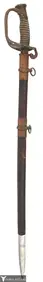
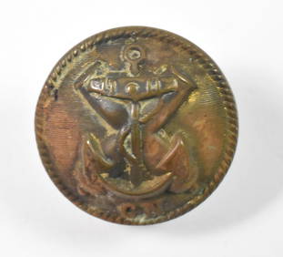
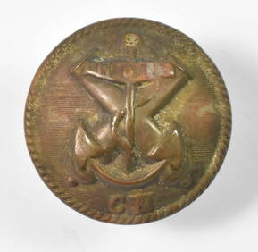
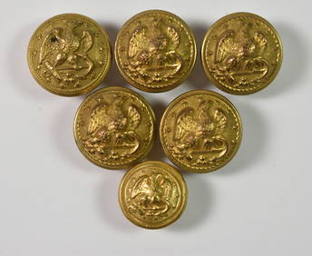
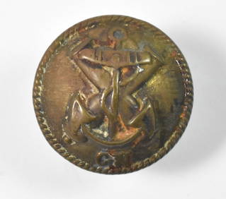
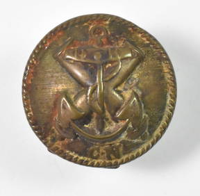
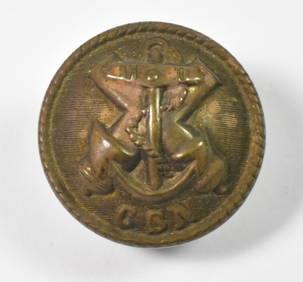
Estate Fresh Civil War Cavalry C. Roby 1863 With ScabbardRalph Fontaine Heritage Auctions Inc.4.7(234)See Sold PriceFeb 25, 2024
ABSTRACT ARAB LEBANESE OIL PAINTING BY ETEL ADNANAntique Arena Inc.4.5(866)See Sold PriceMar 02, 2024
SoldJohnson's Civil War era Atlas 1861Heading: Author: Johnson, A. J. & J. H. Colton Title: Johnson's New Illustrated (Steel Plate) Family Atlas, with descriptions, geographical, statistical, and historical Place Published: New York PublSee Sold Price
SoldJohnson's 1861 Family Atlas, Civil War eraHeading: Author: Johnson, A.J. & A.H. Colton Title: Johnson's New Illustrated (Steel Plate) Family Atlas, with descriptions, geographical, statistical, and historical... Place Published: New York PubSee Sold Price
SoldEarly Civil War era map of AmericaNice example of A. J. Johnson's 1862 map of North America. Presents a fascinating snapshot of North America just after the outbreak of the American Civil War. States generally follow the 1861 configurSee Sold Price
SoldJohnson's Civil War era Atlas 1862Heading: Author: Johnson, A. J. & J. H. Colton Title: Johnson's New Illustrated (Steel Plate) Family Atlas, with descriptions, geographical, statistical, and historical Place Published: New York PublSee Sold Price
SoldJohnson's Civil War era Atlas 1862Title: Johnson's New Illustrated (Steel Plate) Family Atlas, with descriptions, geographical, statistical, and historical Author: Johnson, A. J. and J. H. Colton Description: 99 text pages + plates. WSee Sold Price
SoldJohnson's Civil War era Atlas 1862Title: Johnson's New Illustrated (Steel Plate) Family Atlas, with descriptions, geographical, statistical, and historical Author: Johnson, A. J. and J. H. Colton Description: 99 text pages + plates. WSee Sold Price
Johnson's Civil War era Atlas 1862Title: Johnson's New Illustrated (Steel Plate) Family Atlas, with descriptions, geographical, statistical, and historical Author: Johnson, A. J. and J. H. Colton Description: 99 text pages + plates. WSee Sold Price
SoldJohnson's Civil War era Family Atlas, 1863Heading: (Maps & Atlases) Author: Johnson, A.J. Title: Johnson's New Illustrated (Steel Plate) Family Atlas, With Physical Geography, and with Descriptions Geographical, Statistical, and Historical, ISee Sold Price
SoldA CIVIL WAR ERA ATLAS, "Johnson's New IllustratedA CIVIL WAR ERA ATLAS, "Johnson's New Illustrated Family Atlas of the World with Descriptions," NEW YORK, 1863, colored lithograph on paper, retaining name plate, "Geo. Shumaker."  ProvSee Sold Price
SoldCivil War era Johnson's Family Atlas, 1864Heading: Author: Johnson, A. J. and J. H. Colton Title: Johnson's New Illustrated (Steel Plate) Family Atlas, with Physical Geography, and with Descriptions, Geographical, Statistical, and HistoricalSee Sold Price
SoldJohnson's North AmericaReserve Reduced! Title: Johnson's North America Publication Date: 1862 Cartographer: JOHNSON, ALVIN JEWETT Publisher: JOHNSON AND WARD Size: 21 x 16 The entire continent from a Civil War era atlas. ShSee Sold Price
Johnson's Missouri and KansasPublication Date: 1865 Title: Johnson's Missouri and Kansas Cartographer: JOHNSON, A.J. Publisher: A.J. Johnson Height: 15.7 Width: 21.9 Civil War era atlas map that shows counties, roads and railroadSee Sold Price
Johnson's Missouri and KansasPublication Date: 1865 Title: Johnson's Missouri and Kansas Cartographer: JOHNSON, A.J. Publisher: A.J. Johnson Height: 15.7 Width: 21.9 Civil War era atlas map that shows counties, roads and railroadSee Sold Price
Johnson: Civil War Era Map of North & South CarolinaJohnson’s Civil War era map of North & South Carolina. Historic map shows the Carolinas in great detail shortly following the outbreak of the Civil War. States hand-colored at the time of publishingSee Sold Price
SoldJohnson’s Civil War era map of North & South CarolinaHistoric map shows the Carolinas in great detail shortly following the outbreak of the Civil War. States hand-colored at the time of publishing with color coding according to county. Inset map depictsSee Sold Price
[World in Hemispheres]Title: [World in Hemispheres] Publication Date: 1862 Cartographer:JOHNSON, ALVIN JEWETT Publisher: JOHNSON AND WARD Brief Description: Eastern and Western hemispheres from a Civil War era atlas. BrownSee Sold Price
Johnson's IllinoisPublication Date: 1862 Title: Johnson's Illinois Cartographer: JOHNSON, ALVIN JEWETT Publisher: JOHNSON AND WARD Civil War era state map with railroaeds, major roads, many place names. With view of orSee Sold Price
SoldCivil War Scenes from Vintage MagazinesIncluding Feb 16, 1861 Civil war Era (St. Valentines), Sept 15 1866 (President Johnson), September 21, 1861 (The Army Forge), and October 14, 1899 (Frederick Remington) , and additional post civil warSee Sold Price
SoldFour Harpers Weekly's & Add. PagesIncluding Feb 16, 1861 Civil war Era (St. Valentines), Sept 15 1866 (President Johnson), September 21, 1861 (The Army Forge), and October 14, 1899 (Frederick Remington) , and additional post civil warSee Sold Price
SoldA CIVIL WAR ERA ANTIQUE MAP, "Johnson's New Map of theA CIVIL WAR ERA ANTIQUE MAP, "Johnson's New Map of the State Of Texas," NEW YORK, 1860-1863, hand colored engraving on paper, page fragments from an atlas, plates no. 43-44, with inset plans of "SabinSee Sold Price
Sold1862 Map Of North AmericaDouble page map, pages 15 and 16, of North America from the "American Atlas" by johnson and Ward, published in 1862. Civil War era map that shows Alaska as Russion Processions and the Nebraska panhandSee Sold Price
SoldCIVIL WAR MAP SAVANNAH CHARLESTON COASTOriginal 1861-1865 Civil War Map of South Carolina & Georgia. This original Julius Bien Civil War-era map (plate CXLIV) serves as The Atlas to Accompany the Official Records of the Union and ConfederaSee Sold Price
Civil War era RR map of Florida by Johnson & WardNice early railroad map of Florida, vividly hand colored by county, with a large inset of the Florida Keys. Dated 1863 and from an 1866 Johnson’s atlas. Curiously, Miami was located on earlier JSee Sold Price
Civil War Era Map, c.1860c. 1860, JOHNSON'S, ARKANSAS, MISSISSIPPI AND LOUISIANA, by Johnson and Ward, (New York), Choice Very Fine. 24.25" x 17.25", colored, disbound from an atlas with original hinge present and text on verSee Sold Price
African American History, Civil War Plantation SlavesConnoisseur Auctions3.9(335)See Sold PriceMar 02, 2024
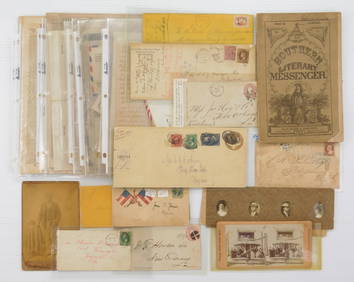
[CIVIL WAR ERA]. [RAILROADIANA]. Atlantic and Great Western...Potter & Potter Auctions4.6(544)See Sold PriceMar 07, 2024
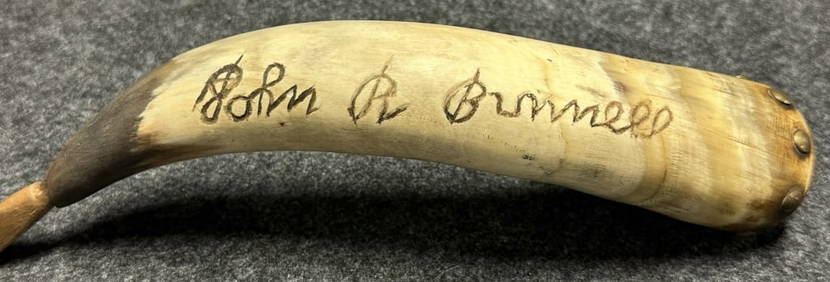
Antique John R Bunnell 189th New York Infantry Carved Civil War Era Powder HornHoller and Hammer4.5(57)See Sold PriceFeb 24, 2024
1863-65 Civil War era handwritten diary of young ne Ohio womanJasper524.5(9.8k)See Sold PriceFeb 27, 2024
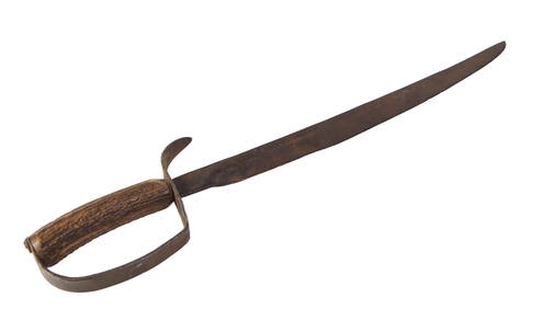
Civil War Era Short Sword, 19th c., H.- 20 1/4 in., W.- 4 in., D.- 1 in.Crescent City Auction Gallery4.3(231)See Sold PriceMar 08, 2024
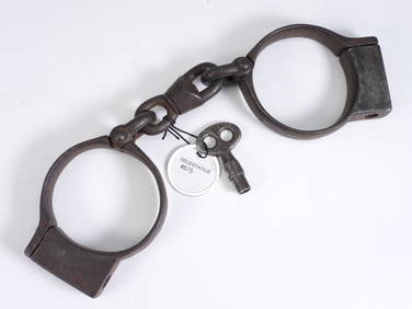
Delestatius Civil War Era Police HandcuffsBruneau & Co. Auctioneers4.5(491)See Sold PriceMar 18, 2024
Jefferson Davis Signed Civil War-Era Document CutDalshire International4.6(2.3k)See Sold PriceFeb 29, 2024
2 Pair Civil War Era Amber Sharpshooter SpectaclesTom Hall Auctions Inc.4.4(113)See Sold PriceMar 04, 2024


![[Tintype] Massive Bowie knife (1 of 1)](https://p1.liveauctioneers.com/7226/317626/170485482_1_x.jpg?height=282&quality=70&version=1706368022)
![[Ambrotype] Magnificent Portrait (1 of 1)](https://p1.liveauctioneers.com/7226/317626/170485477_1_x.jpg?height=282&quality=70&version=1706368022)


![[Tintype] Native American Man w/ Knife (1 of 2)](https://p1.liveauctioneers.com/7226/317626/170485453_1_x.jpg?height=282&quality=70&version=1706368022)
![[REES, Charles] Enlistedman w/ Bowie Knife (1 of 1)](https://p1.liveauctioneers.com/7226/317626/170485489_1_x.jpg?height=282&quality=70&version=1706368022)
![[Ambrotype] Wounded at Gettysburg (1 of 1)](https://p1.liveauctioneers.com/7226/317626/170485471_1_x.jpg?height=282&quality=70&version=1706368022)


![[Ambrotype] Young Soldier w/ Bowie Knife (1 of 1)](https://p1.liveauctioneers.com/7226/317626/170485459_1_x.jpg?height=282&quality=70&version=1706368022)

![[Daguerreotype] Soldier w/ Bowie Knife (1 of 2)](https://p1.liveauctioneers.com/7226/317626/170485458_1_x.jpg?height=282&quality=70&version=1706368022)
![[Tintype] Soldier w/ Flowers (1 of 1)](https://p1.liveauctioneers.com/7226/317626/170485495_1_x.jpg?height=282&quality=70&version=1706368022)
![[Tintype] Identified North Carolina Infantryman (1 of 2)](https://p1.liveauctioneers.com/7226/317626/170485474_1_x.jpg?height=282&quality=70&version=1706368022)


![[World in Hemispheres] (1 of 1)](https://p1.liveauctioneers.com/5584/195010/98380642_1_x.jpg?height=282&quality=70&version=1614121450)


![[CIVIL WAR ERA]. [RAILROADIANA]. Atlantic and Great Western... (1 of 2)](https://p1.liveauctioneers.com/928/318880/171360952_1_x.jpg?height=282&quality=70&version=1707501302)