ETRO Margot 1C362-2735 Mini Boston Bag Leather Wine Red LadiesBidhaus4.3(762)See Sold PriceFeb 26, 2024
SoldJohn Farmer, "Map of the Surveyed Part of Michigan"John Farmer, "Map of the Surveyed Part of Michigan" (J.H. Colton, New York 1837); While this map was originally published by John Farmer in Detroit 1836, this printing is possibly the first of MichigaSee Sold Price
Farmer, Map of the Surveyed Part of Michigan.FARMER, John (1798-1859). Map of the Surveyed Part of Michigan. New-York: J. H. Colton & Co., 1837. Engraved, original hand color in full. Float mounted and framed. Framed: 33 x 43 1/8 inches. Sheet sSee Sold Price
SoldMap of the Surveyed Part of MichiganJohn Farmer. Engraved pocket map. New York: J.H. Colton & Co., 1837. 23 1/2 x 33 1/2 inche sheet, 33 x 43 inches framed. This is a rare early map of Michigan shortly before it was admitted to the UnioSee Sold Price
SoldAN 1811 UNITED STATES MAP BY JOHN CARYA New Map of Part of the United States of North America Exhibiting the Western Territory, Kentucky, Pennsylvania, Maryland, Virginia & c. also the Lakes Superior Michigan Huron Ontario & Erie with UppSee Sold Price
SoldTallis, John (Pub) 1852 Map. Part of South AustraliaSteel Engraved Map with Original Outline Hand Color Published 1852-56 by John Tallis, London for "The Universal Pronouncing Dictionary" by Thomas Wright. Drawn & Engraved by John Rapkin. Centre fold aSee Sold Price
SoldJohn Tallis & Co Map 'Part of South Australia.' CJohn Tallis & Co Map 'Part of South Australia.' Coloured engravings of Adelaide, natives, dog & state seal. 35x27cmSee Sold Price
SoldThe Dakotas. Silas Chapman (1813-1899) Sectional MThe Dakotas. Silas Chapman (1813-1899) Sectional Map of the Surveyed Part of Dakota. Milwaukee: engraved by J. Knauber, 1872. Large folded hand-colored map printed by a steam powered lithographic prinSee Sold Price
Sold1835 MAP OF WISCONSIN W/INDIAN MOUNTSEntitled “Map of the surveyed part of Wisconsin Territory: compiled from public surveys as returned to the Surveyor General's Office,” 17.5” x 23”.See Sold Price
Sold(MINNESOTA) CHAPMAN, SILAS. Chapman's Sectional Ma(MINNESOTA) CHAPMAN, SILAS Chapman's Sectional Map of the Surveyed Part of Minnesota. Milwaukee: Silas Chapman, 1871. Color lithograph folding pocket map of Minnesota, folded into original limp maroonSee Sold Price
SoldAntique Surey Map of Wisconsin Territory"Map of the Surveyed part of Wisconsin Territory Compiled from Public Surveys as returned to the Surveyor General Office". Inset map of private claims at Green Bay. Index key lower left. Southwest corSee Sold Price
SoldSaudi Arabia.- Murray (John) Map of the Northern PartSaudi Arabia.- Murray (John) Map of the Northern Part of Arabia Shewing the Routes of Mr. G.A. Wallin, engraved map by J. & C. Walker, with hand-colouring, 217 x 250 mm. (8 1/2 x 9 7/8 in), central veSee Sold Price
SoldCARY, JOHN. A New Map of Part of the United StCARY, JOHN. A New Map of Part of the United States of North America, exhibiting the Western Territory, Kentucky, Pennsylvania, Maryland, Virginia &c. Double-page engraved map, 520x600 mm, wide marginsSee Sold Price
Sold* GARDINER, John. Map of the Northern part of Missouri* GARDINER, John. Map of the Northern part of Missouri Territory. Washington, D. C.: John Gardiner, [1817?] Engraved map, image 398 x 468 mm (sheet 463 x 570 mm). FIRST EDITION, "PERHAPS THE FIRST PRISee Sold Price
SoldCARY, JOHN. A New Map of Part of the United States ofCARY, JOHN. A New Map of Part of the United States of North America, Exhibiting the Western Territory, Kentucky, Pennsylvania, Maryland, Virginia &c. Double-page engraved map of the Great Lakes and WeSee Sold Price
SoldCARY, JOHN. A New Map of Part of the United StCARY, JOHN. A New Map of Part of the United States of North America. Engraved map, 510x575 mm, wide margins; hand-colored; minor scattered soiling. London, 1806 New York, Vermont, New Hampshire, MassaSee Sold Price
SoldJohn Cary, 1805, Map of Part of United States"A New Map of Part of the United States of North America", by John Cary, engraver, 1805, 18 1/2" x 20", sold by Goodspeeds of Boston.See Sold Price
Cary (John) - A New Map of Part of the United States offrom New Brunswick to North Carolina, engraved map with original hand-colouring in outline, 520 x 580mm., central vertical fold, some faint offsetting, 1806.See Sold Price
DAVID H. BURR - MAP OF MICHIGAN & PART OF WISCONSINDavid H. Burr - Map Of Michigan & Part Of Wisconsin Territory, 1839 - 40 X 29 1/2 In. - This Giclée Print Is Gallery Stretched And Ready To Hang Or Lean Against A Wall, Or Display On An Easel. - A GiSee Sold Price
David H. Burr - Map Of Michigan & Part Of WisconsinDavid H. Burr - Map Of Michigan & Part Of Wisconsin Territory, 1839 Size: 36 X 26 5/8 In. - This Is A Gallery Stretched Giclee Print On Canvas. The Piece Was Printed On High Quality Artist Grade 350 GSee Sold Price
MAP OF MICHIGAN & PART OF WISCONSIN TERRITORY, 1839 …David H. Burr - Map Of Michigan & Part Of Wisconsin Territory, 1839 - 30 X 22 1/8 In. - This Giclée Print Is Gallery Stretched And Ready To Hang Or Lean Against A Wall, Or Display On An Easel. - A GiSee Sold Price
DAVID H. BURR - MAP OF MICHIGAN & PART OF WISCONSINDavid H. Burr - Map Of Michigan & Part Of Wisconsin Territory, 1839 - 36 X 26 5/8 In. - This Giclée Print Is Gallery Stretched And Ready To Hang Or Lean Against A Wall, Or Display On An Easel. - A GiSee Sold Price
DAVID H. BURR - MAP OF MICHIGAN & PART OF WISCONDavid H. Burr - Map Of Michigan & Part Of Wisconsin Territory, 1839 - Giclée On Canvas - 44 X 32 1/2 In. A Giclée Print Is The Highest Quality Print Available Today. Because There Is No Visible DotSee Sold Price
David H. Burr - Map Of Michigan & Part Of WisconsinDavid H. Burr - Map Of Michigan & Part Of Wisconsin Territory, 1839 - 40 X 29 1/2 In. - Giclée On Canvas - Museum Wrapped - Large Piece Of Art - This Piece Is Ready To Hang On Your WallSee Sold Price
DAVID H. BURR -MAP OF MICHIGAN & PART OF WISCONSINDavid H. Burr -map Of Michigan & Part Of Wisconsin Territory, 1839 - Giclée On Canvas -44 X 32 1/2 In. - A Giclée Print Is The Highest Quality Print Available Today. Because There Is No Visible DotSee Sold Price
Michigan Southern and Northern Indiana RR 14th Annual Report-February 28, 1869JM Hobby Supply and Railroad Artifact Auctions4.4(127)See Sold PriceFeb 24, 2024
18TH C. ANTIQUE MAP: FRENCH & INDIAN WAR, FRAMEDThomaston Place Auction Galleries4.4(393)See Sold PriceFeb 24, 2024
Numismatic Books - Fowles & Legg - John Aubrey's Monumenta Britannica, Part I & IITimeLine Auctions Ltd.4.6(183)See Sold PriceMar 09, 2024
Numismatic Books - Fowles & Legg - John Aubrey's Monumenta Britannica, Part III and IndexTimeLine Auctions Ltd.4.6(183)See Sold PriceMar 09, 2024
Hand Colored Map of the city of Amsterdam 1720Global Auctions Company4.3(36)See Sold PriceMar 03, 2024
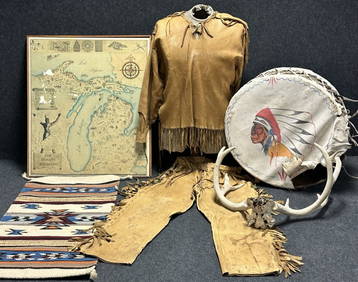
Antique Native American 5 Piece Lot: Deerskin Jacket & Pants, Rug, Drum, Michigan Map & Mule DeerHoller and Hammer4.6(64)See Sold PriceFeb 24, 2024
Audubon, Imperial Folio - 4 Lithographs of Squirrel, Rat, MiceTrillium Antique Prints & Rare Books4.5(32)See Sold PriceFeb 24, 2024
Audubon, Imperial Folio - American Cross Fox. 6Trillium Antique Prints & Rare Books4.5(32)See Sold PriceFeb 24, 2024
Audubon, Imperial Folio - Canada Lynx. 16Trillium Antique Prints & Rare Books4.5(32)See Sold PriceFeb 24, 2024
Map: A 19thC engraved map of West Riding, titled A Map of the North Part of the West Riding ofClaydon Auctioneers Ltd4.3(125)See Sold PriceFeb 26, 2024
1675 Horae Hebraicae et Talmudicae by John Lightfoot antique JUDAICAJasper524.5(9.9k)See Sold PriceFeb 27, 2024
1738 RUSSIA SIBERIA & GREAT TARTARY Description illustrated ANTIQUE in ENGLISHJasper524.5(9.9k)See Sold PriceFeb 27, 2024
Ireland.- Smedley (Edward) Erin. A Georgraphical and Descriptive Poem, 2 parts in 1, first edition,Forum Auctions4.3(53)See Sold PriceFeb 29, 2024
Herman Moll A New Map of Ye North Parts of AmericaWillow Auction House4.5(289)See Sold PriceMar 14, 2024