John Cary: Austria 1819Map: Austria Maker: John Cary Publishing: John Cary, London Date: 1819 Size: 9 x 11.2 inches (230 x 282mm) Medium: Hand colored engraving From Cary's New Universal Atlas John Cary (1754-1835) was an ESee Sold Price
Maps - Engraved by T Jeffreys and hand coloured,Maps - Engraved by T Jeffreys and hand coloured, comprises Poland, Lithuania and Prussia; South America; and England and Wales; and an unframed map of Africa, engraved by John Cary, 1819, 58 x 53cm, oSee Sold Price
SoldTwo Framed MapsFramed 1819 map of Asia, London, printed for John Cary 1819 along with a later 19th C "Geographical, Statistacisl, and Historical Map of Rhode Island, both approximately 17" x 21"See Sold Price
Maps - Engraved by T Jeffreys and hand coloured,Maps - Engraved by T Jeffreys and hand coloured, comprises Poland, Lithuania and Prussia; South America; and England and Wales; and an unframed map of Africa, engraved by John Cary, 1819, 58 x 53cm, oSee Sold Price
SoldJohn Cary: Portugal 1819Map: Portugal Maker: John Cary Publishing: John Cary, London Date: 1819 Size: 11 x 8.9 inches (280 x 225mm) Medium: Hand colored engraving From Cary's New Universal Atlas John Cary (1754-1835) was anSee Sold Price
SoldUS Map and Book Plate MapUS Map and Book Plate Map. A New Map of Part of the United States by John Cary; c. 1819; Some foxing and toning; 21" x 23". Small Book Plate Map of North America; London: published by G. Virtue; 13" xSee Sold Price
SoldJohn Cary U.S. map,"A New Map of Part of the United States of North America, containing the Carolinas and Georgia also the Floridas…", published by John Cary, London, 1819, copper plate engraving, hand colored, centerSee Sold Price
John Cary: Germany, Divided into Circles 1819Map: Germany, Divided into Circles Maker: John Cary Publishing: John Cary, London Date: 1819 Size: 9 x 11.2 inches (230 x 282mm) Medium: Hand colored engraving From Cary's New Universal Atlas John CarSee Sold Price
A CARY MAP OF CHINA 1819.B019.A CARY MAP OF CHINA 1819.B019. Description Author: Cary, John Title: A New Map of China, from the Latest Authorities Place Published: London Publisher: Date Published: 1819 Description: Copper-engraveSee Sold Price
A CARY MAP OF CHINA 1819.B019.A CARY MAP OF CHINA 1819.B019. Description Author: Cary, John Title: A New Map of China, from the Latest Authorities Place Published: London Publisher: Date Published: 1819 Description: Copper-engraveSee Sold Price
A CARY MAP OF CHINA 1819.B019.A CARY MAP OF CHINA 1819.B019. Description Author: Cary, John Title: A New Map of China, from the Latest Authorities Place Published: London Publisher: Date Published: 1819 Description: Copper-engraveSee Sold Price
SoldA CARY MAP OF CHINA 1819.B019.A CARY MAP OF CHINA 1819.B019. Description Author: Cary, John Title: A New Map of China, from the Latest Authorities Place Published: London Publisher: Date Published: 1819 Description: Copper-engraveSee Sold Price
A CARY MAP OF CHINA 1819.B019.A CARY MAP OF CHINA 1819.B019. Description Author: Cary, John Title: A New Map of China, from the Latest Authorities Place Published: London Publisher: Date Published: 1819 Description: Copper-engraveSee Sold Price
19th C. European Maps - Austria, Saxony, HollandTHREE ANTIQUE EUROPEAN MAPS including: (1) John Cary (British, 1754-1835). "A New Map of the Circle of Austria, from the Latest Authorities." London, 1801. An attractive 1801 map of Austria by BritishSee Sold Price
SoldCary (J) A New Map of the Circle of AustriaCary (John) A New Map of the Circle of Austria,Austria and environs, engraved map with original hand-colouring, 460 x 515mm., central vertical fold, slightly discoloured, one or 2 minor marginSee Sold Price
SoldJohn Cary Travel Celestial Globe in Box marked Cary &John Cary Travel Celestial Globe in Boxmarked Cary & Co., London, No. 21540having George Lee & Son Optical and Nautical Instrument, established 1847, label on inside of the boxalso handwritten on insiSee Sold Price
SoldAN 1811 UNITED STATES MAP BY JOHN CARYA New Map of Part of the United States of North America Exhibiting the Western Territory, Kentucky, Pennsylvania, Maryland, Virginia & c. also the Lakes Superior Michigan Huron Ontario & Erie with UppSee Sold Price
John Cary: Map of the Middle States, 1806Map: Middle States Maker: John Cary Date: 1806 Size: 30 x 30 inches Medium: Original copperplate engraving John Cary (1754-1835) was an English cartographer who is known for his maps, globes, and hisSee Sold Price
SoldJOHN CARY 1799 MAP OF IRELANDHand colored engraving. Dimensions: (Paper) H 20" x W 26" Condition: Toning and wrinkles. With center fold and small worm holes.See Sold Price
Sold"A New Map of North America" by John Cary, 1806John Cary (English, 1754-1835). An engraved map with hand coloring by famed cartographer John Cary, whose maps of North America documented the wide ranging unknown, especially surrounding the MidwestSee Sold Price
Sold1812 John Cary Map ofTitled "A New Map of Part of the United States of North America", published by J. Cary, London, 1812. There are a few small pinholes, and one small hole in the bottom center along the center fold.See Sold Price
SoldJohn Cary, Map United States, Treaty of Peace 1783John Cary (London, 1754-1835) "An Accurate Map of the United States of America, with Part of the Surrounding Provinces agreeable to the Treaty of Peace of 1783", 1783 (created/published) Hand coloredSee Sold Price
Sold1811 Map of the United States, John CaryAntique hand colored map of part of the United States, engraved by John Cary, 1811. Sight size is 18" tall.See Sold Price
SoldA John Cary Pocket Globe with Shagreen Case, LonA John Cary Pocket Globe with Shagreen Case, London, 1791 Marks to globe: Cary's Pocket Globe. Agreeable to the Latest Discoveries. London: J & W Cary Strand, April 1, 1791. 3 inches (7.6 cm) (gloSee Sold Price
PAIR (18th c) OF FLINTLOCK DUELING PISTOLSJohn McInnis Auctioneers,LLC4.6(502)See Sold PriceFeb 24, 2024
PAIR T KETLAND of LONDON .60 CAL FLINTLOCK PISTOLSJohn McInnis Auctioneers,LLC4.6(502)See Sold PriceFeb 25, 2024
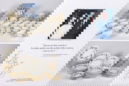
THE FITZGERALD FAMILY TEA and DINNER SERVICEJohn McInnis Auctioneers,LLC4.6(502)See Sold PriceFeb 25, 2024
John Bluck, act. 1791-1819 Handcolored Etching Aquatint View at Hastings signedGlobal Auctions Company4.3(36)See Sold PriceMar 03, 2024
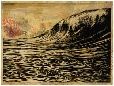
Shepard Fairey (b. 1970), "Dark Wave," 2010, Screenprint, collage, and hand-painted (HPM) on paper,John Moran Auctioneers, Inc.4.7(453)See Sold PriceFeb 27, 2024
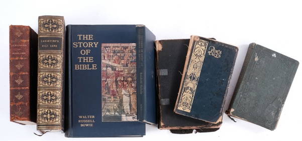
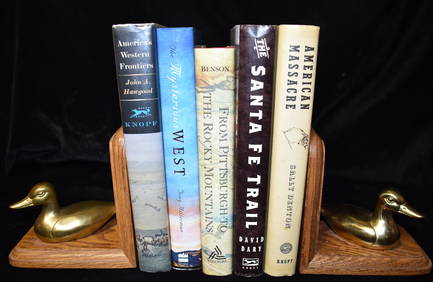
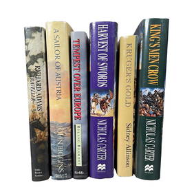
5 Books About the Old West in Excellent Condition Hardbacks w/ DustcoversNorth American Artifact Auctions4.6(182)See Sold PriceApr 20, 2024
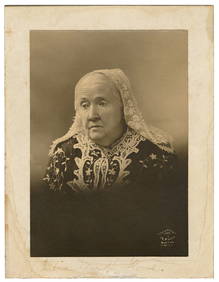
HOWE, Julia Ward (1819-1910). Signed Photo. Boston: J. E. P...Potter & Potter Auctions4.6(539)See Sold PriceMar 07, 2024
Large lidded goblet ''JOHN OF AUSTRIA''Dr. Fischer Fine Art Auctions4.5(109)See Sold PriceMar 09, 2024
Map: A 19thC engraved map titled Gloucestershire from the Best Authorities, after John Cary. Approx.Claydon Auctioneers Ltd4.3(125)See Sold PriceFeb 26, 2024
Map: A 19thC engraved and hand coloured map of Buckingham titled A New Map of BuckinghamshireClaydon Auctioneers Ltd4.3(125)See Sold PriceFeb 26, 2024
Map: A 19thC engraved map of West Riding, titled A Map of the North Part of the West Riding ofClaydon Auctioneers Ltd4.3(125)See Sold PriceFeb 26, 2024
Caunois (François Augustin) Portrait Medal of John Locke, 1819 & others, medals, pin boxes etc. (6)Forum Auctions4.3(52)See Sold PriceFeb 29, 2024
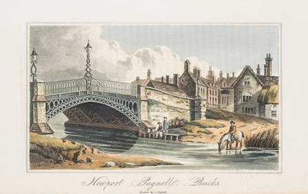
England.- Hassell (John) Tour of the Grand Junction, large paper copy, 24 hand-coloured aquatints,Forum Auctions4.3(52)See Sold PriceFeb 29, 2024
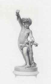
Antonio Rossetti 1800s Engraving "The Genius of Electricity" FRAMEDKCM Galleries4.7(164)See Sold PriceFeb 25, 2024
Manner Of Amie Millet Austrian Monumental Orientalist Gilt BronzeBKG Antique Mall4.3(420)See Sold PriceFeb 25, 2024