SoldJoan Blaeu (Alkmaar 1596 - Amsterdam 1673) and PierreJoan Blaeu (Alkmaar 1596 - Amsterdam 1673) and Pierre Mortier (Leida 1661 - Amsterdam 1711) publishers Antique map of Mirandola Etching 455x528 mm. (defects) IT Joan Blaeu (Alkmaar 1596 - Amsterdam 16See Sold Price
SoldJoan Blaeu (Alkmaar 1596 - Amsterdam 1673) WatercoleredJoan Blaeu (Alkmaar 1596 - Amsterdam 1673) Watercolered etching depicting the State of Milano, 1642 (41.5x53 cm.). Framed (defects) IT Incisione acquerellata raffigurante lo Stato di Milano, 1642 (cmSee Sold Price
JOAN (JOHANNES) BLAEU 1596 Alkmaar - 1673 Amsterdam 'MAGNIJOAN (JOHANNES) BLAEU 1596 Alkmaar - 1673 Amsterdam 'MAGNI MOGOLIS IMPERIUM' Engraving, colored, on paper, with center fold. Print size approx. 42 x 52.6 cm (f. 57.5 x 68 cm). Titled in the caption upSee Sold Price
SoldJOAN (JOHANNES) BLAEU 1596 Alkmaar - 1673 Amsterdam 'BARONAJOAN (JOHANNES) BLAEU 1596 Alkmaar - 1673 Amsterdam 'BARONATUS CAROLATO BETHANIENSIS IN SILESIA INFERIORE' (BARONIE BEUTHEN - AROUND 1662) Engraving, colored, on chamois colored paper; with center folSee Sold Price
JOAN (JOHANNES) BLAEU 1596 Alkmaar - 1673 Amsterdam 'MARCH.JOAN (JOHANNES) BLAEU 1596 Alkmaar - 1673 Amsterdam 'MARCH. BRANDENBURGICI PARS QUAE MARCHIA MEDIA' Engraving, colored, on paper, with center fold. Print size 39.5 x 52.5 cm (f. 59.5 x 72 cm). TitledSee Sold Price
Johannes (Joan) Blaeu Landkarte "ComitatusKartograf und Kupferstecher (1596 Alkmaar - 1673 Amsterdam) grenzkolorierte Kupferstichkarte/Papier unsigniert um 1662 Karte der Thüringer Grafschaft Henneberg aus dem Atlas Major (AtlaSee Sold Price
Sold[MILANO - BLAEU, Joan (1596-1673)] - Mediolanum vulgo[MILANO - BLAEU, Joan (1596-1673)] - Mediolanum vulgo Milanen. Amsterdam: Pierre Mortier, [1704]. (533 x 618mm). A good impression and state of conservation of this renowned map of Milan engraved by BSee Sold Price
SoldBlaeu French Regional Map, 17th C.Les Souverainetez de Sedan et de Raucourt et la prevosté de Doncheri. Willem Janszoon Blaeu (1571-1638). Joan Blaeu (1596-1673). Amsterdam: Mid 17th Century. Hand-colored engraving19 3/4 x 24 inchesSee Sold Price
SoldJoan Blaeu Map of Amersfoort ca. 1650Joan Blaeu (1596-1673), "Amisfurtum," Amsterdam, ca. 1650. Hand colored map of the town of Amersfoort in the Netherlands. Dimensions: Sight; height: 16 1/4 in x width: 20 1/4 in. Framed; height: 17 3/See Sold Price
SoldArchitectural Drawing of St. Peter's Basilica in RomeProspetto della Basilica Vaticana/Architettura di Carlo Maderno. L'eglise de S. Pierre A Rome. Joan Blaeu (1596-1673). from Nouveau Theatre D'Italie, Ou Description Exacte De Ses Villes, Palais, EglisSee Sold Price
SoldWillem and Joan Blaeu MapWillem and Joan Blaeu (Dutch, 1571-1638 and 1596-1673), "Turcicum Imperium", Amsterdam, c. 1635, hand-colored map of the Ottoman Empire, from an edition of Theatrum Orbis Terrarum, 16 1/4 in. x 20 1/2See Sold Price
SoldA Very Fine 17th Century Map of Poland,published in Amsterdam c.1665, Blaeu, Joan, (1596-1673), cartouche reads 'PALatinATVS POSNANIENSIS IN MAIORI POLONIA PRIMARII NOVA DELINEATIO. Per G. F. M.' copper plate engraving, hand coloured, untrSee Sold Price
SoldOLFERT DAPPER - Insulae Canariae alias FortunataeOLFERT DAPPER The Netherlands 1639-1689 JOAN BLAEU 1596 - 1673 Insulae Canariae alias Fortunatae dictae. Amsterdam, 1668 Colored copper engraving Signed, titled and dated Size 26.1 x 34.4 cm plate ComSee Sold Price
SoldBlaeu Map of BrazilMaritima Brasiliae Universa. Joan Blaeu (1596-1673). Engraved map with original color in part. Amsterdam: Blaeu, 1647. 21 x 24 1/2 inches sheet, 32 1/2 x 36 inches framed. This separately issued and rSee Sold Price
Blaeu Joan map Lithuania BelarusJoan Blaeu (1596-1673) MAGNI DVCATVS LITHVANIE et Regionum Adiacentium Exacta Descriptio Â… 1648, copper engraving on paper, watercolor, 45 x 52 cm, Amsterdam Dimensions (in cm): 45 x 52See Sold Price
SoldBlaeu, Map of the BalkansIllyricum Hodiernum Quod Scriptores...Joan Blaeu (1596-1673). Engraved map with original hand color. Amsterdam, c. 1680.See Sold Price
SoldFirst Dutch map to focus on the Lesser AntillesCanibales Insulae... Joan Blaeu (1596-1673). Engraved map with original hand color in outline. Amsterdam, 1662.. 20 1/2 x 24 inches sheet, 30 x 33 1/2 inches framed. This is the first Dutch chart to fSee Sold Price
Engraved Map of Northumbria by BlaeuComitatus Northvmbria Vernacule Northumberland. Joan Blaeu (1596-1673). Engraved map with original hand color in outline. Amsterdam, c. 1647. 20 x 23 3/4 inches sheet. Title banderole supported by putSee Sold Price
SoldJoan Blaeu (1596-1673), "Burgundia Ducatus"Joan Blaeu (Dutch, 1596-1673). "Burgundia Ducatus". 17th century. Colored copper engraving map of the Burgundy region of France. Engraved and colored in Amsterdam. Sight 17 7/8" x 21 7/8", frame 20" xSee Sold Price
Joan Blaeu (1596-1673), "Burgundia Ducatus"Joan Blaeu (Dutch, 1596-1673). "Burgundia Ducatus". 17th century. Colored copper engraving map of the Burgundy region of France. Engraved and colored in Amsterdam. Sight 17 7/8" x 21 7/8", frame 20" xSee Sold Price
Sold* BLAEU, Joan (1596-1673). Ducatus Eboracensis pars* BLAEU, Joan (1596-1673). Ducatus Eboracensis pars Borealis, The North Riding of York Shire. Amsterdam, ca 1662. Engraved map with hand-coloring of North Riding Yorkshire, Latin text on verso, sheetSee Sold Price
SoldOne of the most attractive maps of the region - BlaeuBLAEU, Willem (1571-1638) & BLAEU, Joan (1596-1673). Nova Belgica et Anglia Nova. Engraved map with hand color. Amsterdam: 1635-1667. 20" x 23 1/2" sheet, 29" x 33" framed. Comparable: Swann, 2017 - $See Sold Price
SoldBleau Map of New EnglandBLAEU, Willem (1571-1638) & Blaeu, Joan (1596-1673). Nova Belgica et Anglia Nova. Engraved map with hand color. Amsterdam: 1635-1667). 20" x 23 1/2" sheet, 29" x 33" framed. This important map, firstSee Sold Price
SoldBLAEU, Willem (1571-1638) e BLAEU, Joan (1596-1673) -BLAEU, Willem (1571-1638) e BLAEU, Joan (1596-1673) - Le Théâtre du Monde ou Nouvel Atlas.. troisieme partie. Amsterdam: Johannes Blaeu, 1650. A splendid copy in contemporary Dutch binding complSee Sold Price
LARGE LATE 17TH C. DUTCH CHART OF CANADA, GREAT LAKES, NEW FRANCE, LABRADOR, HUDSON BAY, BY PIERREThomaston Place Auction Galleries4.4(386)See Sold PriceFeb 24, 2024
LARGE EARLY 18TH C. DUTCH CHART OF UPPER NORTH AMERICA, PIERRE MORTIER (1661-1711), FRAMEDThomaston Place Auction Galleries4.4(386)See Sold PriceFeb 24, 2024
ABRAHAM ORTELIUS (1527-1598) MAP OF ROMAN GAUL (FRANCE)Thomaston Place Auction Galleries4.4(386)See Sold PriceFeb 24, 2024
WILLEM JANSZOON BLAEU (NETHERLANDS, 1571-1638)Thomaston Place Auction Galleries4.4(386)See Sold PriceFeb 24, 2024
Willem Blaeu, Etc. 17th C. Antiquarian Maps, 2Auctions at Showplace4.5(726)See Sold PriceMar 17, 2024
1757 MYTHOLOGY Pantheum mythicum ILLUSTRATED antique ROTTERDAM ARMORIAL VELLUMJasper524.5(9.8k)See Sold PriceFeb 27, 2024
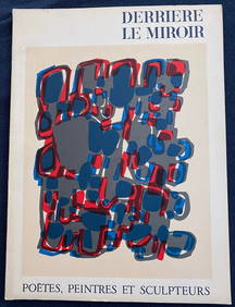
Derriere Le Miroir 119, 1960 Lithographs by Kandinsky, Leger, Miro and othersTheRedFinch Auctions4.4(24)See Sold PriceFeb 29, 2024
LE TABLIER BLANC. With Signed Etching by Miro (P.A.B)TheRedFinch Auctions4.4(24)See Sold PriceFeb 29, 2024
Jeanne qu’on brula verte. BRAQUE, CHAR, P.A.B. 1956. MiniatureTheRedFinch Auctions4.4(24)See Sold PriceFeb 29, 2024
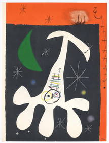
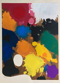
JEAN-PAUL RIOPELLE (Montreal, Canada,1923-2002). "Force des forêts", from the folder "Alechinsky,Setdart Auction House4.1(22)See Sold PriceMar 05, 2024
MONTAND YVES: (1921-1991)International Autograph Auctions Europe S.L.4.5(52)See Sold PriceMar 13, 2024
INTRODUCTION OF UNIVERSALIS IN OMNES RESPUBLICAS, 1632, POLITICS OF REPUBLICSNY Elizabeth 4.3(84)See Sold PriceMar 03, 2024
1655 CASPAR BARLAEUS'S POEMATA HEROICORUM OLD VELLUM BOUND POETRYNY Elizabeth 4.3(84)See Sold PriceMar 03, 2024
CASPAR BARLAEUS'S POETRY FROM THE 17TH CENTURY, ABOUT 1655NY Elizabeth 4.3(84)See Sold PriceMar 03, 2024


![[MILANO - BLAEU, Joan (1596-1673)] - Mediolanum vulgo (1 of 1)](https://p1.liveauctioneers.com/3662/175274/88222357_1_x.jpg?height=282&quality=70&version=1597918246)