SoldJ.H. Colton 'La Crosse & Milwaukee Rail Road' MapJ.H. Colton 'La Crosse & Milwaukee Rail Road' Map c.1853, drawn by George W. Colton, engraved by J.M. Atwood New York, depicting railroad routes throughout La Crosse and Milwaukee Wisconsin Height: 12See Sold Price
SoldRailroad Circular and Gold Bond Prospectus, 1856 and 18Full title, 'Circular to the Stockholders of the La Crosse & Milwaukee Railroad Company,' published by Nathan Lane & Co., NY, 1856. Folding map in front of pamphlet. Very rare. Pencil notation on coveSee Sold Price
SoldJ.H. Colton, Colton's Railroad & Township Map of theCOLTON, Joseph Hutchins (1800-1893). Colton’s Railroad & Township Map of the State of New York, with Parts of the Adjoining States & Canada. New York: J. H. Colton & Co., 1854. Engraved, original haSee Sold Price
Sold1 piece. Colton, J.H., pub. Colton's Railroad & T1 piece. Colton, J.H., pub. Colton's Railroad & Township Map of the State of New York." New York, 1865. Hand-colored lithographic map, 26 x 28 inches. Tears along folds but complete. In orig. red clotSee Sold Price
Colton (J.H.) - Colton's Railroad & Township Map of theengraved map with extensive original hand-colouring, on tissue-thin paper, 635 x 725mm., a few minor splits on old folds, a marginal tear affecting decorative border lower right, folding into contempoSee Sold Price
SoldColton's New Railroad & County Map of the UnitedColton's New Railroad & County Map of the United States, the Canadas, &c., 1862 Colton's New Railroad & County Map of the United States, the Canadas, &c. New York: J.H. Colton, 1862. Dissected foldinSee Sold Price
SoldColton's Map of the State of New York 1857Heading: Author: Colton, J. H. Title: Colton's Railroad & Township Map of the State of New York with Parts of Adjoining States & Canada Place Published: New York Publisher:J.H. Colton Date PubliSee Sold Price
SoldCivil War map of U.S. 1862Heading: Author: Colton, Joseph Hutchins Title: Colton's New Railroad & County Map of the United States the Canadas &c. Place Published: New York Publisher:Published by J.H. Colton Date PublisheSee Sold Price
SoldPocket Map of Arkansas, 1856Antique Pocket Map of Arkansas, "Colton's Railroad & Township Map of Arkansas Compiled from the U.S. Surveys and other Authentic Sources by D.F. Shall", New York, J.H. Colton & Co., 1856, hand-coloredSee Sold Price
SoldFolding map of New York 1859Title: Colton's Railroad & Township Map of the State of New York, with Parts of Adjoining States and Canada Author:Colton, J.H. Description:Lithographed map, hand-colored. 53x64 cm. (20¾x25¼"), foldSee Sold Price
Colton's Railroad & Township Map of Ohio 1852Title: Colton's Railroad & Township Map of the State of Ohio Author: Colton, J.H. Description: Engraved folding map, hand-colored. 60.5x70 cm. (24x27½") including the decorative border. With brown giSee Sold Price
SoldColton's new railroad and country map of the UnitedColton's new railroad and country map of the United States and Canada. NY: J.H. Colton 1863.600 mile scaleDimenstions: 31" X 36 3/4"Note: Proposed railroad routes to the Pacific Ocean. Includes railroSee Sold Price
Colton's Railroad & Township Map of the Western SAuthor: Colton, J.H. Lithographed map, hand-colored. 73.5x93 cm (29x36½") plus decorative border, overall 88x108 cm.; folding into original blindstamped brown leather covers with "Map of the WesternSee Sold Price
Sold1873 Colton's hand colored map of Maine.Beautiful map of Maine published in 1873 by J.H. Colton, for Hoyt, Fogg & Breed, Portland Maine. Original hand coloring shows individual counties. Map includes railroad lines, common roads, canals, anSee Sold Price
Sold1850 Colton's Map of the United StatesColton's map of the United States / the Canada's & C. / Rail Roads, canals, & stage roads.../J.H. Colton, 86 Cedar St., New York / 1850. [framed]. 26 h x 30 1/2 w = sheet (sight) 33 1/2 h x 37 3/4 w =See Sold Price
Colton's Map of the United States of America, theTitle/Content of Map: Colton's Map of the United States of America, the Canadas &C Date: 1857 Cartographer: COLTON, J.H. Publisher: J.H. COLTON & CO. Size: 25.5Height - 30.5Width showing the rail roadSee Sold Price
Colton's Map of the United States of America, thePublication Date: 1857 Title: Colton's Map of the United States of America, the Canadas &C Cartographer: COLTON, J.H. Publisher: J.H. COLTON & CO. Height: 25.5 Width: 30.5 "showing the rail roads, canSee Sold Price
SoldTWO MAPS: KANSAS/NEBRASKA 1855, ARIZONA/NEW MEXICO 1882J.H. Colton territories of Nebraska and Kanzas map dated 1855, with proposed routes for the Pacific Railroad, measures 23 x 26 inches overall. _x000D_ _x000D_ Also an 1882 map by S. August Mitchell ofSee Sold Price
South America (Physical)Title/Content of Map: South America (Physical) Date: 1860 Cartographer: Size: 12Height - 9.8Width Publisher: J.H. Colton & Co. Crests of mountains are represented as if they were railroad lines. The bSee Sold Price
SoldColton MAP OF THE UNITED STATES THE CANADAS &C 1853Details: COLTON, J.H. (1800-1893). Colton's Map of the United States the Canadas &c. Showing the Rail Roads, Canals & Stage Roads with Distances from Place to Place. New York: Colton, 1853. Folding pSee Sold Price
SoldColton's Railroad abd Township Map, Ohio 1851Colton's Railroad & Township Map of the State of Ohio by G. W. & C. B. Colton & Company 1851. Its in its original cover. The map is a fold out that comes out of the cover. Cover is rough but the map iSee Sold Price
Sold* COLTON, George Woolworth. Colton's County and* COLTON, George Woolworth (1827-1901). Colton's County and Township Rail Road Map of Wisconsin, Illinois, Missouri, & Iowa. New York and Chicago: G. Woolworth Colton, Rufus Blanchard, 1863. EngravedSee Sold Price
Colton's new Rail Road and County Map of the UnitedTitle/Content of Map: Colton's new Rail Road and County Map of the United States the Canadas &c. Cartographer: Date: c1868 Publisher: G.W. & C.B. Colton & Co Size: 31.75Height - 37.75Width The originaSee Sold Price
Colton's new Rail Road and County Map of the UnitedTitle: Colton's new Rail Road and County Map of the United States the Canadas &c. Publication Date: c1868 Cartographer: Publisher: G.W. & C.B. Colton & Co Description: The original owner of this fineSee Sold Price
LaCrosse and Milwaukee RR 4th Annual Report-January 1856JM Hobby Supply and Railroad Artifact Auctions4.4(126)See Sold PriceFeb 24, 2024
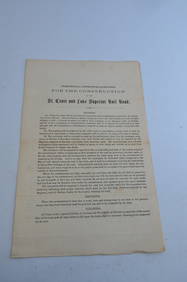
St Croix and Lake Superior RR General Specifications for Construction Document-1856JM Hobby Supply and Railroad Artifact Auctions4.4(126)See Sold PriceFeb 24, 2024
American Express/New York Central Railroad Map of the United States-1934JM Hobby Supply and Railroad Artifact Auctions4.4(126)See Sold PriceFeb 24, 2024
Crams Railroad Map of New York-1881JM Hobby Supply and Railroad Artifact Auctions4.4(126)See Sold PriceFeb 24, 2024
Crams Township and Railroad Map of New York-1890JM Hobby Supply and Railroad Artifact Auctions4.4(126)See Sold PriceFeb 24, 2024
Crams Township and Railroad Map of Pennsylvania-1898JM Hobby Supply and Railroad Artifact Auctions4.4(126)See Sold PriceFeb 24, 2024
Rand McNally County/Township/Railroad Map of Kansas-1911JM Hobby Supply and Railroad Artifact Auctions4.4(126)See Sold PriceFeb 24, 2024
Rand McNally Railroad Map of Arizona-1909JM Hobby Supply and Railroad Artifact Auctions4.4(126)See Sold PriceFeb 24, 2024
Rand McNally Railroad Map of Colorado-1929JM Hobby Supply and Railroad Artifact Auctions4.4(126)See Sold PriceFeb 24, 2024
Rand McNally Railroad Map of Washington-1906JM Hobby Supply and Railroad Artifact Auctions4.4(126)See Sold PriceFeb 24, 2024
Rand McNally Township County and Railroad Map of Illinois-1879JM Hobby Supply and Railroad Artifact Auctions4.4(126)See Sold PriceFeb 24, 2024
Rand McNally Township County and Railroad Map of Indiana-1880JM Hobby Supply and Railroad Artifact Auctions4.4(126)See Sold PriceFeb 24, 2024
Rand McNally/Santa Fe Railroad Map of Iowa-1912JM Hobby Supply and Railroad Artifact Auctions4.4(126)See Sold PriceFeb 24, 2024
Chicago Milwaukee and St Paul RY Panama Pacific Exposition Brochure-1915JM Hobby Supply and Railroad Artifact Auctions4.4(126)See Sold PriceFeb 24, 2024
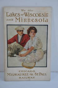
Chicago Milwaukee and St Paul RY To the Lakes of Wisconsin and Minnesota Book-1909JM Hobby Supply and Railroad Artifact Auctions4.4(126)See Sold PriceFeb 24, 2024
Chicago Milwaukee and St Paul RY Why and Wherefore Book-1886JM Hobby Supply and Railroad Artifact Auctions4.4(126)See Sold PriceFeb 24, 2024
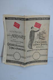
Chicago Milwaukee and St Paul RY March 1, 1889 Public TimetableJM Hobby Supply and Railroad Artifact Auctions4.4(126)See Sold PriceFeb 24, 2024
1853 Colton's Railroad & Township Map of Massachusetts, Rhode Island, and ConnecticutRail & Road Auctions4.6(165)See Sold PriceMar 07, 2024
Pair of Early Railroad Maps - 1874 Delaware, Lackawanna & Western and 1876 Pennsylvania RailroadRail & Road Auctions4.6(165)See Sold PriceMar 07, 2024
Pair of Early Railroad Maps - 1862 Pittsburgh, Ft. Wayne & Chicago Railway and 1873 PennsylvaniaRail & Road Auctions4.6(165)See Sold PriceMar 07, 2024
Group of Ten Railroad Photographs, Maps, and Prints - New Jersey, Long Island, and New YorkRail & Road Auctions4.6(165)See Sold PriceMar 07, 2024
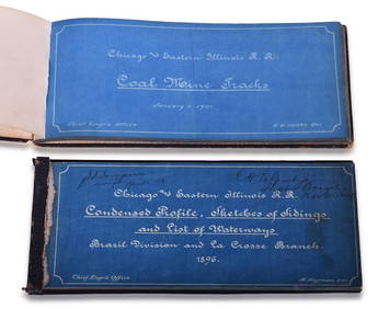
Chicago & Eastern Illinois Railroad 1901 Coal Mine Track and 1896 Brazil Division Track Chart BooksRail & Road Auctions4.6(165)See Sold PriceMar 08, 2024
Rand McNally Railroad Map Cabinet w/ 21 Railroad MapsRail & Road Auctions4.6(165)See Sold PriceMar 08, 2024