Jefferys (T) Map of the Country Round PragueJefferys (Thomas) A Map of the Country Round Prague,Showing Ye Junction & March of the Prussian Army, two plates on one sheet, the first showing the march of the Prussian army, the second theSee Sold Price
Sold1776 Map of Country Round Philadelphia New JerseyA Map of the Country round Philadelphia including Part of New Jersey New York, Staten Island and Long Island, published for Gentleman's Magazine, London, 1776. Fine condition, folds as issued, measureSee Sold Price
Sold1776 Accurate Map of Country Round BostonAccurate Map of the Country Round Boston in New England with inset "A Plan of Boston and Charlestown from Drawing Made in 1771". Published by A, Hamilton, January 16, 1776 for the Town and Country MagSee Sold Price
Sold1760 Map of Country Round DresdenC1760 "A Map of the Country Round Dresden with the Towns and Fortresses which the several Armies have occupied during the Campaign". Fine condition, measures 11 x 8". Please note that this lot has a cSee Sold Price
1776 Accurate Map of Country Round BostonAccurate Map of the Country Round Boston in New England with inset "A Plan of Boston and Charlestown from Drawing Made in 1771". Published by A, Hamilton, January 16, 1776 for the Town and Country MagSee Sold Price
1758 Map of Country Round Dresden“A Map of the Country Round Dresden with the Towns and Fortresses…”, 1758, printed for Gentleman’s Magazine, Fine, measures 11 x 9”. Free shipping within the continental USSee Sold Price
SoldMap of the country round Soochow China 1901Title: Map of the country round Soochow, surveyed by Thos. Ferguson, 1900-1901 Author: Fergusopn, Thomas Description: Lithographed map. 40.5x60 cm. (14¾x23¾"), backed with linen & sectioned for foldSee Sold Price
SoldColor engraved Map of the country round PhiladelColor engraved Map of the country round Philadelphia including part of New Jersey New York Staten Island & Long Island, 7'' x 8 3/4''.See Sold Price
SoldMap of the Country round Philadelphia 1776Title: A Map of the Country round Philadelphia Including Part of New Jersey New York Staten Island & Long Island Author: Scots Magazine Description: Copper-engraved map. 17.5x21.7 cm. (6¾x8½").JollySee Sold Price
SoldMap of the Country round Philadelphia 1776Title: A Map of the Country round Philadelphia Including Part of New Jersey New York Staten Island & Long Island Author: Gentleman's Magazine Description: Copper-engraved map. 18x22 cm. (7x8½").JollySee Sold Price
Stockdale New Map of the Country Round LondonStockdale (John, publisher) A New Map of the Country Round London,showing London as the central point, with areas of Buckinghamshire, Surrey, Kent and Essex, engraved map, with original hand-cSee Sold Price
1776 Revolutionary War Map PhiladelphiaA Map of the Country round Philadelphia including Part of New Jersey New York, Staten Island and Long Island, published for Gentleman's Magazine, London, 1776. Fine condition, folds as issued, measureSee Sold Price
SoldRevolutionary War map with Valley ForgeTitle: A Chorographical Map, of the Country, round Philadelphia / Carte Particuliere, des Environs de Philadelphie Author: [Romans, Bernard] Description: Copper-engraved map, hand-colored in outline.See Sold Price
SoldRev. War map of Eastern PA, NJ, NYC etc.Title: A Map of the Country round Philadelphia Including Part of New Jersey New York Staten Island & Long Island Author: Gentleman's Magazine Description: Copper-engraved map. 18x22 cm. (7x8½").RevolSee Sold Price
The country round Philadelphia. New Jersey PennsylvaniaTITLE/CONTENT OF MAP: 'A map of the country round Philadelphia including part of New Jersey, New York, Staten Island & Long island' The top image on the right hand side shows the entire map. To view aSee Sold Price
The country round Philadelphia. New Jersey Pennsylvania NY. GENTS MAG 1776 mapTitle: The country round Philadelphia. New Jersey Pennsylvania NY. GENTS MAG 1776 map Description: A map of the country round Philadelphia including part of New Jersey, New York, Staten Island & LongSee Sold Price
India.- Camp of Exercise 1875-76.India.- Roberts (Frederick Sleigh, first Earl Roberts, army officer, as Quarter-Master General India, 1832-1914) Camp of Exercise 1875-76. Map of the Country Round Delhi,map printed on silk, pSee Sold Price
Andrews (John) and Andrew Dury. A New Travelling MAndrews (John) and Andrew Dury. A New Travelling Map of the Country Round LondonExtending from the North to South 190 Miles and East to West 150 Miles, engraved map with hand-colouring, 1010 xSee Sold Price
Stockdale (John, publisher) A New Map of the CountStockdale (John, publisher) A New Map of the Country Round London,showing London as the central point, with areas of Buckinghamshire, Surrey, Kent and Essex, engraved map, with original hand-cSee Sold Price
London.- Andrews (John) A New Travelling Map of theLondon.- Andrews (John) A New Travelling Map of the Country Round London Extending from the North to South 190 Miles and East to West 150 Miles, engraved map with hand-colouring, 1010 x 1230 mm (43 1/See Sold Price
SoldMap of the Arctic 1875Heading: Author: Stanford, Edward Title: Stanford's Map of the Countries Round the North Pole Place Published: London Publisher:Published by Edward Stanford Date Published: 1875 DescriSee Sold Price
SoldA New Map of the Country Twenty Miles Round (sic)A New Map of the Country Twenty Miles Round (sic) London, Printed for Carington Bowles in St. Paul's Church Yard, London [n.d., c. 1780], copperplate engraving with hand-coloured delineations, laid onSee Sold Price
JOHN H. EDDY - MAP OF THE COUNTRY THIRTY MILES ROUNDJohn H. Eddy - Map Of The Country Thirty Miles Round The City Of New York, 1811 - 44 X 43 3/8 In. This is a Giclée on Canvas. Very Large Piece!See Sold Price
JOHN H. EDDY - MAP OF THE COUNTRY THIRTY MILES ROUNDJohn H. Eddy - Map Of The Country Thirty Miles Round The City Of New York, 1811 - 36 X 35 1/2 In. - Giclée Print - Gallery Stretched - Ready to hang.See Sold Price
LARGE GULF SERVICE STATION MAP COLLECTION WITH DISPLAY STAND.Dan Morphy Auctions4.2(1.3k)See Sold PriceFeb 24, 2024
5 Dollars - Elizabeth II Map of North AmericaWeatherham Estate Treasures3.9(157)See Sold PriceMar 07, 2024
10 Dollars - Elizabeth II Map of the WorldWeatherham Estate Treasures3.9(157)See Sold PriceMar 07, 2024
These United States 1968 Folio Size HardbackNorth American Artifact Auctions4.6(182)See Sold PriceApr 20, 2024
1764 MAP OF COUNTRIES THIRTY MILES ROUND LONDON antique 12.5 by 15"Jasper524.5(9.8k)See Sold PriceFeb 27, 2024
1738 RUSSIA SIBERIA & GREAT TARTARY Description illustrated ANTIQUE in ENGLISHJasper524.5(9.8k)See Sold PriceFeb 27, 2024
Carte de la Guinée, contenant…'. Guinea & Cape Verde islands. BONNE 1771 mapJasper524.5(9.8k)See Sold PriceFeb 28, 2024
NORTH AFRICA. 'Biledulgerid', a former North African country. MALLET 1683 mapJasper524.5(9.8k)See Sold PriceFeb 28, 2024
Rivières de Sanaga & Gambra'. Senegal Gambia rivers. Guinea. BELLIN 1746 mapJasper524.5(9.8k)See Sold PriceFeb 28, 2024
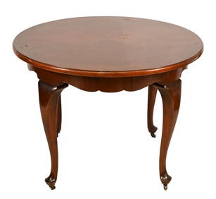
French Country Style Carved Round Table on CastersGreenwich Auction4.3(1.4k)See Sold PriceFeb 29, 2024
Stanford, Edward 1901 Large Map. Burma and Adjacent CountriesAlbion Auctions4.6(336)See Sold PriceMar 01, 2024
A PAIR OF EARLY SILVER SABBATH CANDLESTICKS. Prague, 1815. On round bases. Made from exceptionallyJ. Greenstein & Co., Inc.4.3(55)See Sold PriceApr 16, 2024