Sold(James, editor) Maps & plans, showing the principaWyld (James, editor) Maps & plans, showing the principal movements, battles & Sieges, in which the British army was engaged during the war from 1808 to 1814..., 39 double-page lithographed mapSee Sold Price
SoldMaps & plans, showing the principal movements, battles(James, editor ) Maps & plans, showing the principal movements, battles & Sieges, in which the British army was engaged during the war from 1808 to 1814… , 57 engraved or lithographed plans andSee Sold Price
SoldWyld (James) Maps & PlansWyld (James) Maps & Plans, Showing the Principal Movements, Battles & Sieges, in which the British Army was engaged during the War from 1808 to 1814 in the Spanish Peninsula and the South of France,See Sold Price
SoldWyld, James, publisher Maps & Plans Showing theLondon, [n.d.] Elephant folio, 37 engraved maps and plans, original red half morocco gilt over green cloth, some foxing and occasional light dampstaining; Belmas, J. Journaux des Siéges faits ouSee Sold Price
Sold(CHICAGO, MAPS) GRAHAM, JAMES DUNCAN. Map G. No. 5(CHICAGO, MAPS) GRAHAM, JAMES DUNCAN Map G. No. 58. Chicago Harbor and Bar. Illinois. From Survey made between the 17th of August & the 2nd of September 1858. Large double-sheet plan showing the NorthSee Sold Price
Sold19th C. Reprint 1798 Map Of New Orleans"Plan of the City of New Orleans and the Adjacent Plantations". "Copy and Translation from the original Spanish Plan dated 1798 showing the City of New Orleans Its Fortifications and Environs". JamesSee Sold Price
Goad (Charles E.) Insurance Plans of LondonGoad (Charles E.) Insurance Plans of London,showing St. James's from Little St. James Street to Haymarket from 1940 to 1942, 3 lithographed maps in original hand-colouring, nos. 208, 209 and 2See Sold Price
SoldWyld (J) The Residency & Palace At LucknowWyld (James) Sketch Of The Residency & Palace At Lucknow,plan of the city showing the fort, with inset map of the insurrectionary districts and key, lithographed map with outline hand-colourinSee Sold Price
Wyld (James) Wyld's New Plan of London and its VicWyld (James) Wyld's New Plan of London and its Vicinity,showing from Highgate down to Brixton, and Victoria Docks across to Wormwood Scrubs, lithographed map with hand-colouring, 810 x 1175mm.See Sold Price
SoldLondon.- Gardner (James) New Plan of the Cities ofLondon.- Gardner (James) New Plan of the Cities of London & Westminster with the Borough of Southwark, showing from Bayswater to Limehouse, and Kennington Common to Islington, engraved map with hand-cSee Sold Price
SoldWyld (James) A New Plan of London and WestminsterWyld (James) A New Plan of London and Westminster, with the Borough of Southwark,showing from Camden Town down to Kennington, and across from Paddington to Limehouse, engraved map with hand-coSee Sold Price
EDINBURGH antique town city map plan showing parishes.TITLE/CONTENT OF MAP: 'Plan of the City of Edinburgh' The top image on the right hand side shows the entire map. To view a close up of the map showing the level of printed detail, please click on theSee Sold Price
BERLIN Antique city town map plan showingTITLE/CONTENT OF MAP: 'BERLIN.' The top image on the right hand side shows the entire map. To view a close up of the map showing the level of printed detail, please click on the bottom image on the riSee Sold Price
SoldMap : ' A Plan showing the Course of the GRAND JUNCTIONMap : ' A Plan showing the Course of the GRAND JUNCTION CANAL through BOXMOOR amd the quantity remaining thereof as Common in the parish of HEMEL HEMPSTEAD HERTFORDSHIRE. ' a wall hanging linen backedSee Sold Price
Sold1803 Map Plan Harbor of Mahon CandiaEngraved map and Plan showing the Harbor of Mahon and the isle of Candia. Published by Cadell and Davies, London, 1803. Fine, measures 8.25 x 11". Reserve: $20.00 Shipping: Domestic: Flat-rate of $5.0See Sold Price
SoldBAIN (James; editor) The Authentic Map Directory ofBAIN (James; editor) The Authentic Map Directory of London and Suburbs. London: Geographia Ltd, 3rd edition, c.1933, 4to, (33.5 x 25cm), numerous colour maps, original clothSee Sold Price
SoldVienna Early Map CoronelliEarly map: Metropolis of Vienna. City plan map showing military fortifications. Vincenzo Maria Coronelli, Venice, 1689. 19 1/2" x 26 1/2".See Sold Price
SoldLos Angeles CountyHeading: (California - Cerritos) Author: Uttley, James E. Title: Map Showing Licensed Dairies in the City of Cerritos Prepared For Mr. Sam Keyes Place Published: Whittier, CA Publisher: Date PublSee Sold Price
SoldCrace (J. G., editor) A Catalogue of Maps...Crace (J. G., editor) A Catalogue of Maps, Plans, and Views of London Westminster & Southwark collected and arranged by Frederick Crace,signed presentation copy from the editor to his son, mouSee Sold Price
Aviation - Deutsche Lufthansa - Winter Time Table...Aviation - Deutsche Lufthansa - Winter Time Table October 1938 – March 1939. Folds out to large poster size showing plan style map of their extensive flights across Europe. Text in English Folds outSee Sold Price
SoldFestland Von Australien Und Benachbarte InselnTitle/Content of Map: Festland Von Australien Und Benachbarte Inseln Date Printed: 1846 Cartographer: STULPNAGEL (CARTOG)/STIELER (EDITOR) Size: 12.5X15.3 Map showing Australia, New Zealand, SouthernSee Sold Price
Shaw Prestwick Golf Club History bookTitle: Prestwick Golf Club: A History and Some Records Author: Shaw, James E., editor Description: Five folding plans of the links and grounds in at rear. Introduction by Bernard Darwin. Red cloth. FiSee Sold Price
Plan of Union City/Mason Co./Wash.Publication Date: c1910 Title: Plan of Union City/Mason Co./Wash. Cartographer: Hood's Canal Land and Improvement Co. Publisher: Lewis & Dryden Print Co. Height: 25.3 Width: 38 Map showing street planSee Sold Price
SoldGray's New Map of CincinnatiTitle: Gray's New Map of Cincinnati Publication Date: 1878 Cartographer: GRAY, FRANK A. Publisher: O.W. GRAY & SON Size: 11.8Height - 15Width Map showing street plan, districts (separately colored), mSee Sold Price
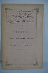
Boston and Maine RR Annual Report-September 12, 1849JM Hobby Supply and Railroad Artifact Auctions4.4(126)See Sold PriceFeb 24, 2024
Rand McNally Railroad Map of Arizona-1909JM Hobby Supply and Railroad Artifact Auctions4.4(126)See Sold PriceFeb 24, 2024
Autobiography Mark Rutherford Dissenting Minister 1st ed 1881 Scarce CalfLuis Porretta Fine Arts4.3(10)See Sold PriceMar 02, 2024
Vintage County Map Of NY State Plate EngravingThe Benefit Shop Foundation Inc.4.3(2.9k)See Sold PriceFeb 28, 2024
Pair of Early Railroad Maps - 1862 Pittsburgh, Ft. Wayne & Chicago Railway and 1873 PennsylvaniaRail & Road Auctions4.6(165)See Sold PriceMar 07, 2024
1887 Appletons' General Guide to the United State and Canada Part IIRail & Road Auctions4.6(165)See Sold PriceMar 08, 2024
Kent & Sussex.- Moss (W.G.) The History and Antiquities of the Town and Port of Hastings, 1824; andForum Auctions4.3(52)See Sold PriceFeb 29, 2024
WEST AFRICA Explorers' routes Senegal Ashanti. Mountains of Kong. SDUK 1857 mapJasper524.5(9.8k)See Sold PriceFeb 28, 2024
AFRICA. Map pre-dating much exploration. Mountains of Kong. SDUK 1851 oldJasper524.5(9.8k)See Sold PriceFeb 28, 2024
WEST AFRICA explorers' routes. Beaufort Gray Park Dochard Caillie. SDUK 1874 mapJasper524.5(9.8k)See Sold PriceFeb 28, 2024
WEST AFRICA I Explorers' routes Senegal Ashanti Ivory Gold Coast. SDUK 1851 mapJasper524.5(9.8k)See Sold PriceFeb 28, 2024
WEST AFRICA showing early explorers' routes & Mountains of Kong. SDUK 1844 mapJasper524.5(9.8k)See Sold PriceFeb 28, 2024
PRE COLONIAL WESTERN AFRICA. Shows Mountains of Kong. Tribes. WELLER 1863 mapJasper524.5(9.8k)See Sold PriceFeb 28, 2024
James Ridgway (1815 - 1847) - Antique Fruit Print of CherryProverde Auctions4.3(3)See Sold PriceFeb 28, 2024