SoldJAILLOT - Plan de Luxembourg.JAILLOT - Plan de Luxembourg. Paris, chez l'Auteur, 1741. Plan en noir des fortifications avec l'explication des chiffres. 385 x 550 mm. Déchirures, restaurations au dos. Joint: - NiSee Sold Price
Sold[VAUBAN ] - Plan de Luxembourg avec tous les nouve[VAUBAN ] - Plan de Luxembourg avec tous les nouveaux ouvrages que le feu Roy a fait faire depuis le siège en 1684. jusques en 1697. [Projet de mise en état des fortifications]. [fin XVIIIe - débSee Sold Price
SoldFrance.- Jaillot (Alexis-Hubert) Plan de la Ville,France.- Jaillot (Alexis-Hubert) Plan de la Ville, cité, université, et faubourgs de Paris…, engraved, hand coloured, vertical folds, slight staining, slight restoration, 52.5 x 107.5cm, Paris, cSee Sold Price
Sold[Luxembourg] Guillaume SANSON - Le Duché de Luxembourg[Luxembourg] Guillaume SANSON - Le Duché de Luxembourg divisé en françois et espagnol. Paris, H. Jaillot, 1788. Quelques pourtours rehaussés. 2 cartouches, à gauche en haut et en bas. 435 x 565 mSee Sold Price
de Fer: Mont Midi'. Montmédy fortified town/city plan.TITLE/CONTENT OF MAP: 'Mont Midi, ville forte, des Pays Bas, dans le Duche de Luxembourg [Montmédy]' DATE PRINTED: 1705 IMAGE SIZE: Approx 16.5 x 29.5cm, 6.5 x 11.5 inches (Medium) TYPE: Early 18th cSee Sold Price
Plan de Coblens et du Château d'Hermanstein. Kol. KupfCol. copper engr. map. - Centrefold, 2 small marginal tears, slightly browned and occ. minor staining. Plan de Coblens et du Château d'Hermanstein. Kol. Kupferstichkarte. Paris, Jaillot, dat. 1781. PSee Sold Price
Plan de Coblens et du Château d'Hermanstein. Kol. KupPlan de Coblens et du Château d'Hermanstein. Kol. Kupferstichkarte. Paris, Jaillot, 1781. Plattenmaße ca. 44 x 56,5 cm. Mittelfalz, leicht gebräunt u. stellenw. gering fleckig. Col. copper engr. maSee Sold Price
SoldRARE 17TH C. SANSON MAP OF LUXEMBOURGAlexis-Hubert Jaillot (c. 1632-1712); Nicolas Sanson (1600-1667) "Le Duche de Luxembourg Divise en Quarter Walon et Allemand....", hand colored engraving, published 1700 from earlier plates, Paris, frSee Sold Price
SoldMortier, Jaillot. Carte du Détroit du Sond[Mortier (Pierre) and Alexis Hubert Jaillot.] Carte du Détroit du Sond contenant les Costes de l'Isle de Zélande comprises entre Nicopen et l'Isle de Meun, et celles du Schonen,with inset planSee Sold Price
SoldKarl BAEDEKER - Belgique et Luxembourg. Avec 3 cartes eKarl BAEDEKER - Belgique et Luxembourg. Avec 3 cartes et 13 plans. 5e édition. Leipzig, Karl Baedeker, 1869. In-12, pleine percaline rouge d'édition (percaline d'un mors partiellement fendue).. JoinSee Sold Price
BAEDEKER, Karl - Belgique et Hollande y compris lBAEDEKER, Karl - Belgique et Hollande y compris le Luxembourg. 19e édition. Leipzig, Karl Baedeker, 1910. In-12, pleine percaline rouge d'édition, jaquette. Avec 19 cartes, 36 plans et villes, etcSee Sold Price
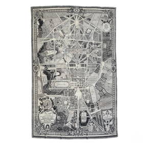
SoldVintage Framed PLAN DE TURGOT MapMap reads PLAN DE TURGOT 1739 near bottom. Piece is professionally framed with silver toned metal frame. Piece measures approximately 31 inches tall 38 inches wide. Art, wall art, map, framed map, vinSee Sold Price
SoldBrassai: Jardin de LuxembourgPrint Title: Jardin de Luxembourg Artist: Brassai Medium: Sheet-Fed Copperplate Gravure Date: 1968 Printing Location: Switzerland Size: 5 x 7 inches Brassai was a Hungarian-French photographer who rosSee Sold Price
SoldPlan de Paris... 20 sheet map.[France]. Plan de Paris Commence l’Annee 1734… Leve et Dessine par Louis Bretez Et Ecrit par Aubin. 20-sheet birds’-eye view of Paris showing all streets and buildings. [Originally published 173See Sold Price
SoldJacques Nicolas Bellin (1703-1772), "Plan de laJacques Nicolas Bellin (1703-1772), "Plan de la Nouvelle Orleans," 1759, copper engraving, H.- 10 1/2 in., W.- 16 in.See Sold Price
SoldFrench, "Plan de la Ville de Londres," c. 1768, H.- 12French, "Plan de la Ville de Londres," c. 1768, H.- 12 5/8 in., W.- 9 1/8 in.See Sold Price
SoldPlan de Paris a Vol D'Oiseau MapMap of Paris. Published by Paris: Blondel la Rougery, 1959. Sheet size 27 x 38 3/4 inches. Unframed.See Sold Price
SoldMap Nouveau Plan De Cartagene, 1741Antique map titled Nouveau Plan De Cartagene, Avec les Dernieres Attaques des Forts, Par L'Amiral Vernon, Suivant l'original Anglois 1741, avec permission de M. de Maurepas. Rare Le Rouge plan of theSee Sold Price
1728 Carte du plan de Venise...This fascinating, highly detailed hand-colored antique map is from Chatelain’s Atlas Historique. The map provides an extremely thorough bird's-eye view of Venice, showing canals and their names,See Sold Price
Sold"Plan de la Nouvelle Orleans," by Jacques Nicolas"Plan de la Nouvelle Orleans," by Jacques Nicolas Bellin, Paris, 1764, hand colored copper engraving, depicting the French Quarter, with a list of keys across the top and turbulent waves of the MissisSee Sold Price
SoldPlan de la Casa Real Arabe, 1836-45Title: Plan de la Casa Real Arabe, en la Fortaleza de la Alhambra Artist: Owen Jones Origin: London Date: 1836-45 Medium: Original chromolithograph Size: 18 1/2 x 24 7/8 inches Owen Jones (1804-1874)See Sold Price
Plan de la Ville de San-Domingo MapMallet's charming bird's eye view map of the old walled city of Santo Domingo, in a beautifully colored example. From his Description de l'Univers. Cartographer: Mallet. Place & Date: Paris / 1683. SiSee Sold Price
1822 Rare Map by Ambroise Tardieu Napoleon Caldiero Battle of Vento 17" x 11Luis Porretta Fine Arts4.3(10)See Sold PriceMar 02, 2024
Versailles Palace Fornasetti Style 16ft Area RugHill Auction Gallery 4.7(1k)See Sold PriceFeb 28, 2024
[MAPS]. DUFOUR, Auguste-Henri (1795-1865). Bound Volume of ...Potter & Potter Auctions4.6(539)See Sold PriceMar 07, 2024
1764 Bellin Map of Port Antonio, Jamaica -- Plan des Havres de Port Antonio et de Saint FrancoisJasper524.5(9.8k)See Sold PriceFeb 27, 2024
FRENCH SUDAN (Now Mali). Soudan Français. Bamako city plan de la ville 1929 mapJasper524.5(9.8k)See Sold PriceFeb 28, 2024
Plan de la Baye & Isle d'Arguim'. Mauritania. Arguin island. BELLIN 1746 mapJasper524.5(9.8k)See Sold PriceFeb 28, 2024
FRENCH SUDAN (Now Mali). Soudan Français. Bamako city plan de la ville 1938 mapJasper524.5(9.8k)See Sold PriceFeb 28, 2024
FRENCH SUDAN (Now Mali). Soudan Français. Bamako city plan de la ville 1931 mapJasper524.5(9.8k)See Sold PriceFeb 28, 2024
Plan de Fort d'Arguim'. Mauritania. Arguin fort. BELLIN 1746 old antique mapJasper524.5(9.8k)See Sold PriceFeb 28, 2024
Lucien Boucher (French, 1889-1971), Five Architectural Views of Paris, 20th c., H.- 11 1/4 in., W.-Crescent City Auction Gallery4.3(229)See Sold PriceMar 08, 2024
Barthelemy, Jean 1790 Map. Greece - Plan de L'AcademieAlbion Auctions4.6(336)See Sold PriceMar 01, 2024
SIMON CLAUDE: (1913-2005)International Autograph Auctions Europe S.L.4.5(52)See Sold PriceMar 14, 2024
Jean-Francois de Neufforge (1714 - 1791) - Set of 15 Architecture Prints - Plan de l' EdificeProverde Auctions4.3(3)See Sold PriceFeb 28, 2024


![[VAUBAN ] - Plan de Luxembourg avec tous les nouve (1 of 2)](https://p1.liveauctioneers.com/828/22384/7783670_1_x.jpg?height=282&quality=70&version=1282667010)


![[MAPS]. DUFOUR, Auguste-Henri (1795-1865). Bound Volume of ... (1 of 2)](https://p1.liveauctioneers.com/928/318880/171361279_1_x.jpg?height=282&quality=70&version=1707501302)