Vintage Ca. 1940's International Panel Delivery Truck Converted into Stationary Food Truck, WasSwisher Bros. Auction LLC4.4(241)See Sold PriceFeb 25, 2024
Martin Custom Acoustic Guitar 000 Body Style Rosewood with Hard CaseHess Fine Auctions4.5(197)See Sold PriceMar 02, 2024
1968 Gibson LG-0 Acoustic Dreadnought Parlor GuitarHess Fine Auctions4.5(197)See Sold PriceMar 02, 2024
Replica Robinson 1862 Sharps CarbineSchmidt's Antiques Inc. Since 19114.8(431)See Sold PriceMar 02, 2024
PAIR (18th c) OF FLINTLOCK DUELING PISTOLSJohn McInnis Auctioneers,LLC4.6(502)See Sold PriceFeb 24, 2024
PAIR T KETLAND of LONDON .60 CAL FLINTLOCK PISTOLSJohn McInnis Auctioneers,LLC4.6(502)See Sold PriceFeb 25, 2024
Gibson ES335 Semi Hollow Vintage Sunburst Electric Guitar with Certificate of Authenticity Hand MadeHess Fine Auctions4.5(197)See Sold PriceMar 02, 2024
WALT DISNEY WORLD - Figment Animatronic Character Skin from EPCOT's Journey Into ImaginationPropstore4.2(6)See Sold PriceMar 12, 2024
Lot Of 3 Early Large Three-Ring Binders Full Of Thousands Of StampsRbfinearts4.4(571)See Sold PriceFeb 24, 2024
A FINE PERSIAN MALAYER PRAYER RUG WITH CYPRESS C. 1860Soulis Auctions4.8(953)See Sold PriceFeb 24, 2024
Thomas Hart Benton; 20thC. American Regionalist Oil SignedMid-Hudson Auction Galleries4.4(468)See Sold PriceFeb 24, 2024
Fender USA Stratocaster Electric Guitar Classic Candy Red and White Original Stickers with Gig BagHess Fine Auctions4.5(197)See Sold PriceMar 02, 2024
1986 Fender Stratocaster Japan Blue-Green with White Pickguard and Gig Bag JapaneseHess Fine Auctions4.5(197)See Sold PriceMar 02, 2024
SoldHolland. The New General Atlas. John Thomson.Maker: Thomson, John. Origin: Edinburgh, Thomson, 1817. Medium: Original engraving hand-colored at publication. Sheet size: 26 x 21 in. No Reserve: This lot starts at $1 and has no reserve as a courteSee Sold Price
New Holland & Asiatic islands Australia New Zealand Melanesia THOMSON 1817 mapTitle: "New Holland & Asiatic islands" Australia New Zealand Melanesia THOMSON 1817 map Description: New Holland and Asiatic islands' by Drawn & engraved for John Thomson's "New General Atlas" (PublisSee Sold Price
Sold2 maps: ''Africa'' and ''New Holland...,'' 1814.[Miscellany]. 5 Maps and Plates. First two listed from John Thomson, A New General Atlas, [Edin]: 1814. Some posts in margins, images very good, original hand-color outline. ++ New Holland And AsiaticSee Sold Price
HollandMap: Holland Publication Date: 1817 Cartographer: THOMSON, JOHN & CO. Publisher: JOHN THOMSON, JUNR. & CO. Size (inches): 23X19.75 No.12 from Thomson's New General Atlas 1817. Neele sculp. London. BroSee Sold Price
New Holland And Asiatic Isles.Title: New Holland And Asiatic Isles. Cartographer: THOMSON, JOHN & CO. Publisher: JOHN THOMSON, JUNR. & CO. Height: 19.6 Width: 24.25 No.55 from Thomson's New General Atlas 1817. J. & G. Menzies, engSee Sold Price
New Holland And Asiatic Isles.Title: New Holland And Asiatic Isles. Publication Date: 1817 Cartographer: THOMSON, JOHN & CO. Publisher: JOHN THOMSON, JUNR. & CO. Dimension: 19.6Height - 24.25Width No.55 from Thomson's New GeneralSee Sold Price
SoldAtlantic Islands. The New General Atlas. John Thomson.Maker: Thomson, John. Origin: Edinburgh, Thomson, 1817. Medium: Original engraving hand-colored at publication. Sheet size: 21 x 26 in. No Reserve: This lot starts at $1 and has no reserve as a courteSee Sold Price
SoldGermany. The New General Atlas. John Thomson.From The New General Atlas Maker: Thomson, John. Origin: Edinburgh, Thomson, 1817. Medium: Original engraving hand-colored at publication. Sheet size: 21 x 26 in. No Reserve: This lot starts at $1 andSee Sold Price
SoldAttica. The New General Atlas. John Thomson.Maker: Thomson, John. Origin: Edinburgh, Thomson, 1817. Medium: Original engraving hand-colored at publication. Sheet size: 21 x 13 1/4 in. No Reserve: This lot starts at $1 and has no reserve as a coSee Sold Price
SoldThe Netherlands. The New General Atlas. John ThomsonFrom The New General Atlas Maker: Thomson, John. Origin: Edinburgh, Thomson, 1817. Medium: Original engraving hand-colored at publication. Sheet size: 21 x 26 in. No Reserve: This lot starts at $1 andSee Sold Price
SoldEuropean Russia. The New General Atlas. John Thomson.Maker: Thomson, John. Origin: Edinburgh, Thomson, 1817. Medium: Original engraving hand-colored at publication. Sheet size: 26 x 21 in. No Reserve: This lot starts at $1 and has no reserve as a courteSee Sold Price
Hindoostan.By J. & G. Menzies Plate 41, in New General Atlas, John Thomson, Edinburgh, 1816 45 cm x 40 cm Original color. Copper-plate engraving. Top and bottom of paper far beyond margins has been folded back.See Sold Price
SoldMap, Southern Provinces of the United StatesMap, Southern Provinces of the United Stateshand colored engraving, Plate 57 from John Thomson's NEW GENERAL ATLAS (Edinburgh: John Thomson & Co., 1817), upper left carries Hudson River view. PresenteSee Sold Price
SoldMap, "The Southern Provinces of the United States"Map, "The Southern Provinces of the United States" hand colored engraving, Plate 57 from John Thomson's NEW GENERAL ATLAS (Edinburgh: John Thomson & Co., 1817). Presented in wooden frame. DOA 22 x 29See Sold Price
SoldOriginal Copper Engraving ANTIQUE MAP AMERICAS 1817Details: Original Copper Engraving ANTIQUE MAP AMERICAS 1817 John & George Menzies Engravers John Thomson New General Atlas Political Borders British Territory Spain British Canada Atlas Original HanSee Sold Price
Sold19th Century Map of the Eastern UnitedStates [The Southern Provinces of the United States,] from John Thomson's [New General Atlas,] Edinburgh, 1817, showing towns, geographical features, and Native American tribes in the southern and midSee Sold Price
SoldNorth America by John Thomson. Forts, Missions & Indian settlements 1817 mapTitle: "North America" by John Thomson. Forts, Missions & Indian settlements 1817 map Description: North America' by Drawn & engraved by Nathaniel Robert Hewitt for John Thomson's "New General Atlas"See Sold Price
Spanish North America. THOMSON. Texas, Mexico & Southwestern USA 1830 mapTitle: "Spanish North America". THOMSON. Texas, Mexico & Southwestern USA 1830 map Description: Spanish North America [northern part] by Drawn & engraved for John Thomson's "New General Atlas" (1830).See Sold Price
SoldAmerica. North/South Americas. British Florida. Missions. THOMSON 1817 mapTitle: "America". North/South Americas. British Florida. Missions. THOMSON 1817 map Description: America' by Drawn & engraved by John & George Menzies for John Thomson's "New General Atlas" (PublishedSee Sold Price
SoldTwo Maps from John Thomson's New General Atlas, "NorthTwo Maps from John Thomson's New General Atlas, "North America," 1814, and "Poland," America- H. - 21 1/2 in., W. - 28 1/2 in., Poland- H.- 21 in., W.- 27 1/2 in.See Sold Price
Corea and Japan by John Thomson. East Asia. Korea 1817 old antique map chartTitle: "Corea and Japan" by John Thomson. East Asia. Korea 1817 old antique map chart Description: Corea and Japan' by Drawn & engraved by John & George Menzies for John Thomson's "New General Atlas"See Sold Price
Spanish North America. THOMSON. Texas, Mexico & Southwestern USA 1817 mapTitle: "Spanish North America". THOMSON. Texas, Mexico & Southwestern USA 1817 map Description: Spanish North America [northern part] by Drawn & engraved for John Thomson's "New General Atlas" (PublisSee Sold Price
Ireland by John Thomson. Coach roads 1817 old antique vintage map plan chartTitle: "Ireland" by John Thomson. Coach roads 1817 old antique vintage map plan chart Description: Ireland' by Drawn & engraved by Samuel John Neele for John Thomson's "New General Atlas" (Published iSee Sold Price
Birman Empire. Burma Myanmar. Western Siam/Thailand Bengal. THOMSON 1830 mapTitle: "Birman Empire". Burma Myanmar. Western Siam/Thailand Bengal. THOMSON 1830 map Description: Birman Empire' by Drawn & engraved by Samuel John Neele for John Thomson's "New General Atlas" (1830)See Sold Price
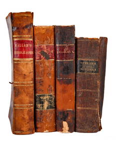
BOOKS on AMERICAN-EUROPEAN HISTORY & KING CHARLESJohn McInnis Auctioneers,LLC4.6(502)See Sold PriceFeb 24, 2024
General Books - Nicolson - The Counties of Britain - A Tudor Atlas by John SpeedTimeLine Auctions Ltd.4.5(183)See Sold PriceMar 08, 2024
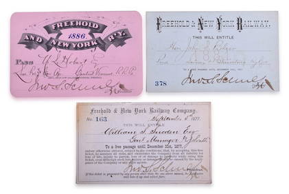
Three Freehold & New York Railway Annual Passes - 1877, 1881, and 1886Rail & Road Auctions4.6(165)See Sold PriceMar 08, 2024
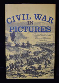
3 Civil War and WWI Books in Excellent ConditionNorth American Artifact Auctions4.6(182)See Sold PriceApr 20, 2024
Battle of the Nile: Disposition of the English & French Fleets, at the Commencement of the Action,Trillium Antique Prints & Rare Books4.5(30)See Sold PriceFeb 24, 2024
Arrowsmith & Lewis - Map of PolynesiaTrillium Antique Prints & Rare Books4.5(30)See Sold PriceFeb 24, 2024
Arrowsmith & Lewis - Map of North AmericaTrillium Antique Prints & Rare Books4.5(30)See Sold PriceFeb 24, 2024
Arrowsmith & Lewis - Map of the World on Mercator's ProjectionTrillium Antique Prints & Rare Books4.5(30)See Sold PriceFeb 24, 2024
Arrowsmith & Lewis - Map of LouisianaTrillium Antique Prints & Rare Books4.5(30)See Sold PriceFeb 24, 2024
Arrowsmith & Lewis - Map of the United StatesTrillium Antique Prints & Rare Books4.5(30)See Sold PriceFeb 24, 2024
JOHN FLEMING GOULD (1906-1996) SOUTHERN PACIFIC RAILROAD. Gouache maquette.Swann Auction Galleries4.4(65)See Sold PriceFeb 29, 2024
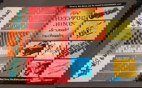
Custom-Line Layouts And Helpful Hints For Model RailroadersRapid Estate Liquidators and Auction Gallery4.5(1.1k)See Sold PriceFeb 24, 2024
West Indies Islands. Guadaloupe. | Mariegalante &C. | Antigua.Jasper524.5(9.8k)See Sold PriceFeb 27, 2024
Robert H Labberton - Map of The Territory of the Present United States - The territory of theProverde Auctions4.3(3)See Sold PriceFeb 28, 2024