Herman Moll A New Map of Ye North Parts of AmericaWillow Auction House4.5(289)See Sold PriceMar 14, 2024
H. Moll, circa 1715, Map of FlandersAlso know as Austrian Netherlands. Les Provinces des Pays-Bas Catholiques. Dedicated to His Grace Iames Duke of Ormond. Major tears to bottom of map. Hand colored. Tears to bottom left includes loss iSee Sold Price
H. Moll, 1715, Map of Brunswick-LunenburgDedicated to His Most Sacred Majesty George, King of Great Britain. Constructed in 4 panels. Hand colored. Tears to top and bottom at panel creases, tear to cartouche area also includes losses. WaterSee Sold Price
SoldH. Moll, circa 1715-1720, Map of the East IndiesDedicated to the Directors of the Honorable East-India Company. Constructed in 2 panels, hand colored. Tears to edges, large tear at center fold. 3 areas of loss at top impacting map. 40-1/4" wide x 2See Sold Price
SoldH. Moll, circa 1740, Map of Turkish EmpireDedicated to the Honourable Tho. Vernon, Esq. Constructed in 4 panels. Hand colored. Wrinkling and tears to edges. Large tear and panel detachment to middle. Waterdamage and mold to upper middle of maSee Sold Price
SoldH. Moll, circa 1736, Map of Great BritainConstructed in 2 panels, hand colored. Tears to edges at folds. Staining and mold to right side. 39-1/2" high x 25" wide. IMPORTANT: Before bidding, please read the terms and conditions. When you regiSee Sold Price
SoldH. Moll, circa 1730s, Maps of Spain & PortugalAlso includes map of France.Spain & Portugal: Dedicated to His Grace John, Duke of Argile. Constructed in 4 panels, hand colored. Tears to bottom at panel creases; adhesive has failed down middle paneSee Sold Price
SoldH. Moll, circa 1750s, Map of Denmark and SwedenDedicated to His Excellency John, Lord Bishop of Bristol. Hand colored. Major tears at fold creases causing losses to map and cartouche at bottom right. Bottom right corner detached but present. WaterSee Sold Price
SoldMOLL - Map of the East-Indies.MAPS. - MOLL, Herman. A Map of the East-Indies.London: printed for H. Moll, [circa 1720]. Engraved map (sheet size: 648x1042 mm.), hand-colored in outline. Condition: margins browned and withSee Sold Price
SoldMOLL - Map of the United Provinces, or NetherlandMAPS. - MOLL, Herman. A New and Exact map of the United Provinces, or Netherlands.London: printed for H. Moll, D. Midwinter and T. Bowles, [circa 1720]. Engraved map (sheet size: 648x1037 mm),See Sold Price
Soldc. 1715 Netherlands by H. Moll [Map]Black and white map with minor hand colorization by Herman Moll, a geographer and cartographer. Moll was born in Bremen and went to London about 1675, possibly as a refugee from the turmoil of the ScaSee Sold Price
SoldCirca 1730 Framed Map Bermuda & TribesA map of the island of Bermuda "The Island of Bermudo's divided into itsTribes, with the Castles, Forts,...", by H. Moll Geographer, circa 1730, framed, provenance: Estate of F. C. Morgan, 8 3/4 x 11See Sold Price
SoldMoll LES PROVINCES DES PAYS-BAS CATHOLIQUES C1715Details: MOLL, Herman (fl. 1678-1732). Les Provinces Des Pays-Bas Catholiques ou A Most Exact Map of Flanders or Austrian Netherlands & c. London: "Sold by H. Moll over against Devereux Court ... D.See Sold Price
SoldJohn Lord Summers Map of North AmericaFine 18th Century Map.John Lord Summers Map of North America, London c. 1715 by H. Moll.Copperplate engraving with hand coloring. Sight 23" x 38", framed.See Sold Price
SoldMAPS. - MOLL, Herman. Map of Asia.MAPS. - MOLL, Herman. Map of Asia.London: printed for H. Moll, D. Midwinter, T. Bowles and P. Overton, [circa 1720]. Engraved map (sheet size: 644x1030 mm) hand-colored in outline. Condition:See Sold Price
SoldMOLL - Map of the World.MAPS. - MOLL, Herman. A New and Correct Map of the World.London: printed for H. Moll, D. Midwinter, T. Bowles and P. Overton, [circa 1720]. Engraved map (sheet size: 644x1025 mm.), hand-coloreSee Sold Price
SoldFRAMED AND MATTED MAP Map of New England, New York, NewFRAMED AND MATTED MAP Map of New England, New York, New Jersey, and Pennsylvania, c. 1715, by H. Moll (1678-1732).See Sold Price
SoldMoll Beaver Map, 1715MOLL, Herman (1654-1732). [Beaver Map] A New and Exact Map of the Dominions of the King of Great Britain on ye Continent of North America... Engraved Map with original hand color in part. Sold By H. MSee Sold Price
SoldMoll MOSCOVY POLAND LITTLE TARTARY C1730 CopperDetails: MOLL, Herman (1654-1732). Moscovy, Poland, Little Tartary. London: H. Moll, T. & J. Bowles, P. Overton & J. King, [circa 1730]. Copper-engraved map, with original outline colour, in excellenSee Sold Price
SoldMOLL- Map of Spain & PortugalMAPS. - MOLL, Herman. A New and Exact Map of Spain & Portugal ... 1714 ; A New Map of Italy... 1711London: printed for H. Moll, D. Midwinter, T. Bowles and P. Overton, [circa 1720]. 2 engravedSee Sold Price
SoldMOLL - Map of Europe ... ; Map of Africa ...MAPS. - MOLL, Herman. Map of Europe ... ; Map of Africa ...London: printed for H. Moll, D. Midwinter, T. Bowles and P. Overton, "1708"- [n.d., but both published circa 1720]. 2 engraved maps (See Sold Price
SoldMAP OF WOTTON. Copper engraving, hand colored. CircaMAP OF WOTTON. Copper engraving, hand colored. Circa 1715. Frame: 23''H x 26.5''W.See Sold Price
Sold16th C. Map, Geldria, (Holland), Abraham OrteliusDouble folio map of "Geldria", (Flanders) circa 1579, Abraham Ortelius. Map is hand tinted with text on verso. Center seam with light age tone. Map measures: 16.75" H x 21.3" WSee Sold Price
SoldMOLL - Map of Moscovy, Poland, Little Tartary anMAPS. - MOLL, Herman. Map of Moscovy, Poland, Little Tartary and ye Black Sea ...; A New Map of Denmark and Sweden ...London: printed for H. Moll, D. Midwinter, T. Bowles and P. Overton, [circSee Sold Price
SoldMOLL, HERMANN. 1654-1732 [after]. Europe, by H. Moll Geographer.MOLL, HERMANN. 1654-1732 [after]. Europe, by H. Moll Geographer. Engraved map with hand coloring, on two sheets joined matted, circa 1720. 9 1/4 x 13 in. Toned. For further information on this lot pleSee Sold Price
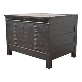
Antique Arts & Crafts Ebonized Oak Architect's Blueprint Flat File Cabinet, Circa 1900Liberty & 33rd Furniture Co.4.4(13)See Sold PriceFeb 27, 2024
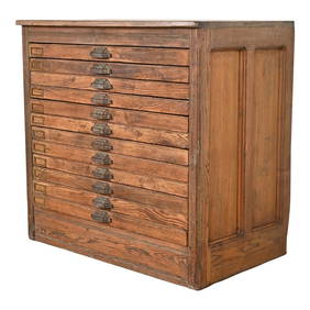
Antique Pine 12-Drawer Blueprint Flat File Cabinet by Hamilton, Circa 1900Liberty & 33rd Furniture Co.4.4(13)See Sold PriceFeb 27, 2024
Antique Arts & Crafts Oak Architect's Blueprint Flat File Cabinet, Circa 1900Liberty & 33rd Furniture Co.4.4(13)See Sold PriceFeb 27, 2024
Johann Homann Hand-Colored Map Engraving, c. 1730Auctions at Showplace4.6(740)See Sold PriceMar 17, 2024
Monumental Antique Carved Wood Corpus ChristiAshcroft and Moore LLC4.5(277)See Sold PriceMar 12, 2024
Georg Bockler Map of Ancient Jerulsaem EtchingAuctions at Showplace4.6(740)See Sold PriceApr 07, 2024
Herman Moll A New Map of Ye North Parts of AmericaWillow Auction House4.5(289)See Sold PriceMar 14, 2024


![c. 1715 Netherlands by H. Moll [Map] (1 of 10)](https://p1.liveauctioneers.com/7226/294713/156486873_1_x.jpg?height=282&quality=70&version=1688308988)


![MOLL, HERMANN. 1654-1732 [after]. Europe, by H. Moll Geographer. (1 of 1)](https://p1.liveauctioneers.com/1043/315399/169913467_1_x.jpg?height=282&quality=70&version=1706001851)