SoldGuillaume Delisle, French, engraved mapGuillaume Delisle (French, 1675-1726), "Carte de la Louisiane et du Cours du Mississipi", Paris, 1718, second state, double page engraved map, probably later color, mounted on board, 19 1/4 in. x 25 1See Sold Price
SoldGUILLAUME DELISLE (FRENCH 1675-1726), DOUBLE-PAGEGUILLAUME DELISLE (FRENCH 1675-1726), DOUBLE-PAGE ENGRAVED MAP, "CARTE DE LA LOUISIANE ET DU COURS DU MISSISSIPI", PARIS 1718, SECOND STATE. SIGHT 20 X 26"; FRAMED 26 3/4 X 32 3/4"See Sold Price
SoldGuillaume Delisle (French, 1675-1726)Guillaume Delisle (French, 1675-1726), "Carte de la Louisiane et du Cours du Mississippi...", 1718, Paris, second state, double-page hand-colored engraved map, sheet 21 1/4 in. x 30 1/2 in., framedSee Sold Price
Sold[DOUBLE HEMISPHERE MAP] Delisle (Frenc[DOUBLE HEMISPHERE MAP] Delisle, Guillaume (French, 1675-1726), (L'Isle), "Hemisphere Oriental and Occidental" , a hand-colored engraved map of the world, pub. Paris, 1724, in two parts, later hand-coSee Sold Price
SoldGroup of French Maps Guillaume de l'Isle SansonGroup of four 17th and 18th century French maps. Guillaume Delisle (1675-1726) hand colored engraved map of Picardie, 1748. Two maps by Nicolas Sanson (1600-1677), "Le Roayaume de France" and "GouvernSee Sold Price
SoldEARLY MAP OF SOUTH AMERICA BY GUILLAUME DEL'ISLEEarly copper-engraved and hand colored map of South America, 25 1/2" x 20 3/4", published by noted French cartographer Guillaume Del'Isle, circa 1710. The map depicts the entirety of the continent asSee Sold Price
A Seminal map of Canada, which first appeared in 1703Carte du Canada ou de la Nouvelle France... Guillaume Del'Isle. Engraved map. Paris: Chez L'Auteur, 1703. 20 1/4 x 26 1/4 inches visible, 30 1/2 x 36 3/4 inches framed. One of the seminal maps of CanaSee Sold Price
SoldA MAP "CARTE D'AMERIQUE," WESTERN HEMISPHERE, GUILLAUMEA MAP "CARTE D'AMERIQUE," WESTERN HEMISPHERE, GUILLAUME DELISLE, PARIS, 1722, double page engraved map, wide margins; handcolored. Second state. Tooley, French Mapping #2. 22" x 30". Framed.NOTE: DeliSee Sold Price
SoldA MAP "CARTE D'AMERIQUE," WESTERN HEMISPHERE, GUILLAUMEA MAP "CARTE D'AMERIQUE," WESTERN HEMISPHERE, GUILLAUME DELISLE, PARIS, 1722, double page engraved map, wide margins; handcolored. Second state. Tooley, French Mapping #2. 22" x 30". Framed. NOTE: DelSee Sold Price
SoldDeLisle Map of New Canada, 1703 1st EditionDE L'ISLE, Guillaume (1675-1726). Carte du Canada ou de la Nouvelle France... Engraved map with original hand color in outline. Paris: Guillaume De L'Isle, Rue de Cannettes, 1703 [First Issue]. 20 3/8See Sold Price
SoldDe L'Isle Engraved Map of CanadaCarte du Canada ou de la Nouvelle France. Guillaume De L’isle (1675-1726). Engraved Map. Paris, Quai de LÂ’Horloge, 1703. 20 x 26 3/4 inches sheet, 31 1/2 x 38 1/2 inches framed. "Del'Isle's mapSee Sold Price
De LDE L'ISLE, Guillaume (1675-1726). Carte de La Louisiane et du cours du Mississipi... Engraved map with original hand-color in full. Paris: Delisle, 1718. 20 1/8” x 26 1/8” sheet, 32 1/2” x 37 1/See Sold Price
SoldGuillaume Delisle engraved mapGuillaume Delisle- ''Carte des Pays Voisins, Mer Caspienne''- engraved map, good condition. 18 5/8 x 24 1/2''See Sold Price
Sold[MAP] BAUCHE, PHILIPPE Carte d'Asie [after Guilla[MAP] BAUCHE, PHILIPPE Carte d'Asie [after Guillaume Delisle] Engraved map, partly colored by hand. 28 1/2 x 34 inches. Framed Paris: 1762See Sold Price
SoldGUILLAUME DELISLE (FRENCH, 1675-1726) MAP OF NORTHGUILLAUME DELISLE (FRENCH, 1675-1726) MAP OF NORTH AMERICA, hand-colored engraving on paper, titled "L'Amerique Septentrionale/America Septentionalis in suas Praecipuas Partes Divisa, ad Usum SerenissSee Sold Price
SoldGUILLAUME DELISLE (FRENCH, 1675-1726) MAP OF CANADAGUILLAUME DELISLE (FRENCH, 1675-1726) MAP OF CANADA, on laid paper with watermark, title in cartouche to upper left corner, lettered in part "CARTE / DU CANADA / OU DE LA / NOUVELLE FRANCE / et des DeSee Sold Price
SoldGUILLAUME DELISLE (FRENCH, 1675-1726) MAP OF NORTHGUILLAUME DELISLE (FRENCH, 1675-1726) MAP OF NORTH AMERICA, hand-colored engraving on paper, titled "L'Amerique Septentrionale/America Septentionalis in suas Praecipuas Partes Divisa, ad Usum SerenissSee Sold Price
SoldGUILLAUME DELISLE (FRENCH, 1675-1726) MAP OF EASTERNGUILLAUME DELISLE (FRENCH, 1675-1726) MAP OF EASTERN CANADA, hand-colored engraving on paper, titled "Carte Du Canada Ou De La Nouvelle France et des Decouvertes quiy ont ete faites Dressee sur plusieSee Sold Price
SoldGUILLAUME DELISLE (FRENCH, 1675-1726) MAP OF THEGUILLAUME DELISLE (FRENCH, 1675-1726) MAP OF THE WESTERN HEMISPHERE, hand-colored engraving on paper, titled "Carte D'Amerique pour le usage du Roy". Published in Paris, 1722. Retains old hand-colorinSee Sold Price
SoldCarte de La Louisiane et du cours du MississipiGuillaume Delisle (1675-1726). Engraved map with original hand-color in full. Paris: Delisle, 1718. 20 x 26 1/2 inches, 29 3/4 x 36 1/4 inches framed. A foundational map and one of the most importantSee Sold Price
French Map Guillaume Delisle Titled Carte de NormandieMap of Normandie titled Carte De Normandie on period paper. Translated the French language reads--- Where are exactly marked the Countries or countries enclosed in this Province as well as the ParishSee Sold Price
Sold1 piece. Hand-Colored Engraved Map. De1 piece. Hand-Colored Engraved Map. Delisle, Guillaume. "L'Amerique Septentrionalis." Amsterdam: Covens and Mortier, [1730]. 18 7/8 x 22 7/8 inches; 480 x 580 mm, full margins. Old outline color, cartSee Sold Price
Sold1 piece. Hand-Colored Engraved Map. De1 piece. Hand-Colored Engraved Map. Delisle, Guillaume. "Carte du Paraguay, du Chili,.." Amsterdam: Covens and Mortier, [1730]. 19 5/8 x 22 5/8 inches; 498 x 575 mm. full margins. Outline color. SomeSee Sold Price
Sold1 piece. Hand Colored Engraved Map. Del1 piece. Hand Colored Engraved Map. Delisle, Guillaume. "Carte de la Terre Ferme du Perou, du Brasil, et du Pays des Amazones." Amsterdam: Covens and Mortier, [1730]. 19 5/8 x 22 5/8 inches; 498 x 575See Sold Price
LATE 17TH C. FRENCH MAP OF THE NEW WORLD BY ALEXIS-HUBERT JAILLOT (1632-1712)Thomaston Place Auction Galleries4.4(386)See Sold PriceFeb 24, 2024
COVENS & MORTIER 1745 MAP OF THE GLOBEThomaston Place Auction Galleries4.4(386)See Sold PriceFeb 24, 2024
17th Century Hand Colored Engraved Map of GermanyGlobal Auctions Company4.3(36)See Sold PriceMar 03, 2024
18th Century Hess Germany Hand colored Engraved MapGlobal Auctions Company4.3(36)See Sold PriceMar 03, 2024
[MAP]. [ALBRIZZI, Giambatista, 1698-1777]. Carta Geografica...Potter & Potter Auctions4.6(539)See Sold PriceMar 07, 2024
Hand Colored Engraved Map of Europe, Jean Baptiste Bourguignon Anville 1754Global Auctions Company4.3(36)See Sold PriceMar 03, 2024
Map: An 18thC engraved map of Bedfordshire titled An Accurate Map of the County of Bedford DividedClaydon Auctioneers Ltd4.3(125)See Sold PriceFeb 26, 2024
COLONIES FRANÇAISES en AFRIQUE. Africa Sénégal Madagascar. LEVASSEUR c1850 mapJasper524.5(9.8k)See Sold PriceFeb 28, 2024
19th C. French Guillaume Grohe Signed Louis XVI Engraved Figural Commode CabinetAntique Kingdom4.1(21)See Sold PriceMar 08, 2024
John Senex Map of Louisiana & Mississippi RiverWillow Auction House4.5(283)See Sold PriceMar 14, 2024
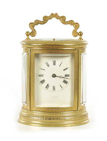
A LATE 19TH CENTURY FRENCH ENGRAVED OVAL CASED REPEATING CARRIAGE CLOCKHutchinson Scott Auctioneers4.4(39)See Sold PriceJul 12, 2024


![[DOUBLE HEMISPHERE MAP] Delisle (Frenc (1 of 5)](https://p1.liveauctioneers.com/268/1168/500538_1_x.jpg?height=282&quality=70)


![[MAP] BAUCHE, PHILIPPE Carte d'Asie [after Guilla (1 of 1)](https://p1.liveauctioneers.com/292/8142/1390870_1_x.jpg?height=282&quality=70)


![[MAP]. [ALBRIZZI, Giambatista, 1698-1777]. Carta Geografica... (1 of 1)](https://p1.liveauctioneers.com/928/318880/171361280_1_x.jpg?height=282&quality=70&version=1707501302)