Vintage Ca. 1940's International Panel Delivery Truck Converted into Stationary Food Truck, WasSwisher Bros. Auction LLC4.4(257)See Sold PriceFeb 25, 2024
Martin Custom Acoustic Guitar 000 Body Style Rosewood with Hard CaseHess Fine Auctions4.5(213)See Sold PriceMar 02, 2024
1968 Gibson LG-0 Acoustic Dreadnought Parlor GuitarHess Fine Auctions4.5(213)See Sold PriceMar 02, 2024
Replica Robinson 1862 Sharps CarbineSchmidt's Antiques Inc. Since 19114.8(440)See Sold PriceMar 02, 2024
PAIR (18th c) OF FLINTLOCK DUELING PISTOLSJohn McInnis Auctioneers,LLC4.5(505)See Sold PriceFeb 24, 2024
PAIR T KETLAND of LONDON .60 CAL FLINTLOCK PISTOLSJohn McInnis Auctioneers,LLC4.5(505)See Sold PriceFeb 25, 2024
Gibson ES335 Semi Hollow Vintage Sunburst Electric Guitar with Certificate of Authenticity Hand MadeHess Fine Auctions4.5(213)See Sold PriceMar 02, 2024
WALT DISNEY WORLD - Figment Animatronic Character Skin from EPCOT's Journey Into ImaginationPropstore4.3(7)See Sold PriceMar 12, 2024
Lot Of 3 Early Large Three-Ring Binders Full Of Thousands Of StampsRbfinearts4.5(579)See Sold PriceFeb 24, 2024
A FINE PERSIAN MALAYER PRAYER RUG WITH CYPRESS C. 1860Soulis Auctions4.8(958)See Sold PriceFeb 24, 2024
Thomas Hart Benton; 20thC. American Regionalist Oil SignedMid-Hudson Auction Galleries4.4(471)See Sold PriceFeb 24, 2024
Fender USA Stratocaster Electric Guitar Classic Candy Red and White Original Stickers with Gig BagHess Fine Auctions4.5(213)See Sold PriceMar 02, 2024
1986 Fender Stratocaster Japan Blue-Green with White Pickguard and Gig Bag JapaneseHess Fine Auctions4.5(213)See Sold PriceMar 02, 2024
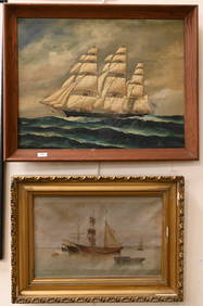
SoldGROUPING OF NAUTICAL CHARTSSome yellowing and fraying. Dates unknown. Largest H rolled up 35.25"See Sold Price
SoldLOT OF EIGHT NAUTICAL CHARTS, 19TH C INCLUDING1) NORTH SEA, TORN EDGES AND STAINING; 2) NORTH PACIFIC, BADLY TORN WITH LOSSES; 3) FRANCE, SPAIN AND PORTUGAL MINOR TEARS WITH STAINING; 4) SOUTH PACIFIC OCEAN, STAINING; 5) NORWAY, BADLY TORN; 6) SOSee Sold Price
SoldAntique Nautical Chart of West Mediterranean SeaMap: Old nautical chart of the west Mediterranean Sea Subtitle: Mediterranean Sea, Gibraltar to Alicante, Cape Spartel to Cape Ferrat from Spanish and French Government Charts to 1877. Creator: BritisSee Sold Price
SoldEight Framed New England Nautical Charts.Largest frame 49 x 36 inches. This item is not eligible for in house shipping. Buyer will be responsible for arranging pickup or delivery.See Sold Price
Sold(19th c) NAUTICAL CHARTS and MAPS(12) James Imray London 1881 China and Japan, Australia and New Zealand, South Part of the North Sea, Coast of North American, Ports of India 1870, Laurie Coast of China, etc. Together with approx 1See Sold Price
SoldLIGHTED NAUTICAL CHART HOLDER & COURSE INDICATOR,MAHOGANY BOX, LATE 19TH C PUTMAN'S (BAYARD T. PUTNAM, NY). GLASS TOP BRASS BOUND BOX WITH 3 BRASS LANTERNS SIDE LIGHTS TO ILLUMINATE THE CHARTS, 2 WITH FITTED BRASS FONTS WITH WHALE OIL BURNERS WITH ASee Sold Price
SoldSEVEN ROLL UP NAUTICAL CHARTS TO INCLUDE: 1) ONESHOWING TAPUTAPUATEA, OR DRUMMOND ISLAND, FROM THE KINGS MILL GROUP 1841. 26 1/2" X 19 1/2" GOOD CONDITION. 2) ONE SHOWING THE KING GEORGE'S GROUP, 1839. SHOWS TEAR AND PAPER LOSS ON BOTTOM RIGHT. 26See Sold Price
SoldLarge Group Old Nautical Charts & MapsGroup Old Nautical Charts / Maps some with San Franciso, California retailer stamps, including: 2 Maps Channels between Magellan Strait and the Gulf of Trinidad, 1885, Office of Navy Department, WashiSee Sold Price
Two unframed nautical charts to include: an 1857chart of the South Atlantic Ocean, compiled by J. S. Hobbs, including the East and West coast of South America, and the West Coast of Africa to Cape Colony. Includes closeups of Rio de Janeiro, PernamSee Sold Price
Collection of 10 Nautical ChartsCollection of 10 nautical charts, to include: Boston Harbor, 35 1/2" h x 45 1/2" w; Narragansett Bay, 47 1/2" h x 32 1/2" w; Nantucket Sound-Chatham Roads, 29 1/2" h x 38" w; Hyannis Harbor and ViciniSee Sold Price
SoldLot of 4 nautical charts, 3 19th c. blue backs anLot of 4 nautical charts, 3 19th c. blue backs and a Eldridge 1924 Vineyard Sound, all as is - poor conditionSee Sold Price
SoldMaury nautical charts 1852Heading: (Wind & Current Charts) Author: Maury, Matthew Fontaine Title: Ten Wind and Current Charts issued by the United States Hydrographical Office Place Published: New York Publisher: Date PubSee Sold Price
Collection of 10 Nautical ChartsCollection of 10 nautical charts, to include: Boston Harbor, 35 1/2" h x 45 1/2" w; Narragansett Bay, 47 1/2" h x 32 1/2" w; Nantucket Sound-Chatham Roads, 29 1/2" h x 38" w; Hyannis Harbor and ViciniSee Sold Price
Collection of 10 Nautical ChartsCollection of 10 nautical charts, to include: Point Judith and Block Island, 25" h x 45" w; Narragansett Bay, 47" h x 35" w; Long Island Sound, 30" h x 45" w; Delaware Bay, 39 x 33 1/2 "; Quoddy RoadsSee Sold Price
Collection of 10 1930s and 1940s Nautical ChartsCollection of 10 1930s and 1940s nautical charts of Maine, to include; Deer Island Thorofare and Casco Passage, 21 5/8" x 34 3/4", fold lines; Blue Hill Bay and western part of Mt Desert Island, 42" xSee Sold Price
Sold6 US Nautical charts including: Martha's Vineyar6 US Nautical charts including: Martha's Vineyard to Block I, Port Bay to Long Pond, Six Miles South of Stony Point to Port Bay, Straight of Florida - Fort MyersSee Sold Price
Nautical Charts Vellum Library Congress Ristow WalterNautical Charts on Vellum in the Library of Congress. Ristow, Walter W. Library of Congress. First edition. 4to. Illustrated in black, white and color. Important reference work.See Sold Price
SoldCollection of 10 1930s and 1940s Nautical ChartsCollection of 10 1930s and 1940s nautical charts of Maine, to include; Deer Island Thorofare and Casco Passage, 21 5/8" x 34 3/4", fold lines; Blue Hill Bay and western part of Mt Desert Island, 42" xSee Sold Price
Maury nautical charts 1852Heading: Author: Maury, Matthew Fontaine Title: Ten Wind and Current Charts issued by the United States Hydrographical Office Place Published: New York Publisher: Date Published: 1852See Sold Price
JOSEPH ROUX. (1834 / 1905). "BALEARIC ISLANDS: Three Nautical Charts".Three copper engravings. Hand-coloured.Oriented with lis to the north, in a bundle of courses. Scales. Depth soundings, anchorages and shallows. Measurements: 81,5 x 105 x 71 cm.See Sold Price
Three 19th century Nautical Charts comprising a ChartThree 19th century Nautical Charts comprising a Chart of the Coast of England and Scotland from Flamborough Head to Cape Wrath including The Orkney Islands by J S Hobbs published by Charles Wilson 185See Sold Price
Maury nautical charts 1852Heading: Author: Maury, Matthew Fontaine Title: Ten Wind and Current Charts issued by the United States Hydrographical Office Place Published: New York Publisher: Date Published: 1852See Sold Price
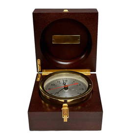
Chelsea Nautical Chronometer Boxed Presentation ClockPremier Auction Galleries4.3(338)See Sold PriceMar 09, 2024
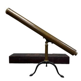
19th Century Brass Nautical Telescope and TripodPremier Auction Galleries4.3(338)See Sold PriceMar 09, 2024
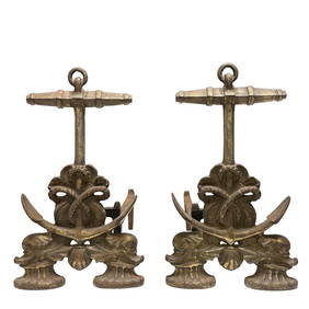
Fine Pair of Nautical Anchor and Dolphin AndironsPremier Auction Galleries4.3(338)See Sold PriceMar 09, 2024
GROUPING OF STERLING & COIN SILVER SPOONSJohn McInnis Auctioneers,LLC4.5(505)See Sold PriceFeb 24, 2024
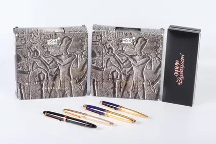
GROUPING OF MONT BLANC PENS & ACCESSORIESJohn McInnis Auctioneers,LLC4.5(505)See Sold PriceFeb 24, 2024
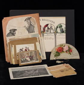
GROUPING OF (19th c) BRITISH SATIRICAL PRINTS etcJohn McInnis Auctioneers,LLC4.5(505)See Sold PriceFeb 24, 2024
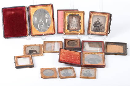
GROUPING of DAGUERREOTYPES, AMBROTYPES & TINTYPESJohn McInnis Auctioneers,LLC4.5(505)See Sold PriceFeb 24, 2024
GROUPING OF NORTH AMERICAN SCHOENHUT ANIMALSJohn McInnis Auctioneers,LLC4.5(505)See Sold PriceFeb 24, 2024
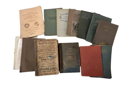
GROUPING OF BOOKS and PAMPHLETS on NE & NY HISTORYJohn McInnis Auctioneers,LLC4.5(505)See Sold PriceFeb 24, 2024
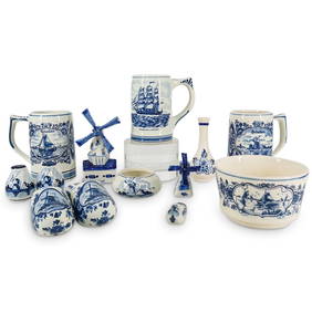
(13 Pc) Vintage Hand Painted Delft Blue Porcelain Collectibles GroupingAkiba Galleries4.7(1.8k)See Sold PriceFeb 29, 2024
West Indies Windward Lesser Antilles. Martinique (Belonging to France)Jasper524.5(9.9k)See Sold PriceFeb 27, 2024
Southern Africa Cape of Good Hope-Madagascar ADMIRALTY sea chart 1935 (1955) mapJasper524.5(9.9k)See Sold PriceFeb 28, 2024
Gulf of Guinea. Ghana Togo Benin Nigeria. ADMIRALTY sea chart 1928 (1954) mapJasper524.5(9.9k)See Sold PriceFeb 28, 2024
South Namibia coast. Walvis Bay-Orange River ADMIRALTY sea chart 1881 (1954) mapJasper524.5(9.9k)See Sold PriceFeb 28, 2024
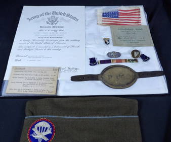
Incredible named and researched Brigadier general GroupingEagles Corps International LLC4.5(107)See Sold PriceMar 10, 2024
WW2 WWII German SS 2nd Lieutenant Insignia Grouping lotEagles Corps International LLC4.5(107)See Sold PriceMar 10, 2024
WW2 WWII Named 101st airborne 506th PIR GroupingEagles Corps International LLC4.5(107)See Sold PriceMar 10, 2024